Posted by: James Wapotich | June 7, 2016

Trail Quest: Bear Camp

Near the headwaters of Sisquoc River, below Big Pine Mountain, are three camps named after our local bears. The camps are in one of the more remote areas of our backcountry and are best visited as part of a backpacking trip.

A loop hike can be made from Santa Barbara Canyon that leads through parts of the San Rafael and Dick Smith Wilderness areas. The route encompasses Judell Canyon, the Upper Sisquoc River, and crosses below Madulce Peak for a total of about 28 miles.

To get to the trailhead from Santa Barbara, make your way to Ojai and continue north on State Route 33 towards Cuyama. As you pass the tiny town of Ventucopa look for Foothill Road on your left. The turnoff is about five miles north of Ventucopa. Foothill Road continues west, across the Cuyama River, which is typically dry, and arrives at Santa Barbara Canyon Road.

Bear Falls Sisquoc River Trail San Rafael Wilderness waterfall los padres national forest hiking backpacking

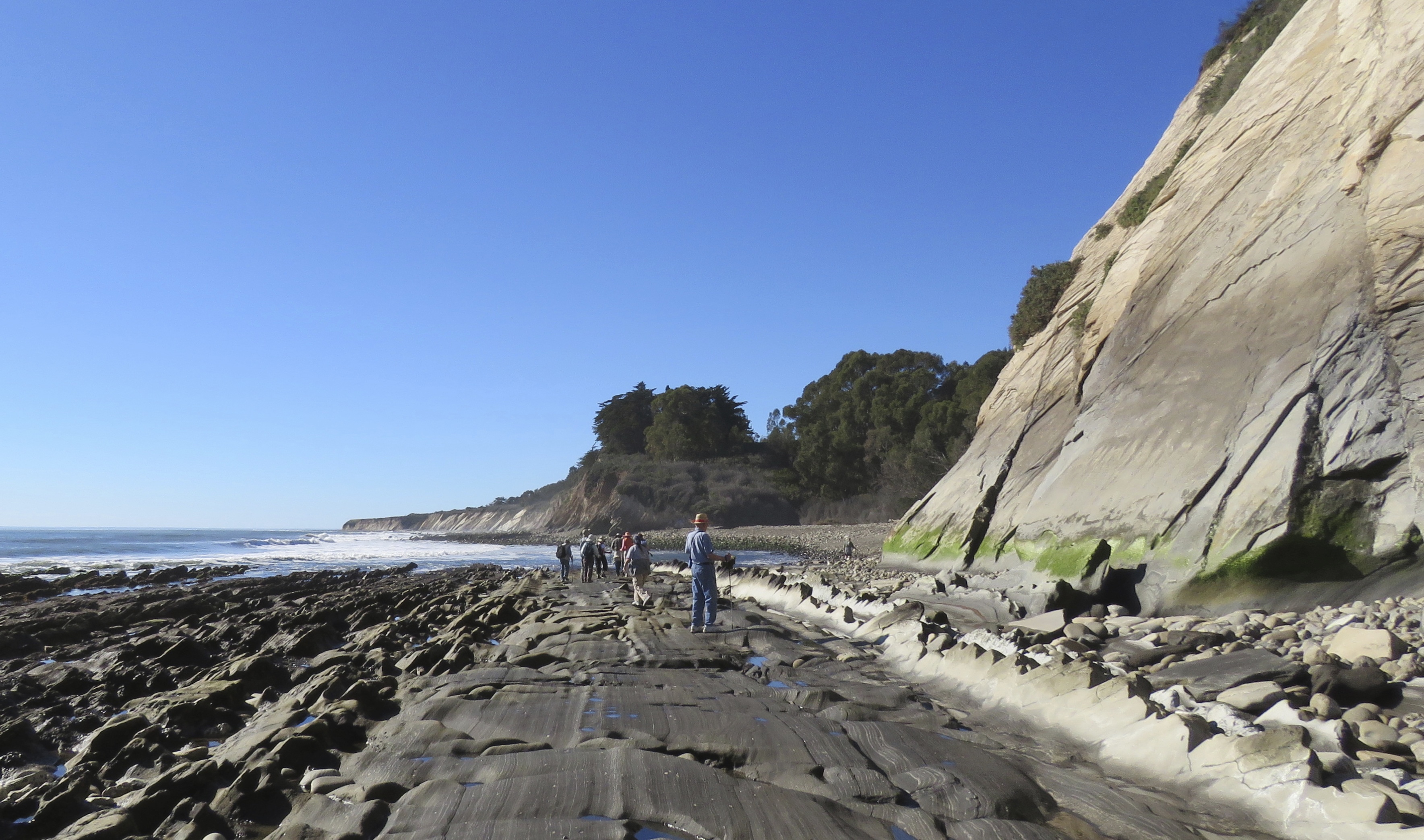
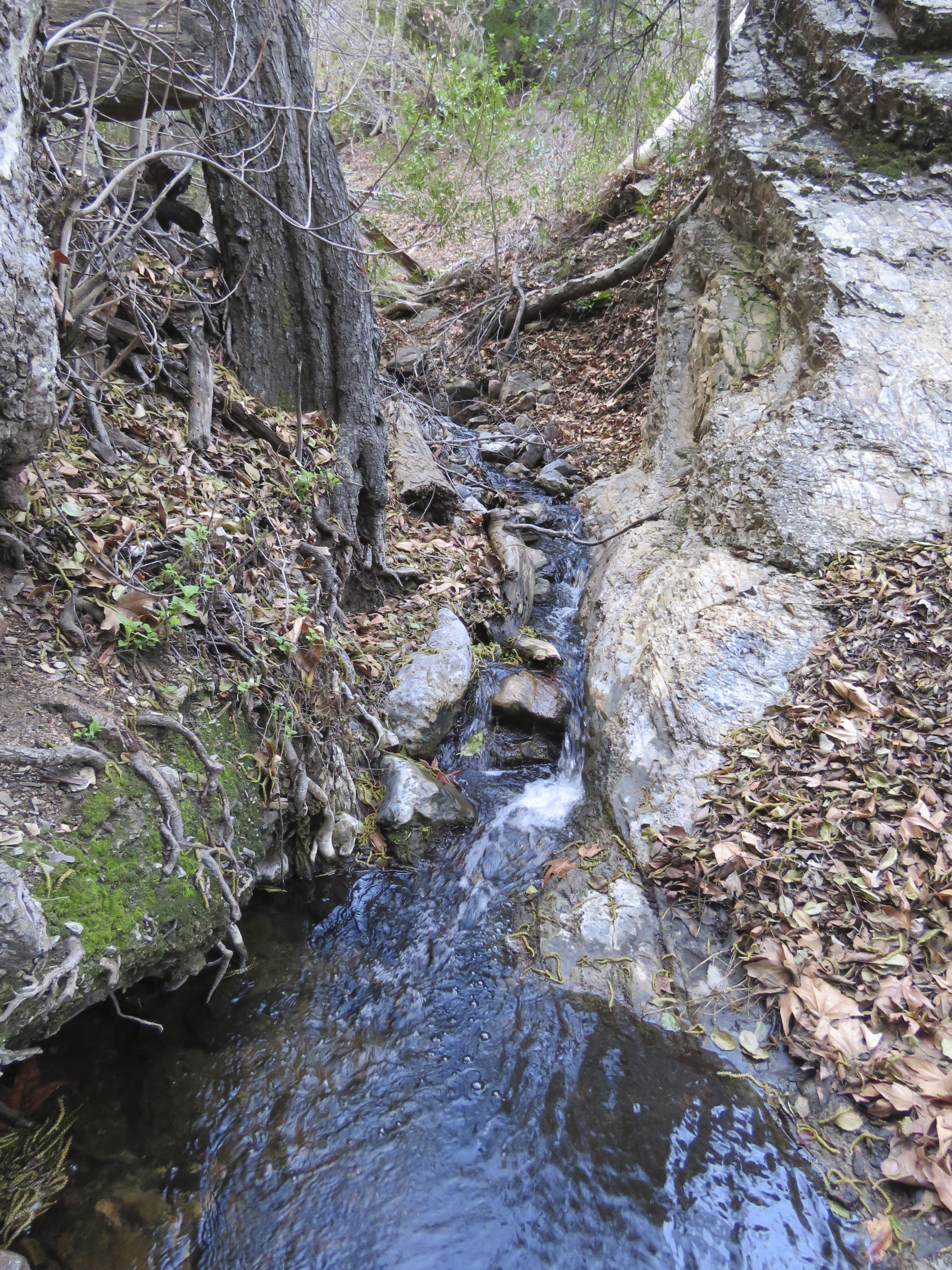
Unnamed waterfall upstream from Lower Bear Camp

Continue along Santa Barbara Road to the Forest Service gate near Santa Barbara Canyon Ranch. The road is paved, but bumpy in places. At the gate, the road becomes Buckhorn Road and continues unpaved. The gate is closed seasonally from November to May. Buckhorn Road is passable to most vehicles, however, conditions can vary and so it’s best to check with the Forest Service regarding current conditions.

Buckhorn Road eventually arrives at Willow Flat and the beginning of Santa Barbara Canyon Trail. From here, the road continues another three-quarters of a mile to a permanently locked Forest Service gate. From the gate, it’s about 4.5 miles along Buckhorn Road to Sierra Madre Road and then another three-quarters of a mile along Sierra Madre Road to Judell Trail, which leads down to Heath Camp and Sisquoc River Trail.

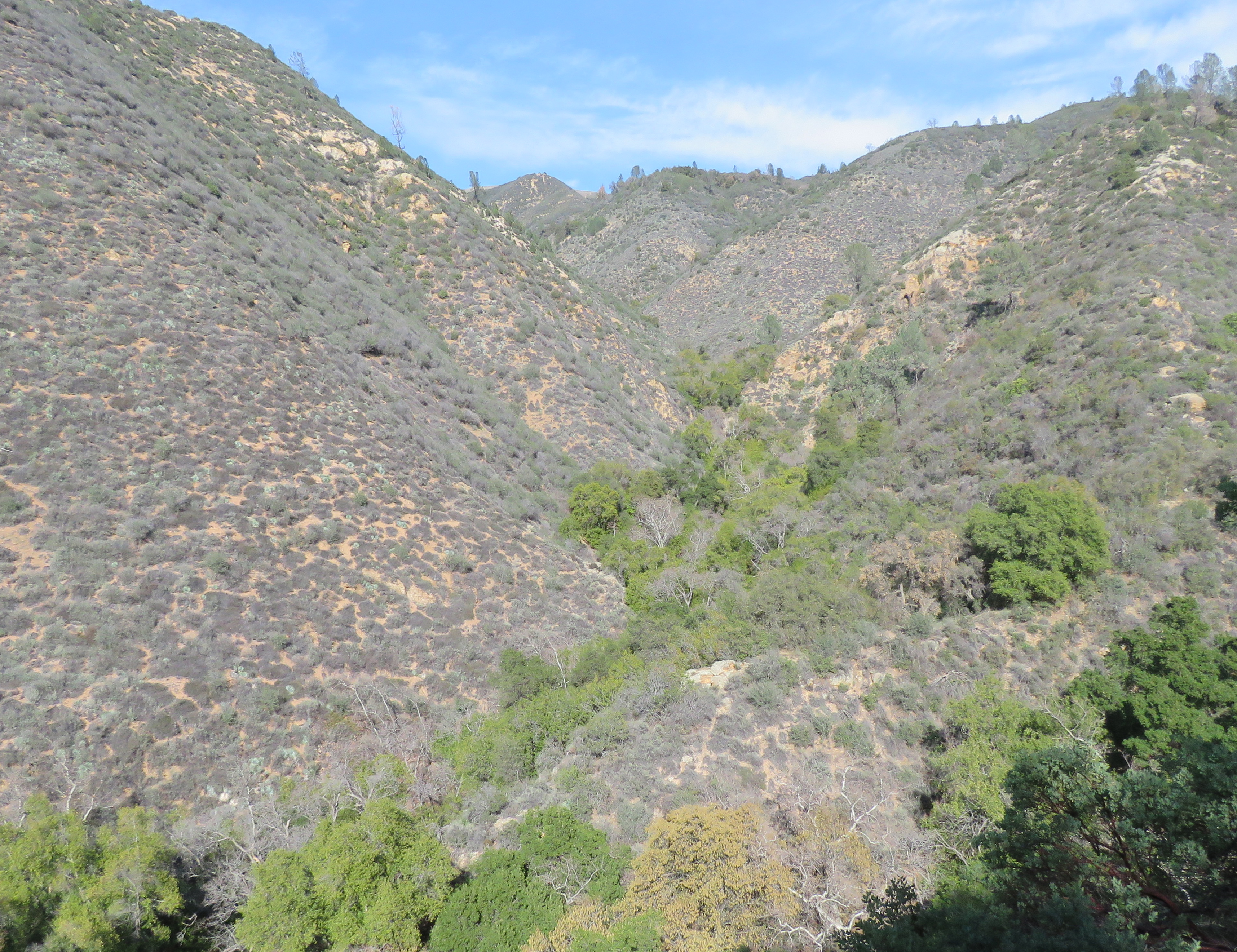
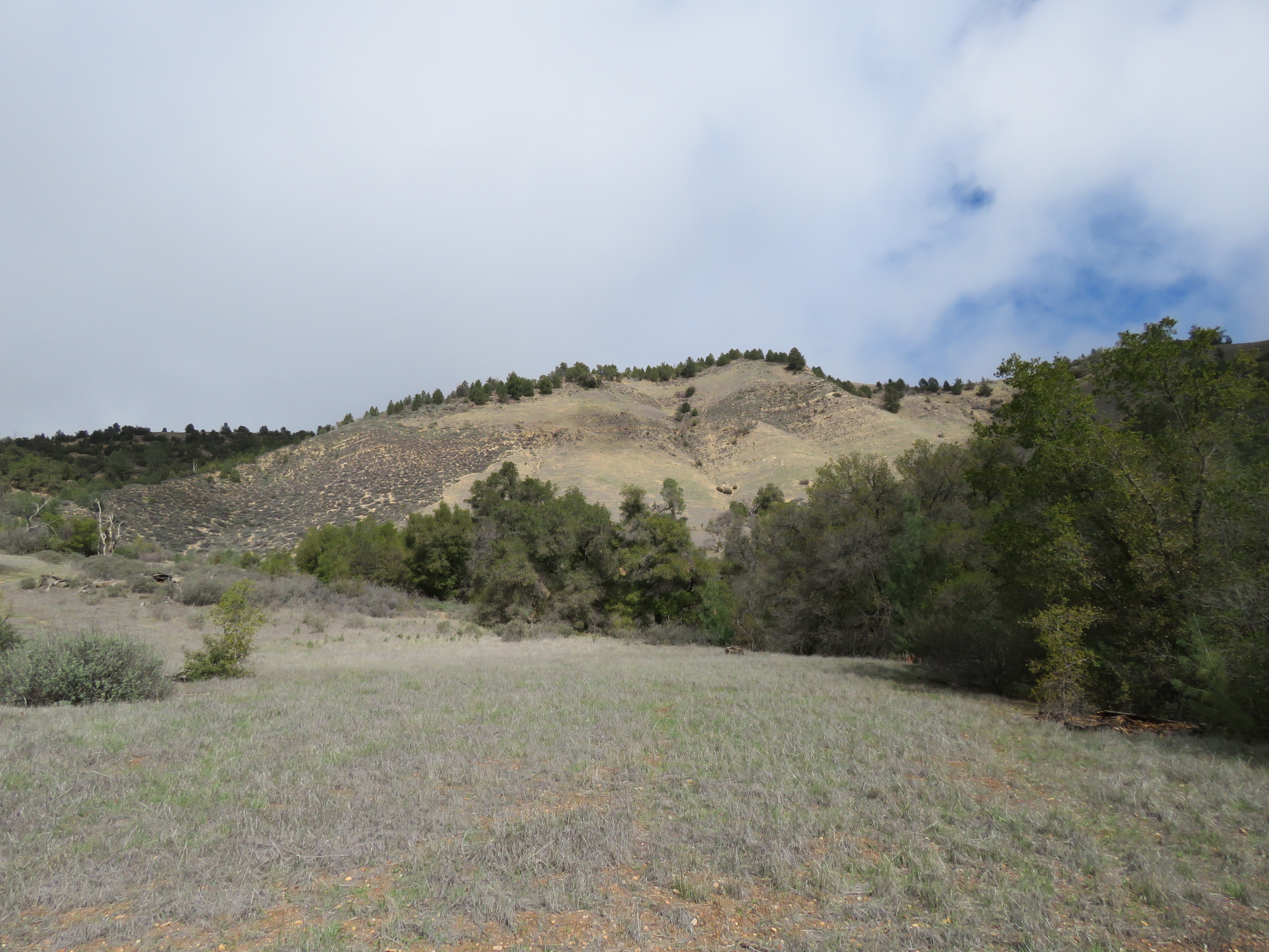
Heath Camp is about 10.5 miles from the trailhead. From here, Sisquoc River Trail follows Sisquoc River upstream towards Alamar Saddle. The trail leads through a mix of riparian and chaparral plants and initially offers views towards Big Pine Mountain at the top of the canyon.

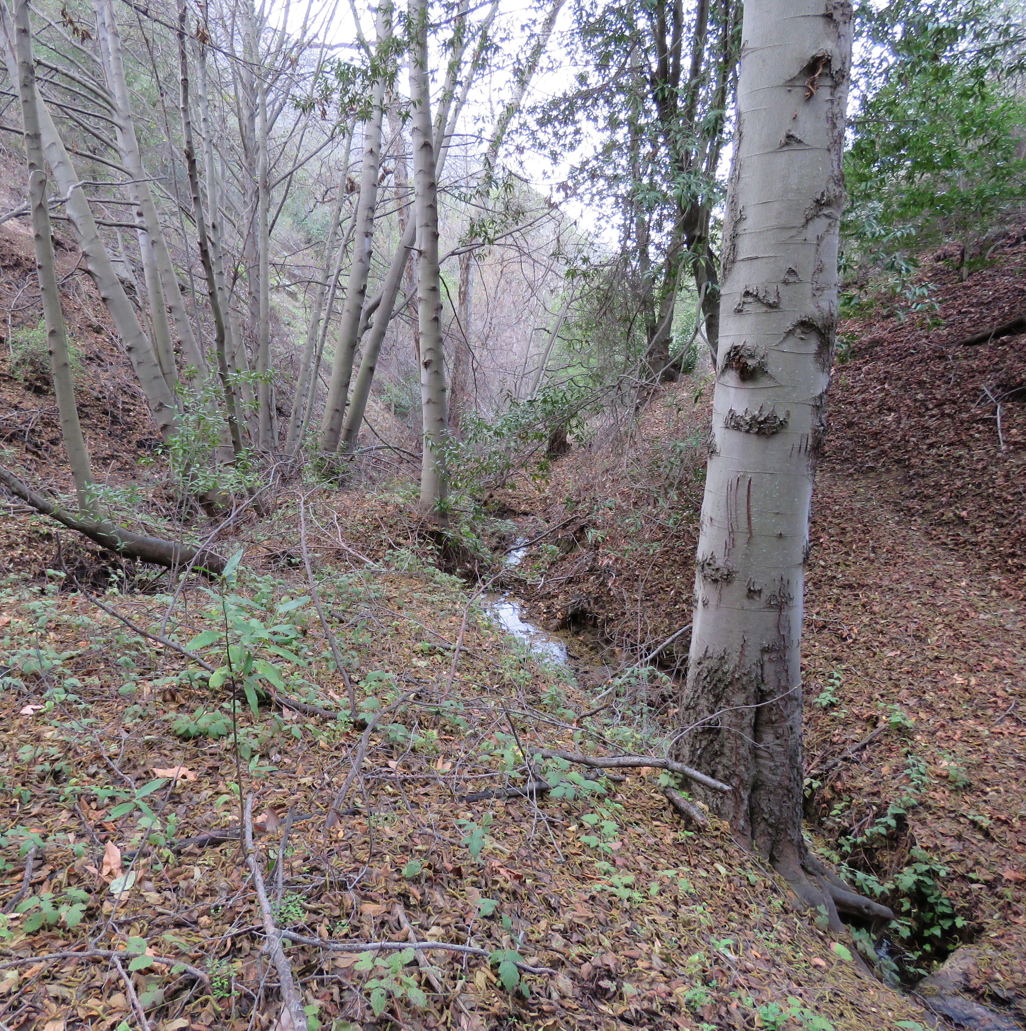
The trail is in generally good shape, although there are several places along the trail with downed trees. The trail crosses the river, little wider than a creek here, more than a half-dozen times on the way to Lower Bear camp.

Map Madulce Guard Station Bear Camp Upper Sisquoc River Trail Santa Barbara Canyon Trail Dick Smith Wilderness San Rafael Los Padres National Forest

Map Courtesy Maps.com

At about 3.75-mile mark from Heath Camp, the trail arrives at Lower Bear Camp. The camp, sometimes referred to as Falls Camp, has a fire ring and the remains of an ice can stove. The camp is located on a small flat, next to the river, tucked in under a mix of alder, maple, and California bay laurel.

Just upstream from the camp is an unnamed waterfall. The falls are flowing, and one could reasonably call them Bear Falls in keeping with the other nearby place names.

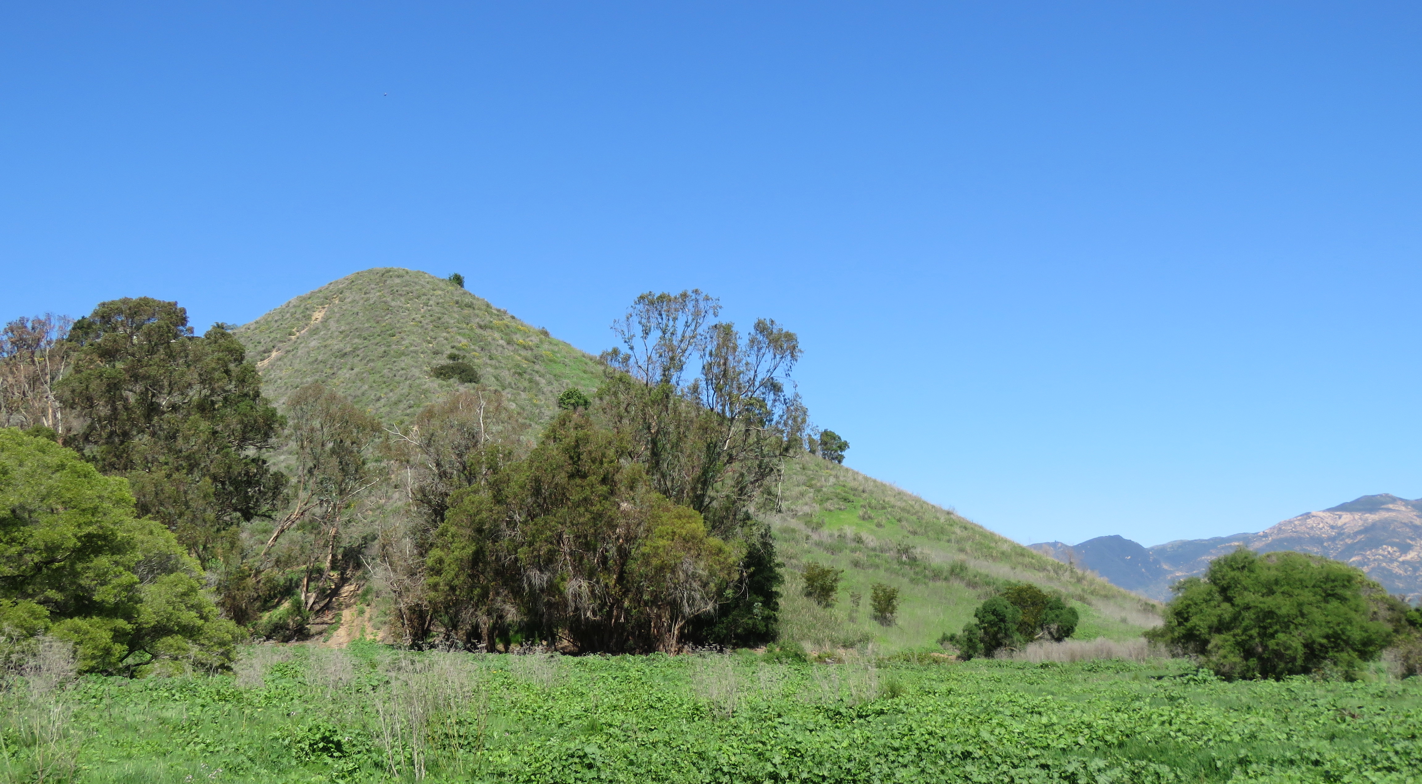
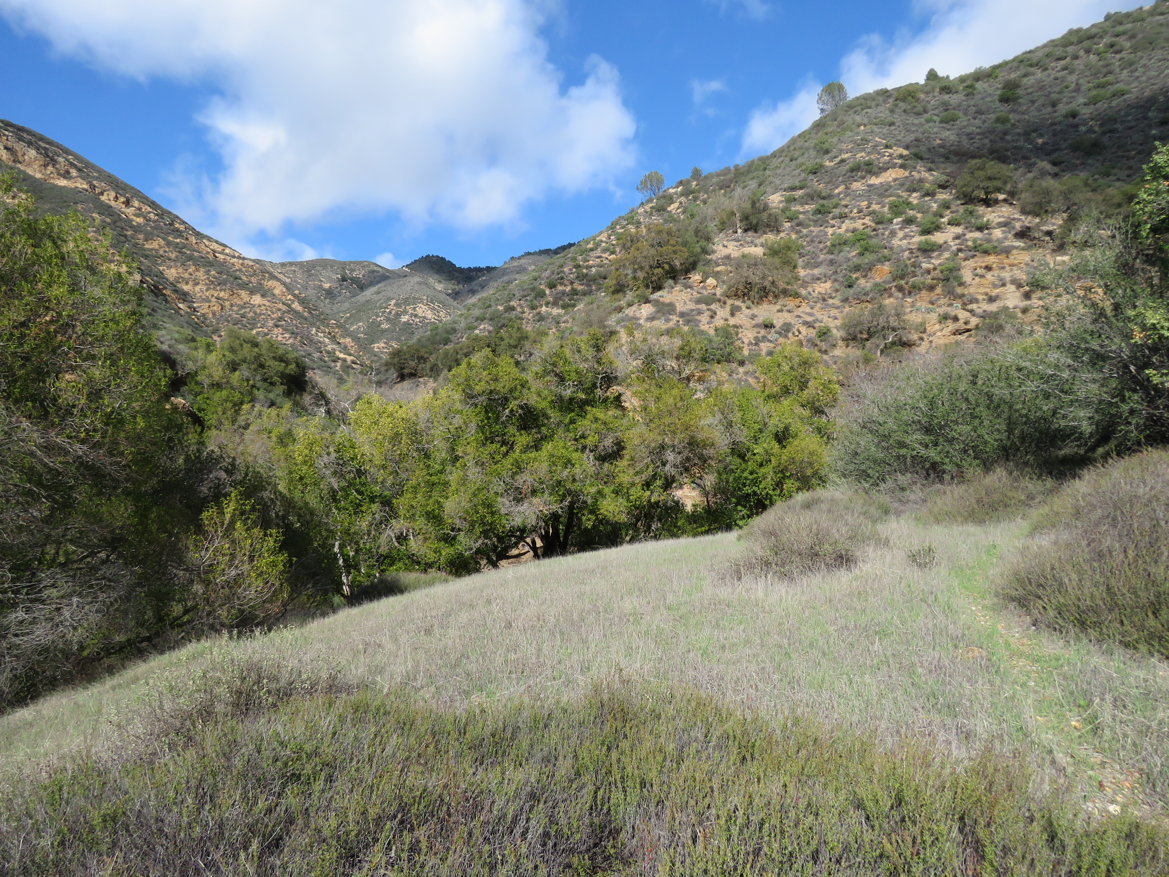
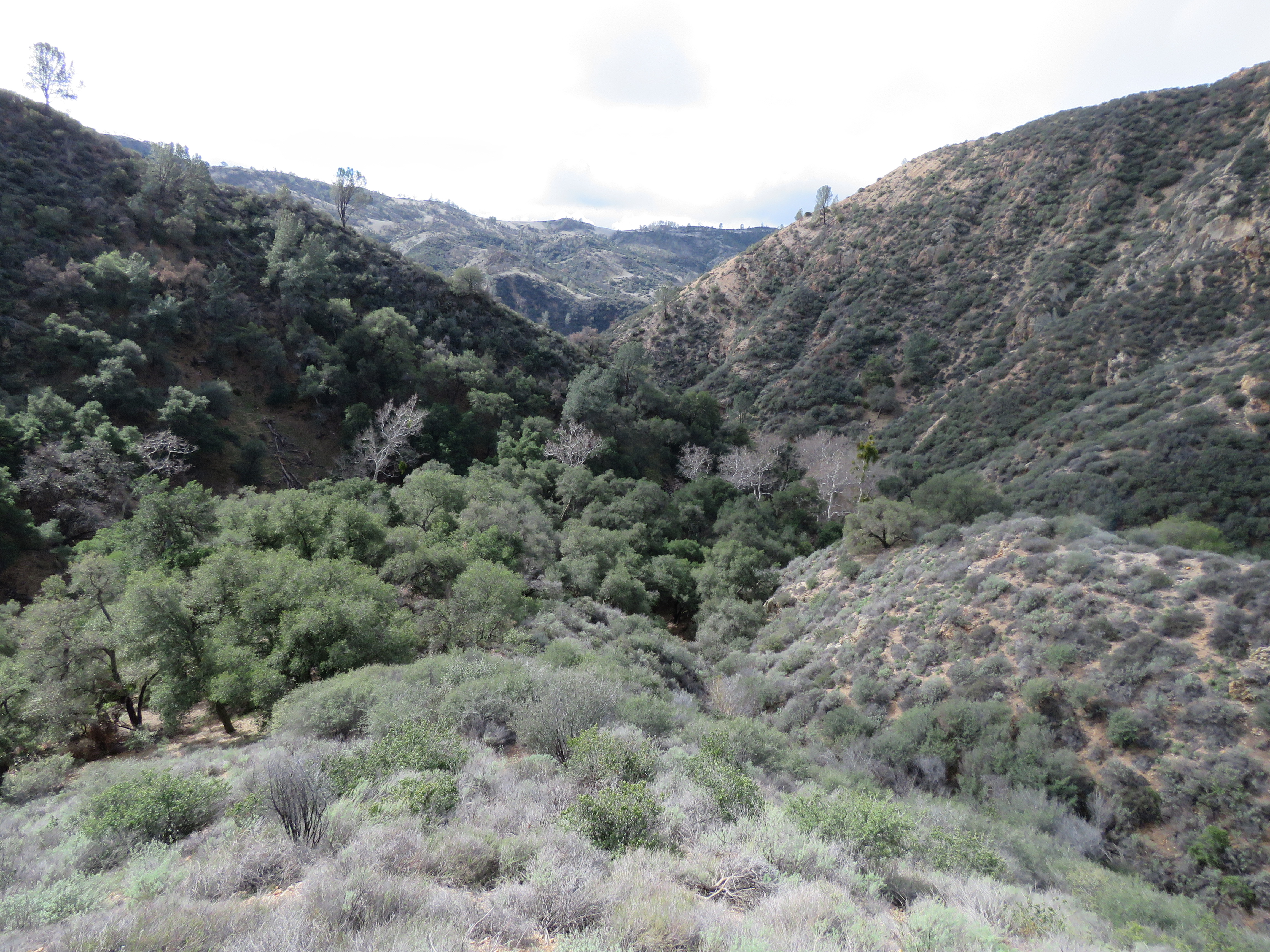
From Lower Bear, the trail begins to climb as it continues towards the headwaters of Sisquoc River. The trail passes several more small cascades above the main waterfall, before arriving a half-mile later at a large open meadow surrounded by conifers. Damage from the 2007 Zaca Fire is still evident in the burned trees that stand in the small valley. Nevertheless, the area is slowly recovering and the meadow itself remains a picturesque sight.

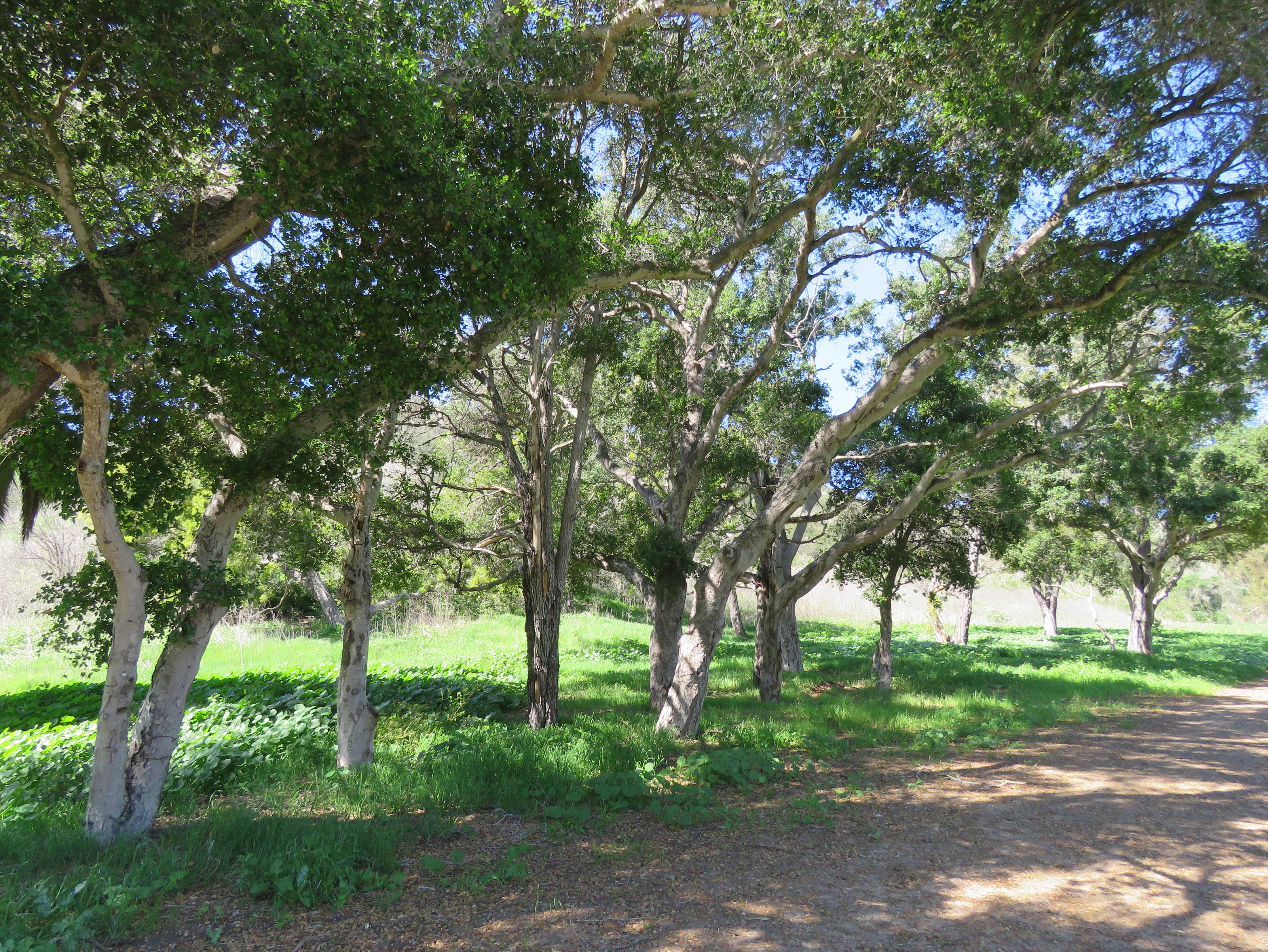
Along the trail, near the southwest corner of the meadow, amongst the conifers, is Bear Camp. Sometimes referred to as Middle Bear, the camp has a fire ring and picnic table; but currently there is no water in the river nearby. An older camp can be found across the river, at the northeast corner of the meadow. Here, one can find the remains of an old ice can stove.

In the late 1800s, James Ord, who had a homestead in Loma Pelona, took a string of burros up and over Big Pine Mountain to the site to gather cedar wood to make shakes for the roof of his adobe.

The route he followed was called Devil’s Flower Garden Trail. The trail, which no longer exists, came up the south side of Big Pine Mountain from Loma Pelona; crossed over the eastern end of the mountain and descended down a canyon towards what is now Upper Bear Camp, before continuing towards Bear Camp.

Bear Camp Sisquoc River Trail Los Padres National Forest San Rafael Wilderness hiking backpacking

Meadow near Bear Camp

During the trip he got caught in a snowstorm and had to wait until the snow had melted enough in order to return over the mountain. With his supplies running out, he was fortunate enough to find a bear that he killed for food and from that point on the site became known as Bear Camp.

It was not recorded whether the bear he killed was a grizzly or black bear. Grizzly bears started becoming extinct in California at the turn of the last century. As grizzly bears declined, black bears began to expand into their areas. This process was supplemented during the 1930s, when California Department of Fish and Game began moving black bears from the Sierras to the mountains of Southern California.

California Department of Fish and Wildlife estimates that there are currently 25,000-30,000 black bears throughout the state, with less than 10 percent of those in Southern California.

California black bears can vary in color from black to brown or tan, with some even having a small white chest patch. Adult females can range from 100-200 pounds, and adult males average from 150-350 pounds.

Omnivorous, bears are master foragers and remember through past experience where and when to look for specific foods. In the spring and into the summer they’ll graze on wild grasses; during the summer they eat insects, as well as wild berries. Bears will also eat fawns when they can catch them and carrion when they find it. In the fall, they add acorns to their diet. Intelligent, curious, and opportunistic, bears roam over a wide area, with territories ranging from 15 to 80 square miles.

From Bear Camp it’s another half-mile to Upper Bear Camp. The trail passes through mostly cedars and pines, with an understory of ceanothus. Along the trail are encouraging signs of regrowth. In addition to ceanothus, which seems to have no trouble growing just about everywhere, there are numerous cedars and pines sprouting up.

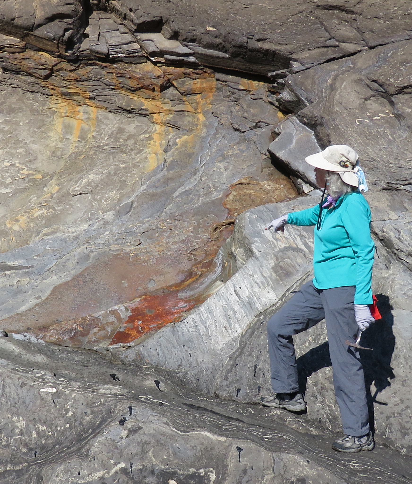
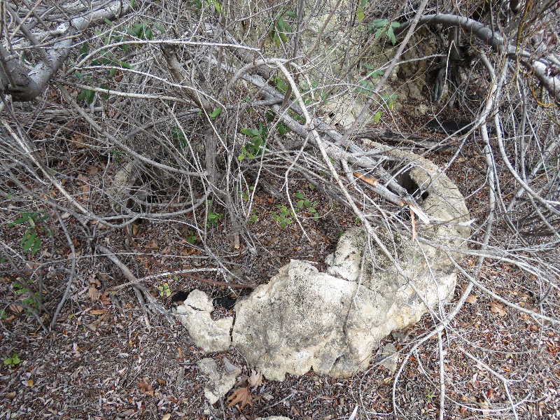
Through this section, one can also find a fair amount of bear sign, particularly on the burned cedar trees. Bears will bite and scratch trees such as alder, sycamore, and pine, as well as man made objects, such as wooden signs, outhouses, and cabins. Bears will repeatedly mark trees along their travel routes, as well as near access points to good feeding areas.

Normally solitary creatures, except when breeding, it’s believed that bears also mark areas that are most important to them to alert other bears of their presence to avoid unnecessary conflicts.

Upper Bear Camp is a simple site with a fire ring tucked in under a couple of cedars, but it has the distinction of having generally reliable water. The camp is at the mouth of a small side canyon and just upstream from the camp one can find a spring-fed creek. The creek near the camp is surrounded by ferns and cedars giving it a uniquely alpine feel.

Hartman Brothers stove upper bear los padres national forest hunting camp san rafael wilderness sisquoc river trail hiking backpacking

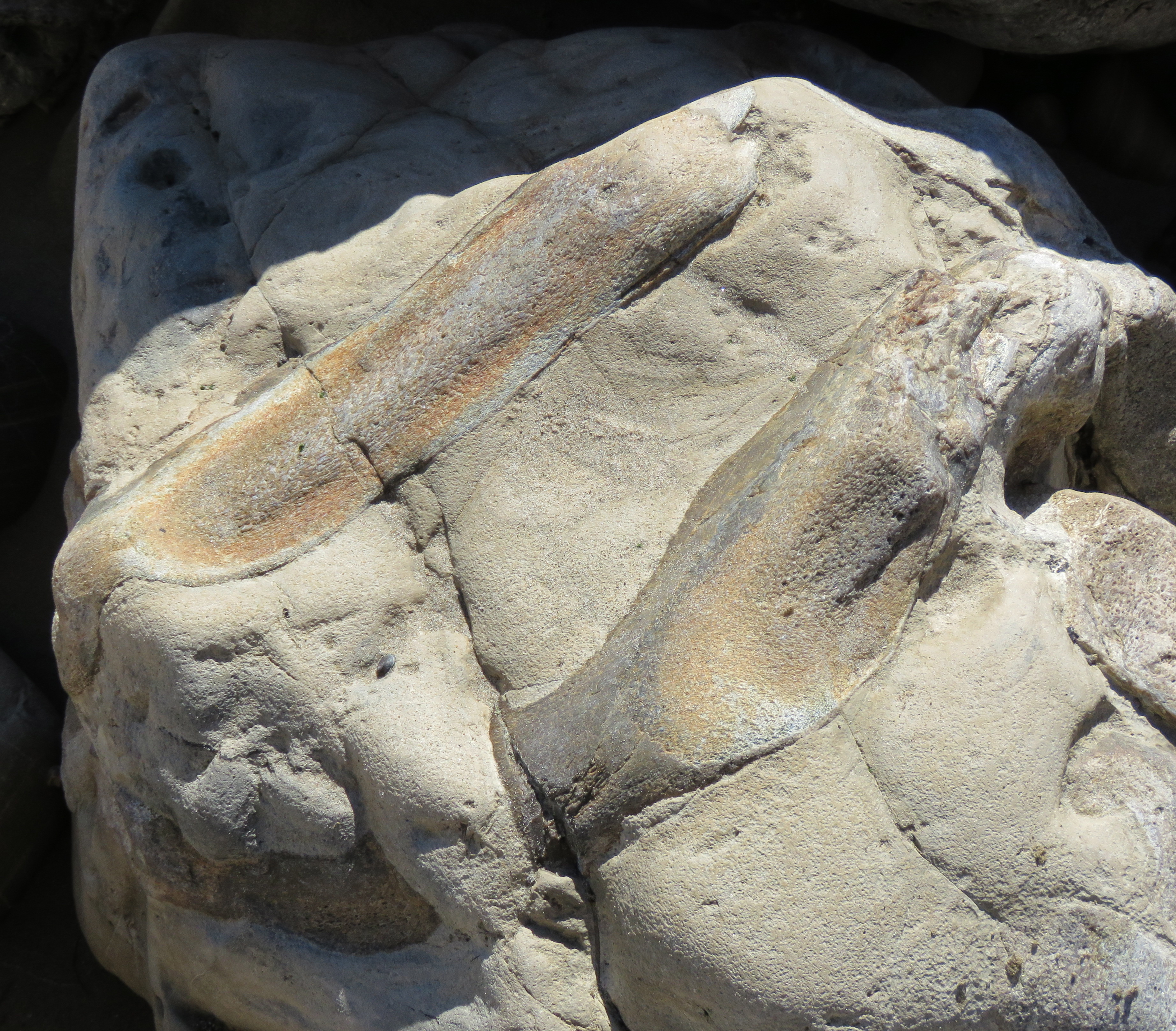
Stove built by the Hartman Brothers at Upper Bear

In the early 1920s, the Hartman Brothers used the site as a hunting camp. Near the creek, upstream from camp, one can still find the old metal stove they built resting on its cement foundation. In 1939, the camp was used by Civilian Conservation Corps while building the Buckhorn Road and other trails in the area.

From Upper Bear it’s a half-mile up to Alamar Saddle. The trail transitions from conifers to mostly canyon live oak, before arriving at the saddle and Buckhorn Road. From the road it’s about a mile to Madulce Trail and from there three miles to Madulce Camp and Santa Barbara Canyon Trail. From Madulce Camp, it’s another eight miles down through Santa Barbara Canyon to complete the loop.

This article originally appeared in section A of the June 6th, 2016 edition of Santa Barbara News-Press.

Bear Sign los padres national forest San Rafael Wilderness burned cedar tree

Bear sign on burned cedar

Lagniappe

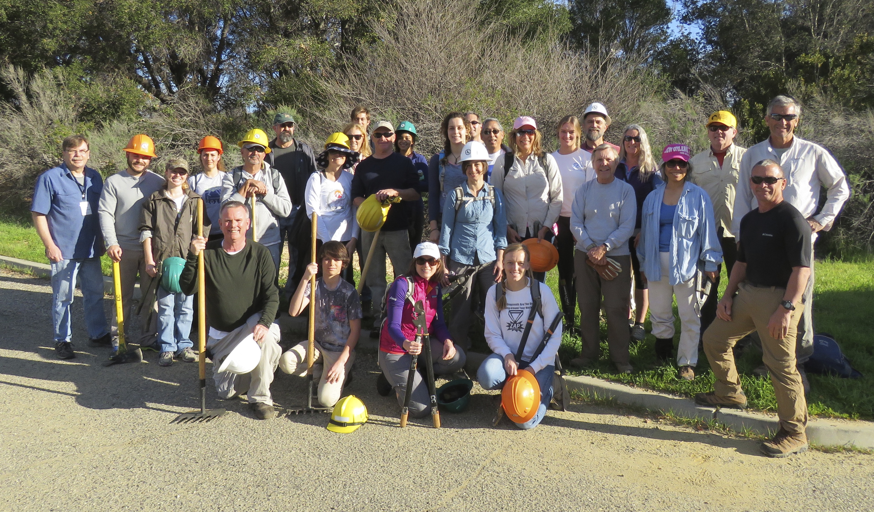
In early May I did a three-day backpacking trip to the Upper Sisquoc with my friend Jasper for a series of three articles. Starting from the Buckhorn Road in Santa Barbara Canyon we hiked in via Judell Trail and came out along Santa Barbara Canyon Trail for a loop hike, visiting Rattlesnake Falls, the various Bear Camps, and Madulce. Two weeks later I made a solo hike to Upper Bear via Santa Barbara Canyon to get some more photos.

While I was out there I did in fact see a bear at Upper Bear. I was gathering firewood right at camp and saw the bear moving quickly up the trail. I took just a few steps to get a view of the bear without the trees in the way. I was so intently focused on the bear that I didn’t adjust my camera, which is why these photos are a little fuzzy. The bear saw me, sniffed the air to try to catch my scent, and then decided it was just going to come on over for a visit. Not really liking this turn of events in a strong voice I “scolded” the bear, saying “Hey,..No!” as it started to move towards me. At the sound of my voice the bear turned and dashed up the trail and a few moments later I heard it yelp, as if to say “That was scary, I didn’t like that”, which made me think that maybe there was a mama bear nearby. But no other bears appeared, and the bear did seem too large to be a cub. In fact, based on its behavior, i.e. being all curious and yelping I’m guessing that it was a teenager on its own.

California Black Bear Upper Sisquoc River Trail San Rafael Wilderness Los Padres National Forest Camp

*

California Black Bear Upper Sisquoc River Trail San Rafael Wilderness Los Padres National Forest Camp

*

California Black Bear Upper Sisquoc River Trail San Rafael Wilderness Los Padres National Forest Camp

*

Posted by: James Wapotich | June 2, 2016

Trail Quest: Rattlesnake Falls

Although this year’s rain hasn’t provided much relief from the drought we’re experiencing, it has added enough water to the backcountry to make for some great backpacking opportunities. And while the waterfalls don’t have enough water to be described as spectacular, the rains have provided enough fresh, flowing water to still make some of them satisfying places to visit.

One of the more remote waterfalls in our backcountry is Rattlesnake Falls. The falls are found in a side canyon along the upper reaches of Sisquoc River in San Rafael Wilderness. A visit to the falls can make for a good backpacking adventure with the falls as an incentive for the hike. The shortest route to the falls starts from Santa Barbara Canyon and follows Judell Trail down to Sisquoc River. The hike is about 25 miles roundtrip.

To get to the trailhead from Santa Barbara, make your way to Ojai. From Ojai, continue north along State Route 33 towards Cuyama. State Route 33 follows North Fork Matilija Creek; climbs out of that drainage; and continues past to the turnoff to Rose Valley. From there, it follows Sespe River towards Pine Mountains Summit and then descends down towards the Cuyama River. Continue on State Route 33 past the tiny town of Ventucopa towards Foothill Road.

Rattlesnake Falls Sisquoc River hike backpacking trail Los Padres national forest San Rafael Wilderness Cottonwood Camp waterfall

Rattlesnake Falls

Foothill Road can be easy to miss. The road follows the Santa Barbara – San Luis Obispo County line west across the river, which is often dry, and arrives at the beginning of Santa Barbara Canyon Road. To avoid having to cross the river, continue north on State Route 33 to State Route 166 and turn left towards Cuyama and then double back on Kirschenmann Road to Foothill Road.

From Foothill Road, Santa Barbara Canyon Road continues south and follows Santa Barbara Canyon into the Sierra Madre Mountains. The road is paved, becoming bumpy in places as it passes through scenic ranch land. The road then arrives at the gate near Santa Barbara Canyon Ranch. The gate is closed seasonally from November to May. Past the gate, the road continues unpaved but is generally accessible to most vehicles.

The road passes Dry Canyon Road, and eventually arrives at Willow Flat and the beginning of Santa Barbara Canyon Trail. From here, the road continues another three-quarters of a mile and arrives at a locked forest service gate and the beginning of the hike to Rattlesnake Falls. An adventure pass is not required to park at the trailhead. The drive from Santa Barbara is about 2.5 hours.

From the trailhead, continue along Buckhorn Road. The unpaved access road follows Alamo Canyon and then begins its climb to the top of the Sierra Madre Mountains offering views back down the canyon. At about the 4.5-mile mark, the road arrives at the intersection with Sierra Madre Road. Continue west along Sierra Madre Road another three-quarters of a mile to the signed beginning of Judell Trail. The road leads through some scenic rolling hills covered with wild grasses.

Map Judell Trail Rattlesnake Falls Sisquoc River Heath Cottonwood San Rafael Wilderness Los Padres National Forest

Map courtesy Maps.com

Judell Trail starts at the top of Judell Canyon, appearing here as little more than a crease in the hillside. The trail passes Santa Barbara Potrero, where one can find a picnic table, before the canyon starts to take on some definition. The trail is in generally good condition, although overgrown with wild grasses.

As the trail descends down through the canyon the burn damage from the 2007 Zaca Fire is still evident. Regrowth from the fire has brought new vitality to the canyon, and here, one can see willow, canyon live oak, big cone spruce, and even maple along the route.

The trail then officially enters San Rafael Wilderness, arriving at a sign that has been well-decorated with scratch marks from the local black bears.

Judell Canyon, as well as Samon Peak, are named for Judell M. Samon, who from 1929-1933, served as Assistant Supervisor of Santa Barbara National Forest, the forerunner to Los Padres National Forest. Samon later served as Assistant Supervisor of San Bernardino National Forest.

As the trail continues towards Sisquoc River, it passes through an unburned section of the canyon, offering a glimpse of pre-Zaca Fire conditions. Along the route the diversity of plants continues to increase and includes ceanothus, scrub oak, elderberry, yerba santa, coffeeberry, and chokecherry.

Judell Canyon Heath hiking trail backpacking San Rafael Wilderness Los Padres National Forest

Judell Canyon scenery

At about the 10.5-mile mark from the trailhead, the trail arrives at Sisquoc River and Heath Camp. The camp has a fire ring and grated stove and currently there is water flowing in the river. Two more sites can be found by continuing upstream along the trail, look for a break in the brush and a faint side trail that leads over to the river. Both sites have a grated stove and see little use.

Heath Camp is named for Jim Heath, who had a ranch in Cuyama Valley and led hunting and fishing trips into the backcountry. He is said to have hunted with Theodore Roosevelt, as well as tamed mountain lions and bears for exhibitions in Maricopa.

From Heath Camp, Sisquoc River Trail continues upstream towards Bear Camp and Alamar Saddle and offers several options for creating extended backpacking trips.

To visit the falls, continue downstream from Heath Camp towards South Fork. The trail follows the river and leads through a mix of riparian and chaparral plants and, about mile later, arrives at Cottonwood Camp.

The camp has three sites. The main site has a fire ring and grated stove. Nearby, under a coast live oak, near the outhouse, is a second site with a grated stove. And downstream, across the river, just off the trail, is a third site with a fire ring and grated stove. There is currently water at the camp.

Sisquoc River Trail hiking backpacking Cottonwood Camp Rattlesnake Falls San Rafael Wilderness Los Padres national forest

Sisquoc River near Cottonwood Camp

Cottonwood Camp likely takes its name from the nearby grove of cottonwood trees. In fact, given the number of cottonwood saplings found there, it could easily be described as a natural nursery.

There are two types of cottonwood common to our area, black cottonwood and Fremont cottonwood. Both have heart-shaped leaves. Black cottonwood is found along the coast and has leaves with smooth edges, while Fremont cottonwood prefers the backcountry and has leaves with scalloped edges.

Cottonwoods favor riparian areas and are often found along creeks and rivers. Fremont cottonwood was named after John C. Frémont and is found in the southwestern United States and western Mexico. The tree can live for more than 130 years, with its bark starting out smooth when it’s young and becoming more furrowed as it ages. In the late spring, the fruit, which is a fluffy wind-dispersed achene, begins to appear and can look like patches of cotton hanging on the trees. And it’s this effect that gives the tree its name. The tree is deciduous and in the fall the leaves turn a golden yellow.

From Cottonwood Camp, it’s about a half-mile downstream along the trail to the turnoff to Rattlesnake Falls. Continue along Sisquoc River Trail towards Mansfield Camp and look for the signed beginning of Rattlesnake Canyon. From the sign, it’s less than a quarter-mile along the informal trail to the base of the falls.

The falls are surprising tall given the contours of the canyon and tumble over a high rock wall, flowing across the face of moss-covered travertine. At the base, is a fairly appealing pool of water that adds to the sense of quietude the falls seem to offer.

This article originally appeared in section A of the May 23rd, 2016 edition of Santa Barbara News-Press.

Bear sign scratches trail sign Los padres national forest San Rafael Wilderness Judell Canyon

San Rafael Wilderness sign decorated with bear scratches

Visited the Upper Sisquoc a couple weeks ago with my friend Jasper. Hiked in along the Buckhorn Road to Sierra Madre Road and then down Judell Trail to the Sisquoc. Got hail on the hike in and then rain. Camped the first night at Cottonwood Camp.

The next morning day-hiked down to Rattlesnake Falls, and then returned to Cottonwood Camp and backpacked to Upper Bear. Originally we’d planned to hike to Madulce Camp with a side trip to Madulce Peak that day, however because we had more rain on part of the second day, we opted to camp at Upper Bear so I’d have a chance to try for more photos of Bear Camp the next morning for the second article.

At Upper Bear, with enough daylight to cause ourselves trouble we decided to day hike to the top of Big Pine Mountain (7 miles round trip), you know ’cause it was still light out.

Anyway the next day, it cleared just enough in the morning for me to hike down to Bear Camp and take some photos. Then from Upper Bear we hiked back to the car via Madulce and Santa Barbara Canyon Trails, with a side hike up to Madulce Peak.

There is water currently along most of the Upper Sisquoc. Water at Cottonwood, Heath, Lower Bear, Upper Bear, and a trickle upstream from Madulce Camp. No water at Bear Camp.

Posted by: James Wapotich | May 17, 2016

Trail Quest: Meet Your Wild Neighbor

After the kids in Ms. Heather Young’s second grade class had finished learning to recognize the nine most common raptors in our area, Gabriele Drozdowski reminded the children to be very quiet and to not create a lot of commotion so that she could bring out their guest for the day.

She went over to Max’s wooden carrying box, and brought him out onto her leather glove. From there Max flew to the perch on top of his carrier and calmly took in the scene around him as Ms. Drozdowski shared his story. Max is a great horned owl and during her presentation, Ms. Drozdowski, would call to him, making a very convincing owl call, and Max, who has decided that Ms. Drozdowski is his mate, would call back.

Max was found along a trail in the Ojai backcountry in 1998, when he was little and was brought to the Ojai Raptor Center. Because of his early introduction to people, he unfortunately imprinted on humans, and according to Ms. Drozdowski, either decided that he was a person, or that we were what owls are; and either way if returned to the wild wouldn’t be able to get along with other owls. And so Max began a new life as an educational ambassador and became the first bird in Santa Barbara Audubon’s Eyes In The Sky educational program. Over the years Max has participated in over 1,000 programs, and also foster-parented 76 orphaned owlets that were returned to the wild.

Eyes in the Sky Gabriele Drozdowski Meet Your Wild Neighbor

Gabriele Drozdowski points out birds around Stow House as part of the field trip at Lake Los Carneros

Max’s visit to McKinley School was part of Santa Barbara Audubon’s Meet Your Wild Neighbor program. The educational program is grant-based and offered free to low-income area schools, and is also available to other organizations. The program has been taught at McKinley School now for 15 years. 

The first grade program is five weeks, and consists of three classroom visits and two field trips. The first grade program covers the 12 most common local birds. During those five weeks students learn about the birds, how to recognize them by sight and sound, and how to help protect them. The first field trip is around the schoolyard where they often see scrub jays, acorn woodpeckers, Anna’s hummingbirds, house sparrows, mockingbirds, and even a red-tailed hawk, which lives near the school. The second field trip is to Lake Los Carneros, which has an even richer variety of birds.

The second grade program teaches students about the nine most common raptors in our area and includes an owl pellet dissection lesson, as well as a walk around Lake Los Carneros. During each of the Meet Your Wild Neighbor sessions one of the seven different bird ambassadors from Eyes In The Sky comes to the class. The third grade program focuses on local sea birds and includes a visit to Goleta Beach. The fields trips are open to the students’ families and often some of their parents will come along.

The program consistently gets high marks and praise from the teachers, and the kids even years later when they see the birds on campus or at the Santa Barbara Museum of Natural History recognize them and remember many of the details that they‘ve learned about the birds.

Ms. Drozdowski’s own introduction to our local birds started in 1991. That year saw a major El Niño event which warmed the waters offshore such that many of the fish that sea birds depend on either went further north or out into deeper waters. As a result many sea birds were dying off from starvation, and those that could be saved were being rehabilitated by Santa Barbara Wildlife Care Network. A couple years earlier, a friend, having sold her house, gave Ms. Drozdowski a good size aviary.

Max great horned owl Eyes in the sky meet your wild neighbor Santa Barbara audubon

Max, the great horned owl, visiting Ms. Heather Young’s second grade at McKinley School

At that time, Santa Barbara Wildlife Care Network didn’t have a facility and volunteers took in animals at their homes. When they learned of Ms. Drozdowski’s aviary they asked if she would be willing to help out. She said yes, and about an hour later the first bird arrived, a brown pelican. Over the course of the next seven years she and her husband helped rehabilitate more than 2,000 sea birds.

Ready to move on from the demands of working with sea birds, they shifted their focus in 1998, to rehabilitating raptors. A common cause of injury to raptors is being hit by a car or truck while trying to capture prey. That is, the raptor becomes so intently focused on tracking its prey through the brush or grass, catching only intermittent glimpses of it, that when their prey breaks out into the open, crossing a road, the raptor will strike, unaware of the oncoming traffic. Raptors are also opportunists and will go after roadkill that they find, and often can get caught up in the wind turbulence caused by passing semis or tractor-trailers.

In all, Ms. Drozdowski has helped rehabilitate over 1,000 raptors, many of whom have been returned to the wild. Birds that aren’t able to be returned, e.g. because of the nature of their injuries, often become educational ambassadors like Max.

In 2000, she started Meet Your Wild Neighbor and Eyes In The Sky. ”I realized that rehabilitating birds wasn’t enough, because it didn’t change the landscape in terms of what happens to birds.” Ms. Drozdowski, Eyes In The Sky Executive Director, told the News-Press. “I wanted to turn it into an educational resource that educated kids about the dos and dont’s of how to interact with wildlife and how they can help protect birds.”

Through Eyes In The Sky, raptors like Max became regular visitors at Santa Barbara Museum of Natural History, serving as educational ambassadors. Similar to classroom visits, the program lets people see the raptors up close and learn more about them.

Kisa peregrine falcon lake los carneros eyes in the sky meet your wild neighbor santa barbara audubon

Eyes In The Sky volunteer Coni Edick with Kisa, the peregrine falcon at Lake Los Carneros

In 2004, Dr. Karl Hutterer, who was then Executive Director of the Museum, asked Santa Barbara Audubon and Eyes In The Sky if they would like to build an aviary at the Museum to permanently house the birds. This was a welcome opportunity, given that the growing aviary at Ms. Drozdowski’s home was largely able to exist thanks to the open mindedness of her landlord. With the offer, Santa Barbara Audubon Society began fundraising and going through the permitting process, and in 2011, the birds moved into their new home at the Museum.

The raptors can be seen daily in the aviary, and are brought out in the afternoon between 2-4 p.m. The aviary is located next to the Museum Backyard, which is the museum’s outdoor exploration and play-in-nature area. On Thursdays, Saturdays and Sundays, between 2-4 p.m. the birds are brought to the museum’s main campus for viewing.

The seven educational ambassadors in the program, including Max, are Ivan, a red-tailed hawk; Kisa, a peregrine falcon; Puku, a western screech owl; Athena, a barn owl; and Kachina and Kanati, a pair of American kestrels.

Ms. Drozdowski’s own connection to nature started in Germany where she grew up, before moving to the United States when she was 17. Her mother had lived through the Bombing of Berlin during the Second World War; and Ms. Drozdowski shared, that as result her own childhood was challenging, but that she was fortunate enough to grow up in a rural area and had easy access to the woods.

“From early childhood on, I would walk around in the open forests; it was so amazing, it felt like a cathedral. Whenever I needed to feel good about anything I would go into nature and feel better.” Ms. Drozdowski reflected. “That’s a big part of why I want kids to be exposed to nature, to become aware that there’s always a place where you can go and just feel better, whether it’s in a park, sitting by a creek, the beach, or on a trail.” 

For more information about Meet Your Wild Neighbor and Eyes In The Sky go to, http://www.eyesinthesky.org.

This is article originally appeared in section A of the May 16th, 2016 edition of Santa Barbara News-Press.

Red-tailed hawk lake los carneros santa barbara goleta

A red-tailed hawk watches the class at Lake Los Careneros

Posted by: James Wapotich | May 9, 2016

Trail Quest: Santa Cruz Falls

Although this year’s El Niño has provided some rain, it so far hasn’t been enough to offset the past several years of drought we’ve experienced, nor has it done much to help bring to life the different waterfalls found in our local mountains. Nevertheless, the timing and amount of rain we’ve received has been a boon to the local wildflowers.

And while Figueroa Mountain remains the most popular destination for viewing wildflowers, many of our local backcountry trails have also seen a great variety of wildflowers in bloom.

Santa Cruz Trail from Upper Oso to Santa Cruz Camp, for example, had more than 25 different wildflowers, including poppies and lupines on Little Pine Mountain. The trail offers both day hiking and backpacking opportunities as there are several trail camps along the route.

Santa Cruz Falls trail hiking backpacking Santa Barbara Los Padres National Forest San Rafael Wilderness creek

Santa Cruz Falls

The hike to Santa Cruz Camp is about 21 miles roundtrip. From the camp, it’s roughly another mile upstream to Santa Cruz Falls. When the falls are really flowing they can make for a great off-trail destination, but even in a year such as this they still provide an excuse to visit a remote part of our backcountry.

To get to the trailhead from Santa Barbara, take State Route 154 over San Marcos Pass. Turn right onto Paradise Road and continue to Lower Oso Day Use Area. From there, turn left onto Romero-Camuesa Road and continue to Upper Oso Campground. As you approach the campground stay to the right and park in the parking area just before the locked Forest Service gate. An adventure pass is still required to park at the trailhead.

From the trailhead, Santa Cruz Trail follows the unpaved Buckhorn-Camuesa Road for the first three-quarters of a mile before arriving at the beginning of the single-track trail.

The route through Oso Canyon follows the creek and leads through a mix of riparian and chaparral plants. Some of the wildflowers on display this year included fiesta flower, blue dicks, shooting stars, fairy lanterns, mariposa lilies, larkspur, and paintbrush.

Map Santa Cruz Trail falls Little Pine Spring Happy Hollow 19 Oaks Upper Oso San Rafael Wilderness Los Padres National Forest

Map courtesy Maps.com

At about the 2-mile mark, the trail arrives at the turnoff to Nineteen Oaks. From here, it’s a relatively short hike, mostly uphill, to the camp. There are two campsites, each with a picnic table and fire ring. The closest water source is Oso Creek; the creek does not flow year round.

Past the turnoff, Santa Cruz Trail crosses a side creek that flows into Oso Creek, and then begins the roughly 3.5-mile climb to Alexander Saddle. As the trail leaves the creek, it passes through predominantly purple sage, coastal sage, and yucca, with a little white lupine thrown in.

As the trail climbs, it offers some exceptional views out across Oso Canyon and eventually the Santa Ynez Valley.

At about the 5.5-mile mark, the trail arrives at Alexander Saddle. Here, the view extends north towards the San Rafael Mountains. At the saddle is beginning of the connector trail to Little Pine Mountain and Happy Hollow, both of which are about three-quarters of a mile away. This year Little Pine Mountain, like a number of open, grassy hillsides in our backcountry, was ablaze with poppies.

Fiddleneck Alexander Saddle Little Pine Mountain Santa Cruz Trail Los Padres National Forest

Fiddleneck flowers cover a hillside near Alexander Saddle

From the saddle, Santa Cruz Trail continues down the backside of the mountain, and about a mile later arrives at the turnoff for Little Pine Spring. The quarter of a mile side trail down to the spring more or less follows the edge of the chaparral along the grassy hillside before turning left and crossing the drainage, and arriving at camp. The camp has a picnic table and fire ring, and nearby, flowing into a large trough, is the reliable spring.

Past the turnoff, the trail continues towards Santa Cruz Camp, making its way towards a long side canyon. Here, the trail arrives at what is affectionately known as the 40-mile wall. So named because this roughly 2-mile stretch of trail, with its southern exposure, can seem to go on forever, particularly on the hike back out.

Checkerspot butterfly holly-leaf cherry Santa Cruz Trail Los Padres National Forest

Checkerspot butterfly on holly-leaf cherry

This same section, however, perhaps because of its southern exposure, has a lot of holly-leaf cherry growing along it. Holly-leaf cherry is found throughout much of California, from Mendocino County, down through San Diego County and into Baja California. It is a large, evergreen shrub with spiny or toothed leaves similar in appearance to holly.

The plant flowers March through May with its clusters of yellowish-white flowers. In September and October the fruit ripens. The fruit is edible, however the fleshy part is just a thin layer over a large pit. Nevertheless, the cherries are popular with the bears. During the fall, one can find a fair amount of scat along this section of trail, suggesting that the bears make regular visits to this extended grove for the cherries.

The Chumash also made use of holly-leaf cherry. Although instead of harvesting it for the fruit, they would gather it for the pits. Once gathered, the fruit was allowed to rot off; the pits were then cleaned and cracked open to get at the kernels, which could be stored similar to acorns. Because the cherry pits contain hydrocyanic acid, which is both poisonous and bitter tasting, the Chumash would first leach the kernels before preparing them. A popular food item, cherry kernels were said to be worth twice as much in trade as an equal volume of acorn kernels.

Also found along this section is chia sage. Chia sage can be found throughout the southwest. The plant, with its blueish-purple flowers, blooms in the spring and then goes to seed in the late spring and early summer. The Chumash used the seeds as a food source and like cherries and acorns, the seeds could be stored. Another popular food item, chia seeds were even more valuable than cherry kernels in terms of trade; the seeds were said to be worth five times a similar volume of acorn kernels.

Santa Cruz Trail is also home to a couple wildflowers that are considered rare. Near Alexander Saddle on the backside of the mountain one can find Ojai fritillary and near the creek by one of the camps at Santa Cruz Camp one can find Humboldt lily. Although both plants can be found over a wide range, the frequency and number of specimens found were they do appear is much more limited in comparison to other plants.

Springtime has also brought out the butterflies. Common along the trail are checkerspot and swallowtails. Another treat that can be seen this time of year are white-lined sphinx moths and their caterpillars. Sometimes referred to as hummingbird moths because their rapid wing movement, hovering and darting from flower to flower to drink nectar is similar to that of hummingbirds.

Santa Cruz Trail Los Padres National Forest hiking backpacking

Santa Cruz Canyon

Past the 40-mile wall section, Santa Cruz Trail rounds a corner and descends down towards Santa Cruz Creek. The trail crosses the creek and continues towards camp. The creek is currently is flowing, but does not flow year round.

The camp is spread out along side the creek under a grove of coast live oaks. There are two main sites, each with a picnic table and metal stove. Because neither the camp or the section of trail from Upper Oso is in the wilderness, Santa Cruz Camp also makes for a suitable destination for mountain bikes.

At the camp, Santa Cruz Trail meets Santa Cruz Jeepway, which is an unpaved Forest Service access road that connects back up to Buckhorn Road.

For the hike to the falls, continue east along the road towards the first creek crossing. There is no trail to Santa Cruz Falls; from the crossing it’s about a mile of rock-hopping upstream to the confluence of East and West Fork Santa Cruz Creeks. Along the way one can find dry side channels and the occasional animal trail to help ease the hike. The falls are located along East Fork Santa Cruz Creek, just above the confluence.

Regardless of how far you go, Santa Cruz Trail provides a wide array of scenery and natural history to discover.

This is article originally appeared in section A of the May 9th, 2016 edition of Santa Barbara News-Press.

White-line sphinx moth hummingbird Santa Cruz Trail Los Padres National Forest

Sphinx moth on purple sage

Posted by: James Wapotich | May 2, 2016

Trail Quest: Hot Springs Canyon

One of the more popular front country destinations, Hot Springs Canyon has been visited by hikers for than a 150 years. The canyon is the site of the once famous Hot Springs Hotel and a hike through the canyon provides a chance to explore one of our front country trails.

The hike to the old hotel site is about 2.5 miles roundtrip.

From Santa Barbara, take Highway 101 south to Hot Springs Road exit, turn left and continue up to the roundabout. Follow Hot Springs Road to East Mountain Drive. Turn left onto Mountain Drive and continue towards the trailhead. There is limited parking at the trailhead, but additional parking can by found along nearby Riven Rock Road.

From the trailhead, the trail follows an easement along the creek between residential properties, briefly following a private road, before continuing around a gate. From here, the trail continues alongside the creek and arrives at an unpaved access road, where the trail starts to open up.

Hot Springs Canyon Montecito hike trail hotel Wilbur Curtiss Los Padres National Forest

A view down Hot Springs Canyon towards the site where Hot Springs Hotel was located

A short ways up the road the trail branches. Hot Springs Trail continues across the creek to the right. To the left, an unnamed trail continues along the creek. Both routes are open to the public and lead up to the hotel site.

The route along the creek stays with the creek all the way up to the Edison access road, which it briefly follows, before returning to the creek and arriving at the base of the hotel site. There the trail branches with one route leading up to the site and the other continuing along the creek towards the hot springs.

Hot Springs Trail crosses the creek and follows the east side of the canyon. The trail soon arrives at the beginning of McMenemy Trail. Here, stay to the left and follow the unpaved access road, now open to the public. The road passes through mostly chaparral and offer views out across the canyon.

At about the one-mile mark, Hot Springs Trail arrives at the Edison access road, which connects over to Cold Springs Canyon. Just before this intersection, on the right, is a small field of Douglas iris in bloom above the trail, and little further up is a field of sour grass. The non-native sour grass also lines the road and is recognizable with its bright yellow flowers and clover-like leaves.

Douglas Iris hot springs canyon Montecito hike trail los padres national forest

A field of Douglas Iris

Douglas Iris Hot Springs Canyon Los Padres national forest hiking trail Montecito Santa Barbara

Douglas iris

The trail then arrives at the hotel site. Here, the road turns ninety degrees and continues over towards San Ysidro Canyon. A number of loop hike opportunities can be created using the network of trails found between the two canyons.

At the hotel site what is most noticeable is the southwest corner of the sandstone wall that served as the hotel’s foundation. Here, one can find non-native century plants and a stairway that leads up to a level area where the hotel was located. From the top one is treated to views back down the canyon and out towards Santa Cruz Island.

Continuing past the site the trail returns to the creek and continues briefly upstream to the main set of hot springs which issue from sandstone at the base of the canyon wall.

The bath houses from the hotel are long gone and there are no pools for visitors to soak in. Today, one must content themselves with the great scenery and history of the site.

The first visitors to the hot springs were the Chumash, who were said to have used the water for its curative properties.

The first person to develop the site was Wilbur Curtiss. Curtiss had come to California from New York to seek his fortune during the 1849 Gold Rush. It’s said that working as a miner had ruined his health and that he’d moved to Santa Barbara for the fresh air and favorable climate. One day while out hiking in Hot Springs Canyon with his Chumash guide he met a Chumash man who was said to be over a hundred years old. Intrigued by the man’s longevity Curtiss asked his guide about the man, who explained that the old man regularly soaked in the hot springs further up the canyon. Curtiss had his guide show him the spot and over the next six months Curtiss regularly soaked in the pools and became cured of his ailments.

In 1862, convinced that there was business opportunity at hand, Curtiss built a road up to the site to serve patrons. That same year the Homestead Act passed. The road was washed out in the first winter rains, but undaunted Curtiss filed a homestead claim in the canyon. At the site he built several bath houses with visions of one day building a world class resort.

In 1871, a fire burned through the canyon and Curtiss rebuilt what he had. The accommodations were meager, nevertheless people continued to visit the hot springs, reporting on the miraculous cures they’d experienced from the healing waters.

In spite of his best efforts, he could never raise enough capital to build the resort he envisioned. Unable to pay back the money he had borrowed over the years to build his dream, the land defaulted to Milton S. Latham of the London and San Francisco Bank in 1877. Curtiss stayed on as the manager, but eventually moved on to other pursuits.

The property passed through several hands, during which time a small three-story hotel was built near the hot springs. In 1886, the property was purchased by Edwin H. Sawyer, who also bought the adjoining property owned by Curtiss’ sister, Ruth. Over the next thirty years the hotel saw different managers; was closed and reopened several times; and plans for a bigger resort were proposed but never materialized.

In 1910, Swayer was eventually able to sell the property to W.H. Bartlett and S.P. Calef. Four years later the two organized Hot Springs Club. Members paid $2,000-$5,000 to join and the membership was capped at 20. Each member had their own room in the hotel, which they could use but had to furnish on their own.

The hotel burned to the ground in 1921 during another forest fire and was rebuilt.

As time went on the members passed away one by one. In 1958, Kenneth Hunter Sr., who was the last caretaker at the club, set out find the heirs of the various members and, in 1962, was able to purchase the property with Lowry McCaslin.

Two years later, the Coyote Fire burned through the site destroying all of the buildings. The fire burned 65,339 acres between State 154 to Romero Canyon on the front side of the Santa Ynez Mountains, and between Knapp’s Castle and Jameson Reservoir on the backside of the mountains.

In 1986, Kenneth Hunter, Jr. sold his interest to the McCaslin Family. Over the years the public continued to visit the site, many unaware that it was actually private property.

In 2008, the McCaslin Family approached the Land Trust for Santa Barbara County to sell the site. In 2012, after raising $7.8 million to purchase the property, the Land Trust for Santa Barbara County acquired the land with the intention of conveying it the United States Forest Service so it could become part of Los Padres National Forest.

However, a number of private easements regarding water, electrical, and road usage complicated the matter, as did the presence of creosote-treated power poles found in the brush at the site. Southern California Edison agreed to remove the poles and contaminated soil, but the issue over the water rights brought the transfer to an impasse.

Unable to resolve the matter in a way that met the Forest Service’s land management requirements and also preserved Montecito Water District’s water rights, the Land Trust for Santa Barbara County ended up retaining the 40-acres of land in question, located at the entrance to Hot Springs Canyon.

In 2013, with the details finally worked out, the Land Trust for Santa Barbara County transferred 422 acres of the property in Hot Springs Canyon to the Forest Service. With the sale and transfer of the land complete, the site became part of the national forest, protected from development and open to the public.

This article originally appeared in section A of the May 2th, 2016 edition of Santa Barbara News-Press.

Posted by: James Wapotich | April 13, 2016

Backpacking Santa Barbara’s Wilderness Trails

Los Padres Forest Association Trail Talk and Mixer Fundraiser Volunteer Projects Backpacking Santa Barbara's Wilderness

*

I’ve been invited to speak at the Los Padres Forest Association’s first ever Trail Talk and Mixer to help raise funds for volunteer trail work projects. Through its volunteer projects the LPFA works with the forest service to help maintain trails in our local backcountry. Many of these trails are in remote wilderness areas and are either badly overgrown or were damaged by the 2007 Zaca Fire. 

Backpacking Santa Barbara’s Wilderness Trails
Tuesday, April 19th, 6:30 – 8:00pm
Santa Barbara Veterans’ Memorial Building
112 W. Cabrillo Blvd., Santa Barbara, CA

This talk dovetails well with the talk I just gave in March. That talk covered trails in the Santa Barbara and Ojai mountains that are well-suited for 2-3 day backpacking trips. This talk will focus in on several trails in the San Rafael Mountains that lend themselves well to longer 3-5 day traverses of our local backcountry. The trails are also ones that Los Padres Forest Association has either done work on through its past projects or will be part of one of their upcoming projects. 

Tickets are $10 each. However, admission is free for LPFA members. Basic membership is just $25, and so the bargain here is by becoming a member not only are you supporting volunteer trail work, but getting free admission for the other upcoming talks this year. The LPFA is planning on hosting quarterly Mixer/Trail Talks and has two more already in the works, one for the summer and one for the fall.

Seating for this event is limited, so get your tickets now by going to https://www.eventbrite.com/e/backpacking-santa-barbaras-wilderness-trails-with-james-wapotich-tickets-24306376025. Tickets are $10 each, plus an Eventbrite service fee of $1.54, making the total price $11.54.

To become an LPFA member go to http://lpforest.org/membership-account/join/. And then go to Eventbrite to reserve your member ticket.

To learn more about the LPFA go to http://lpforest.org/

I’ve been on a number of LPFA trail projects. They are a great way to give back to the trials, as well as connect with other outdoor enthusiasts. In 2014, I wrote an article about the LPFA, Trail Quest: Los Padres Forest Association, which describes a little bit about what goes into these projects and how the organization got started.

James Wapotich has hiked many of the trails in the southern Los Padres National Forest. He is a Volunteer Wilderness Ranger with the Forest Service, and the author of the Santa Barbara News-Press hiking column, Trail Quest.

Posted by: James Wapotich | April 4, 2016

Trail Quest: Yucca Trail

Gaviota State Park Yucca Trail Las Cruces Ortega Woodland Tunnel Hollister Ridge Ranch hike
Volunteers gather for the project at Gaviota State Park

Not many people have heard of Yucca Trail, and fewer still have hiked it, at least not until very recently. The trail is found in Gaviota State Park and, due to lack of funding, hadn’t been maintained in more than 10 years. In fact, the trail was all but unhikeable until volunteers recently helped clear the brush as part of an overall effort to improve the trails within the park.

The 2,787-acre state park stretches inland from the coast and Yucca Trail is one of 10 trails within the park. The trail follows the ridge along the park’s northern boundary and offers some great views out across of surrounding area. The trail is just a mile long, but connects to several other trails and can be used as part of a larger loop hike through the park. 

To get to the trailhead from Santa Barbara, take Highway 101 north to the State Route 1 exit for Lompoc. From the exit, turn left and cross over the freeway and continue west. Look for the first road on your left, which is San Julian Road, and follow it as it leads back towards the freeway. The road passes Vista de Las Cruces School, before arriving at the parking area for the trails. Parking is free. Park hours are 7:00 a.m. to sunset.

From the parking area, continue along the paved access road to the locked gate, and from there continue along the unpaved access road. A short ways in the road arrives at the first trail juncture. Here, Las Cruces Trail continues along the unpaved access road. To the left, is the beginning of Ortega Trail and, to the right, is the beginning of Yucca Trail. 

At the trail juncture is a new kiosk with a map of the trails, as well as information about the history of the area. A map of the trails can also be found online at http://www.parks.ca.gov.  At each of the trail junctures are also newly installed trail signs.

From the access road, Yucca Trail leads through a mix of chaparral with the predominant plants being coastal sage, black sage, and lemonade berry. The trail then passes through a small stand of coast live oak before continuing through mostly chaparral as it makes its way towards the ridge along the northern boundary of the park.

As the trail climbs it offers views to the west towards Gaviota Peak and to the south across the park. As the trail moves off the ridge one starts to see some yucca along the trail and the contours of the original ranch road that the trail follows becomes more evident.

At the top, Yucca Trail meets La Cruces and Hollister Trails. From here, one can make a return loop along Las Cruces Trail or extend their hike by following Hollister Trail as it traces the ridge along the western edge of the park and return via Overlook Fire Road and Ortega Trail for a larger loop hike of 4.5 miles.

Volunteers have done a great job of reopening the majority of Yucca Trail and making it hikeable, along with the other trails in the park. 

The work is part of a concerted effort by Santa Barbara Trails Council to improve and develop new trails along the coast between Ellwood and Gaviota. Created in 1967, the Trails Council advocates for local trails at the county level, both in terms of trail access and ongoing maintenance.

In 2013, as part of that effort, Curt Cragg, Volunteer Trail Projects Coordinator, reached out to California State Parks to see about organizing volunteer projects at Gaviota State Park.

An avid hiker, Mr. Cragg, in 2011, launched Santa Barbara County Hikers Meetup Group. The site grew out of the hikes he was already informally organizing for his friends and network of fellow hikers. For several years he regularly led a Saturday morning hike on the different trails in Santa Barbara County before becoming more focused on trail maintenance projects.

Mr. Cragg has also served on the board of Santa Ynez Valley Historical Society. An interest in collecting early gas station memorabilia led him to the organization. In working with the images in their collection on the subject and adding to it photos he had collected on his own, he created an exhibit for the museum and also helped digitize their existing collection.

“There weren’t really any existing volunteer relationships with State Parks in our area that would allow volunteer trail work to go forward.” Mr. Cragg told the News-Press. “The major shift occurred when we approached them and offered to start taking on some trail projects at Gaviota. And I have to give a lot of credit to park ranger Dustin Patterson, who shared our interest in getting the trails system back in shape, and helped us get started.”

The first volunteer project at the park cleared brush along the popular Beach to Backcountry trail that connects from the coastal side of the park, past Gaviota Wind Caves, to the ridge that overlooks the northern half of the park. More projects ensued after that, including clearing Tunnel View and Trespass Trails. And in just the past six months, in addition to reopening Yucca Trail, volunteers have helped reestablish the Woodland Trail, which had all but disappeared; and reopened the underpass connector trail, which lets hikers cross under the freeway, and connects together the trails on both sides of the freeway into a single network.   

A partnership was also developed with California State Parks Foundation, which is the non-profit arm of California State Parks. The foundation donated material for all of the signs and kiosks; tools for the projects; and provided funds for lunches and snacks for the volunteers. The organization also helped put out the call for volunteers to their membership. A recent project at Gaviota State Park saw more than 30 volunteers with participants coming from as far away as Orange County and Santa Cruz.

The success of the volunteer work at the park and the relationship created with State Parks has allowed the Trails Council to also start organizing projects to improve and maintain Bill Wallace Trail in El Capitan State Beach.

In addition to serving as Volunteer Trails Project Coordinator for the Trails Council, Mr. Cragg also leads volunteer trail projects for Los Padres Forest Association (LPFA), which works with Los Padres National Forest to help brush and maintain trails in our local backcountry. 

A resident of the Santa Ynez Valley, Mr. Cragg got back into hiking in 2009 while going through his divorce. “I’d always enjoyed being out in nature, but had gotten away from it raising a family, running a business, etc., and so getting out on the trails for me was a way to clear my head and sort things out.”  

While out hiking, like a number of hikers, he noticed that many of the trails were in need of maintenance. On his own he began picking up liter where he saw it, but realized that in order to clear brush along the overgrown trails he would need to involve others, and so began organizing trail projects. One of his first projects was brushing the trails near Zaca Lake. Through that project he was introduced to LPFA. His interest in helping improve trails at the Midland School Property introduced him to Santa Barbara County Trails Council, which was also looking at ways to improve the trails there. 

Not one to sit by idly, the latest project he’s has added to his volunteer endeavors is helping Los Padres National Forest digitize its collection of historic photos of the forest. This new project combines both Mr. Cragg’s love of the forest and interest in preserving the local history of our area.

For more information about Santa Barbara Trails Council and how to help improve trail access along the Gaviota Coast go to, http://www.sbtrails.org, and for more information about upcoming volunteer trail projects and how to get involved go to https://www.meetup.com/Santa-Barbara-Trail-Volunteers/.

This article originally appeared in section A of today’s edition of Santa Barbara News-Press.

Posted by: James Wapotich | March 21, 2016

Trail Quest: Arroyo Burro Open Space

On March 16, the City of Santa Barbara celebrated the opening of its newest park. The site along Arroyo Burro Creek, at the end of Alan Road, has yet to be given an official name, but has been informally referred to as Arroyo Burro Open Space.

The 14.7-acre site was just recently purchased by the city in partnership with the Trust For Public Land.

As early as the late 1990s, the previous owner, Mark Lee, had sought to develop the land for residential use. In 2006, the city council approved his Veronica Meadows project, which included the building of 25 homes on the property.

Arroyo Burro Open Space Santa Barbara City Park trail hike Veronica Meadows Spring Creek

Part of Campanil Hill is seen from the main trail through the park. In the background is the Santa Ynez Mountains

The proposal included a request to build a bridge across Arroyo Burro Creek to provide access for the residents of the new development. The bridge would’ve been located across from the entrance to Elings Park and built in part on city owned park land. In addition to offering to pay for the bridge, Lee also proposed to fund creek restoration at the site, as well as include trails and open space as part of the development.

Following the council’s approval, however, a civil suit was brought against the developer over concerns regarding the environmental impact of the bridge’s construction on the creek habitat. It was then determined in court that because construction of the bridge would utilize a portion of city owned park land that the matter be put before the voters.

In 2012, Measure Y was placed on the ballot asking voters to approve the access bridge across the creek. The measure was defeated with two-thirds of the voters against the proposal.

Rather than build a smaller development and try to use Alan Road as the entrance, Lee chose to sell the land. In 2015, The Trust for Public Land, in partnership with the city, entered into negotiations with Lee to purchase the land for $4 million, the property’s appraised market value.

The city council approved the use of $2.7 million of Measure B funds to be used towards the purchase, and the Trust For Public Land raised $1.3 million in grants, securing $500,000 through California Natural Resources Agency’s Environmental Enhancement and Mitigation Program; $500,000 from the State Coast Conservancy; and $300,000 through Santa Barbara County’s Coastal Resources Enhancement Fund (CREF).

Veronica Springs Water Company mineral arroyo burro open space city park creek Santa Barbara hike trail buildings meadows

Historic photo that was at the opening celebration showing buildings from the Veronica Springs Water Company’s operation at the site

In February, the sale was completed, and The Trust for Public Land conveyed the property to the City of Santa Barbara to be preserved as a community open space, similar to the nearby Douglas Family Preserve.

The 14.7-acre site, west of Arroyo Burro Creek, is adjacent to six acres of public park land already owned by the city, bringing the combined total for the open space to 20.7 acres.

Among the city’s first tasks at the new site will be creek and habitat restoration.

“The prior landowner did quite a bit of design work for the creek restoration.” Jill Zachary, Santa Barbara Parks and Recreation Director told the News-Press. “So, we will be able to use some of that work. Our objectives will be to look at ways to maintain the flood capacity of the creek. Naturalize the banks and make them more stable. Eliminate the non-native plants, such as arundo donax, and enhance the native habitat.” Through the restoration efforts the city also hopes to improve water quality in the creek and by extension at Arroyo Burro Beach, where the creek meets the ocean.

The park is now open to the public and is located at the end of Alan Road. Park hours are from sunrise until a half an hour after sunset. A hike along the main trail is less than a mile roundtrip.

Veronica Springs Medicinal Water Company vintage bottles Arroyo Burro Open Space Campanil Hill

Antique Veronica Springs water bottles on display at the opening celebration

To get to the trailhead from downtown Santa Barbara, take Highway 101 north to the Las Positas exit. Turn left, towards the ocean, and follow Las Positas Road to the end, where it meets Cliff Drive. Turn right onto Cliff Drive, and then right again onto Alan Road, which is just before Arroyo Burro Beach County Park. Follow Alan Road to the end. Parking is found along the street.

From the entrance, an unpaved access road leads through the open space and serves as the main trail. The access road parallels Arroyo Burro Creek and leads through a mix of native and non-native plants. Some of the familiar non-natives include palm trees, eucalyptus, Monterey cypress, pepper trees, and cherry. And among the native trees and habitat one finds coast live oak and coastal sage chaparral.

Less than a quarter-mile in, the road branches, forming a loop around a large, open meadow. Here, the views to the north are framed by the Santa Ynez Mountains and to the east by the hills of Elings Park.

The new park is a welcome addition to the nearby open areas provided by Elings Park, Douglas Family Preserve, and Arroyo Burro Beach County Park. In fact, it’s possible to walk between all three of those sites by using existing trails and crossing Cliff Drive. And so hopefully at some point access from this new park will be created that will let visitors connect over to Elings Park for additional hiking and riding opportunities in the area.

The main trail through the open space also leads past the site of the once famous Veronica Springs and a piece of Santa Barbara history.

It’s said the Chumash used the water for a variety of medicinal purposes and were familiar with the different springs in what is sometimes referred to as the Las Positas Valley.

In 1769, the Portola expedition camped near the springs, where they celebrated the first Catholic mass held in the Santa Barbara area. A three-legged, arched bell tower on top of Campanil Hill, which can be seen from Los Positas Road, commemorates the event.

Arroyo Burro Open Space Veronica Springs Meadow Park hike trail Santa Barbara

Coast live oaks line a section of trail at the open space

The mission padres were the first to bottle the water for medicinal use. According to one story that has been handed down, Tsuigui, the daughter of a Chumash chief, brought water from the spring to the padres to help heal one of the early settlers. When she was later baptized, she was Christened Veronica, after Saint Veronica, and the source of the water became known as Veronica Springs.

In the late 1800s, the Hawley family was one of the first to bottle the water commercially. They later sold the venture to Captain Frederick H. Kimball, who started out as one of their distributors. Kimball purchased the company with his business parter Joseph H. Thomas. They built wooden structures on the site for their operation and transported water gathered from the spring across town to their bottling facility.

Building on Santa Barbara’s growing reputation as a health resort, the company successfully marketed the water across the country touting its curative properties. The water was said to act as a natural laxative, and advertisements for the water claimed that it could relieve a wide range of ailments including rheumatism, bronchitis, malaria, arthritis, and gout.

The site also served a tourist destination, with visitors coming from town to visit the springs.

The property changed hands over the years, while housing developments spread closer to the site. The last water to be bottled from the springs was in 1962, when they were capped because of complaints about the odor from nearby residents.

Today, the benefit of the site to the community has come full circle. As Mayor Helene Schneider shared during the opening celebration, reflecting on the history of Veronica Springs, “This was a place where people came for their health and well being, and this [land] is going to be something that continues to be for people’s health and well being.”

This article originally appeared in section A of the March 21st, 2016 edition of Santa Barbara News-Press.

white egret arroyo burro creek open space Santa Barbara

White egret

In January I visited the site to scout it out and was surprised by the variety of birds I found there. (The site was technically open to the public at the time, in spite of the no trespassing sign, due to the public easement along the trail)

Western Scrub Jay blue veronica springs meadow santa barbara arroyo burro creek

Scrub jay

Northern Flicker arroyo burro open space creek veronica springs meadow Santa Barbara

Northern flicker

Mourning dove Santa Barbara Arroyo Burro Creek Veronica Springs Meadow

Mourning dove

Say's Phoebe Veronica Springs Meadow Arroyo Burro Creek open space Santa Barbara

Say’s phoebe

Posted by: James Wapotich | March 21, 2016

Trail Quest: Haskell’s Beach Geology Walk with Susie Bartz

Like a number of our local beaches Haskell’s provides a great opportunity to learn about the geology of our area. 

The beach is near the estuary of Tecolote Creek and as one hikes up or down the coast the beach becomes sheltered by high bluffs providing an opportunity to study both the rocks and how they were formed.

Haskell’s Beach is accessible from Hollister Avenue, just east of Bacara Resort. From the coastal access parking area a short interpretive trail through restored native plants leads down to the beach.

Eagle Canyon Haskell's Beach geology monterey shale Susie Bartz hike walk

Eroded Monterey Shale is seen near Eagle Canyon

Recently, as part of a series of four geology walks hosted by Santa Barbara Botanic Garden, Susie Bartz led a guided walk along the beach during a minus tide towards Eagle Canyon, which is about a mile west from Haskell’s Beach.

Ms. Bartz began by describing how the rocks we see today got to be where they are, and how their history is tied to that of the San Andreas Fault and the movement of two tectonic plates. The fault was created around 20 million years ago when the Pacific Plate began grinding alongside the North American Plate, moving northward along the fault line. In the process, the Pacific Plate took a good size piece of the North American Plate with it, essentially Baja California and everything west of the San Andreas Fault up to the San Francisco Bay area.

Starting around 18 million years ago, through this same movement, a smaller piece of crustal block, that was originally down where San Diego is now, was dragged up the coast and rotated 90 degrees before being driven back into the rest of the land mass. This block became the Western Transverse Ranges, and is also the reason why it our local mountains are oriented east-west. 

About 6-7 million years ago there was enough compression and uplift to bring what is now the Santa Ynez Mountains above the water, lifting sedimentary rock that had been formed on the sea floor over millions of years to where it is now.   

Haskell's Beach geology ash Susie Bartz Santa Barbara Botanic Garden hike walk goleta

Susie pointing out weathered volcanic ash seen in Monterey Shale

This same ongoing compression and uplift also tilted the sedimentary rock, which was originally flat, up on end, such that the layers are now at an angle. In fact, as you move from the coast up into the mountains you’re progressively moving across older and older rock formations until you reach to the top of the Santa Ynez Mountains. Along the bluffs at Haskell’s, the youngest of these sedimentary rocks is the Monterey Formation. 

The first stop along the walk was Goleta Historical Marker 3, located just past the restrooms. In 1942, a Japanese submarine fired on the Elwood oil installation above where Haskell’s Beach is now. Oil was first discovered in the Elwood field in the late 1920s and the attack underscored the strategic importance of the site. The event also indirectly highlights our ongoing relationship with Monterey Shale. 

Continuing down the coast the group stopped at the first visible out cropping of Monterey Shale, which is the source of the oil. The tan-colored sedimentary rock was formed underwater between 18-6 million years ago.  

“As mud and sand are washed down from the land they find their way out from the beach. The sand pretty much drops out in the surf and tidal zone. The mud finds its way further out to where the water is a lot quieter and all the tiny mud or clay grains fall to the ocean floor.” Ms. Bartz told the News-Press. “As time goes on, all of these various sediments get buried under more and more layers and eventually hardened into rock.” 

Monterey Shale is a mudstone or claystone formed through this process. The same time that these layers were being built up, microscopic phytoplankton and zooplankton such as diatoms and foraminifera were living in the ocean. When these organisms died, their bodies settled on the ocean floor in the soft mud and became part of Monterey Shale. 

While this was happening, the sea floor was already experiencing the ongoing effects of tectonic compression, which was causing folds and wrinkles in the underlying rock, creating a rolling surface of troughs and rises. And in the deeper troughs, where there was very little oxygen, the decomposing organic matter collected and slowly turned into oil and gas.

Over time as more sediment was deposited and the layers hardened, the oil and gas, being less dense than water, slowly migrated upward, where it often met an impervious stone layer. Here, in the rises, or anticlines, of the folded layers the oil collected forming reservoirs, many of which are being now drilled into today. In fact, as Ms. Bartz pointed out, Platform Holly, which is visible from Haskell’s Beach, sits above of one of these anticlines, tapping into the oil that is trapped there. Where the oil is able to freely reach the surface, it congeals and washes ashore forming the tar we find along our beaches.

marine mammal fossils haskell's beach Susie Bartz Santa Barbara botanic garden walk hike goleta

Fossilized marine mammal bones seen along the walk

Near Venoco Pier, the group stopped to look for fossils of marine mammals. While most of the fossils in Monterey Shale are microscopic, deep water marine mammals such as dolphins, porpoises, and whales that died and sank to the ocean floor also became part of the formation. To help participants recognize fossilized bone, Ms. Bartz brought a cross section of a modern bone showing the “spongy” looking marrow inside, which can also be seen in fossilized bones. 

Midway between the pier and Eagle Canyon, Ms. Bartz pointed out a section of Monterey Shale that looked unusually weathered. Here, part of the formation appeared almost rusted, and disintegrated much more easily than the surrounding rock layers. This weathered layer was caused by volcanic ash that had been deposited millions of years ago while the Monterey Shale was being formed underwater.

Through radiometric dating, geologists are able to use these relatively thin layers of volcanic ash to determine the age of the surrounding rock; and through chemical analysis, they can determine where the ash came from. During the Miocene epoch, when Monterey Shale was formed, there were a number of active volcanoes in our area – Tranquillon Mountain, south of Lompoc; Morro Rock and the Nine Sisters in what is now San Luis Obispo County; the Santa Monica Mountains; and further inland in the Mojave desert. 

On the return hike, Ms. Bartz led the group in exploring tide pools exposed by the minus tide. Some of the animals found along the walk included mussels, gooseneck barnacles, chitons, limpets, sandcastle worms, and giant limpets, many of which were also found on the pilings supporting Venoco Pier.

Ms. Bartz’s interest in geology solidified after she moved to Santa Barbara in the mid-1970s. “I’ve always been interested in what’s under my feet, even as a child growing up in Pennsylvania, but driving west across the country for the first time was a real eye-opener because I could see the landscape over a great distance.” Ms. Bartz reflected. ”After that, I wanted to understand the geology of what I was hiking over.” This led her to taking the full curriculum of geology classes at Santa Barbara City College and earning a degree in geology. 

In the late 1990’s, she met renowned geologist Thomas Dibblee, Jr. After his death in 2004, she helped edit his geologic maps at the Santa Barbara Museum of Natural History, bringing them to final publication.

Haskell's Beach Geology walk Santa Barbara Botanic Graden Goleta

The group making its way down the beach during low tide

A firm believer that we need to get back into physical connection with the earth and the natural world around us, Ms. Bartz began leading natural history walks in the mid-1990s. 

“We are very much drawn into media. Our children, for example, are learning at a very young age how to find information about our earth on computers. And while it’s important to know how to access that information, to complete the picture it really requires going outside and actually experiencing the landscape,” Ms. Bartz shared. 

Two more upcoming geology walks are being offered through Santa Barbara Botanic Garden. On April 2, Ms. Bartz will lead a walk to Inspiration Point and on April 20, she’ll lead another at La Cumbre Peak. In October, she will also be leading a walk for the Botanic Garden along the Santa Ynez River at Red Rock. For more information about these upcoming walks go to, http://www.sbbg.org. 

This article originally appeared in section A of the March 14th, 2016 edition of Santa Barbara News-Press.

Posted by: James Wapotich | March 21, 2016

Trail Quest: Ballard Camp

Although the original Ballard Camp no longer appears on today’s maps, the site is still relatively easy to locate and can make for an interesting destination. The camp is in Birabent Canyon, which is tucked up against the San Rafael Mountains.

The trail down into the canyon and along the creek leads through a diverse mix of plants and the hike to the original Ballard Camp is about 4.5 miles round trip.

To get the trailhead from Santa Barbara, take State Route 154 to Los Olivos and turn right onto Figueroa Mountain Road. Continue along Figueroa Mountain Road through the broad valley of Alamo Pintado Creek to the mouth of Birabent Canyon. From here, Figueroa Mountain Road begins its climb out of the valley, towards Figueroa Mountain and the top of the San Rafael Mountains.

Birabent Canyon Ballard Camp La Jolla Trail hiking Figueroa Mountain San Rafael Los Padres National Forest

The meadow where the original Ballard Camp was located

The drive offers some exceptional views out across Birabent Canyon to the north and the Santa Ynez Valley to the south. As the road approaches the top of the mountains look for the signed beginning of La Jolla Trail on your left. Parking is found in the pullouts on both sides of the road. You’ll know if you’ve gone too far if you arrive at the turnoff for Figueroa Mountain. An adventure pass is not required to park at the trailhead.

From the trailhead, continue across the open, grassy field, which is dotted with mistletoe-laden oaks. Here, the views across the canyon are framed by Zaca Peak, the back side of Grass Mountain, and the San Rafael Mountains.

The trail then transitions into a mix of ceanothus, toyon, coast live oak, and the occasional grey pine. As the trail continues and descends down into Birabent Canyon, the plants begin to feel much more woodsy, as one starts to see scrub oak, taller manzanita, and big cone Douglas fir. The trail then follows a series of more exposed switchbacks, as the trail leads through a mix of chaparral including holly-leaf cherry, yerba santa, coastal sagebrush, and black sage.

The canyon was likely named for Jean Marie Birabent who homesteaded in the area. Birabent was born in France, in 1834, and in 1853, came to America and settled in San Francisco. Following the drought of 1864, which cost him his entire herd of cattle, Birabent moved to Santa Barbara with his family and opened a hotel. In 1880, he retired from the hotel business and returned to ranching, homesteading near Figueroa Mountain. Birabent passed away in 1909.

Birabent Canyon La Jolla Trail Springs hike backpacking Santa Barbara Los Padres National Forest

Birabent Canyon is seen from La Jolla Trail

The trail into the canyon is in good shape and the descent is well spread out, which makes the hike back up not as hard as it could be. At about the 1.75-mile mark, the trail arrives at Ballard Camp. The camp has two sites each with a grated stove. The second site is just downstream from the first and both are along the trail.

From here, it’s roughly a half-mile downstream to the site of the original Ballard Camp. The trail follows the creek and is well-shaded, and has the feeling of being in a hidden world with the San Rafael Mountains seeming to tower above. The creek through here typically has some water flowing in it year round, and recent rains have made it into a pleasantly babbling brook.

Along the creek is a mix of riparian plants and trees. Here, one can find wild blackberry, gooseberry, mugwort, poison oak, and nettle. The trees include alder, maple, coast live oak, sycamore, arroyo willow, and California bay laurel.

Of the trees, the two most prominent are alder and maple. The alder trees are a good indicator that the creek flows nearly year round and with its golden catkins currently on display is easy to recognize. But the real star of the show is maple. Big leaf maple can be found in the mountain canyons of Santa Barbara and Ventura Counties, but here their numbers seem particularly plentiful.

Big leaf maple is found in California, Oregon, Washington, and British Columbia. The tree can grow to 50-80 feet and is the largest maple in North America.

Maple prefers moist areas such as forests and canyons, and is recognizable by its characteristic five-lobed palmate leaf, and has the largest leaves of any North American maple. The leaves are deciduous turning golden yellow before falling and becoming a rusty brown on the ground, similar in appearance to sycamore leaves. In fact, during the fall Birabent Canyon offers some rich autumn colors with the leaves of alder, maple, sycamore, and arroyo willow all changing color.

The bark of maple starts out smooth and grayish brown on younger trees, becoming furrowed and more reddish brown as they mature. The tree can live to 50-200 years. Its range is limited by cold winters to the north and insufficient rain to the south, and in southern California is largely confined to riparian woodlands. The tree is also found on Santa Cruz Island.

Cortinarius mushroom birabent canyon ballard camp los padres national forest la jolla trail hike san rafael mountains

Cortinarius mushrooms are seen pushing up through the leaf litter

Also along the trail this time of year one can find cortinarius mushrooms poking up through the leaf litter. Our recent cycle of rain alternating with warm sunny weather has inspired the mushroom, with its rusty orange color and noticeable gills, to appear. Cortinarius has a mycorrhizal relationship with coast live oak and it’s interesting to observe just how far from the trunk of the oaks the mushrooms are growing, in some cases 50-70 feet. A reflection of not only how far the roots of oak extend, but also how far down the mushroom’s mycelium reaches.

At about the 2.25-mile mark, the trail arrives at a side canyon on the right. Here, La Jolla Trail turns and follows this spring-fed canyon on its way to the top of the San Rafael Mountain. However, by continuing downstream one can find an informal trail the leads up to an open, grassy area above the creek, on the left, where the original Ballard Camp was located.

Nothing remains of the camp, but the open meadow, awash in sunlight and framed by the canyon can make for a nice picnic spot.

Ballard Camp was named for William N. Ballard. Ballard worked for the Overland Mail Company and served as the superintendent for the stagecoach line that ran from San Francisco to Yuma, Arizona. Realizing the need for a stagecoach stop between San Luis Obispo and Santa Barbara he moved to the Santa Ynez Valley. In 1860, under his direction an adobe was built between what is now Los Olivos and the town of Ballard.

The adobe housed a dining room for passengers, a Well’s Fargo express office, and Ballard’s residence. The site, which included two horse barns, was named Alamo Pintado Station by Ballard, but became known as Ballard’s Station.

A second adobe was added in 1866. The two buildings were later joined and still stand today, serving as a private residence. In 1981, the structure became a Santa Barbara County Historical Landmark.

In 1862, Ballard’s friend, George W. Lewis, asked him if he would manage his nearby ranch while Lewis went to Mexico to look after property he had there.

Alder tree la jolla trail Birabent Canyon ballard camp los padres national forest hike san rafael mountains

Alder trees line the creek in Birabent Canyon

In 1870, with his health failing, Ballard sent for his fiancé, Cynthia Lunceford, and the two were married. Three months later Ballard passed away. Following Ballard’s death, Lewis returned to the Santa Ynez Valley to manage his ranch, as well as the stage coach station. And after an appropriate amount time, married Ballard’s widow.

In 1881, Lewis surveyed the site of what would become the town of Ballad and named it in honor of his friend.

It’s said that both Lewis and Ballard hunted in Birabent Canyon and likely used the site along the creek as a hunting camp.

From the turnoff towards the original camp, La Jolla Trail continues up the side canyon. The trail becomes more overgrown, but is still followable for another quarter-mile before damage and regrowth from the 1993 Marre Fire makes the trail essentially unhikeable.

Regardless of how far you go, the hike through Birabent Canyon offers a chance to visit another unique place in the San Rafael Mountains.

This article originally appeared in section A of the February 29th, 2016 edition of Santa Barbara News-Press.

Alamo Pintado Creek birabent canyon los padres national forest ballard camp la jolla trail

*

Lagniappe

The last time I visited this trail, Trail Quest: The Search for the La Jolla Trail, I wasn’t able to find the middle section of the trail, which had become overgrown with regrowth from the 1993 Marre Fire. I had hiked down from Zaca Ridge Road to the “meadow” and hunted around, as well as came at it from Birabent Canyon. In both cases I wasn’t able to find enough of the trail to connect the two ends.

Since then, I had heard that someone had opened up the middle section of the trail and was curious to see if that was the case. Instead, it looked like just the very beginning of the trail coming out of the canyon had been worked. Nevertheless, it proved enough to get me started, and this time around I was able to “hike” the entire middle section.

La Jolla Trail birabent canyon San Rafael Mountains hike Los Padres national forest meadow ballard

View looking back down canyon from the middle section of La Jolla Trail

From the trailhead along Figueroa Mountain Road, La Jolla Trail is in decent shape all the way down to where it turns up the side canyon fed by La Jolla Springs. The trail then continues another quarter-mile along the creek, before it climbs up onto a low ridge covered with coast live oaks that separates two side canyons on the east side of the creek. Just before the trail reaches the chaparral it hooks left to stay up on the ridge between the two canyons. Here it starts a series of switchbacks, the very first portion of which appears to have been worked.

The switchbacks are overgrown, with knee-high brush crowding in and growing in the tread in a number of places. As the trail climbs, the switchbacks become intermittent from slide and sluff damage. At one point the trail returns back to the ridge separating the two side canyons, and it’s here that it appears to continue into the canyon on what would be your left, before returning, and crossing back over into the canyon on your right, where the first set of switchbacks is located.

Because I was pressed for time I did not recon this portion completely. That is, I followed the trail up the left canyon until it become too brushy and then doubled-back to the ridge. From there, I just continued cross-country up the ridge on the assumption that I would refind the trail, which I did, and continued from there.

La Jolla Trail birabent canyon ballard hike San Rafael Mountains Los Padres national forest

*

The tread along this “upper” section of the trail is in a little bit better shape, but still overgrown with plants growing in the tread, as well as ceanothus crowding in. The trail then starts to become more overgrown and more meandering, and eventually arrives at an old water catchment for a spring that’s next to the trail – essentially a rain barrel surrounded by travertine. From here, the trail becomes still more overgrown, requiring, in places, crawling through brush in order to stay on the trail, before making the final push up to the meadow and connecting with the existing, hikeable section of trail.

meadow la jolla trail Birabent Canyon Los Padres National Forest San Rafael Mountains hiking

Part of the meadow along the upper part of La Jolla Trail

« Newer Posts - Older Posts »

Categories