Posted by: James Wapotich | March 21, 2016

Trail Quest: Mission Falls

High in Mission Canyon is a rare waterfall that only appears under the right conditions. The falls, which overlook the city, don’t run every year, and can only be seen when there is sufficient runoff to activate them.

This year with our recent rains the land has become saturated such that our last big storm provided enough runoff to get them flowing. However, the falls are short-lived and by now already dry. But this being an El Niño year, with still some hope of more rain, there may be another chance to see them.

Even when the falls aren’t flowing, a hike to the site can make for an interesting destination. The shortest route to the falls is along Tunnel Trail from East Camino Cielo Road. The hike to down to the falls is a little over two miles round trip.


The best time to look for the falls is when there’s been enough rain to produce substantial runoff. However, it’s not recommended to visit the site while it’s raining or immediately afterwards as Gibraltar Road is prone to rockslides and the saturated trail and surrounding hillsides can be unstable.

To get to the trailhead from the Santa Barbara Mission, take East Los Olivos Street to Mountain Drive. Turn right onto Mountain Drive and follow it to Sheffield Reservoir Open Space, where it turns to the left and continues to the beginning of Gibraltar Road.

Gibraltar Road continues to the top of the Santa Ynez Mountains where it meets East Camino Cielo Road. Turn left onto East Camino Cielo Road towards La Cumbre Peak. Tunnel Trail crosses the road at a low point along the ridge line. You’ll know if you’ve gone too far if you start to dramatically climb again and eventually arrive at the turnoff for La Cumbre Peak. The beginning of Tunnel Trail is marked with a sign and parking can be found in the pullout along side the road at the trailhead.

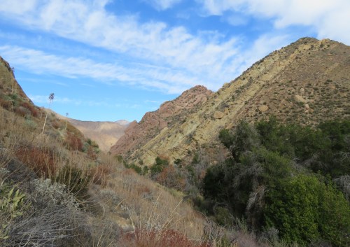
From the road, Tunnel Trail crosses a rolling, relatively flat area of Juncal formation shale dotted with chamise and ceanothus. The trail then drops down into a small canyon. Juncal formation shale is comparatively soft to sandstone and more easily eroded, and here a small creek has cut a meandering course through the shale on its way down into Mission Canyon. When runoff from the rain is strong, even this side creek is flowing, adding to the sense of traveling through a hidden place high in the mountains.

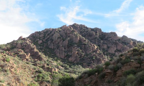
The trail then transitions from the enclosed canyon and opens up, offering views out across Mission Canyon towards the backside of Arlington and Cathedral Peaks. Here, the rock type transitions into Matilija sandstone, making for a more rocky descent and requiring more alertness. The route leads through mostly chamise and manzanita.

As the trail descends it’s framed by views of the canyon and can give the impression of being on an ancient route through the mountains. At times the trail can be shrouded in clouds or fog, adding to the feeling of being somewhere remote.

As the trail continues the chaparral becomes more diverse with black sage, holly-leaf cherry, ceanothus, toyon, laurel sumac, and, in places, California bay laurel.

The trail then rounds a corner and offers views to the east towards White Mountain and the sweep of Tunnel Trail down towards Rattlesnake Connector Trail. Here, when the falls are flowing, one can hear the sound of rushing water in the small side canyon that feeds the falls.

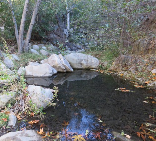
The water from this side canyon flows across the trail forming a picturesque twin cascade. These however are not the main falls. From here, continue down along the trail until the view opens up again out across Mission Canyon. The falls are just to the right, however the best views are a little farther down the trail where one can look back up the canyon and see the falls in their fullness.

The falls are an impressive site worth the diligence required to successfully view them. The water originates near White Mountain and is channeled through this small side canyon, where it flows over a large exposed sandstone face before disappearing down into Mission Canyon.

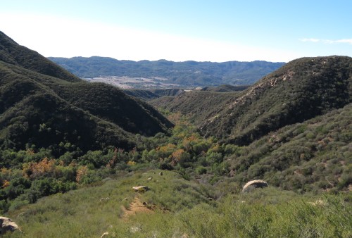
From the site, one is also treated to dramatic views down the canyon and out across the city towards Arroyo Burro Beach and the Channel Islands.

The falls of course can also be reached by hiking up Tunnel Trail from the trailhead at the end of Tunnel Road. This route is longer and steeper, but can add to the sense of reward for one’s efforts when viewing the falls. The hike from Tunnel Road is about 7.5 miles round trip.

To reach Tunnel Road from the Santa Barbara Mission, take East Los Olivos Street to Mission Canyon Road. Continue on Mission Canyon Road as it turns right from Foothill Road and then turns left near the fire station on its way to Tunnel Road. Parking for the trailhead is found along side the road where permitted.

From the trailhead, continue about a mile along the paved access road that leads up to the trail juncture for Tunnel and Jesusita Trails. There is a sign at the juncture for Jesusita Trail, but the one for Tunnel Trail has disappeared. Nevertheless, the trail is recognizable as a single track trail perpendicular to the access road.

From here, Tunnel Trail makes its way up the front of the mountains through a mix chaparral, predominantly ceanothus and laurel sumac, with some black sage, toyon, and holly-leaf cherry. Also noticeable along the trail is wild cucumber or manroot, which is currently in bloom. The plant which grows as a vine has yellowish-white flowers.

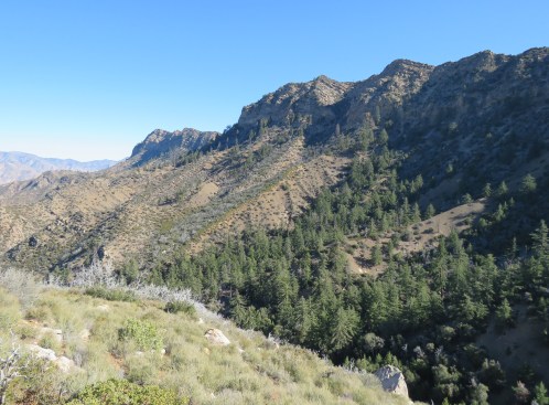
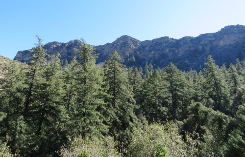
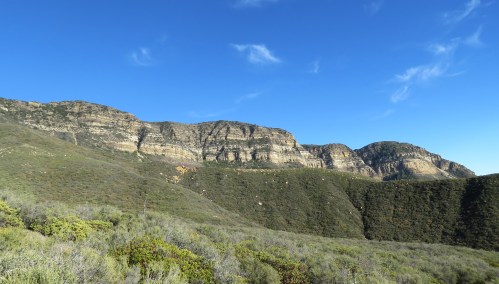
As the trail continues, Arlington and La Cumbre Peaks come into view. Here, the mix of chaparral begins to include chamise and manzanita. It’s also here that the sandstone along the trail becomes more evident. This lower portion of the trail passes over coldwater sandstone, which is the same rock type as Arlington and Cathedral Peaks seen across the canyon.

The climb is aided by a series of switchbacks along the trail, however, the trail itself offers little shade during most of the day.

The trail then rounds a corner, and here the views extend north out across the canyon towards the falls, framed by La Cumbre Peak and White Mountain. In this view, the falls are small, but what’s interesting here is that the canyon between you and the falls is made of Cozy Dell shale. That is, the more easily eroded shale lies between the coldwater sandstone found on the hike up and the Matilija sandstone that the falls are flowing over; and it’s easy to see how the canyon grew over time and why it’s framed by the dramatic sandstone mountainside to the north.

From here, the trail the continues in a broad arc, following the curvature of the canyon, and at the about 3.25-mile mark from the trailhead, arrives at Rattlesnake Connector Trail. The connector trail offers an alternate way to reach the falls by hiking up through Rattlesnake Canyon. From here, it’s roughly another half-mile to where the falls are located.

Even when the falls aren’t flowing, Tunnel Trail can make for a great day hike because of the views it has to offer, and visiting the site where the falls are located can make it easier to find them when conditions are right for viewing.

This article originally appeared in section A of the February 22nd, 2016 edition of Santa Barbara News-Press.

Posted by: James Wapotich | March 21, 2016

Trail Quest: Wheeler Gorge Nature Trail

Just past Wheeler Gorge Campground, along North Fork Matilija Creek, is a well-designed interpretive trail that provides a great opportunity to learn and recognize some of our local plants in their native habitat.

The scenic trail leads through a mix of riparian and chaparral plants, and is about three-quarters of a mile long.

An interpretive brochure for the trail with pictures of the plants can be found at Wheeler Gorge Visitor Center. The brochure can add to the experience as sometimes the plant being described by the numbered signs is either behind you or off to the side. Many of the plants also appear more than once along the trail, and so the brochure makes it easy to refer back to them during hike.

To get to the trailhead from Santa Barbara, make your way to Ojai, and continue north along State Route 33 towards Wheeler Gorge Campground. The visitor center is across the road from the campground and is open weekends from 9 a.m. to 3 p.m.

The trail begins at the upper end of Wheeler Gorge Campground, just downstream from where State Route 33 crosses North Fork Matilija Creek.

The trail can also be accessed from State Route 33, by parking in the pullout just past the bridge, about a half-mile from the visitor center, and crossing the road to the upper end of the campground.

At beginning of the trail is a large sign with a map of the route. From here, the trail continues upstream along the creek passing under the bridge.

The first stop along the trail describes poison oak, which can be found in riparian areas, as well as in canyons and along hillsides. The plant can grow as a vine on other plants; as a shrub; or even as just a few stalks coming up out of the ground. It is a powerful plant that teaches one to pay attention to their surroundings. And it can also inspire agility to avoid brushing up against the plant and the urushiol oil found on its leaves and the tips of its stems. The oil causes an allergic rash for most people. The plant is recognizable by its distinctive compound leaf composed of three leaflets, which resemble a lobed oak leaf. The leaves are green in the spring, turning red into the fall.

The next stop describes white alder, which lines much of the creek along the trail. It is sometimes said of alders that they like to keep their feet wet, meaning that alders prefer growing close to the water’s edge and where water is flowing year round. The bark is light grey and generally smooth to the touch. The tree, which can grow to 50-80 feet tall, is deciduous, with its green, somewhat oval-shaped leaves turning gold in the fall.

The trail then crosses the creek, and it’s here that it begins the loop.

The next plant highlighted is laurel sumac, a large shrub with green taco-shaped leaves. The flowers with their light yellow inflorescence appearing late in the spring. The plant does well at the edge of riparian areas, as well as in dry, chaparral environments.

Yerba Santa is also found along the trail. This evergreen shrub, with its aromatic leaves, can be found in both riparian and chaparral areas. The leaves on the ones found along the trail are dark green; slightly toothed on the edges; and sticky on top. The flowers, in the spring, are white to purple, and can serve as a hub of activity for checkerspot, swallowtail, and other butterflies.

The canyon also supports coast live oak. Coast live oak and oak woodlands provide important habitat for a wide range of animals. The acorns produced by oaks also provide food for a number of animals including, scrub jays, acorn woodpeckers, wood rats, bears, and deer. The tree, with its oval-shaped, spiny leaves, can live more than 250 years, and is the only oak that thrives in a coastal environment.

Also a favorite of the bears is holly leaf cherry. This low shrub, in the rose family, has dark green leaves with serrated edges and tiny spines similar in appearance to holly. The dark red fruit ripens in the fall and has a large pit covered by a thin fleshy layer.

Another riparian tree along the trail is arroyo willow. Arroyo willow favors areas where water can be found and can often be an indicator of where there is water underground. The tree has furrowed bark and long, slender leaves similar in appearance to other types of willow. The tree, which can grow to 30 feet tall, is deciduous and sheds its leaves in the fall.

It’s past this stop, that the trail turns up an unnamed side creek. Near the confluence of the two creeks is found sycamore.

Sycamore is another riparian tree and, similar to arroyo willow, requires access to the water table. The tree’s distinctive bark is smooth, beige-white, and becomes darker as it peels away from the tree in pieces creating a mottled or patchwork look. The large five-lobed leaves can sometimes be confused with maple leaves. Sycamore leaves however have fuzzy undersides. The tree can grow to over 100 feet tall and is deciduous with its leaves turning golden to orangish red in the fall.

Also along trail is pacific blackberry, another member of the rose family. Blackberry is a vine that can build upon itself forming wide, brambly mounds. The leaves typically have three leaflets and can sometimes be confused with poison oak, however the stems of blackberry are covered with tiny thorns. Blackberries ripen in the summer. The fruit is edible but also quite popular with birds and mammals, who often get there first.

The trail continues up the side creek and transitions from riparian into chaparral as it leaves the creek and starts to follow the low ridge that separates the creek from State Route 33.

The first chaparral plant described in this section is black sage. The sage is in the genus salvia and part of the mint family, along with many of our other local sages. The aromatic plant can sometimes be hard to differentiate from purple sage, which fortunately, doesn’t grow along the trail. The matter can be further complicated elsewhere as black sage hybridizes with purple, white, and chia sage.

As the trail continues along the ridge and begins its descent it passes through a lot of chamise. Chamise is a hardy, drought tolerant plant that grows on a variety of soil types. The plant with its small leaves and dry looking stick-like branches often grows in dense stands that can dominate an area, particularly on hot, dry, south-facing slopes.

As the trail moves off the ridge it passes toyon. This woody shrub has serrated leaves similar in appearance to holly. The plant flowers in June and July with corymbs or clusters of white flowers, with first green berries appearing in August or September. In December, the small fruit, about the size of a blueberry, ripens becoming red. The plant is also known as Christmas berry and California holly.

Also along the trail is scrub oak. The Spanish word for scrub oak is chaparro, which also gives us the word chaparral and ultimately the word chaps. Chaps of course being the coverings that vaqueros wore to protect their legs when riding through brushy areas. California scrub oak is a small evergreen shrub with sharply toothed leaves, that can be found in chaparral, oak woodland, and conifer woodland habitats. The acorns, like that of coast live oak, are used by a variety of animals.

The trail then returns to the creek to complete the loop.

The trail was built by Youth Conservation Corp in 1979. In 2011, new signs were installed, and the text and brochure updated by William Hohensee with the support of Boy Scout Troop 808 as part of Hohensee’s Eagle Scout Project.

This article originally appeared in section A of the February 8th, 2016 edition of Santa Barbara News-Press.

Posted by: James Wapotich | February 6, 2016

Backpacking Made Easy

backpacking class Santa Barbara Los Padres National Forest hiking trails skills

*

Backpacking class Santa Barbara Los Padres National Forest hiking trail skills

*

Through this class, you will learn the basic skills and awareness to set out on our local trails and craft your own backpacking trips. Many of these skills can also be used for day hiking as well.

This class is unique in that it takes place on our local trails. As the best place to learn something is in the context in which it applies, in this case outdoors. You’re also probably interested in backpacking because you want to get out on the trails and experience nature more. 

Past participants have said: “James and Sierra make a perfect team. They made the richness of the backcountry accessible to me, even though I started with very little experience. They helped open me to a level of connection with nature I had never experienced.”

“The best part was the combination of practical skills and teaching with the nature connection, as the two together inspired the confidence that I can do this.”

In general, the class covers three main areas: wilderness navigation; nature connection; and gear/trip planning.

Our approach to wilderness navigation is also somewhat unique. You will learn route-finding and orienteering skills that are not dependent on having a GPS or compass. While we do use these tools on occasion, knowing how to navigate without them can help build the confidence to hike anywhere.

Nature connection is also a big part of our time out on the land. For many of us, the whole point of carrying gear out into the wild is to immerse ourselves in the elements and feel a deeper sense of connection with the natural world around us.

We will cover the gear basics and provide insights into how to evolve your own gear set. You don’t need to buy the latest gear in order to head out into the backcountry; what’s more important is to have the basics covered so that you can get out there and get started.

Backpacking Made Easy

March 26 – April 9

Santa Barbara and Ojai are home to a variety of incredible backpacking destinations, and yet, often the biggest obstacle is simply having the knowledge and skills to get started.

Through this immersive workshop, you will learn the basic skills needed to comfortably explore and enjoy our local trails.

Hot springs, waterfalls, epic views, and unspoiled wilderness are just some of the rewards for those who are willing to make the journey.

Each class takes place outside, on one of our local trails, and provides a mix of hands on instruction, immersive exercises, and council sharing circles that allows for learning on many levels.

Lay of the Land
March 26th 9AM-3PM

Learn how to orient yourself to the local landscape, and begin learning the skills and awareness that will help you remove the word lost from your vocabulary. Become familiar with maps and creating your own mental maps. Learn about the different gear options and how to choose equipment that suits you.

Nature Connection
April 2nd 9AM-3PM

Venturing out onto the land is even more enjoyable when we take time to develop a meaningful connection with it.

Learn to see the natural world around you as an ally, rather than an obstacle to overcome, and shift your hikes from feeling like endurance contests to journeys of discovery. And learn how to feel at home in the woods. Practical skills include trail navigation, menu planning, personal care and basic first aid skills.

Pathfinding
April 9th 9AM-3PM

Many of our local trails are overgrown, particularly those off the beaten path. Learn how to read the trails, practice route-finding, and develop your own sense of “body radar” to help you navigate in the wilderness. Practical skills include trip planning, campsite evaluation, water assessment, and camp set up.

Optional Free
Overnight Backpacking Trip
April 16-17

For those who are interested, we will help organize a free, optional backpacking trip. Here’s a chance to put all these great skills to use, and build on the material covered so far.

Length of the hike and destination for the overnight trip to be determined according to current conditions and the capabilities of the participants.

Guides:

James Wapotich is a Volunteer Wilderness Ranger with the Forest Service and the author of the Santa Barbara News-Press hiking column, Trail Quest. James leads guided hikes and has hiked many of the trails in our local backcountry.

Sierra Butler is a UC Certified California Naturalist, council facilitator, and nature connection guide. An alumna of Pacific Crest Outward Bound School, Sierra has backpacked in the Appalachians, Sierras, and our local backcountry.

Workshop is $225 per person, or bring a friend and both 20% off.
Limit 12 students

To sign up or for more information please contact:

James (805) 729-4250 jwapotich@yahoo.com

Posted by: James Wapotich | February 4, 2016

Exploring the Santa Barbara & Ojai Mountains

Hiking Backpacking Santa Barbara Ojai Los Padres National Forest trails wilderness

*

Exploring the Santa Barbara & Ojai Mountains
Free Slideshow Presentation with Q&A

Wednesday, March 9th, 7:00PM
Karpeles Manuscript Library
21 W. Anapamu St., Santa Barbara, CA

Ever changing, the Santa Barbara and Ojai backcountry is a place of surprising diversity and rich beauty. Within these natural lands, you’ll find waterfalls, quiet potreros, Chumash villages sites, old homesteads, and miles of trails to explore. Many of these trails are within less than two hours of Santa Barbara. This talk will highlight some of the best trails and camps that can be used to craft 2-3 day backpacking trips, as well as some great day hikes.

Join local author James Wapotich as he shares images, stories, and trail conditions from his treks through our local backcountry. James has hiked many of the trails in the southern Los Padres National Forest. He is a Volunteer Wilderness Ranger with the Forest Service, and is the author of the Santa Barbara News-Press hiking column, Trail Quest.

For more information email me at jwapotich@yahoo.com or call (805) 729-4250.

Posted by: James Wapotich | January 25, 2016

Trail Quest: Buckhorn Canyon

It’s been a while since Dinsmore Camp appeared on any Forest Service map. The camp was removed at some point during the 1970s or ‘80s, but one can still find remnants of the site. The camp was named after Thomas Dinsmore, an early Forest Service Ranger, who used the site as a hunting camp.

The remote site is tucked away in Buckhorn Canyon, about 6.5 miles from the nearest trailhead, and because of its history can make for an interesting destination. Nearby trail camps make it possible to include a visit to the site as part of a backpacking trip.

To get to the trailhead, find your way to Gibraltar Road in the foothills behind Santa Barbara. Take Gibraltar Road to the top of the Santa Ynez Mountains and turn right onto East Camino Cielo Road. East Camino Cielo Road follows the top of the mountains to Romero Saddle. Here, the road becomes unpaved and begins its descent down the backside of the mountains, and although there is no sign, the road officially becomes Romero-Camuesa Road. The road eventually arrives at Mono Campground, roughly an hour-and-half drive from Santa Barbara. There are several forest service gates along the road that are closed when there is significant rain in the forecast and so it’s best to check with the Forest Service regarding current conditions.

Buckhorn Canyon Indian Creek Canyon Trail Dinsmore Los Padres National Forest hike backpacking

Buckhorn Canyon is seen from Indian Canyon Trail

From Mono Campground, Romero-Camuesa Road continues about a half-mile to the Indian-Mono Trailhead. Here, the road arrives at a permanently locked Forest Service gate. Parking is found at the trailhead.

From the trailhead, continue along Romero-Camuesa Road for the first mile. The road crosses Mono Creek and then Indian Creek several times before arriving at the beginning of Indian Canyon Trail. From here, the trail continues up Indian Canyon. The trail is mostly level and in generally good condition and leads through a mix of chaparral and riparian plants.

At about the 4.5-mile mark from the trailhead, Indian Canyon Trail arrives at the intersection with Pie Canyon Jeep Road. From here it’s another half-mile to the confluence of Buckhorn and Indian Creeks.

At the confluence, Indian Canyon Trail leaves Indian Creek and follows Buckhorn Creek for the next half-mile to Lower Buckhorn Camp. The trail through this section follows an old road cut that served as a continuation of the route provided by Pie Canyon Jeep Road.

Map Indian Canyon Trail Meadow Camp Lower Buckhorn Trail Dinsmore Dick Smith Wilderness Los Padres national forest

Map courtesy Maps.com

Lower Buckhorn Camp, like many camps in the backcountry, got its start as a hunting camp. The camp is located along Buckhorn Creek under several coast live oaks. The camp features a fire ring, grated stove, and a collapsed picnic table.

Just past the turnoff off to Lower Buckhorn Camp, Indian Canyon Trail arrives at the beginning of Buckhorn Trail. From here, Indian Canyon Trail climbs over the small rise separating the two creeks and drops down to Meadow Camp and returns to Indian Creek. Meadow Camp is about a half-mile from Lower Buckhorn Camp and features a picnic table, fire ring, and ice can stove. Neither camp has reliable water year-round and so the best time to visit the area is during the spring.

From Indian Canyon Trail, Buckhorn Trail continues up Buckhorn Canyon. The trail follows the creek upstream and is in generally good shape up to the Dinsmore site thanks to a volunteer project last year organized by Los Padres Forest Association that removed the downed trees and cleared some of the brush.

About a mile from Lower Buckhorn Camp, the trail arrives at the confluence of Buckhorn and Middle Buckhorn Creeks, and it’s here that Dinsmore Camp was located. The site is in a small clearing with nothing more than two ice can stoves nearby, letting one know that they’re in the right area. Continuing in the direction of Middle Fork Buckhorn Creek, one can find old bottles and rusted cans and other trash from the hunting camp; and past that, the remains of the old outhouse and horse corral.

Dinsmore Camp Thomas hike trail Buckhorn Canyon ice can stove Los Padres National Forest

A pair of ice can stoves mark the area where Dinsmore Camp was located

The camp is named for Thomas Dinsmore, who was born in 1870, in Montecito. His grandfather, Colonel Bradbury True Dinsmore, had moved the family from Maine to California in 1861. Following the financial crisis in 1857 that ruined the family’s lumber business, Colonel Dinsmore became part of a venture to drive livestock out to Northern California, where he decided to settle after first returning to Maine to gather his extended family.

In 1868, because the damp climate of Northern California was affecting his son’s health, he moved the family to Montecito. There he purchased 130 acres of land, including most of what is now San Ysidro Ranch, and began farming. Colonel Dinsmore is credited with planting Montecito’s first orange grove.

Thomas Dinsmore grew up working on the family farm, and in 1890, married Julia Agnes Tubbs; together they had two children, Augustus and Hazel.

In 1905, Dinsmore, who was already making regular trips into the backcountry to hunt and camp, joined the newly-formed Forest Service and became an assistant ranger.

The following year, to help his wife’s health, which was being affected by the cold and damp of our seasonal fog, Dinsmore took an assignment at Madulce Cabin. The site was a two-day ride into the backcountry and during the summer he would take his wife and kids to stay there with him.

In 1908, Dinsmore oversaw the construction of Mono Adobe, to replace the one-room cabin that had been built there two years earlier to serve as the ranger station. The larger structure was required to house Dinsmore and his family, and was also closer to town, by a day, than Madulce Cabin. The adobe site is about a half-mile south of Mono Campground and about seven miles from where Dinsmore Camp was located.

In 1913, Dinsmore retired from the Forest Service and returned to farming and, in 1924, was elected to the County Board of Supervisors where he served until 1942. He passed away the following year.

Dinsmore’s son, Gus, who also worked for the forest service for a period of time, later led the effort in 1966 to restore Mono Adobe. The forest service hadn’t used the site since 1933, after the more accessible Pendola Station was built.

Past the site of Dinsmore Camp, Buckhorn Trail continues along Buckhorn Creek. The trail passes a spring alongside the trail and then starts to become more brambly and overgrown. The trail crosses the creek numerous times as it continues up the canyon and eventually arrives at the site of Upper Buckhorn Camp. The site occupies a small area clear of brush along the trail and the only indication that one has found the site is a lone ice can stove and some barbed wire. The camp was likely removed around the same time as Dinsmore Camp.

Buckhorn Canyon trail hike backpacking Los Padres National Forest

Madulce Peak is seen in the distance from Buckhorn Trail

From here, the trail continues upstream, following the canyon as it begins to narrow and wind its way up the watershed. Here, the damage and regrowth from the 2007 Zaca Fire is still evident. The trail then turns up a side wash, partially obscured and covered with deadfall, before arriving at the beginning of the switchbacks that climb out of the canyon.

From here, the route is easier to follow but requires pushing through ceanothus most of the way as the trail makes its way towards Buckhorn Road. As the trail nears the top, it offers views out across the canyon and towards Madulce Peak and West Big Pine Mountain.

At about the 10-mile mark from the Indian-Mono Trailhead, Buckhorn Trail arrives at Buckhorn Road. For those incorporating the trail into a longer backpacking trip, from here, it’s about nine miles along the road down to Upper Oso and about 2.5 miles over to Happy Hollow and Little Pine Mountain.

This article originally appeared in section A of the January 25th, 2016 edition of Santa Barbara News-Press

Indian Meadow Camp trail hike backpacking Santa Barbara Los Padres National Forest

Indian Meadow

Lagniappe

I did this hike over the Christmas break with my sister from Colorado. We backpacked in the first day to Meadow Camp and base camped there. Only one decent pool of standing water from the recent rains in the creek below Meadow Camp, rich with sulphur and tannin, mm-mm. On the second day, I day hiked the length of Buckhorn Trail up to the Buckhorn Road and back.

Good water along Buckhorn Trail starting before the first crossing and all the way to the site of Upper Buckhorn Camp. The trail itself is in good shape up to Dinsmore Camp, from there it starts to become overgrown. The worst section however is where the trail eventually leaves the creek and starts its climb to the Buckhorn Road. This transition before the first switchback is cluttered and obscured by deadfall. The switchbacks are another matter and require pushing through ceanothus almost all the way to the top. [The trail has since been worked as part of an LPFA Trail Project – and then of course got burned in the 2016 Rey Fire]

The third day, we day hiked to Maiden Falls. Flowing water in Indian Canyon from the site of Peg Leg Camp to a little ways past “Brain Rock”. No water at Indian Camp and only a trickle of water in the falls. I would post photos of the falls, but it’s too depressing seeing them so dry.

Brain Rock Indian Canyon hike trail backpacking Santa Barbara Los Padres National Forest Dick Smith Wilderness

“Brain Rock”

Indian Creek Meadow Camp hiking backpacking Santa Barbara Dick Smith Wilderness Los Padres National Forest

A dry Indian Creek near Meadow Camp

During our last night at Meadow Camp a fox visited while we were sleeping and took one of my shoes for a ride, along with two of our trekking poles. It’s the sort of thing foxes like to do.

When we got back to the car we had another fox encounter of a different kind. I had left a half-eaten breakfast burrito in the car from the drive in, and when we started our hike my sister had commented “aren’t you worried about bears breaking into your car?” “No,” I replied, “our bears aren’t into that sort of thing.” Apparently, however, our foxes are, as there were fox tracks all over the hood and roof of my car. It was particularly interested in the damaged weather stripping on my driver side door as a means to getting to its quarry. The fox was unsuccessful, but from the scratches on my door you could tell it liked what it was smelling.

fox tracks

Fox tracks

Scrub jay

Scrub Jay along Indian Creek

Posted by: James Wapotich | January 11, 2016

Trail Quest: 1969 Floods

In January 1969 California saw a series of storms that brought 10 continuous days of rain to the southland. 1969 was not the wettest year on record, that distinction goes to 1997-1998 with its El Niño storms. 1969 experienced only a moderate El Niño, however history has shown that while El Niño can bring higher than average rainfall, not every El Niño year brings record rainfall. And while flooding is often associated with heavy rains, not every year with heavy rainfall brings with it major floods. Nevertheless, the events from the 1969 winter storms can serve as a cautionary tale as we anticipate what is being predicted as the strongest El Niño year on record.

On January 18, 1969, the first of two 5-day storms made landfall along the coast of California. The rain for Santa Barbara that day was around 1-2 inches. The county to date had seen a only modest amount of rain for the year. The next day, however, the rain started coming down heavier, bringing with it flash floods and the first tragedy associated with the storms.

On Sunday afternoon, January 19, seven teenage boys decided to test out their homemade raft on rain-swollen Arroyo Burro Creek near La Cumbre Plaza. The boys put in near the YMCA where strong currents grabbed the raft. Four of the boys jumped off, while the other three were swept downstream towards the 426-foot long cement tunnel that carries the creek under Calle Real, the railroad tracks, and Modoc Road. Two of the boys were able to make it ashore and call out for help, while the third, Mark Williams, was carried through the tunnel and drowned.

Members of Los Padres Search and Rescue Team arrived on the scene and two of them entered the tunnel, one from each end, in an effort to find Williams. They met midway on separate catwalks. When team member Don Buck attempted to jump across to the other catwalk he was swept away in the rising water, pulling in Rick Mohun, who was holding the safety line attached to Buck. Two more team members, Denis Huestis and Donald Thompson, tried to help and all four were swept downstream through the tunnel. Buck was pulled out, but failed to respond to resuscitation. Mohun and Thompson made it out safely, but Huestis drowned.

Meanwhile, a second tragedy was unfolding in the backcountry. Over the weekend six boys from Canoga Park, Bobby and Ronny Cassol, Danny and Eddie Salisbury, Frank Donato, Frank Ruah, and one adult, Robert Samples, were camping along the Sespe River. They had driven in along the unpaved road back to Sespe Hot Springs when the rains hit. The road was later closed to vehicles in late 1970s.

Realizing the need to leave they headed out but their vehicle got stuck in the mud near Coltrell Flat, about 13 miles from Lion Campground, near where the Piedra Trailhead is now. There they met Scott Eckersley, who had come in Friday, and also got stuck trying to leave on Saturday. Eckersley, who had stayed in his car for shelter, spotted the other vehicle in the distance and went over to investigate. On Sunday, Eckersley suggested that they break into the cabin at Coltrell Flat and wait out the storm there, which they did.

With the boys reported overdue and their location unknown, Ventura County Sheriff’s Department was contacted and deputies Gary Creagle and Chester Larson were dispatched on Monday, January 20, to Lion Campground. With the river swollen and conditions that prevented flying into the area, Larson suggested using one of the 15.5-ton bulldozers from the nearby Navy Seabee Training Center in Rose Valley to search for the stranded campers and bring them back out. The Seabees maintained the dirt road back to the hot springs as part of their training program and if anything could get there and back it would be one of the large bulldozers. Chief Equipment Officer Robert Sears of the Seabees volunteered to drive the bulldozer. Forest Service Ranger James Greenhill, who was familiar with area, also offered to ride out.

The rescue party of Larson, Sears, and Greenhill, after fording close to a dozen river crossings, arrived at Coltrell Flat around 7 p.m. to find the campers inside the cabin. The decision was made to leave the cabin and return to Lion Campground.

The group traveled upriver along the road, fording each crossing as before, making it as far as Oak Flat Camp around midnight. However, by this time the torrential rains had steadily raised the level of the river. During the next crossing, while passing through the eight-foot deep water, the river flooded over the top of the hood and the engine stalled out. Unable to start the engine, the group remained stuck in the middle of river, cold water flowing over them, until one by one the river swept them off the bulldozer and into the rushing water. Eckersley was the last to be swept away and was the sole survivor.

When the water took Eckersley, it slammed him against a rock and he blacked out. He later regained consciousness and found himself at the edge of the river. He pulled himself ashore and dug a small hole, covering himself with mud and rocks for shelter, and waited out the night still in pain. The next morning he hiked about four miles back to some abandoned vehicles he’d seen on the way out to seek shelter and was rescued later that day by helicopter.

Elsewhere, the same heavy rains that brought tragedy to the backcountry, were causing all too familiar events of overflowing creeks, mudslides, flooded streets, road closures, and power outages. The rains were also rapidly filling our local reservoirs. On January 20, Gibraltar Reservoir was the first to overflow, having risen 15 feet the day before. The next morning, Jameson Reservoir, having risen 20 feet the previous day, overflowed.

On January 23, there was a lull in the weather as the first storm played out. The county saw modest rainfall that day and some clearing skies, but more rain was on its way. The next day, the second 5-day storm system hit an already saturated California, compounding the flood damage from the previous storm.

Carpinteria was hit the hardest. During the first storm, 39 families had been forced to evacuate. When the second storm hit all three major creeks, Santa Monica, Franklin, and Carpinteria Creeks, overflowed, flooding much of the town and leaving behind silt-laden water, mud, and debris. 1,000 of the 7,000 people living in Carpinteria were evacuated.

Many of the creeks originating in the Santa Ynez Mountains overflowed causing flood damage to the nearby neighborhoods. Heavy rains loosened boulders weighing as much as 30 tons, that then rolled down the canyons, clearing everything in their path and creating debris that would then jam up at various bridges. San Ysidro Creek, for example, backed up at the East Valley Road bridge sending water into the adjoining neighborhoods.

On January 25, Governor Reagan declared the county a disaster area as more rain continued to fall. The next day, the Santa Barbara News-Press headline read “Wettest January Since 1916 Douses Santa Barbara County”. The January rainfall total was surpassed only by the 1995 storms.

The record, however, for the most amount of rain in a 24-hour period still belongs to 1969. On January 26, Jameson Lake recorded 16.31 inches of rain. The heavy rain however brought with it more tragedy. The already overflowing reservoir washed out the caretaker’s cabin below the dam killing the caretaker, William Brooks.

The raging waters also fueled unfounded rumors that Gibraltar Dam was going to break under the strain of more water flowing through its spillway than it was designed to handle.

Further downstream along the Santa Ynez River, residents along Paradise Road trying evacuate from the rising waters were cut off when the bridge across Los Laureles Creek was washed out. 120 residents were then airlifted out by helicopter.

Those same rising waters caused Lake Cachuma to overflow on January 25. When the flood gates were opened the river grew to a 600-foot wide torrent, flooding various parts of the valley. In Lompoc, the sewage treatment plant located next to the river was flooded, along with 4,000 acres of farmland.

Then, on January 28, just as the rain was starting to play out Santa Barbara was struck by a second disaster. The blowout at Platform A occurred, which released 80,000-100,000 barrels of oil over the next several months into the Santa Barbara Channel. It was the worst oil spill at that time and helped lay the foundations for the modern environmental movement.

February brought still more rain and flooding, however by comparison the damage wasn’t as bad in Santa Barbara County. Ventura County, which also saw major flooding during January, was hit harder by the February rains. On February 25, around 2:30 a.m. one of the levees along the Santa Clara River gave way. The river changed course and flowed out through the Ventura Marina. 300 boats were damaged or completely destroyed. No lives were lost and a number of boats were spared by being in dry dock to avoid damage from the oil spill. According to engineers on site, if the rain and erosion had continued the river would have likely returned to its ancient course through downtown Oxnard.

In our local backcountry, the rain also left its mark. In addition to trails being washed out, four trail camps were destroyed and later rebuilt or relocated. Upper Bear at the headwaters of Sisquoc River was washed out, as was Water Canyon Camp further downstream. Along Manzana Creek, both Fish and Coldwater Camps were destroyed by flooding. All four camps were in the burn area of the 1966 Wellman Fire.

There are many lessons from these years of heavy rains and flooding, and it is a testament to the work of our first responders and city planners that those lessons have been integrated into our disaster preparedness programs. That awareness has in turn helped to reduce the overall impact of subsequent storms and the damage they can create.

The article appears in section A of today’s edition of Santa Barbara News-Press.

A more detailed account of the Sespe River Tragedy can be found here, http://www.outsideonline.com/1825311/hell-high-water.

Posted by: James Wapotich | December 21, 2015

Trail Quest: Franklin Trail, Phase II

Earlier this year a new section of trail in Carpinteria became open to the public. The trail is the second section of Franklin Trail and is part of an ongoing community effort to reopen this historic trail. Once completed the trail will lead from Carpinteria, over the mountains, to Jameson Lake and the upper Santa Ynez River.

The trail has been closed since the 1970s but is starting to be reopened. In 2013, the first 2.25-mile section of trail opened with a ribbon cutting ceremony that celebrated what was truly a community achievement. Meanwhile, work continued to reopen the remaining two sections that lead to the top of the mountains.

This spring, Phase II was completed, which adds three more miles of open trail and starts to give one a sense of just how long the trail will be once it’s fully open. No longer a mere stroll through the woods, the hike from the trailhead to the end of the second section is about 10.5 miles roundtrip and offers some great views of both the coast and the mountains. The trail is open to hikers, mountain bikes, and equestrians.

Franklin Trail Carpinteria hike backpacking Los Padres National Forest

A view along the coast is seen from Franklin Trail

To get to the trailhead from Santa Barbara, take Highway 101 south to Carpinteria and exit at Linden Avenue. Follow Linden Avenue north towards the mountains and turn left onto Malibu Drive. From Malibu Drive, turn right onto Sterling Avenue and continue to Franklin Park.

From the park, follow the bike path across Franklin Creek and continue upstream along the bike path to Foothill Road. The trail crosses the road, and continues west towards Carpinteria High School. Parking is also permitted at the high school on the weekends, provided there are no school related event happening there.

From the trail kiosk at the high school, the trail continues around the western edge of the campus and travels along the top of the flood control berm installed by the Army Corp of Engineers. The trail is fenced on the school side of the trail. The trail then follows the easement through Persoon Ranch, crossing a bridge and continuing through an avocado orchard, where the trail is fenced on both sides.

Franklin Trail map Santa Barbara Carpinteria hike

Map courtesy Maps.com

At about the one-mile mark, the trail enters Horton Ranch, where the trail opens up. The trail passes through chaparral and climbs a series of switchbacks that immediately deliver views out across Carpinteria and towards the Channel Islands.

About about the two-mile mark, the trail arrives at an Edison access road and levels out some what. Nearby, is the turnoff to Frank’s Bench, which provides a shady rest stop. From here, it’s another quarter-mile along the access road to the beginning of Phase II, which is marked with a small trail kiosk that includes a map of the route showing the mileage. This same map can be found here on Friends of Franklin Trail website.

This second section of trail follows the easement through Rancho Monte Alegre to the beginning of forest service land. Please respect private property.

From the map kiosk, Franklin Trail continues along the access road, which offers views to the east out across Franklin Canyon. The trail traces the contour of the canyon before arriving at the ridge line that separates the Franklin Creek drainage from that of Sutton Creek and it’s from this ridge that one gets their first views of the Santa Ynez Mountains.

Franklin Trail Sutton Canyon hiking backpacking Los Padres National Forest Carpinteria

The Santa Ynez Mountains frame a view of Sutton Canyon

From here, the trail continues its climb along the ridge, passing a second bench, before descending down towards a tributary of Sutton Creek, where one can find coast live oak bordered by the chaparral. The trail then climbs away from the creek, rounding another corner and dropping down toward Sutton Creek. In fact, the trail provides a surprising amount of up and down for a trail supposedly making its way to the top of the mountains.

At Sutton Creek, the trail passes through even more oak woodland, before then climbing from the canyon. And it’s through here that it can start to sink in what a gift this trail is to the community, to be able to hike this far into the mountains behind Carpinteria and one day continue over to the other side.

At about the 4.5-mile mark, the trail levels out and arrives at a collection of power line poles and towers. From this large open area one is treated to some exceptional views of the Santa Ynez Mountains.

From here, the trail follows the ridge between Sutton Creek and Carpinteria Creek, and three-quarters of a mile later arrives at the beginning of the third section of trail and National Forest land.

This third section remains closed for safety as it still needs to be cleared and, in places, rebuilt. Nevertheless, it is exciting to stand there knowing that it will become open at some point in the future.

Franklin Trail Carpinteria Los Padres National Forest

Coast Live Oak are seen along Franklin Trail

Once open, the trail will follow the ridge line to the top of the Santa Ynez Mountains, where it meets Divide Peak OHV Road. From there, Franklin Trail continues down the backside of the mountains through Alder Creek towards Jameson Lake. This last part of the trail is already open, and so all that is needed to reopen the full route is the completion of the Phase III section.

Franklin Trail was built in 1913 by the Forest Service to provide recreational access to the backcountry. Originally called Carpinteria-Juncal Trail, the trail lead from Carpinteria to the backside of the mountains and Juncal Canyon, where Jameson Lake is now.

Even before the trail was built, Franklin Canyon was a popular destination. The Franklin Family regularly hosted picnics, camp outs, and community events on their property, which is how the trail also became known as Franklin Trail.

During the late 1930s, the Franklin Family reluctantly closed access to their property after a fire broke out that was attributed to picnickers. Following the closure, people began using the nearby Edison access road to bypass the Franklin property and tie into the trail above Franklin Canyon.

Following the second World War, Carpinteria saw the beginning of what would become its burgeoning avocado industry. By the mid-1970s, access to the trail was closed by landowners over concerns of avocado root rot being spread through their orchards by trail users.

Franklin Trail Carpinteria hiking backpacking Los Padres National Forest

The Santa Ynez Mountains are seen from Franklin Trail

In the mid-2000s, the County’s Riding and Hiking Trails Advisory Committee (CRAHTAC), along with The Land Trust for Santa Barbara County and Montecito Trails Foundation, began working with landowners to establish easements to reopen the trail.

In 2011, Friends of Franklin Trail formed to raise the funds needed to build the trail and meet the permitting requirements. Through the group’s leadership the community raised more than $500,000 for the project.

In 2013, one hundred years after the trail was originally built, the first section of the trail was reopened to the public, while work continued to reopen the second section.

In the past year, volunteers working with Santa Barbara Trails Council, and led by long time trails advocate Ray Ford, cut a preliminary line, or p-line, that follows the original tread and marks the route through the third section.

What’s needed to now are the funds to clear and rebuild this last section of trail, as well as pay for the environmental review associated with reestablishing the trail through the National Forest. The 2.7 mile section of trail has not see any maintenance in more than 40 years.

Santa Barbara Trails Council has started a fundraising campaign to raise the $110,000 necessary to complete the work. Earlier this month, Santa Barbara Sierra Club offered a challenge grant that helped raise $10,000, bringing the total raised so far to around $38,000.

To make a donation to help support reopening this third and final section of Franklin Trail go to http://www.sbtrails.org.

This article originally appeared section A of the the December 20th, 2015 edition of Santa Barbara News-Press.

Posted by: James Wapotich | December 14, 2015

Trail Quest: Red Reef Trail

There are a number of trails in the Ojai area that lead from the Ojai Valley over the mountains towards Rose Valley and Sespe River. Of these trails, Red Reef Trail is unique in that in addition to offering some great views and scenery provides an opportunity to connect over to Willett Hot Springs as part of a backpacking trip.

The hike from the trailhead along Sisar Canyon Road to Ladybug Camp is about 11.5 miles, and from there it’s another 6.5 miles down to Sespe River Trail and over to Willett Camp.

To get to the trailhead from Santa Barbara, make your way to Ojai. From Ojai, continue east on State Route 150 to the Upper Ojai Valley and look for Sisar Road on your left. The narrow one-lane road leads through a residential neighborhood and a half-mile later arrives at the beginning of unpaved Sisar Canyon Road. From here, it’s another half-mile of rough road to the locked forest service gate where the trail begins.

Red Reef Trail backpacking hiking ojai sespe wilderness Los Padres national forest

Sespe formation rocks are seen from Red Reef Trail

From the gate, Sisar Canyon Road follows Sisar Creek for the first two miles before making a wide switchback and climbing away from the creek. The road then returns to the creek, passing a second locked forest service gate, and arrives at the beginning of Red Reef Trail.

Red Reef Trail makes its way through upper Sisar Canyon and at about the 4.25-mile mark from the trailhead arrives at White Ledge Camp. The camp has two usable campsites in a grove of California bay laurel next to Sisar Creek. The creek is currently flowing.

Past the camp, the trail continues its climb to the top of the mountains and offers great views out towards the ocean, including the Channel Islands. And to the east, one is treated to striking views of Topatopa Bluff.

At the 6-mile mark from the trailhead, Red Reef Trail meets Hines Peak Road. From here, continue east a short way along the unpaved road to Elder Camp, which is a dry camp. Past Elder Camp, Hines Peak Road begins its climb towards the back side of Topatopa Bluff and a half-mile later arrives at another locked forest service gate.

Hines Peak Road is accessible from Rose Valley with a temporary use permit from the forest service. The unpaved route starts near Rose Valley Campground and is only open to four-wheel drive vehicles. For more information about current conditions and to apply for a permit contact the Ojai Ranger District at 805-646-4348.

Map Sisar Canyon Red Reef Trail White Ledge Lady Bug Sespe Wilderness area topatopa Los padres national forest ojai

Map courtesy Maps.com

Past the gate, the road continues its climb along the back side of the mountains, passing through mostly scrub oak. To the west, the road offers views back towards Chief Peak. At the top, the road branches; the road to the right continues towards the connector trail that leads down to Last Chance Trail. To the left, Red Reef Trail follows the road along the top of the mountains towards Hines Peak and the Topatopa Mountains.

Here, the route levels out somewhat and passes through mostly chaparral with the dominant plants being scrub oak, ceanothus, and yerba santa. Along the way one is treated to great views to the north out across Bear Canyon and the Sespe Valley towards Pine Mountain Ridge. To the northeast, one can see Mt. Pinos.

At about the 8.5-mile mark, the road cut passes an unnamed summit, which is essentially a cut off island from the main ridge of the Topatopa Mountains. The exposed tops of the mountains are composed of Matilija sandstone, while the north side is bordered by softer Juncal formation shale. Over time, erosion and uplift have helped create the dramatic features seen today.

Past the summit, the views to the south include Santa Paula Canyon and out towards Pt. Mugu, the Oxnard Plain, and part of the Santa Monica Mountains. The trail then passes the top of Last Chance Trail, which leads down through Santa Paula Canyon and ends near Thomas Aquinas College.

Timber Canyon Red Reef Trail Ojai hike backpacking Sespe Wilderness Los Padres National Forest Topatopa Mountains

Timber Canyon and the Topatopa Mountains are seen from Red Reef Trail

At the 9.5-mile mark, the trail arrives at the saddle overlooking Timber Canyon. To the east, the ridge line climbs steeply up to Hines Peak. At the saddle, Red Reef Trail begins its descent down into Timber Canyon. The single-track trail winds its way down through the canyon and offers dramatic views of the backside of the Topatopa Mountains.

The trail passes through mostly chaparral and eventually crosses Timber Creek. As the trail continues down into the canyon it enters a grove of big cone Douglas fir that were spared the ravages of the 2006 Day Fire. The fire burned over 160,000 acres, including portions of Sespe Wilderness and most of Red Reef Trail, before it was contained.

Just before the trail crosses the creek a second time, look for a side trail that follows the creek downstream. Here, Red Reef Trail crosses the creek, while the side trail continues down to Ladybug Camp. The trail to the camp crosses water that is flowing from the spring that feeds into Timber Creek. Currently the spring is the only source of water for the camp.

The camp is nestled in a stand of some very large big cone Douglas fir. In the mix are also canyon live oak and along the creek can be found California bay laurel and big leaf maple. Ladybug Camp is named for the many ladybugs that can be found there. The camp has one stone fire ring with a picnic table and a second table nearby. Also at the site are two ice can stoves.

IMG_0512

Ladybugs huddling together at Ladybug Camp

Past the turnoff to Ladybug Camp, Red Reef Trail continues its descent down into Timber Canyon. The trail eventually crosses Timber Creek one last time and then makes a quick hop over a low ridge into Red Reef Canyon.

Just past this last crossing one can find an old side trail that leads down to the site of Horsethief Camp. The trail is overgrown, but still somewhat followable and parallels Timber Creek. The camp was removed during the 1970s, but one can still find three double-wide ice can stoves at the site. The site is also visible from Red Reef Trail just before it crosses over into Red Reef Canyon.

As the trail continues down into Red Reef Canyon it follows Red Reef Creek passing through a mix of plants including coast live oak, sycamore, coffee berry, California bay laurel, and holly-leaf cherry. Several downed trees along the trail add to the wilderness experience.

Big Cone Spruce Douglas fir Topatopa Mountains Ojai hike backpacking Red Reef Trail Los Padres National Forest Lady Bug ladybug sespe wilderness

A grove of big cone Douglas fir are framed by the Topatopa Mountains near Ladybug Camp along Red Reef Trail

The canyon then narrows and arrives at Harris Tunnel, a short passage carved through the red Sespe formation rock found in this stretch of the canyon. The tunnel, according to the inscription carved on the rock wall, was completed on February 23rd, 1904, by R. Harris and T.J. Harris.

Past the tunnel, the trail eventually rounds a corner in the canyon. Here, the views back up the canyon include the eroded Sespe formation rocks that likely give the trail its name, the eroded rock appearing as a series of fins jutting up towards the sky.

The trail then arrives at Sespe River. From here, the trail cross the river and passes near the site of the old Sycamore Camp before arriving at Sespe River Trail, which represents an alternate way to access Red Reef Trail. From this juncture, it’s 8.5 miles west along Sespe River Trail to the Piedra Blanca trailhead, which can be reached from Rose Valley via State Route 33.

To reach Willett Hot Springs, continue east along Sespe River Trail another mile to the turnoff to the camp. From here, it’s roughly a half-mile up to Willett Hot Springs and a well-deserved soak.  

This article originally appeared in section A of the December 14th, 2015 edition of Santa Barbara News-Press.

Red Reef Trail sespe wilderness hiking backpacking Ojai los padres national forest

Scenery along Red Reef Trail

Hiked this trail over Thanksgiving. Started from the Piedra Blanca trailhead on the first day and hiked Sespe River Trail to Willett. A zoo of people out at Willett. At night going up to the hot spring and gazing out across Ten Sycamore Flat with its many lights was like looking out across a small village. Some water to be found at Willett. The second day we hiked Red Reef Trail and camped at Ladybug. Saw no one once we left Sespe River Trail. No water in Timber Creek at Horsethief or Ladybug, but the spring at Ladybug was flowing. Finished Red Reef Trail on the third day coming out through Sisar Canyon.

Posted by: James Wapotich | November 30, 2015

Trail Quest: Sisar Canyon

Neatly tucked away in a large valley in the Transverse Range of mountains, the town of Ojai is a great starting point for a number of day hikes. The Ojai Valley is framed to the south by Sulphur Mountain and to the north by Nordhoff Ridge.

There are a number of trails in and near Ojai that take you to the top of Nordhoff Ridge, several of which also provide access down the backside of the mountain to Rose Valley and Sespe River for longer backpacking treks.

The hike along Sisar Canyon Road and Red Reef Trail, east of Ojai, connects to the top of Nordhoff Ridge. The route offers some great views out across the valley towards the ocean, as well as east towards Topatopa Bluff. The hike to the top is about 12-14 miles roundtrip, depending on where you park. White Ledge Camp, which also makes a good return point, is about 8.5-10.5 miles roundtrip.

Sisar Creek Canyon trail hike ojai Los Padres National Forest

Sisar Creek

To get to the trailhead from Santa Barbara, make your way to Ojai. From Ojai, continue east along State Route 150 towards Santa Paula. Past Ojai, the road climbs out of the Ojai Valley to the Upper Ojai Valley. Sisar Road is on the left in the upper valley, between Summit Elementary School and Stagecoach Station store.

Sisar Road is a narrow, one-lane road through a residential neighborhood. The paved road continues a half-mile before arriving at the beginning of unpaved Sisar Canyon Road. There is little parking along the road and so you may have to park back along State Route 150. The unpaved road continues roughly another half-mile to a locked forest service gate. The road is rough, but still drivable with a high-clearance vehicle. At the gate is enough parking space for just a couple cars.

From the locked forest service gate, Sisar Canyon Road continues up the canyon following Sisar Creek for the next two miles. The trail is mostly shaded and leads through a mix of a riparian plants along the creek and chaparral along the canyon sides. In the mix are California bay laurel, toyon, coffee berry, coast live oak, and yes, some poison oak. Adding to the colors are sycamore, maple, and California black walnut, all of which have their leaves turning gold for the fall.

Map Sisar Canyon Red Reef Trail White Ledge Lady Bug Sespe Wilderness area topatopa Los padres national forest ojai

Map courtesy Maps.com

From the road, there are a number of little sides trails that lead down to the creek for additional exploring. Currently the creek is flowing intermittently, so there are still some quiet pools to be found.

The road then leaves the canyon floor, making a wide switchback as it climbs away from the creek. Here the trail moves through predominantly chaparral and one sees ceanothus, chamise, yucca, yerba santa, buckwheat, and white and black sage. As the road gains elevation it offers some great views back down the canyon towards the Upper Ojai Valley, and, as it continues, offers views up towards Topatopa Bluff.

Topatopa Bluff is an easily recognizable feature, even from Ojai. The dramatic ridge is an exposed outcropping of matilija sandstone and with its nearly horizontal layers of sedimentary rock is a captivating sight. Because the bluff faces westward it is sometimes bathed in a distinctive salmon-pink glow for several minutes at sunset, which some people refer to as the “pink moment”. Conditions for viewing the phenomenon are said to be best on days that are partly cloudy, between November and February.

Sisar Canyon Trail creek hiking backpacking ojai Los padres national Forest

Sisar Canyon and Upper Ojai Valley is seen from Sisar Canyon Road

At the 3.25-mile mark, the road arrives at a second locked forest service gate. Just past the gate is the beginning of Red Reef Trail. Sisar Canyon Road continues northeast, eventually crossing Horn Canyon Trail, before arriving at the top of Nordhoff Ridge, where it meets Hines Peak Road.

Red Reef Trail leaves the road and continues into upper Sisar Canyon. Here, the trail returns into the shade, passing under several large big cone spruce trees before climbing still further through the chaparral. It’s here, along the trail, that the views begin to open up towards the ocean. The view, still limited by the canyon walls, includes just Point Mugu and Santa Barbara Island.

At the 4.25-mile mark, Red Reef Trail arrives at White Ledge Camp. The camp is tucked under a grove of California bay laurel along Sisar Creek. The camp sports a somewhat popular name, and is not to be confused with the White Ledge Camp at the eastern end of Hurricane Deck Trail in the San Rafael Wilderness, or the long forgotten White Ledge Camp in the Santa Ynez Mountains near White Ledge Peak.

The camp has three sites, each with a stone fire ring and an adjustable barbecue grill on a low metal post, a feature found in many of the camps in the Ojai Ranger District. Two of the campsites have enough space to camp in, the third being too small and sloped. Currently there is water flowing in the creek.

Topatopa Bluff Red Reef Trail Sisar Canyon Ojai hike backpacking trip Los Padres national Forest

Topatopa Bluff is seen from Red Reef Trail

Past the camp, the trail continues its climb to the top of the ridge, returning into chaparral. As the trail climbs, it offers views out towards the ocean that now include Anacapa and Santa Cruz Islands, and to the east, striking views of Topatopa Bluff.

At the 6-mile mark, the trail reaches the top of the mountains and joins Hines Peak Road. From here it’s just a short way east along the road to Elder Camp, which makes a good return point. The camp features a picnic table and metal fire ring with a grill, but no water.

From Elder Camp, Red Reef Trail continues still further into the backcountry. The trail continues along Hines Peak Road about a half-mile east to Sespe Wilderness and follows the top of the mountains towards Hines Peak. The trail then descends down the backside of the mountains towards Sespe River, where it meets Sespe River Trail. From this juncture it’s roughly a mile to Willett Camp and the nearby hot spring.

Regardless of how far you hike you’ll get to some of the rich scenery of this part of Los Padres National Forest.

This article originally appeared in section A of the November 30th, 2015 edition of Santa Barbara News-Press.

Posted by: James Wapotich | November 30, 2015

Trail Quest: McPherson Peak

Although we can’t see them, there are actually three sets of mountains behind Santa Barbara. These mountains are part of the Transverse Range. Along the coast are the Santa Ynez Mountains, which we can see from downtown. Inland, to the north, are the San Rafael Mountains and beyond that are the Sierra Madre Mountains, the most distant of the three from Santa Barbara.

The Sierra Madre Mountains overlook the San Rafael Wilderness and Cuyama Valley, and on a clear day can even offers views of the Sierra Nevada Mountains in the distance. Its two tallest peaks are Peak Mountain (5,843’), and McPherson Peak (5,749’).

A loop hike can be made from Aliso Park Campground, in the Cuyama Valley, to the top of McPherson Peak. The hike is about 10 miles roundtrip and offers a chance to take in the views and scenery of these unique mountains.

McPherson Peak Trail Lookout hike Aliso Park Campground Los Padres national forest sierra madre mountains

Mt. Pinos is seen from McPherson Peak Trail

There are two routes from Santa Barbara that one can take to reach the trailhead and, in this rare instance, both are roughly the same distance and take about two hours to drive.

The first route is to head north along Highway 101 to Santa Maria. Just past Santa Maria, look for the exit for State Route 166 East. The road travels through ranch land towards Twitchell Reservoir and from there follows the Cuyama River east through the mountains towards New Cuyama.

The second route is to head over to Ojai, and take State Route 33 north through the mountains to State Route 166. Turn west onto State Route 166 and continue past New Cuyama.

The little town of New Cuyama, population 661, is something of an oasis in this remote part of Santa Barbara County. The town features a gas station, several restaurants, a grocery store, and even a motel.

Aliso Canyon Road is two miles west of New Cuyama along State Route 166. The paved leads south towards the Sierra Madre Mountains and ends at Aliso Park Campground.

Map McPherson Peak Trail Aliso Canyon Park Sierra Madres Mountains San Rafael Wilderness Los Padres national forest

Map courtesy Maps.com

The campground is located in a grove of coast live oaks along Aliso Creek and has seven camp sites, each with a picnic table and metal fire ring. An adventure pass is required to camp at the campground, but not to park at the trailhead.

There are two trails from the campground with confusingly similar names, McPherson Trial and McPherson Peak Trail. McPherson Trail follows the unpaved continuation of Aliso Canyon Road and leads up the canyon to Hog Pen Spring before then turning into a single track trail. McPherson Peak Trail starts across the creek from the last campsite on the right. Neither trail is marked with a sign.

For the loop hike, take McPherson Peak Trail. The trail climbs out of Aliso Canyon and makes its way along the ridge line that traces the western edge of the Aliso Canyon drainage. The trail starts off in generally good condition and leads through a mix of canyon live oak and chaparral.

McPherson Peak Trail hike Aliso Canyon Park Campground Sierra Madre Mountains Los Padres National Forest Cuyama

Aliso Canyon is seen from McPherson Peak Trail

As the trail makes its way along the ridge line it offers views out across Aliso Canyon to the east, and Messenger Canyon to the west. But the most impressive views are those out across the Cuyama Valley towards the Caliente Range, which is the next set of mountains to the north. Not covered in dense chaparral, the Caliente Range with its rich colors and desert hues is a captivating sight.

As the trail continues its climb towards McPherson Peak it becomes less distinct at times, but still generally follows the ridge line.

At the 4-mile mark, the trail arrives at McPherson Peak and the communications array that is housed there. The peak and other features were named for the McPherson family, who homesteaded in the Cuyama Valley during the late 1800s.

Just east of the communications tower is the cement water tower and foundations for McPherson Peak Lookout. The lookout was built in 1934, and was somewhat unique in that the commanding view from the peak didn’t require the cabin be placed on top of a lookout tower. The structure was removed in 1987.

Caliente Range McPherson Peak Trail hike Cuyama Sierra Madre Mountain Los Padres National Forest

The Caliente Range frames a view of the Cuyama Valley from McPherson Peak Trail

Views from the peak include Mt. Pinos and the Sierra Nevada Mountains to the northeast, and to the south extend out across the San Rafael Wilderness.

For the loop hike, from the peak continue down along the unpaved access road that leads to the peak and look for the beginning of what looks like an old road cut or fuel break on your left. The route traverses the south side of the mountains eastward roughly three-quarters of a mile before arriving at an open flat area.

It’s here, that McPherson Camp was once located and one can still find one of the old campsite stoves. Past the camp the route becomes less distinct but essentially continues east along the fuel break and drops down towards a large metal corral where it meets Sierra Madre Road and arrives at a locked forest service gate.

From here, continue east another half-mile on Sierra Madre Road to the signed beginning of McPherson Trail, which drops down into Aliso Canyon. The trail follows a series of long, gentle switchbacks and offers some nice views of the canyon before arriving at the canyon floor, where it meets the unpaved road coming up from Aliso Park Campground.

At this intersection, the road continues a short ways to the left up to Hog Pen Spring, where one can find a cattle trough filled with water and the shade of several large maple trees. The spring was named by the McPherson family, who used to run hogs and cattle in the canyon.

From Hog Pen Spring, the unpaved road continues down the canyon towards Aliso Park Campground to complete the loop.

While one can extend their hike west along the top of the Sierra Madre Mountains to reach Peak Mountain, an additional eight miles roundtrip, an alternate approach is to drive there. The road is somewhat bumpy and requires a high-clearance vehicle, but it does provide a way to visit both peaks.

Aliso Park Campground Sierra Madre Mountains Cuyama hike trail los padres national forest

Sierra Madre Mountains are seen from Aliso Canyon Road

From Aliso Canyon Road, continue west along State Route 166 to Cottonwood Canyon Road, which leads to Bates Campground. The road is paved until the last mile or so before the turnoff to the campground. The campground is shaded by canyon live oak, and features six camp sites, each with a picnic table and metal fire ring.

Past the campground, Bates Canyon Road continues unpaved to the top of the Sierra Madre Mountains. The road is narrow and at times rough, but the climb itself is spread out along a somewhat reasonable grade. The road is easily affected by storm damage and so it’s best to check with the forest service regarding current conditions and access.

At the top of the mountains, Bates Canyon Road meets Sierra Madre Road, which is also unpaved. To the right, Sierra Madre Road continues northwest along the top of the mountains and eventually connects over to State Route 166. To the left, the road continues east and ends at the locked forest service gate just past the turnoff to McPherson Peak.

Peak Mountain is about halfway between Bates Canyon Road and McPherson Peak. To access the peak continue east along Sierra Madre Road until you round a corner that gives you the first views of McPherson Peak and continue to where the ridge line meets the road. Park alongside the road and hike west following the fuel break along the ridge. About halfway up, look for the beginning of an old road cut, on the left, that leaves the steep fuel break and more gently takes you to the top of Peak Mountain. The hike is about a mile round trip.

Regardless of how far you go you’ll get to see some of the rich scenery of the Cuyama Valley and Sierra Madre Mountains.

This article originally appeared in the November 22nd, 2015 edition of Santa Barbara News-Press.

« Newer Posts - Older Posts »

Categories