Posted by: James Wapotich | November 16, 2015

Trail Quest: Arroyo Verde and Grant Parks

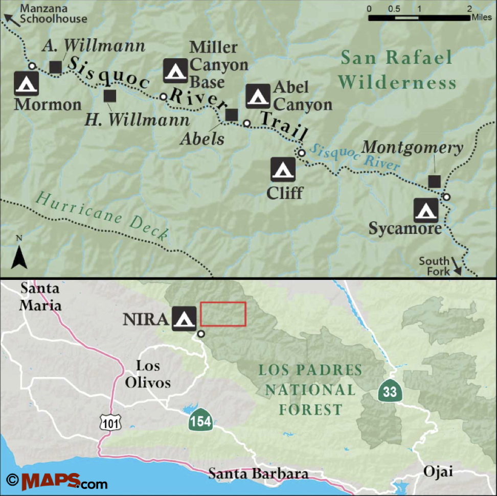
While Ventura is perhaps better known for its State Beaches, the city does have a couple of interesting trails in the foothills that one can visit. Less than 45 minutes from Santa Barbara, the trails in both Arroyo Verde and Grant Parks lead through native coastal sage scrub and offer views out across Ventura.

Arroyo Verde Park is the largest of Ventura’s parks and includes 3.5 miles of trails that one can explore.

To get to Arroyo Verde Park from Santa Barbara, take Highway 101 south to State Route 126. Continue on State Route 126 to Victoria Avenue. Take Victoria Avenue north towards Foothill Road. Turn left on to Foothill Road and continue to Day Road, which dead ends into Arroyo Verde Park.

IMG_3307

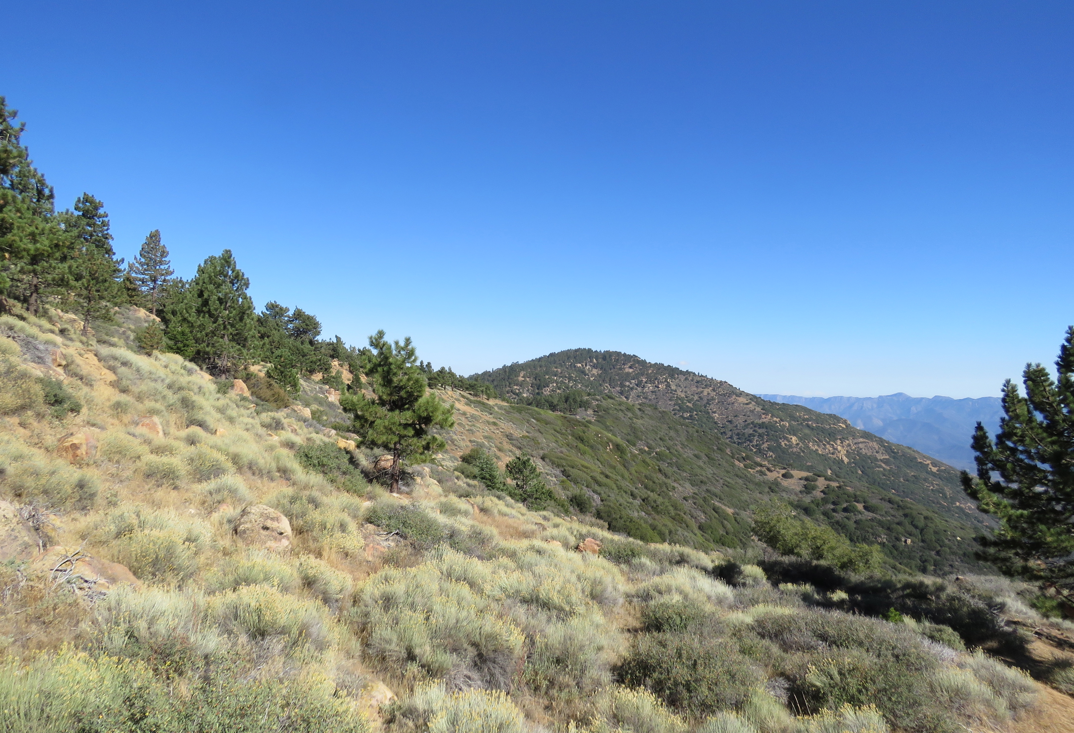
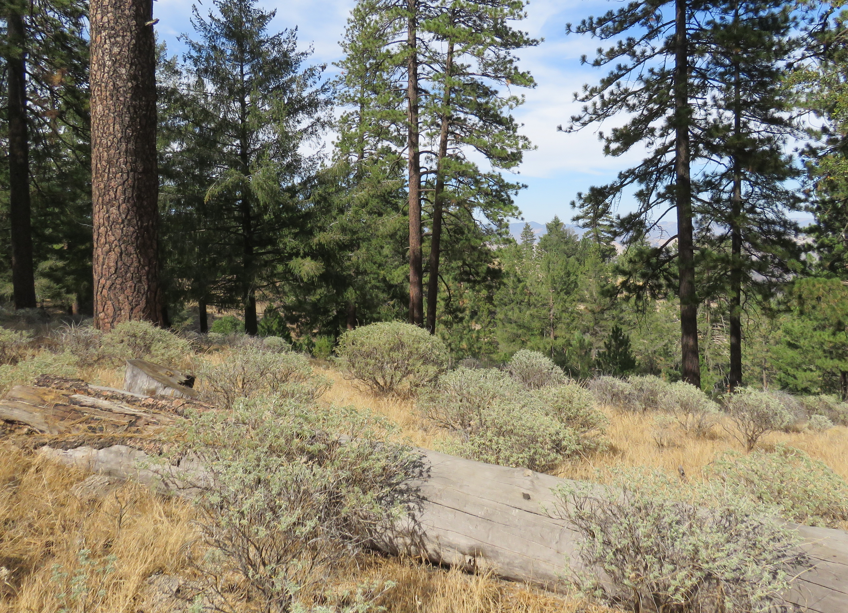
Ventura frames a view Arroyo Verde Park from one of the open space trails

The park is open from dawn to dusk. Parking on the weekends and holidays is $2 per hour or $5 per day; access is free during the week.

The 132-acre park is in many ways an idyllic community park. Along the western side of the park road is the 14-acre developed portion of the park, which features open grassy areas, barbecue grills, picnic tables, children play areas, and group sites.

Along the eastern side of the park road is 118 acres of open space that expands up into the canyon. With the network of trails in the park, it is possible to craft a roughly three-mile loop hike that traces the contours of the canyon and provides a tour around most of the park. For more information about the park go to http://www.cityofventura.net/parks. A map of the trails can be found here.

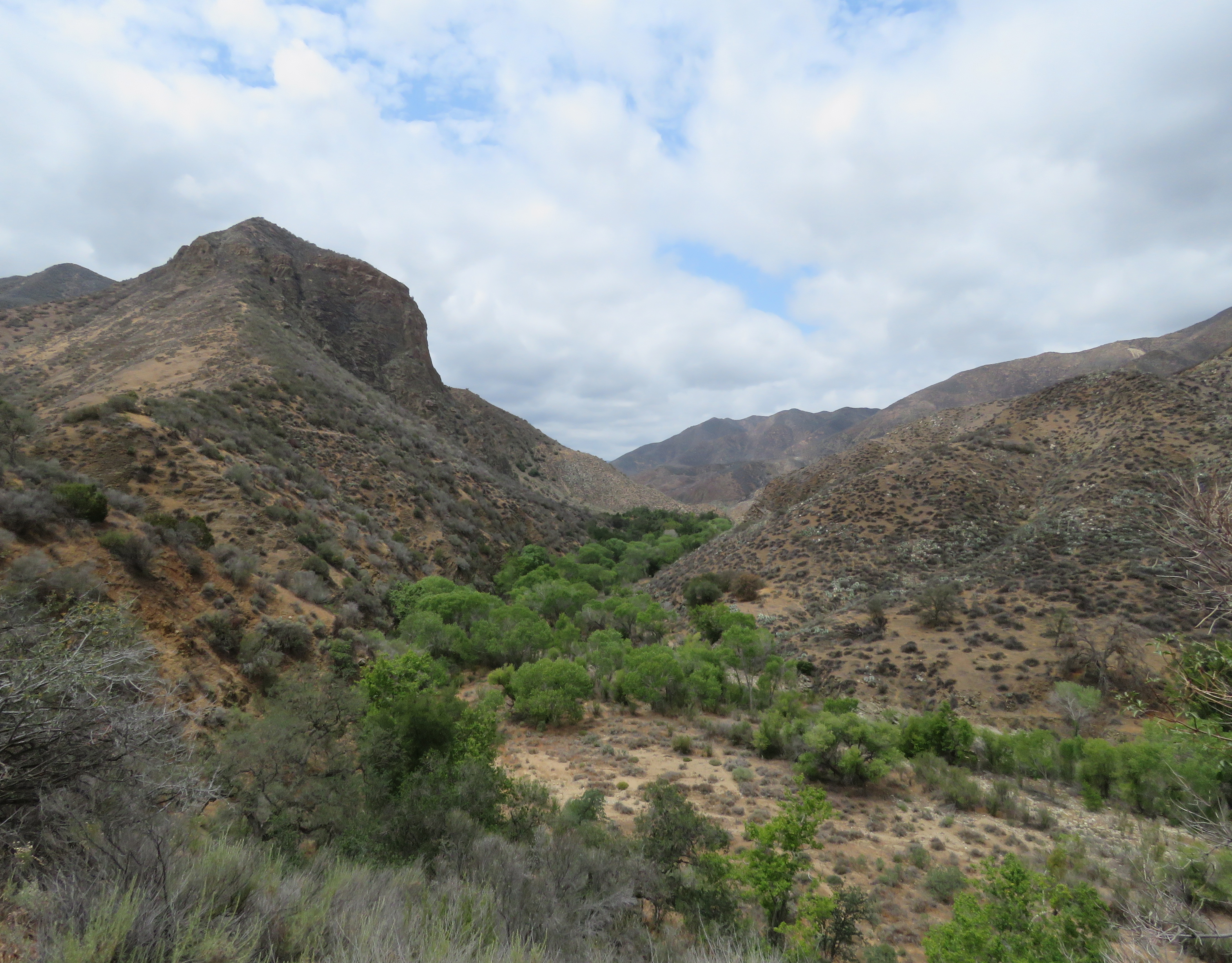
For the loop hike, look for the beginning of the trail along the eastern side of the park, just past the park entrance. The trail leads through predominantly coastal sage scrub. Here, you will find purple sage, coastal sagebrush, coyote brush, lemonade berry, and in a couple places some poison oak. Further along the trail is coast live oak, toyon, elderberry, and even a couple of California black walnut trees.

The trail parallels the park road for a quarter-mile to the first trail juncture. Here, the trail to the right leads somewhat steeply up to a vista point overlooking the park, while the trail to left parallels the road further, before turning east into the canyon. The two trails meet a quarter-mile later and briefly follow an access road before continuing deeper into the canyon.

Venture hike trails Arroyo Verde Park

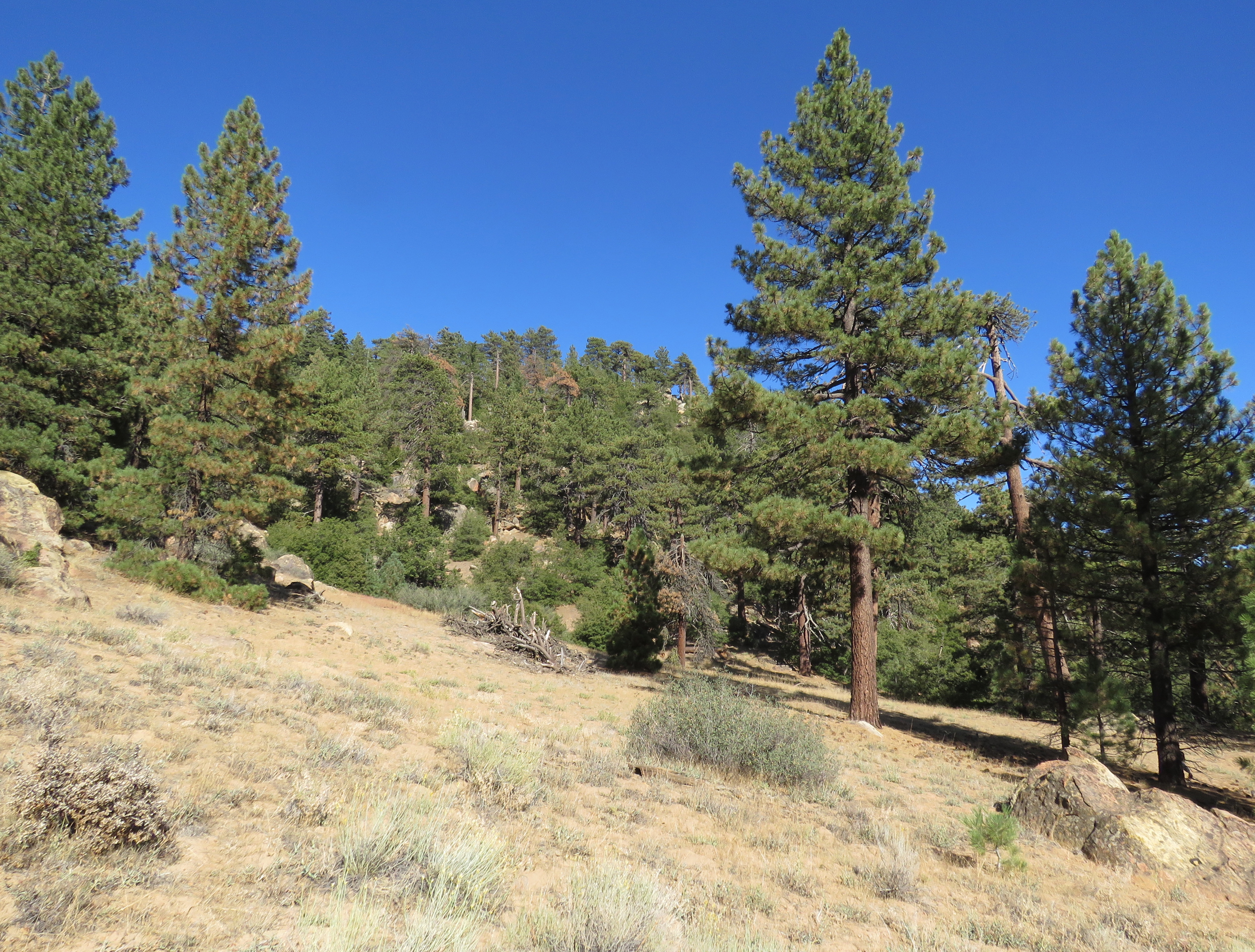
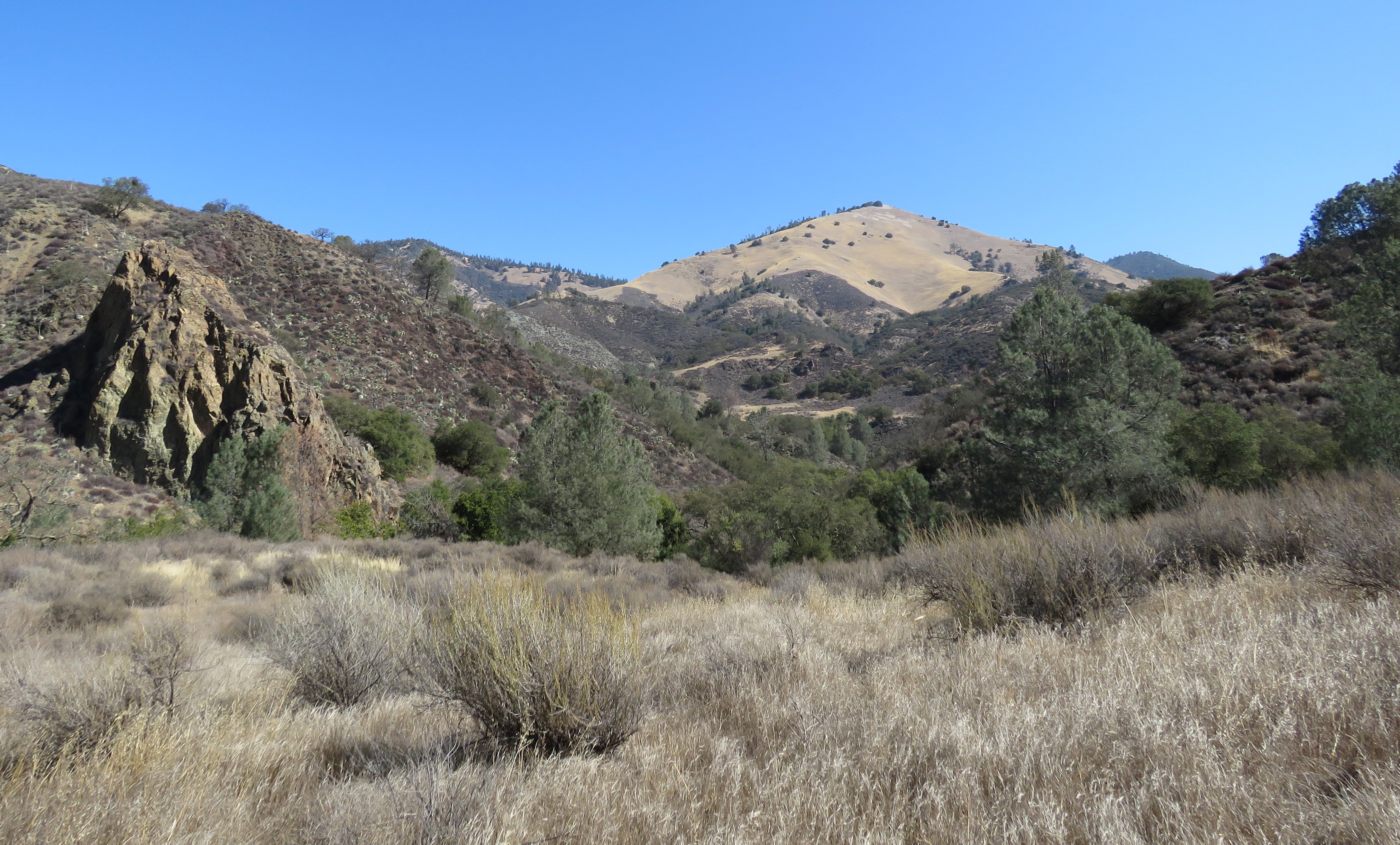
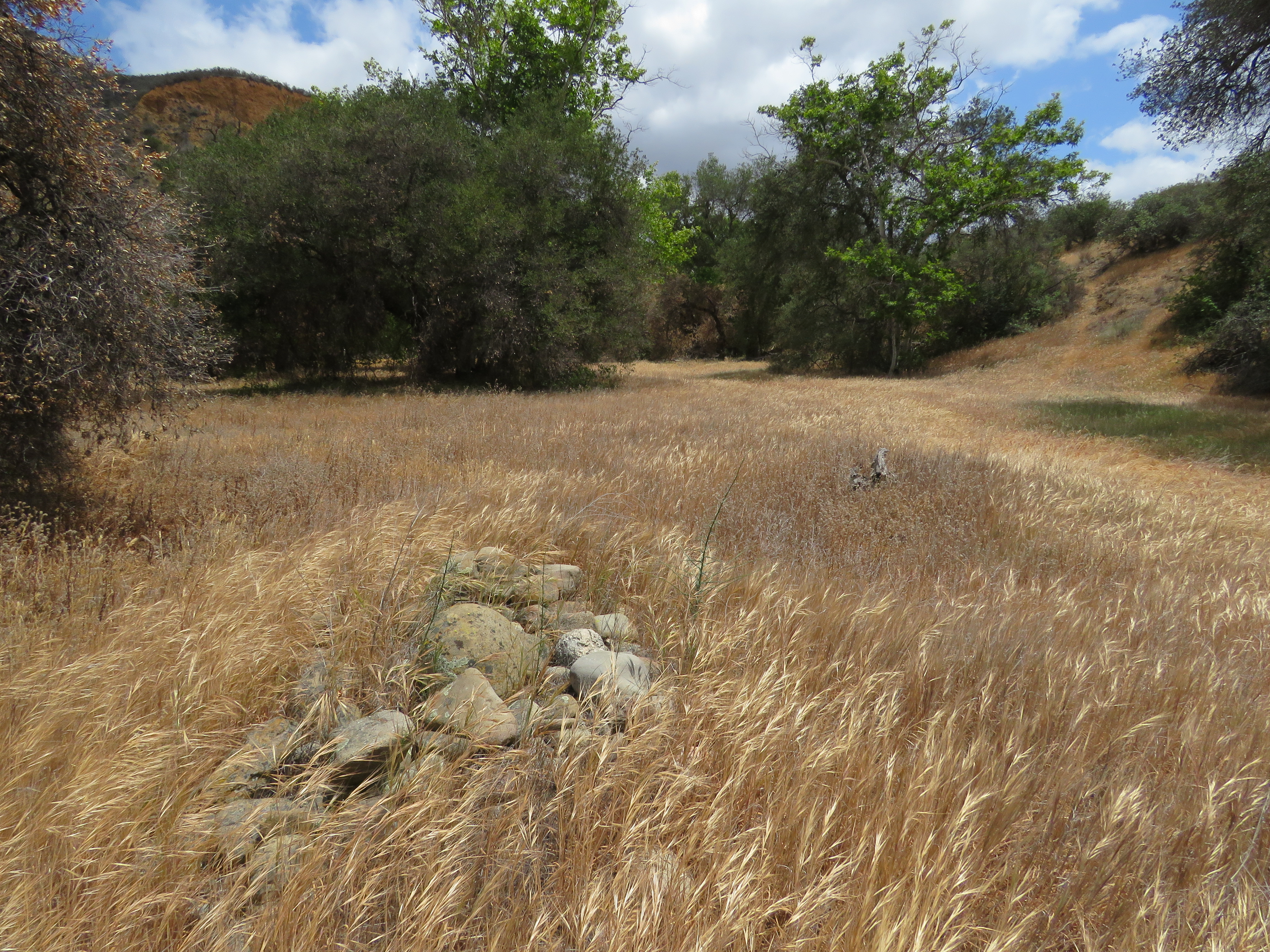
The upper canyon at Arroyo Verde Park is seen from one of the trails

Continuing around the canyon the trail passes a couple more connector trails that lead back down to the developed area, before reaching what’s affectionally described as the “wall”. Here, the trail branches again, with the trail to the right climbing steeply before leveling out, while the trail to left bypasses the climb. Both trails return to the developed area and arrive at a redwood grove, completing the open space portion of the hike.

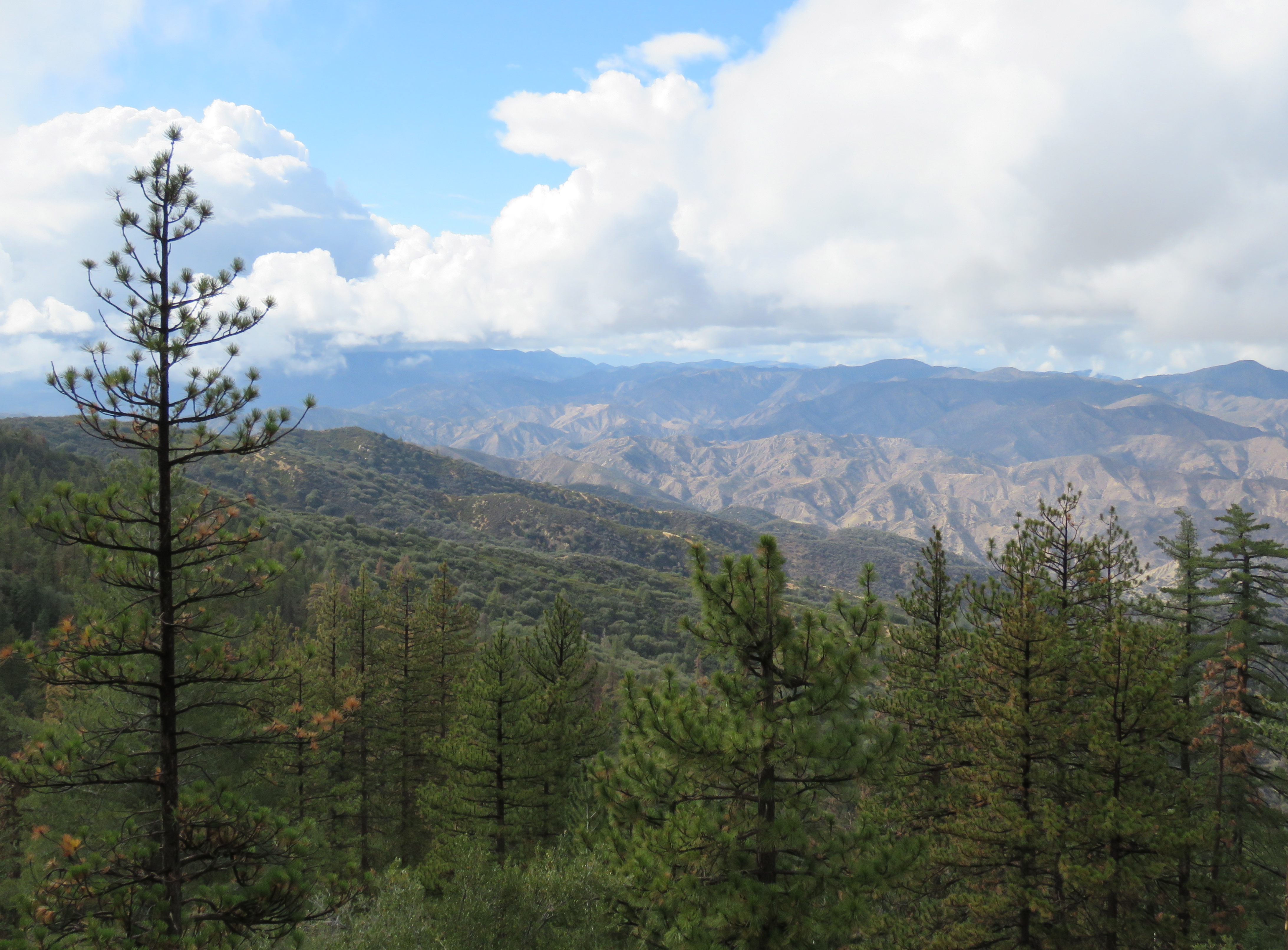
At different points along the hike the views extend out across the park and Ventura towards the ocean.

To complete the last mile of the circuit, from the redwood grove continue back through the developed park area towards Vista Bluff Group Site, where you can find the beginning of the trail along the western side of the park. The tree-lined trail leads back to the park entrance.

The park was created in 1959, when the city of Ventura acquired the land from various landowners. A master plan for the park was developed and, in 1961, the site officially became Arroyo Verde Park.

The park is also home to Twilight’s Last Gleaming Cross Country Challenge. The four-mile run along the park’s trails was created in 1986, by Andrew Hecker, and typically coincides with the last Saturday before Daylight Saving.

Ventura’s second largest park is Grant Park. The park is located behind City Hall and offers some of the best views of Ventura. The park features a new mile-long trail that leads up into the foothills. From the trail, a short side trip can be made to historic Serra Cross.

To get to Grant Park from Santa Barbara, take Highway 101 south to the Ventura Avenue exit. Turn right onto Thompson Boulevard and follow it to California Street. Take California Street north towards City Hall, which dead ends into Poli Street. Turn right onto Poli Street, and then make an immediate left into the parking area for City Hall. Continue to the upper parking lot, where one can find parking near the trailhead. The park is open from dawn to dusk.

Grant Park was created in 1918, when Kenneth and Tonie Grant donated 109 acres to the city of Ventura. Grant had originally envisioned building an observatory on the hillside property.

Demonstration Trail Ventura Botanical Gardens hike Grant Park

Demonstration Trail leads from City Hall into the foothills behind Ventura

Over the years, the park remained undeveloped and with no trails under-used as well. In 2005, community members began envisioning a botanical garden at the park that would include plants from the five different Mediterranean biomes around the world. The park would feature native plants from Chile, the Cape of South Africa, Australia, the Mediterranean, and of course, California.

In 2012, Demonstration Trail was built and opened to the public. The mile-long trail will connect to the various features of the garden as they are added. In 2014, the first Chilean plants were installed along the trail, and it will be exciting to watch the envisioned garden grow and develop over the coming years.

From the parking area, Demonstration Trail continues up the small canyon behind City Hall and follows a series of switchbacks to an overlook, which offers some great views out across the city. This first quarter-mile section of trail is also ADA accessible.

From the overlook, the trail continues along the ridge of the canyon arriving at Brakey Road. The trail crosses the road and continues east along the hillside to another overlook that features an even more expansive view of the city.

In the future, a second trail from the parking area may be added along the eastern side of the canyon that would also connect to Brakey Road.

Other features the garden hopes to add may include an educational center, heritage center, gift shop, café, and amphitheater. For more information about Ventura Botanical Gardens, or to make a donation or volunteer, go to http://www.venturabotanicalgardens.com.

Ventura hike trail Grant Park Serra Cross

Historic Serra Cross

From Demonstration Trail, one can make a short, quarter-mile walk over to Serra Cross Park for additional views. Starting from where Demonstration Trail crosses Brakey Road, continue west on Brakey Road to where it meets Ferro Drive and the road into Serra Cross Park. The park can also be reached directly from Ferro Drive.

The park is named for Father Junipero Serra, who founded the first nine of California’s 21 missions. In 1782, Serra founded Mission San Buenaventura. Shortly after the mission was built, a cross was placed on the hillside as a landmark for travelers. Over the years the cross has been replaced a number of times. The current cross was installed in 1941, and stands on a circular stone pedestal overlooking the city.

In 2003, the city of Ventura sold the cross and surrounding one acre of land to Serra Cross Conservancy, which now maintains the one-acre park with donations from the community. The sale was in response to a potential lawsuit centered on the separation of church and state, and the city’s ownership and maintenance of the cross site.

A popular wedding location, the park also offers some of the best views of the city. To the southeast, one can see out across the Santa Clara River and Oxnard Plain; to the south out towards Anacapa and Santa Cruz Islands; and to the west out across the Ventura River.

Regardless of how far you hike, you’ll have a chance to see some of the local scenery of Santa Barbara’s neighbor city to the south.

This article originally appeared in section A the November 16th, 2015 edition of Santa Barbara News-Press.

Posted by: James Wapotich | October 26, 2015

Trail Quest: Visiting Pine Mountain Campground

If you’re looking for a place to camp out amongst the pines, then Pine Mountain and Reyes Peak Campgrounds may be the answer. The camps are located along Pine Mountain Ridge, which is a series of peaks and summits in the backcountry behind Ojai.

The mountain ridge is part of the Transverse Ranges, and, as the name implies, is home to a variety of pines. The two campgrounds along the ridge are situated near several different trails, which provide a variety of hiking opportunities.

To get to the campgrounds from Santa Barbara, make your way to Ojai. From Ojai, take State Route 33 north towards Cuyama. Continue past the turnoff to Rose Valley and follow State Route 33 towards Pine Mountain Summit. Just before reaching the pass or summit, look for the beginning of Reyes Peak Road on your right. You’ll know if you’ve gone too far if State Route 33 begins its descent down into the Cuyama Valley.

Pine Mountain Campground ridge hike Los Padres national Forest

A grove of pines near Pine Mountain Campground

Reyes Peak Road was built during the 1950s by Shell Oil company to search for oil on the southeast side of Reyes Peak. And while no oil was found, the road now provides access to the campgrounds and trailheads along the ridge. In 2013, the road was paved, making the drive that much easier. The road, however, is seasonally closed from December to May.

There are two campgrounds to choose from along the ridge. The first is Pine Mountain Campground, which is in a small valley along the road surrounded by pines with six sites to choose from.

Past Pine Mountain Campground, the road continues west along Pine Mountain Ridge. The road passes a seventh campsite, and then arrives at Reyes Peak Campground, which has six more campsites spread out along the road.

Both campgrounds are located near the top of the ridge and depending on the time of the year can be windy. All of the campsites along Pine Mountain Ridge are available on a first come, first served basis. Each campsite has a picnic table, metal fire ring, and pedestal barbecue. There is no water at any of the campgrounds, so plan accordingly. An adventure pass is required to camp at the campgrounds, but not to park at the trailheads.

In addition to just camping out amongst the pines, there are also a number of nearby trails that one can explore.

Chorro Grande Trail Reyes Peak Campground Los Padres National Forest Pine mountain ridge hike

A view across Pine Mountain Ridge looking east from the top of Chorro Grande Trail

Continuing a short way past Reyes Peak Campground the road arrives at the beginning of Chorro Grande Trail. The trail leads down the front side of Pine Mountain and provides some great views out across the Sespe Valley. From the trailhead, it’s less than a mile to Chorro Camp.

The hike provides a nice contrast to the plants along the top of the ridge, which are dominated by pines. As the trail descends, it transitions into a mix of pines and chaparral. Here, you’ll find plants such as canyon live oak, scrub oak, ceanothus, manzanita, and coffeeberry.

Chorro Camp is named for the spring that issues from underneath a large boulder. The spring is currently dry, but if predictions for a strong El Niño come true, the spring will likely start flowing. The word chorro is Spanish for gushing or flowing water.

Chorro Grande Camp trail hike Pine Mountain Ridge Los Padres national Forest

Scenery along the trail down to Chorro Grande Camp

The camp has two sites, one just past the spring with a grated stove beneath a large sugar pine, and the other below the spring with an old ice can stove. Past the camp, the trail continues another 4.25 miles down to State Route 33.

Past the Chorro Grande trailhead, Reyes Peak Road continues another mile, unpaved, to the Reyes Peak trailhead. The road is suitable for most vehicles and can also make for easy hiking.

From the trailhead, Reyes Peak Trail continues along the old road cut a short way before arriving at a three-way intersection. To left, Reyes Peak Trail continues across the north side of the ridge, and to the the right, the old road cut dips down across the front of Reyes Peak. In the center is the trail that leads to the top of Reyes Peak.

The hike to Reyes Peak is roughly a mile and offers views to the north out towards Mt. Pinos and, to the south, out across the mountains towards the Channel Islands. The trail, which at times is somewhat steep, leads through predominantly Jeffrey pines.

Named for botanist John Jeffrey, who first identified and described the plant in 1852, Jeffrey pines are similar in appearance to ponderosa pines. One way to tell them apart is by their cones, both of which have barbs on the end of their scales. The barbs on ponderosa pines stick out, making the cones rough to the touch, while those of Jeffrey pines do not. Another differentiator is the bark. While the bark on both trees is reddish-brown, Jeffrey pines have a sweeter aroma. The smell has often been described as being reminiscent of vanilla or pineapple.

Reyes Peak is the tallest summit along Pine Mountain Ridge with an elevation of 7,514 feet. The peak was named after the Reyes Family, which homesteaded along the Cuyama River in the mid-1800s. Near the peak one can find the metal supports left over from the lookout that once stood there. The lookout was built around 1925 and burned down during the 1932 Matilija Fire.

For a longer hike, Reyes Peak Trail continues west towards Haddock Peak and then drops down towards Haddock Camp where it meets Gene Marshall-Piedra Blanca Trail.

Another short hike that leads through the pines is the hike down to Raspberry Spring. The trail starts from Reyes Peak Campground. The trailhead is in the pullout for the only camp that is on the north side of the road. The well-established trail leads through a mix of pines, including ponderosa and sugar pines, as well as white fir. Resembling Christmas trees in their appearance, white fir are relatively easy to differentiate from the other trees along the trail.

At about the half-mile mark, the trail arrives at the first camp, which has a stone fire ring and grated stove. Just below that is a second camp. To the west of the first camp, in a small wash, is Raspberry Spring. The spring takes its name from the raspberries growing wild next to the spring. The spring is still flowing, even during this drought, and serves a magnet for local birds. Here, one can find mountain chickadee, white-breasted nut hatch, northern flicker, and Steller’s jay.

Pine Mountain Ridge Campground hike Boulder Canyon Trail McGuire Spring

The Cuyama Valley frames a view from Boulder Canyon Trail

Another trail that leads down the backside of Pine Mountain is Boulder Canyon Trail. The trail is probably the least used of the trails along the ridge, which is surprising given that the trailhead is directly across from Pine Mountain Campground. From the campground, the trail quickly climbs out of the basin, and then descends roughly five miles down to State Route 33, arriving next to Ozena Fire Station. The trail leads through a mix of pines, before transitioning into chaparral.

A shorter hike along the trail can made down to McGuire Spring. The unsigned turnoff to the spring is about a mile from Pine Mountain Campground. And although the trail is unmaintained, it is it fairly easy to follow. The trail is on the left and leads west from Boulder Canyon Trail roughly a quarter-mile to the spring.

McGuire Spring is the site of an old hunting camp that later became a trail camp. And while the camp no longer appears on forest service maps, one can still find the grated stove where the camp was located. Past the camp is the spring, which is currently flowing and supports an expansive patch of horsetail.

McGuire Spring Boulder Canyon Trail Pine Mountain Ridge hike Los Padres national Forest

Horsetails add a touch of vibrant green near McGuire Spring

Regardless of how far you hike you’ll get to see some of the diversity of our local mountains.

This article originally appeared in section A the October 26th, 2015 edition of Santa Barbara News-Press.

Posted by: James Wapotich | October 17, 2015

Trail Quest: Zaca Peak

Zaca Peak is one of a number of summits in the San Rafael Mountains that overlook the Santa Ynez Valley. Zaca Peak has the distinction of being the site of the first lookout tower in what is now the southern Los Padres National Forest. And while reaching the peak can be challenging, the remoteness of the site can make the effort worthwhile.

The hike to the peak is about 7.5 miles round trip and follows the trails on the Midland School Property before entering the national forest. A relatively short extension of the hike can be made to include views of Zaca Lake.

To get the trailhead from Santa Barbara, take State Route 154 to Los Olivos, and turn right onto Figueroa Mountain Road. The road leads through ranch land as it follows the broad valley of Alamo Pintado Creek. Along the way it offers views to the east of Grass Mountain and behind it, Zaca Peak.

Zaca Peak hike Grass Mountain Trail Los Padres National Forest Midland School

Zaca Peak is seen from Grass Mountain Trail

Figueroa Mountain Road crosses Alamo Pintado Creek just before it begins its climb towards Figueroa Mountain. And it’s here, just past the crossing, that one finds the trailhead for the hike to Grass Mountain and Zaca Peak.

The trail is part of the network of trails on the Midland School Property. The trails are open to the public for hiking and horseback riding. Hikers need to fill out a day permit, which can be found in a box at the trailhead. Equestrian users need to contact the school directly in order to make arrangements for access. A sign with a large map of the trails is just past the trailhead along the main trail.

From the trailhead, the main trail continues upstream along Alamo Pintado Creek through Birabent Canyon for the first .75 miles. Some of the trails are signed, but unfortunately Grass Mountain Trail is not. Grass Mountain Trail is first trail on the left, just past Maple Creek, which is a small side creek along the main trail.

The hike from the canyon floor to the summit of Grass Mountain is best done during cooler weather. The trail is mostly exposed and gains roughly 2,250 feet over the next 1.5 miles. There is no water along the trail.

Midland School Trails Map Grass Mountain Zaca Peak Los Padres national forest

Map courtesy Maps.com

Grass Mountain takes its name from its exposed southern side which is mostly covered in wild grasses.

At about the 2.25-mile mark, the trail reaches the top of Grass Mountain, where one is treated to expansive views out across the Santa Ynez Valley.

From the top of Grass Mountain, the trail enters the chaparral and continues along the ridge line that connects Grass Mountain to Zaca Ridge. The trail climbs to the top of an unnamed summit, where one starts to see coulter pines mixed in with the canyon live oak and chaparral. As the trail continues towards Zaca Ridge it offers some great views of Zaca Peak.

At about the 3-mile mark from the trailhead, Grass Mountain Trail meets Zaca Ridge Trail. There is no longer a sign at the intersection, just the small metal post where the sign once was. From here, continue east a quarter-mile along Zaca Ridge Trail as it makes its way to the top of Zaca Ridge.

To get to Zaca Peak, look for where trail leaves the ridge and continues east across the front of the peak towards Zaca Ridge Road. From here, leave the trail and continue up the ridge. There is no designated route to the top of the peak, but occasionally you’ll find what likes the route others have taken. The hike from the trail to the top is about a quarter-mile.

Grass Mountain Birabent Canyon Midland School hike trail

Grass Mountain frames a view of Birabent Canyon

At the top, one can find several wooden boards that are likely the remains of the lookout tower that was established there in 1914 by John Libeu. The wooden tower had a platform with a seat and was covered with an umbrella. During the summer months, a patrolman would ride up there on horseback and man the lookout.

Libeu homesteaded the area around Zaca Lake in 1898, and served as the first ranger for the Pine Mountain and Zaca Lake Reserve, which later became part of Santa Barbara National Forest, the forerunner to today’s Los Padres National Forest.

The impetus to build the lookout at Zaca Peak was likely inspired by the Great Fire of 1910. Also known as the Big Burn and the Big Blowup, the fire in many ways defined the forest service’s approach to fighting forest fires.

The fire, which is the largest recorded forest fire in US history, burned 3,000,000 acres in northeast Washington, the Idaho Panhandle, and western Montana. And while the area in 1910 had an average amount of snowfall, by the time summer arrived it had seen little rain and was entering drought-like conditions.

There was no single cause of the fire. In those dry conditions hundreds of small fires took hold. Some were started by careless farmers, loggers, and prospectors; more were started by the red-hot cinders from coal-powered locomotives that traversed the area. In July, lightning strikes added still more fires to the count, until by August, there were an estimated 1,500-3,000 fires burning across the area.

By mid-August, it started to look like the fires were under control, but on August 20th, the weather shifted. Hurricane-force winds came in from the west. These 70-mile-an-hour winds whipped the hundreds of small fires into a single large firestorm that burned for two straight days, until the weather shifted again, and cooler temperatures and rain helped extinguish the fire. During those two days, 86 people lost their lives, 78 of them fire fighters. Five towns were completely destroyed.

The Forest Service, which had just been created in 1905, did its best to contain the fire with its limited personnel and resources, until the firestorm forced those fighting the fire to retreat in order to save their own lives.

In the aftermath of the fire, the debate between viewing forest fires as part of a natural cycle to be managed versus suppressing forest fires as quickly as possible effectively ended. New policies and practices were put in place that defined fire management for the forest service. Funding was made available for fire prevention and suppression. Roads were built that provided access into remote wilderness areas; lookout towers were constructed; and specialized crews of fire fighters were trained.

During the 1930s, with the resources of Civilian Conservation Corps, even more roads and lookouts were built in the national forests. Over 200 new lookouts were built in California alone.

When Libeu retired, the lookout at Zaca Peak was moved to nearby Figueroa Mountain. In 1965, the wooden lookout tower at Figueroa Mountain was replaced with one made of concrete and metal. The tower is still standing, but closed to the public.

Zaca Peak lookout hike trail Los Padres national forest

A view looking east from Zaca Peak toward Figueroa Mountain

From the top of Zaca Peak, one can continue a short ways east to where the views open up to include Figueroa Mountain.

Unfortunately, because of the topography, Zaca Lake is not visible from Zaca Peak. However, by returning back down to Zaca Ridge Trail one can extend the hike to include views of the lake.

Continue west along Zaca Ridge Trail, past the turnoff for Grass Mountain. The trail is somewhat overgrown, but is still followable. About a quarter-mile past the turnoff to Grass Mountain, the trail rounds a corner in the landscape and offers views of the lake below.

Zaca Lake is seen from Zaca Ridge

Zaca Lake is seen from Zaca Ridge

Zaca Lake is the only natural lake in Santa Barbara County, and although it has shrunk some because of the drought, the spring-fed lake still retains some of its blue color.

From the ridge, if you’re lucky, you may even get to see a bald eagle.

This article originally appeared in section A of the October 12th, 2015 edition of Santa Barbara News-Press.

Posted by: James Wapotich | October 16, 2015

Trail Quest: Carpinteria Tar Pits

One of the common sights along our beaches is naturally occurring tar. Most of the tar is from offshore seeps that has washed ashore. However, along the coast there are several active tar seeps. Perhaps the most famous is Carpinteria Tar Pits.

Tar from the seep was used by the Chumash for a variety of purposes ranging from making water-tight baskets to the construction of wood-plank canoes.

One way to visit the tar seep is with a hike along Coastal Vista Trail. The trail starts from Carpinteria Bluffs Nature Preserve, and passes through Tar Pits Park and Carpinteria State Beach before arriving at Linden Avenue. The hike along the length of the trail is about three miles roundtrip.

Carpinteria Tar Pits Park hike trail Chumash tomol

Tar can be seeping from the bluffs near Tar Pits Park

To get to the trailhead from Santa Barbara, take Highway 101 south, past Carpinteria, to the Bailard exit. Turn toward the ocean and continue straight to the preserve entrance.

From the parking area, continue southwest through the preserve along Coastal Vista Trail toward the ocean. The trail crosses the railroad tracks and arrives at the bluffs overlooking the ocean. From the overlook, there is a trail to the left that heads down to the beach. The overlook also provides some sweeping views to the east toward Rincon Point.

From the overlook, continue west along the trail past Casitas Pier to Tar Pits Park. Here, the trail branches. Coastal Vista Trail continues near the railroads tracks, while a social trail continues closer to the bluffs. The two trails meet at the west end of the park.

An interpretive sign along the trail describes the history of the park. From the sign, follow one of the social trails that leads down to the beach. The route leads through a break in the bluff and arrives at the ocean.

Here, looking to the west, one can see tar seeping from the bluffs. On a warm day the oozing tar forms small, black rivulets that glisten in the sun.

The tar at the seep started out as oil formed from sea life long ago. Over time, earthquakes created fractures and fissures in the overlying Monterey Shale. As the oil moved toward the surface it slowly changed to bitumen, and as it moved through the rock and shale it picked up clay and water becoming asphalt.

Where it reached the surface and flowed out, it would often be covered in places with a layer of dust and leaves and even rainwater, creating a camouflaged snare. Animals drawn to the water or just browsing would get mired in the tar pit and die. Their cries would bring in predators and the smell would draw in carrion feeders both of whom would also get stuck.

Some of the animal fossils found at Carpinteria Tar Pits include prehistoric mastodon, bison, horse, camel, giant sloth, dire wolf, and saber-tooth cat. Along with these now extinct animals were also found fossils from coyote, fox, and skunk, as well as golden eagle and California condor. The site, in terms of fossils, is considered to be second only to the more famous La Brea Tar Pits, where more than a million such fossils have been found.

However, Carpinteria Tar Pits is somewhat unique in the amount of plant fossils, as well as smaller fossils such as non-raptor birds and insects found with the fossils of the larger animals. These additional fossils have helped provide us with a sense of what the climate of the region during the last Ice Age was like. Among the plant fossils are Monterey and Bishop Pines, as well as the remains of redwood trees, suggesting that 40,000 years ago our area was once cooler and wetter, and more akin to the climate found today near Big Sur and Monterey.

The Chumash used tar from the site to seal baskets used for carrying water and to make seaworthy their wood-plank canoes or tomols. Tar was also used to affix arrowheads to shafts.

During the late 1800s asphalt mining began at the site. Asphalt from the mine was used to pave some of the first roads in Santa Barbara County, including Linden Avenue and Casitas Pass Road.

It was during the mining that some of the first fossils were found, but it wasn’t until the 1920s that the site was first excavated. After the mining operation was closed the site was later used as a dump.

Carpinteria Creek Mishopshno Coastal Vista Trail State Park hike trail

Carpinteria Creek meets the ocean near where the village of Mishopshno was located

Continuing past Tar Pits Park, Coastal Vista Trail enters Carpinteria State Park and eventually crosses over Carpinteria Creek. The Chumash village of Mishopshno was located near the creek. The name is said to mean “correspondence” a reference to the role it played as a trade center.

In 1769, when Gasper de Portola’s expedition arrived at the village they saw a group of Chumash on the beach splitting driftwood and shaping planks to build wooden canoes. The soldiers from the expedition named the site La Carpinteria, the carpentry shop.

Tomols were typically made from redwood that had drifted down the coast from Northern California. When redwood was in short supply native pine would sometimes be substituted. The wood was split into long planks using bone wedges and hammerstones, and shaped by steaming the boards to bend them. The boards were then trimmed and leveled with tools made from bone, stone or shell, and made into different sized planks.

The planks were sanded with sharkskin, fitted together, and held in place using yop, which was a made from a mixture of tar and pine pitch that had been melted and boiled together. Holes were drilled into the planks so they could be bound together with cordage made from animal sinew and natural fibers such as milkweed. The seams and the holes were then also caulked with yop. The completed craft was painted with a coat of red ochre and pine pitch that further sealed it, and inland shells were added for decoration.

The finished tomol could be anywhere from 8 to 30 feet in length depending on the design and could take up to 6 months to complete. A large tomol could carrying up to 20 people and was propelled using double-bladed paddles similar to those used for kayaks.

The Tongva, the Chumash’s neighbor to the south, also built wood-plank canoes in a similar fashion called ti’ats. Both groups used the crafts to travel along the coast and out to the Channel Islands.

With the arrival of the Spanish and the introduction of western diseases and the Mission system, the Chumash population steadily declined and the practice of building tomols died out in the early 1800s.

Tomol Fernando Librado Chumash

The tomol built under the direction of Fernando Librado can be seen at Santa Barbara Museum of Natural History

In 1912, a tomol was built for display purposes under the direction of Fernando Librado, who was one of the Chumash extensively interviewed by anthropologist John P. Harrington. The tomol is on display at Santa Barbara Museum of Natural History in Gould Hall, along with the other Chumash exhibits.

In 1976, using the information Harrington had gathered, the Museum staff built a tomol called Helek, or peregrine falcon. The tomol made several test voyages, including one from San Miguel Island to Santa Rosa Island, and from there to Santa Cruz Island. The Helek can be seen in the Museum’s Fleischmann Auditorium.

In 1996, the Chumash Maritime Association built a 26-foot long tomol called ‘Elye’wun, or swordfish. In 2001, the group made the first tomol crossing of Santa Barbara Channel in more than 100 years from the mainland to Santa Cruz Island, reviving a lost tradition. In 2009, construction began on a second tomol, Muptami of Kalawashaq, or memories of Kalawashaq, which is a Chumash village site along the Santa Ynez River. In 2011, the two tomols made the crossing together to the islands.

Continuing past Carpinteria State Park, Coastal Vista Trail arrives at Tomol Interpretative Park and Linden Avenue, which is an alternate starting point to visit the tar seep.

Regardless of how far you hike you’ll get to see some of Carpinteria’s historic coast.

This article originally appeared in section A of the September 28th, 2015 edition of Santa Barbara News-Press.

Posted by: James Wapotich | September 19, 2015

Backpacking Made Easy

backpacking class workshop trails santa barbara ojai ventura lompoc los padres national forest

*

Backpacking class workshop Santa Barbara Ventura Ojai Trails los padres national forest

*

Backpacking Made Easy
October 17-31

Santa Barbara and Ojai are home to a variety of incredible backpacking destinations, and yet, often the biggest obstacle is simply having the knowledge and skills to get started.

Through this immersive workshop, you will learn the basic skills needed to comfortably explore and enjoy our local trails.

Hot springs, waterfalls, epic views, and unspoiled wilderness are just some of the rewards for those who are willing to make the journey.

Each class takes place outside, on one of our local trails, and provides a mix of hands on instruction, immersive exercises, and council sharing circles that allows for learning on many levels.

Lay of the Land
October 17th 9AM-3PM

Learn how to orient yourself to the local landscape, and begin learning the skills and awareness that will help you remove the word lost from your vocabulary. Become familiar with maps and creating your own mental maps. Learn about the different gear options and how to choose equipment that suits you.

Nature Connection
October 24th 9AM-3PM

Venturing out onto the land is even more enjoyable when we take time to develop a meaningful connection with it.

Learn to see the natural world around you as an ally, rather than an obstacle to overcome, and shift your hikes from feeling like endurance contests to journeys of discovery. And learn how to feel at home in the woods. Practical skills include trail navigation, menu planning, personal care and basic first aid skills.

Pathfinding
October 31st 9AM-3PM

Many of our local trails are overgrown, particularly those off the beaten path. Learn how to read the trails, practice route-finding, and develop your own sense of “body radar” to help you navigate in the wilderness. Practical skills include trip planning, campsite evaluation, water assessment, and  camp set up.

Optional Free
Overnight Backpacking Trip
November 7-8

For those who are interested, we will help organize a free, optional backpacking trip. Here’s a chance to put all these great skills to use, and build on the material covered so far.

Length of the hike and destination for the overnight trip to be determined according to current conditions and the capabilities of the participants.

Past participants have said: “James and Sierra make a perfect team. They made the richness of the backcountry accessible to me, even though I started with very little experience. They helped open me to a level of connection with nature I had never experienced.”

Guides:

James Wapotich is a Volunteer Wilderness Ranger with the Forest Service and the author of the Santa Barbara News-Press hiking column, Trail Quest. James leads guided hikes and has hiked many of the trails in our local backcountry.

Sierra Butler is a UC Certified California Naturalist, council facilitator, and nature connection guide. An alumna of Pacific Crest Outward Bound School, Sierra has backpacked in the Appalachians, Sierras, and our local backcountry.

Workshop is $225 per person, or bring a friend and both 20% off.
Limit 12 students

To sign up or for more information please contact:

James (805) 729-4250 jwapotich@yahoo.com

Posted by: James Wapotich | September 19, 2015

Exploring the Sespe Wilderness

Sespe Wilderness Los Padres National Forest hiking backpacking trails

*

Exploring the Sespe Wilderness
Free Slideshow Presentation with Q&A

Thursday, October 8th, 7:00PM
Karpeles Manuscript Library
21 W. Anapamu St., Santa Barbara, CA

Created in 1992, the Sespe Wilderness encompasses more than 200,000 acres of wild and protected land within Los Padres National Forest. Perhaps best known for its famous hot springs, within these natural lands you will also find waterfalls, pine-covered mountains, homestead sites, quiet potreros, and miles of trails to explore.

Join local author James Wapotich as he shares images and stories from his hikes through this diverse wilderness area. James has hiked many of the trails in our local backcountry. He is a Volunteer Wilderness Ranger with the Forest Service, and is the author of the Santa Barbara News-Press hiking column, Trail Quest.

For more information email me at jwapotich@yahoo.com or call (805) 729-4250.

Posted by: James Wapotich | September 8, 2015

Trail Quest: Thorn Point Lookout

While the trailhead for Thorn Point is some distance from Santa Barbara, roughly 2.5 hours, the hike to the old Forest Service lookout at Thorn Point provides an opportunity to take in some rich scenery and great views that can make the drive worthwhile.

The hike to the lookout is about seven miles round trip.

To get to the trailhead from Santa Barbara, make your way to Ojai and take State Route 33 towards Cuyama. The road crests Pine Mountain summit, before continuing down towards the intersection with Lockwood Valley Road. Turn right onto Lockwood Valley Road and follow it to the turnoff for Grade Valley Road, on the right.

Thorn Point Trail hike backpacking Los Padres national Forest lookout

Mt. Pinos and Frazier Mountain are seen in the distance from Thorn Point Trail

Grade Valley Road is paved for the first 1.5 miles, and then continues unpaved the rest of the way. On the drive in, the road passes the turnoff for Pine Springs Campground, as well as the Fishbowls trailhead, before crossing Piru Creek. A high-clearance vehicle is recommended in order to cross Piru Creek.

Past the creek crossing the road branches. The road to the left continues past the Cedar Creek trailhead and ends at Thorn Meadows Campground and the Thorn Point trailhead. The road to the right continues towards Half Moon Campground and the Johnson Ridge trailhead. Grade Valley Road is seasonally closed December through May.

Because of then lengthy drive, one option is to car camp in one of the nearby campgrounds and explore several trails in the area. The extra time in the area can also help one adjust to the altitude; the trailhead for Thorn Point is around 5,000’ and climbs to almost 7,000’. And during the summer, the best time to hit the trail is early in the morning to avoid the heat on the hike to the top.

Map courtesy Maps.com

Map courtesy Maps.com

There are several campgrounds found along the drive, Reyes Creek, Pine Springs, and Thorn Meadows. All of the campsites include a fire ring and picnic table, and are on a first come, first served basis. An adventure pass is required to camp, but not to park at any of the trailheads.

Reyes Creek is perhaps the most popular campground with 30 campsites, roughly half of which are along Reyes Creek. The turnoff for the campground is on Lockwood Valley Road between State Route 33 and the turnoff for Grade Valley Road.

Pine Springs has a dozen campsites and Thorn Meadows has two. Unfortunately, the restrooms and nearby guard station at Thorn Meadows have been needlessly shot up by people with their guns.

Thorn Meadows Campground was originally known as Snedden Campground. The Snedden family homesteaded in Lockwood Valley during the late 1800s and in 1895, purchased the land at Thorn Meadows, which is now part of the National Forest.

The hike to Thorn Point provides an opportunity to get to know some of the plants that can be found in the area. For example, ponderosa pines can be seen growing along much of Grade Valley Road and the trail.

black oak kellogg oak thorn meadows point lookout trail hiking backpacking los padres national forest

Black oak seen along the trail

Another noticeable plant along the trail is California black oak, also known as Kellogg oak. Nature has made it easy to get a sense of this plant by placing a lone specimen in one of the campsites at Thorn Meadows, this in turns makes it easier to spot the tree along the trail.

Black oak has smooth gray bark when it’s young, which becomes thick and ridged as the tree matures. The leaves are dark green, deeply lobed, and somewhat pointed at the end. Of the oaks in our area, it bears the closest resemblance to valley oak, which also has deeply lobed leaves.

Black oaks are found in California and southern Oregon, typically growing inland in the foothills and lower mountains. The tree can live between 100-200 years of age and is often found growing with ponderosa pines or mixed conifers.

The wood of black oak is used commercially for flooring and pallets, and historically the forks of open-grown trees were used for ship keels and ribs. The tree is also used in landscaping.

From the campground, the trail crosses an unnamed creek and enters Sespe Wilderness. The creek is dry and no water is found along the trail.

The trail then continues upstream along another unnamed creek. Here, the trail passes through some breathtaking scenery of conifers and ferns. Western bracken ferns line the trail and in several sections carpet the forest floor. Mixed in with ferns are some very tall ponderosa pines and almost equally tall incense cedars.

western bracken fern ponderosa pines thorn point meadows trail lookout hike backpacking Los Padres national Forest

Ferns and ponderosa pines

At about the .75-mile mark, the trail arrives at the beginning of the first series of switchbacks on its climb to the lookout. Here, the plants transition from riparian and chaparral to mostly conifers. As the climb continues, big cone Douglas fir and sugar pines become part of the mix of trees, with sugar and ponderosa pines becoming the codominant plants.

Sugar and ponderosa pines are the two tallest pines found in California, with both growing to over 200 feet. The tallest sugar pine ever recorded was “Yosemite Giant” found in Yosemite National Park. The tree grew to 269 feet before succumbing to bark beetles in 2007.

Both sugar and ponderosa pines have reddish-brown bark; however, one of the main characteristics that distinguishes sugar pine from other pines is its long pine cones. The cones form near the end of the branches and can be 10-20 inches in length, the longest of any conifer.

Sugar pines can be found in Oregon, California and parts of Baja California. The name is said to come from the sweet-smelling resin the tree produces. The wood from sugar pines is used commercially for doors, molding, and window and door frames, as well as for piano keys.

As the trail continues its climb towards Thorn Point, each hard-earned gain in elevation along the trail is rewarded with equally more expansive views of Grade Valley and Mount Pinos to the north.

Eventually the lookout tower can be seen in the distance, and the trail starts to level out for a brief respite, before making the final push to the top.

Thorn Point Lookout trail hike backpacking peak los padres national forest AWS

Thorn Point Lookout

Thorn Point Lookout hike trail Sespe Wilderness Los Padres National Forest

Personnel cabin is seen from Thorn Point Lookout

The trail then arrives at Thorn Point Lookout. The lookout was built in 1933 with material that was hauled up to the site by mules. During World War II, the lookout was manned around the clock and the nearby ground cabin, which is still standing, was added for off-duty personnel. The site was later used a condor monitoring station.

Today, the interior of the lookout, as well as the cabin, could be best described as run down. However, one of the highlights of the lookout tower is the artwork of Lorinda Poole, who manned the lookout during the summer of 1971.

To pass the time she fixed up the cab, including repainting two of the cupboards with a can of red paint, the same red used by the Forest Service to paint trail signs. As the paint dried, using an ice pick, she engraved woodland scenes on the cupboard doors. One cupboard features a picture of a quail on one door and a grey squirrel gathering acorns on the other door. The other cupboard features a scene across both doors of a crouched mountain lion stalking a resting fawn.

The images are well rendered and convey a sense of someone who probably enjoyed her time in nature.

From the lookout site, the panoramic views include the Cuyama Badlands, San Emigdio Mesa, Mount Pinos, Frazier Mountain, Cobblestone Mountain, Sespe Valley, and the Channel Islands.

Regardless of how far you hike you’ll get to see some of the unique scenery found in this remote part of Los Padres National Forest.

This article originally appeared in section A of the September 8th, 2015 edition of Santa Barbara News-Press.

Thorn Point Trail lookout hike sespe wilderness los padres national forest

Cobblestone Mountain is seen in the distance from Thorn Point Trail

Posted by: James Wapotich | August 17, 2015

Trail Quest: Lake Casitas

While Lake Casitas is better known for its fishing and camping, there is a trail overlooking the eastern shore of the lake that provides an opportunity to see some of the wild and undeveloped land surrounding the lake.

The hike along Lake Shore Trail is about four miles roundtrip and follows an unpaved access road. The route is mostly level and sees surprisingly little use given how many people visit the lake each year.

To get to the lake from Santa Barbara, take Highway 101 south, past Carpinteria, to State Route 150. Take State Route 150 towards Ojai and State Route 33. Past East Casitas Pass, the road continues above the western and northern sides of the lake, before arriving at Santa Ana Road. Turn right onto Santa Ana Road, and continue a short way to the entrance of Lake Casitas Recreation Area. Santa Ana Road is about three miles west of State Route 33.

Lake Casitas Lake Shore Trail hiking Ojai

Hidden Island is seen from Lake Shore Trail in a view framed by the Santa Ynez Mountains

The day use fee for the lake is $10-15 per vehicle depending on the time of year. One can also park outside the recreation area and walk or bike in, this adds an additional three miles roundtrip to the hike.

From the park entrance, continue to the left. The road leads through several campgrounds and picnic areas, past the Santa Ana boat launch, and towards the 1984 Olympic site. During the 1984 Summer Olympics held in Los Angeles, Lake Casitas hosted the canoeing and rowing events.

Continue past the Olympic site, to the end of the paved road and the beginning of the gated, unpaved access road that serves as the trail along the eastern shore of the lake. Parking is found at the trailhead. The trail is open to both hikers and mountain bikes. Dogs are allowed on the trail, provided they are on a leash.

From the trailhead, the access road continues along the north side of the lake tracing an inlet called Wadleigh Arm. The road passes through mostly non-native plants, such as wild mustard and fennel, before arriving at Saddle Dam. The road continues across the top of the earthen dam and provides views out across the town of Oak View and toward Sulphur Mountain.

From Saddle Dam, the road continues around Wadleigh Arm towards the main body of the lake. North across the lake the views are framed by the eastern end of the Santa Ynez Mountains, with White Ledge Peak being the most noticeable feature. Here, the route starts to see some shade as it passes through a mix of grassland, coast live oak, southern California black walnut, and a handful of other plants.

Lake Shore Trail Casitas Ojai hike

Coast live oak and southern California black walnut dot the landscape along Lake Shore Trail

Of the plants along the route, southern California black walnut is perhaps the most interesting in terms of its occurrence. The tree is found only in southern California between Santa Barbara and San Diego Counties. Where the tree does grow it is often abundant, as is the case around the lake, however, overall its habitat is being significantly reduced through urbanization, overgrazing from livestock, and competition from non-native plants.

In fact, there are only five remaining large stands of black walnut woodland left in southern California. Two are in Ventura County, a third straddles Ventura and Los Angeles Counties, and the other two are farther south.

In Ventura County, the large stands are found on the north slope of Sulphur Mountain overlooking Ojai; at Hopper Mountain National Wildlife Refuge; and along the north slope of the Santa Susana Mountains stretching into Los Angeles County. Another large stand is found along the north slope of the Santa Monica Mountains, and the fifth is in the San Jose Hills in Los Angeles County.

The tree can be recognized by its pinnately compound leaves and can often have multiple trunks growing from a ring at the base. The bark becomes dark brown and more furrowed as the tree matures. The trees can live up to 125-150 years. They produce walnuts that are smaller and more difficult to open than the more familiar Persian or English walnuts found at the store.

Southern California black walnut Lake Casitas Hike Trail Ojai

Southern California black walnut

The nut meat of black walnut is edible and was used by the Chumash. However, because of the size of the nut and degree of difficulty in opening them, black walnuts are not grown commercially. Nevertheless, the tree is still cultivated as rootstock. Early on it was discovered that native black walnuts were the only variety that could withstand local pests and fungus, and so imported walnuts were grafted onto to them.

In addition to harvesting black walnuts for food, the Chumash also used the shells for their dice game. They would take the emptied shell halves and fill them with tar, sometimes decorating them with pieces of abalone shell. Two players would then take turns tossing six dice onto a flat basket tray. Each player at the beginning of their turn would call “odd” or “even” and then after three rolls, the number of times the shells landed with the flat side up would be tallied to determine if “odd” or “even” won. If the player guessed correctly, they would win a counter stick from the initial ten laid out for the game and go again. If not, it became the other player’s turn. Once the ten counter sticks were won between the two players, the game continued with players winning counter sticks from their opponent and ending when one player had all ten.

As the trail continues along the eastern shore of the lake, it offers views out across the lake towards Main Island. Currently with the drought, the view also includes Hidden Island. Normally hidden underneath the water, with the lake at 46.6% of its carrying capacity, the island is now exposed.

Main Island Lake Shore Trail Casitas Ojai hike

Main Island is sent from Lake Shore Trail

Lake Casitas was created in 1959 when the earthfill dam across Coyote Creek was completed. The lake is fed by water from Coyote and Santa Ana Creeks, as well as with water diverted from Ventura River by way of the 4.5-mile long Robles-Casitas Canal that delivers water into Coyote Creek.

The dam and surrounding land is owned by U. S. Bureau of Reclamation, while the water is owned by Casitas Municipal Water District. The lake’s 9,400 acres of land and water serve as a wildlife preserve, and provides habitat for a wide variety of birds and animals, including black-tailed deer, coyote and gray fox.

At the end of the access road is a picnic area, and nearby is a shaded bench under an oak tree. Both sites offer views out across the lake.

In addition to hiking, the lake offers a host of other recreational opportunities. There are over 400 campsites spread out along the north shore of the lake. The campsites include a picnic tables, fire rings and barbecue grills, and range from those with tent sites to those with RV hookups. Group sites are also available. Reservations for the different sites can be made online.

For many, Lake Casitas is a fishing destination. The lake is stocked with large mouth bass, rainbow trout, crappie, red-ear sunfish, bluegill, and channel catfish. There are two boat launches; however, if you bring your own boat, be aware that all vessels are subject to a mandatory inspection and 35-day quarantine for invasive quagga and zebra mussels. The lake also provides boat rentals, ranging from motor boats to kayaks and canoes.

No swimming is allowed in the lake; however, the lake offers some engaging alternatives. For the kids, there’s Casitas Water Adventure, which is essentially a water playground. And for kids and adults, there’s Lazy River, a quarter-mile watercourse complete with inner tubes.

The lake also features a cafe, convenience store, and disc golf course.

For more information about Lake Casitas, go to, http://www.casitaswater.org, and select the link for Lake Casitas Recreation Area. From the camping link, one can find a map of the campgrounds and facilities that also shows Lake Shore Trail.

This article originally appeared in section A of the August 17th, 2015 edition of Santa Barbara News-Press.

Posted by: James Wapotich | August 10, 2015

Trail Quest: Pino Alto Nature Trail

Near the summit of Figueroa Mountain, overlooking the Santa Ynez Valley, is a stand of conifers and oaks that provide an opportunity to appreciate the beauty of our local mountains.

Pino Alto Nature Trail is an interpretive trail that describes the ecology of these plants. The half-mile long trail is wheelchair accessible and starts from Pino Alto Picnic Area.

To get to the trailhead from Los Olivos, take Figueroa Mountain Road. The road leads through the ranch lands of Alamo Pintado Valley, before climbing towards Figueroa Mountain.

Pino Alto Nature Trail hike los padres national forest figueroa mountain

The Santa Ynez Valley frames a view from Pino Alto Nature Trail

The road eventually arrives at the turnoff for Figueroa Lookout Road. The unpaved road is suitable for most vehicles and leads to the top of Figueroa Mountain. It’s roughly 1.5 miles along Figueroa Lookout Road to the signed turnoff for Pino Alto Picnic Area.

The picnic area is at about 4,500 feet of elevation and has five sites spread out under the trees. The picnic area and trail were built in 1973 by the Forest Service with the help of volunteers and local organizations. Each site has a picnic table and standing barbecue grill. Three of sites are wheelchair accessible and have paths that tie in with the interpretive trail.

The nature trail leads through a mix of predominantly ponderosa pine, big cone Douglas fir, canyon live oak, and sky lupine. And this limited variety of plants actually makes it easier to identify them. This in turn helps one learn some of the key characteristics of each plant, making them easier to recognize elsewhere in the forest, particularly when they’re growing amongst different plants.

Pino Alto Nature Trail Los Padres National Forest hike Figueroa Mountain Ponderosa pine

Ponderosa pines are seen from Pino Alto Nature Trail

The tallest, and perhaps easiest of the trees along trail to identify is ponderosa pine. The bark of the mature tree is a rusty orange and brown color that is split into large plates, and on closer examination has smaller, jigsaw-puzzle looking pieces that flake off. Younger trees, those under 150 years old, have darker bark, but the tree’s overall appearance is similar.

Ponderosa pines take their name from the latin ponderosa, which means heavy, a reference to the tree’s heavy wood. Elsewhere, where the tree is more widespread, ponderosa pines are harvested for their lumber. In fact, ponderosa pines are third in annual production behind Douglas fir and hem-fir, with Oregon being the largest supplier in the United States.

The tree can grow to over 200 feet and live for more than 500 years. Ponderosa pines prefer elevations from 3,000-9,000 feet, and can be found in many of the mountain ranges in the western United States and southern British Columbia, including the Rocky Mountains, Cascades, Sierra Nevada, and our local Coastal Range.

Competition amongst the conifers and other plants for sunlight, moisture, soil, and nutrients is one of the factors the defines the composition of the trees and plants along the trail. Because of its height, ponderosa pines under the right conditions are able to thrive, taking more of the available sunlight.

Big Cone Douglas Fir Pino Alto Nature Trail hike figueroa mountain los padres national forest

Big Cone Douglas Fir is seen along the Pino Alto Nature Trail

The other shorter conifer found along the trail, often found growing right next to ponderosa pines, is big cone Douglas fir, which is more shade tolerant than other trees.

The cones of the two trees can be differentiated by how they feel. The cones of ponderosa pines are rougher to the touch when rolled between the hands than those of big cone Douglas fir.

Also known as big cone spruce, although not a spruce, big cone Douglas fir are found only in southern California. In fact, its western limit in the San Rafael Mountains is near Zaca Peak. Its northern limit is at Mount Pinos. And its southern limit is in the Peninsular Range in San Diego County, near where it was first identified in 1858.

Big cone Douglas fir typically grow to between 60-100 feet in height, and can live for more than 250 years. The tallest recorded big cone Douglas fir is “Old Glory”, found in the San Gabriel Mountains near the trailhead to Mount Baldy. The tree, which was 145-feet tall before it was damaged during a windstorm, is said to be between 600-700 years old.

Big cone Douglas fir can be found along cool moist slopes and in canyon bottoms, as well as warm south facing plateaus, in elevations ranging from 900-8,000 feet. The tree can often be found in the transition between lower elevation chaparral and higher elevation mixed conifers, moving as far down into the chaparral as conditions will allow.

The tree is also often found growing with canyon live oak, and in some cases can form a somewhat exclusive and stable plant community with the oaks, with the two serving as the codominant plants.

Pino Alto Nature Trail Los Padres National Forest hike Figueroa Mountain golden cup canyon live oak

Canyon live oak, also known as golden cup oak, are seen from Pino Alto Nature Trail

Canyon live oak, which is also found along the trail, does well here amongst the conifers, as the seedlings and saplings are both shade tolerant. Canyon live oak can grow to between 20-70 feet in height, and can live as long as 300 years. The tree is found throughout much of the southwest, and can be found in elevations ranging from 700-9,000 feet.

Canyon live oak goes by several other names. It’s also called maul oak because its hard, dense wood has been used for wood-splitting mauls and other tools, and even wagon wheels and axels. And it’s also called golden cup oak because of the golden layer of wooly down found on the acorn caps.

The acorns, like those of other oaks, are used by a wide variety of animals, including acorn woodpecker, band-tailed pigeon, scrub jay, Steller’s jay, dusky footed wood rat, western grey squirrel, deer, and black bear.

Standing under the oaks, during the summer, one can sometimes find the temperatures to be noticeably cooler. This effect is caused by transpiration, whereby moisture is transmitted from the roots, through the tree, to the pores on the leaves, and released as water vapor providing a cooling effect. The effect is even more noticeable at Cumbre Picnic Area, where there is a higher ratio of canyon live oak amongst the ponderosa pine and big cone Douglas fir.

Roughly midway through the loop, the trail offers views out across the Santa Ynez Valley. On a clear day the view can include Cachuma Lake, the Santa Ynez Mountains, and beyond them, the Channel Islands.

Pino Alto Nature Trail Los Padres National Forest hike Figueroa Mountain Ponderosa pine sky lupine

Sky lupine is seen growing beneath ponderosa pines

Continuing around the loop, the next noticeable plant is sky lupine. This flowering plant, which is in the legume family, appears as a low bush. During the spring, its purple flowers are part of the annual display of spring wildflowers for which Figueroa Mountain is famous.

From Pino Alto Picnic Area, one can continue along Figueroa Lookout Road towards the top of Figueroa Mountain. About a quarter-mile past Pino Alto Picnic Area, the road branches, with the road to the right continuing to the lookout site, and the road to the left leading to Cumbre Picnic Area.

From the top of Figueroa Mountain, one is treated to exceptional views out across the San Rafael Wilderness, including out towards Hurricane Deck and the Sierra Madres Mountains. At the site is a picnic table. The nearby lookout tower is closed to the public.

Cumbre Picnic Area is about a half-mile from Figueroa Lookout Road, along a somewhat rougher unpaved road. The site is under a stand of canyon live oak mixed with big cone Douglas fir and ponderosa pine. There is one picnic site with a picnic table and standing barbecue grill.

Figueroa Mountain Campground, which is just a short ways past the turnoff for Figueroa Lookout Road, offers car camping. The campground has 33 campsites, each with a metal fire ring, standing barbecue grill, and picnic table. The campsites are on a first-come first-served basis. An adventure pass is required to camp, as well as use the picnic areas associated with Figueroa Mountain. There is no water at any of the sites.

This article originally appeared in section A of the August 10th, 2015 edition of Santa Barbara News-Press.

Pino Alto Nature Trail hike los padres national forest figueroa mountain ponderosa pines

Ponderosa pines and canyon live oak are seen from Pino Alto Nature Trail

Posted by: James Wapotich | August 3, 2015

Trail Quest: Montgomery Homestead

This is last in the series of articles on the homesteads along Manzana Creek and Sisquoc River. This one covers the Miller, Abels, and Montgomery homesteads. Article appears in section A of today’s edition of Santa Barbara News-Press.

William Miller Canyon Base Camp homestead los padres national forest san rafael wilderness sisquoc river trail hiking backpacking

The remains of the Miller homestaed are seen from Sisquoc River Trail

Sisquoc River Trail hike Map Mormon Wellman Willmann homestead Able Abel Cliff Sycamore Montgomery Miller Canyon Base Los Padres National Forest San Rafael Wilderness

Map courtesy Maps.com

Henry Abels Able Canyon Camp homestead los padres national forest san rafael wilderness sisquoc river trail hiking backpacking

Remnants from the Abels homestead

Cliff Camp homestead los padres national forest san rafael wilderness sisquoc river trail hiking backpacking

The rock outcropping above Cliff Camp is seen from Sisquoc River Trail

Older articles can be seen by scrolling down or using the search feature in the upper right corner. Articles from the News-Press appear here a couple months after they appear in the News-Press.

historic photo Edward Montgomery homestead sycamore camp los padres national forest san rafael wilderness sisquoc river trail hiking backpacking

Edward Montgomery homestead, 1906 – image courtesy Los Padres National Forest Archive

Edward Montgomery homestead sycamore camp los padres national forest san rafael wilderness sisquoc river trail hiking backpacking

Ruins from the Edward Montgomery homestead

« Newer Posts - Older Posts »

Categories