During the late 1800s, a group of settlers made their way east from Santa Maria along the Santa Maria River in search of land that they could claim as their own. With much of the best land in the Santa Maria Valley either already homesteaded or part of former Mexican land grants, they pushed up river, past the Rancho Sisquoc land grant, and settled along the Sisquoc River and its tributaries in the Santa Barbara backcountry.
Life along the river was not easy. The settlers formed a close-knit community and relied on one another. Roughly 25-30 families lived along the river and its tributaries before the homesteading period in the area came to a close in the early 1900s.
Of the families living there, some stayed less than a year before moving on, while others remained until the end. Those who were cut out for homesteading typically proved up on their homestead claim by fulfilling the five-year residency requirement, and made their living raising cattle and farming the land.
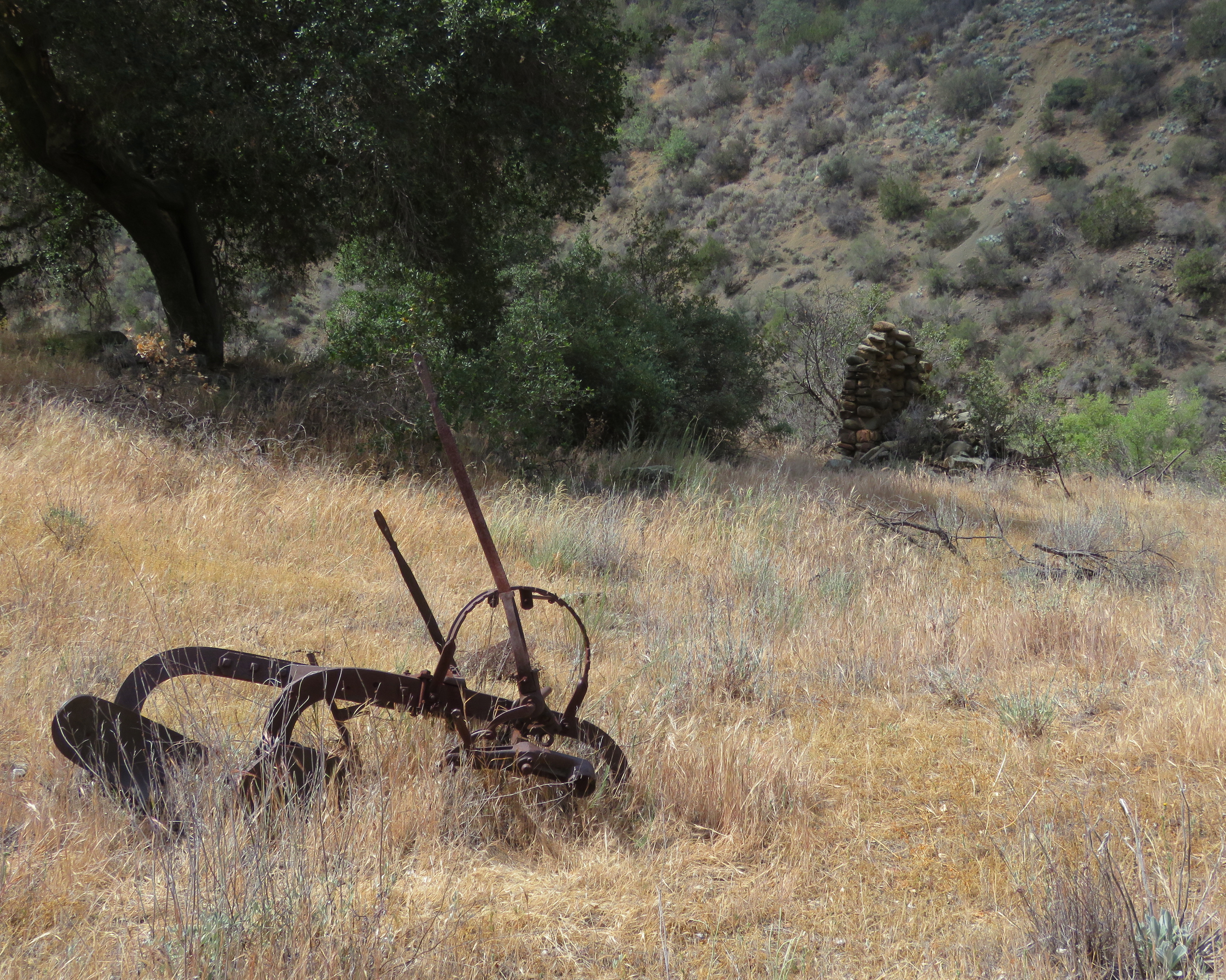
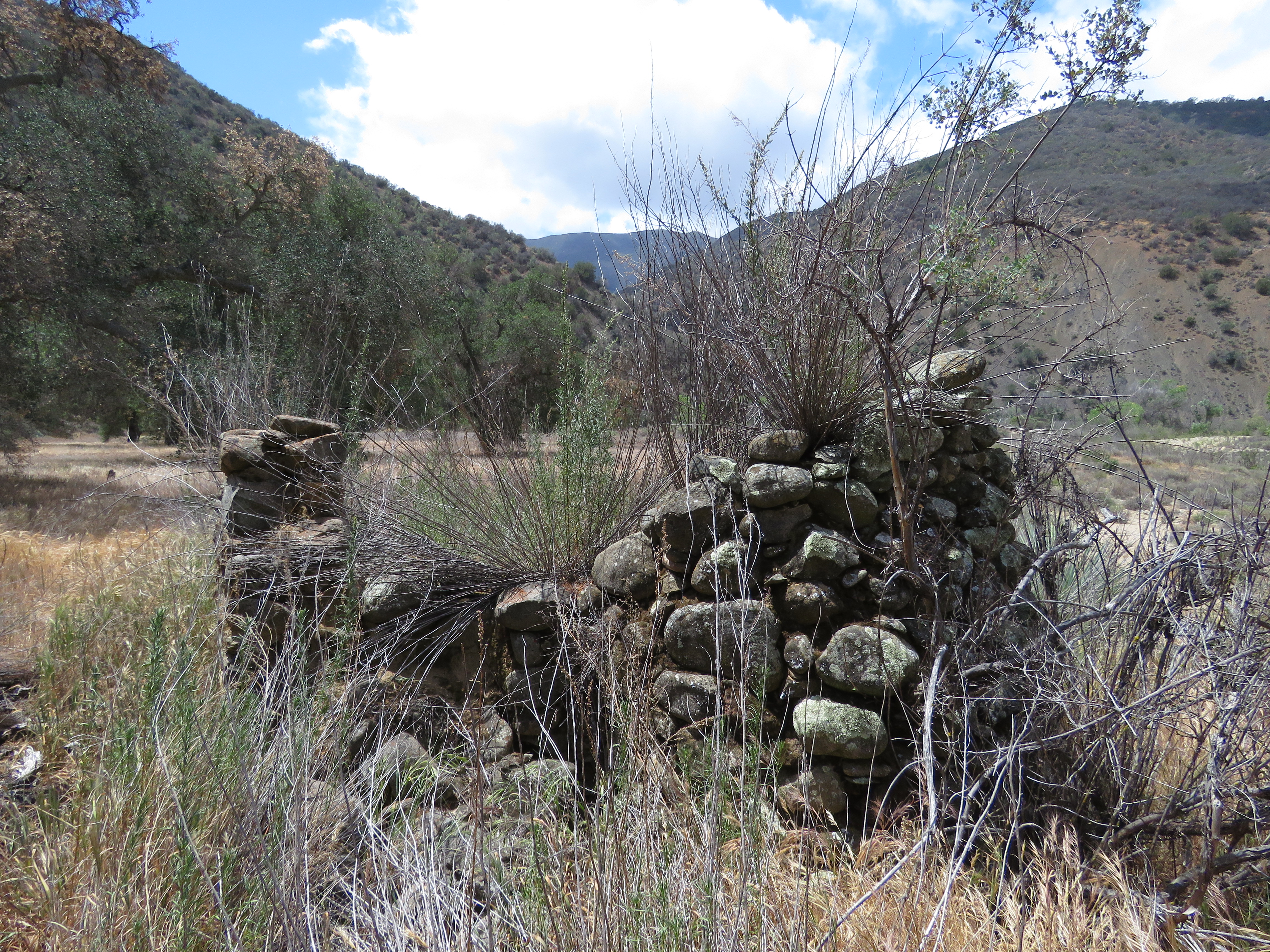
A plow and chimney are seen at the Adolph Willmann homestead site
One of the more successful homesteaders in the group was Adolph WIllmann. Born in Germany in 1854, Willmann immigrated to the United States and become a naturalized citizen in 1873.
Willmann made his way west and in 1896, joined the community of settlers living along Sisquoc River. Willmann homesteaded near the mouth of what is now called Wellman Canyon, a corruption of the name Willmann.
Willmann lived there with his wife, Louise Kleine, and their son, Henry Leo. Willmann ran cattle and the couple also raised turkeys. In addition to a having a garden and an apricot orchard, Willman also had a vineyard and made wine.
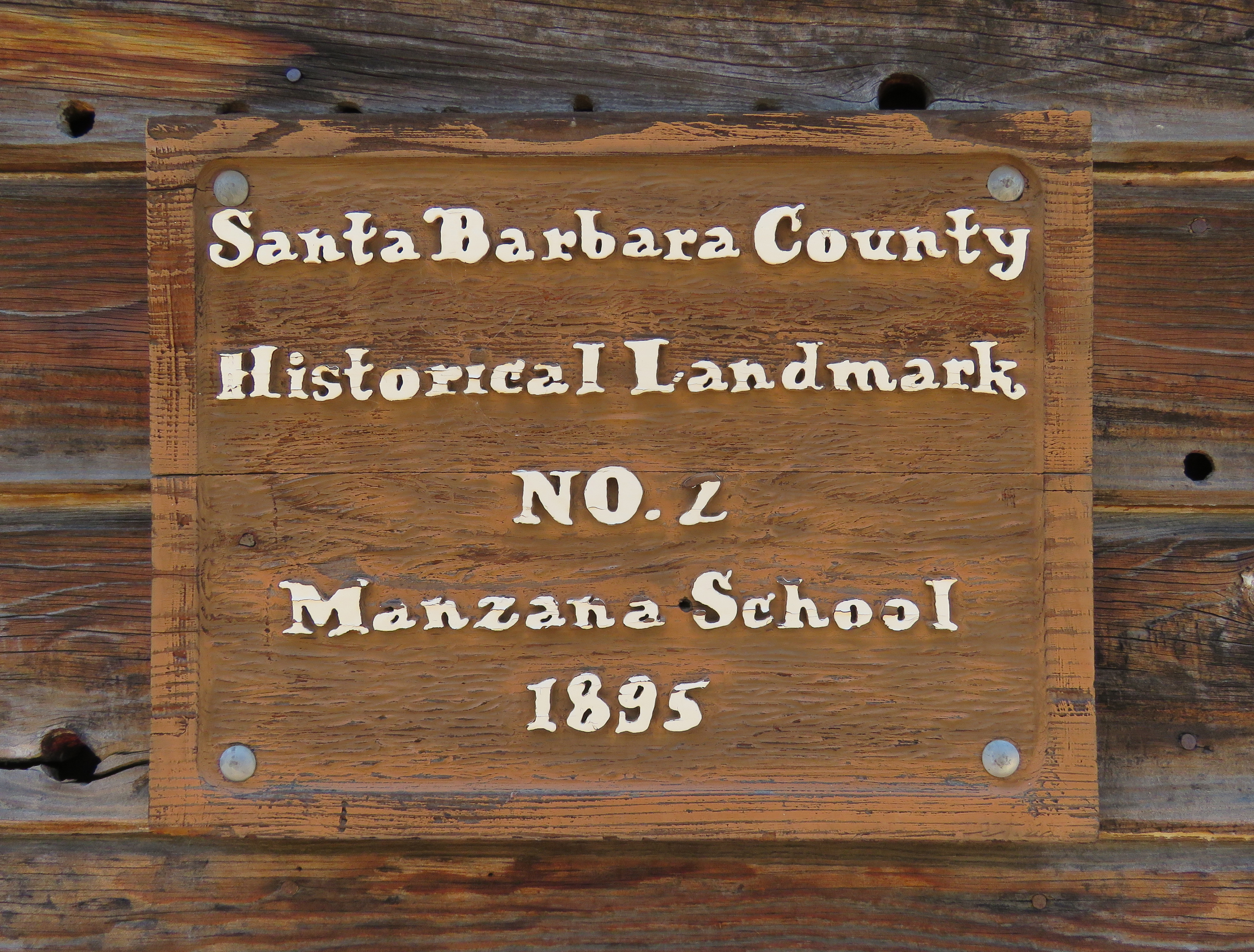
The Willmanns were active in the community of settlers along the Sisquoc River and its tributaries. He served on the board of Trustees for Manzana School District when the community petitioned the county to build a school there.
Louise Kleine Willmann’s younger sister, Bertha Kleine, was the last school teacher at Manzana Schoolhouse. Bertha Kleine was married to Joe Libeu, whose brother had a homestead at Zaca Lake.
When the school closed in 1902, with an enrollment of just one student, Henry Leo Willmann, the Willmanns decided to move to Santa Maria so their son could attend high school there.
Adolph Willmann died in 1908, and is buried in Nipomo. The home they built along Sisquoc River later burned down during a forest fire in the 1920s.
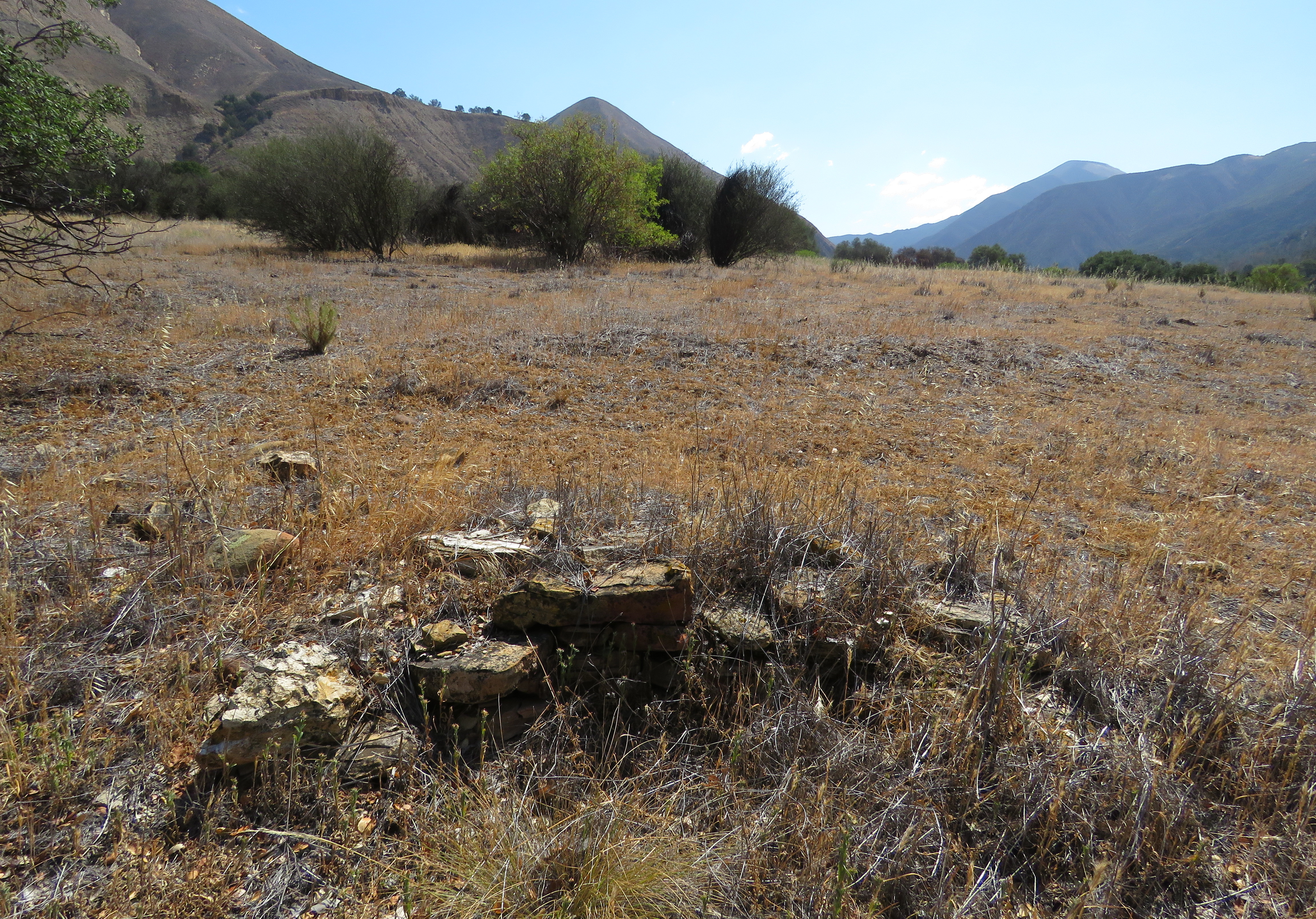
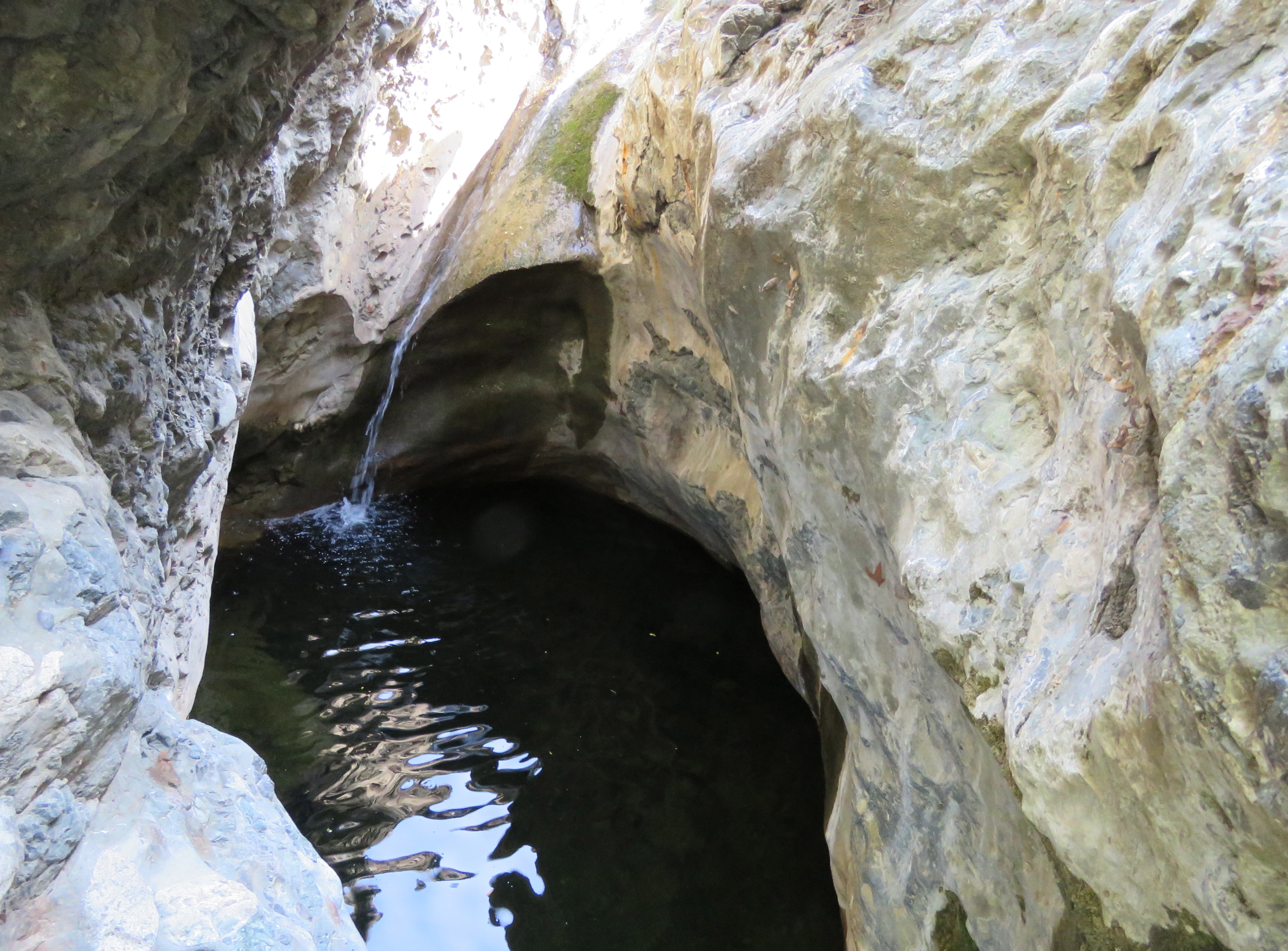
Today, what remains from the homestead is the chimney and nearby root cellar. Out in the field, by the homestead site, one can find what’s left of the well, a fair amount of corrugated metal, and some rusting farm equipment.
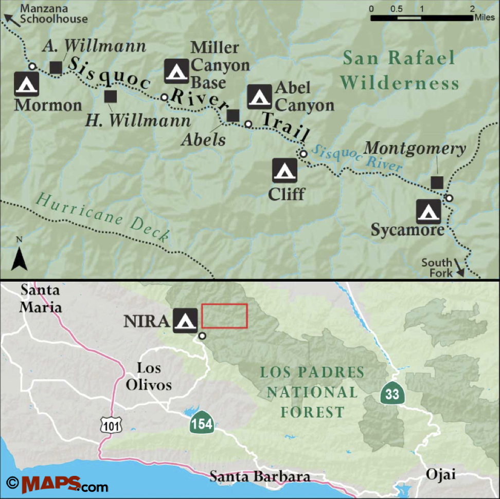
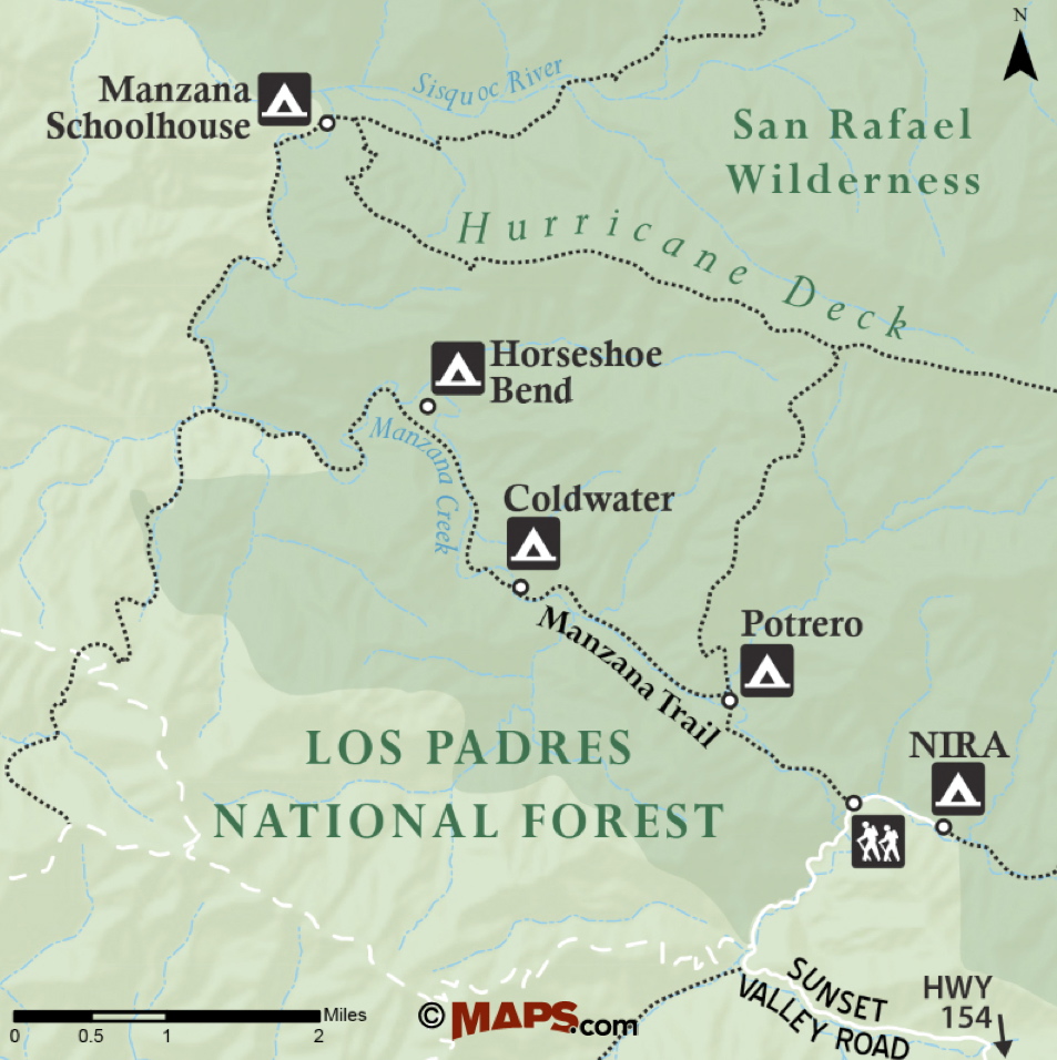
Map courtesy Maps.com
The Willmann site is best reached as part of a backpacking trip. From the trailhead near Nira Campground, it’s about 14.5 miles to the homestead site. There are a number of trail camps along the way; however both Manzana Creek and Sisquoc River flow intermittently through the summer, and so it’s best to check with the forest service regarding current conditions.
The route follows Manzana and Sisquoc River Trails. The trailhead is reached from Santa Barbara by way of State Route 154 and Happy Canyon Road. The Manzana trailhead is just before Nira Campground, where the road ends.
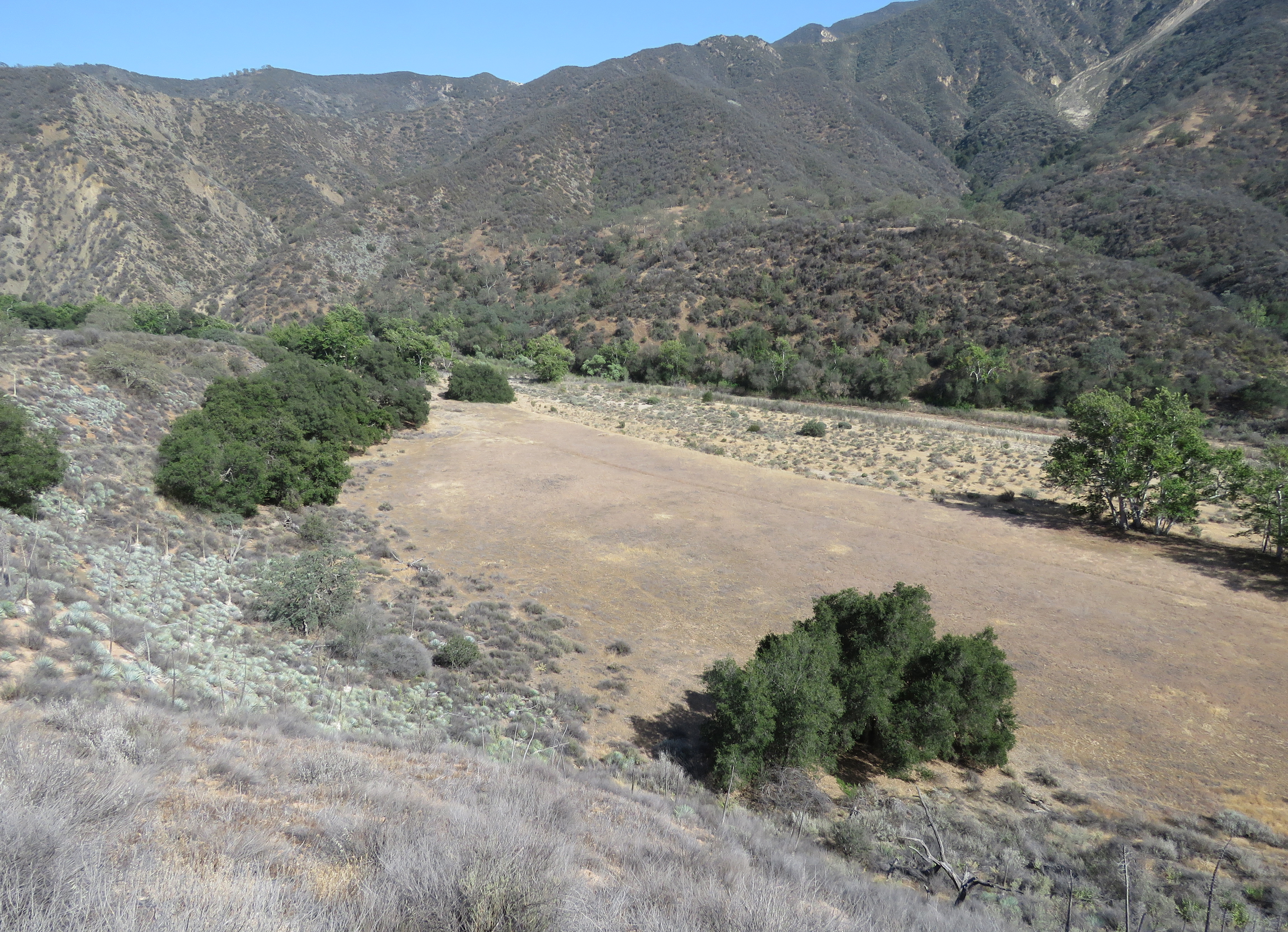
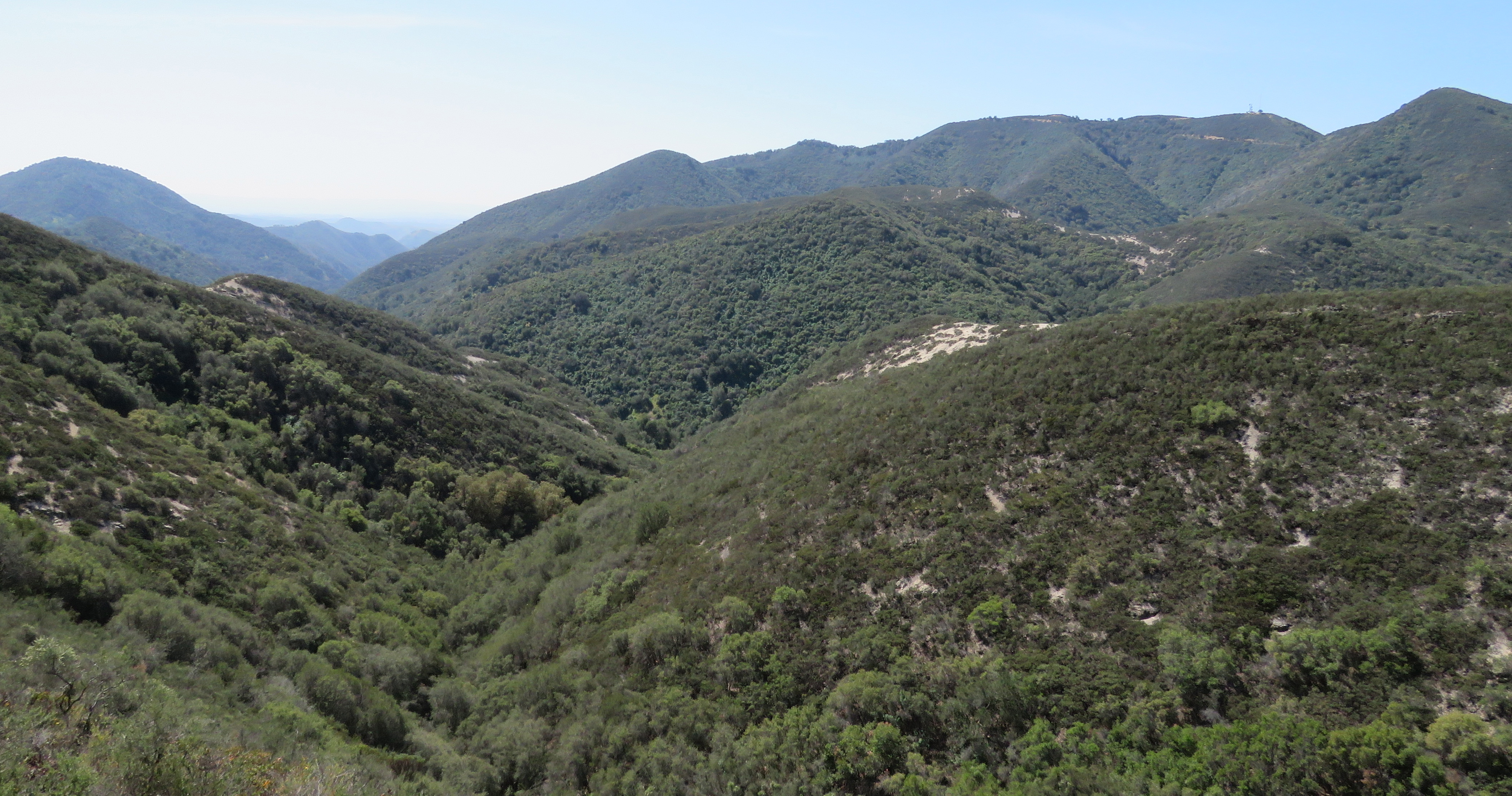
From the trailhead, Manzana Trail follows Manzana Creek downstream to Manzana Schoolhouse Camp, where it meets Sisquoc River Trail. From Manzana Schoolhouse, continue upriver along Sisquoc River Trail. The trail follows the Sisquoc River through the San Rafael Wilderness and, in places, travels along the old road cut used by the early homesteaders.
The trail leads past Water Canyon and Lorna Camps before arriving at Mormon Camp. About a quarter mile past Mormon Camp, the trail arrives at the Willmann homestead. The homestead site is on the north side of the river in a small side canyon.
Continuing upriver from the Willmann site, the trail crosses the river several times before veering north, away from the river. Here, about a mile past the Willmann site, the road cut branches. The more overgrown road cut to the left leads up to Wellman Mesa, where Adolph Willmann used to grow grain. To the right, the more traveled route follows the other road cut, which leads back down to the river.
The remains of the Herman Willmann homestead
Just as the trail starts to level out along the river, look for a pile of stones across the river, on the south side. This is the remains of Herman Willmann’s homestead, Adolph Willmann’s younger brother.
Herman Willmann began building his house there out of river stone. However, he died of tuberculosis before he could complete it. Herman Willmann is buried on the low mesa just east of his brother’s homestead. The grave is under an oak tree and marked with a rectangle of stones.
Wellman Mesa, which is located just west of the Herman Willmann homestead site, is near where the 1966 Wellman Fire started.
On June 11, 1966, four airmen from Vandenberg Air Force Base flying over the area on a sightseeing tour attempted to land on the mesa.
While approaching the large, and mostly level mesa the pilot misread the prevailing wind conditions and touched down with too much speed to safely land before reaching the end of the mesa. Realizing his error, the pilot attempted to take back off. However, during the takeoff attempt, the tail wheel hit a bush causing the plane to tip and turn. The plane then crashed into a juniper. The collision tore off one of the wings and sent the plane over the edge of the mesa, where it crashed in the riverbed below.
On impact, the plane split open. The two men in the back half of the plane, both with broken legs, were able to crawl clear of the wreckage before a ruptured wing tank burst into flames. The pilot and other passenger, who were trapped in the wreckage, died in the fire. The two survivors, who spent the night avoiding the fire as it spread, were airlifted out the next day when two forest service fire fighters arrived to investigate the reported plume of smoke.
The fire, which was first spotted from Figueroa Mountain Lookout, burned through an area that hadn’t been burned since the 1920s. From Wellman Mesa, the fire burned north to the top of the Sierra Madres Mountains. To the west, it burned to Horse Gulch Canyon; and to the east, it burned past Sycamore Camp. The fire posed the greatest potential threat to the south. It burned up and over Hurricane Deck, continued to the top of the San Rafael Mountains, and down into the Santa Cruz Creek drainage before it was contained.
The fire burned for 12 days before a shift in the weather brought cooler temperatures that aided in containing the fire. The fire burned 92,000 acres and was similar in scope to the 2009 La Brea Fire, which burned close to 90,000 acres and took about two weeks to contain. In comparison, the 2007 Zaca Fire burned more than 240,000 acres and took almost two months to fully contain.
All three fires burned through parts of what is now San Rafael Wilderness. And it’s interesting to note that the area along Sisquoc River burned by the Wellman Fire lies between the burn areas of the La Brea and Zaca Fires and was spared during those fires.
Past Wellman Mesa and the Willmann homesteads, the road used by the early settlers continued upriver to the last homestead site along the river, that of Edward Montgomery, where the road ended.
This article originally appeared in section A of July 27th, 2015 edition of Santa Barbara News-Press. The next, and last, article in the series covers the Miller, Abels, and Montgomery homesteads.