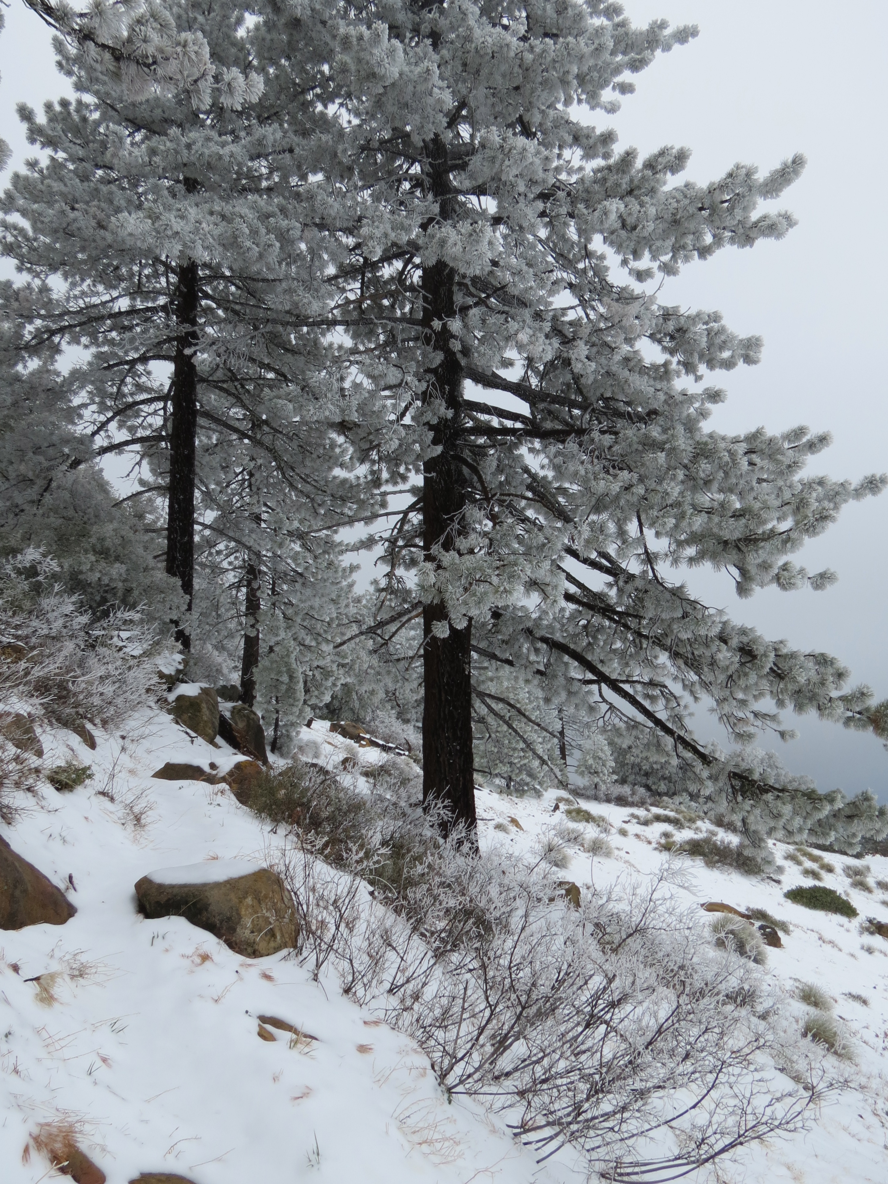
On the Santa Barbara Riviera are two parks named for men who made significant contributions to landscapes and gardens of Santa Barbara.
The two parks can be connected with a fun urban hike of about four miles round trip that makes use of several “hidden” stairways and offers a chance to explore some of the Riviera.
The hike can be started at the end of East Pedregosa Street, where Pedregosa Street meets Grand Avenue. Here, you can find a set of stairs on the left hand side of the noticeable sandstone wall.
North Orpet Park
Pedregosa Street is one block south of Mission Street, which can be reached from Highway 101 by taking the Mission Street exit and continuing north towards the Santa Barbara Mission. From Mission Street turn right onto Garden Street to reach Pedregosa Street, and continue to the end of Pedregosa Street. Parking can be found along the residential streets.
As with any urban hike please be respectful of private property and help preserve the quiet enjoyed by the residents of the neighborhoods that you pass through.
The shaded stairway climbs up towards and crosses an extension of Loma Street where you can find a second, shorter set of stairs that takes you up to the last little section of East Pedregosa Street, just below Alameda Padre Serra.
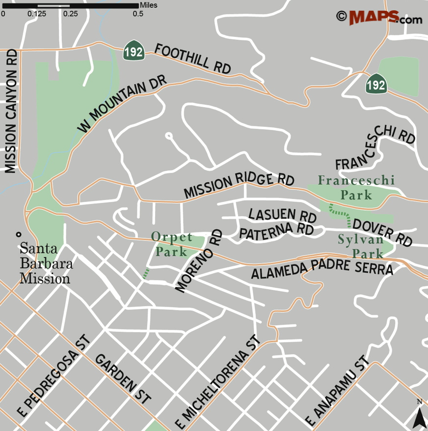
Map courtesy Maps.com
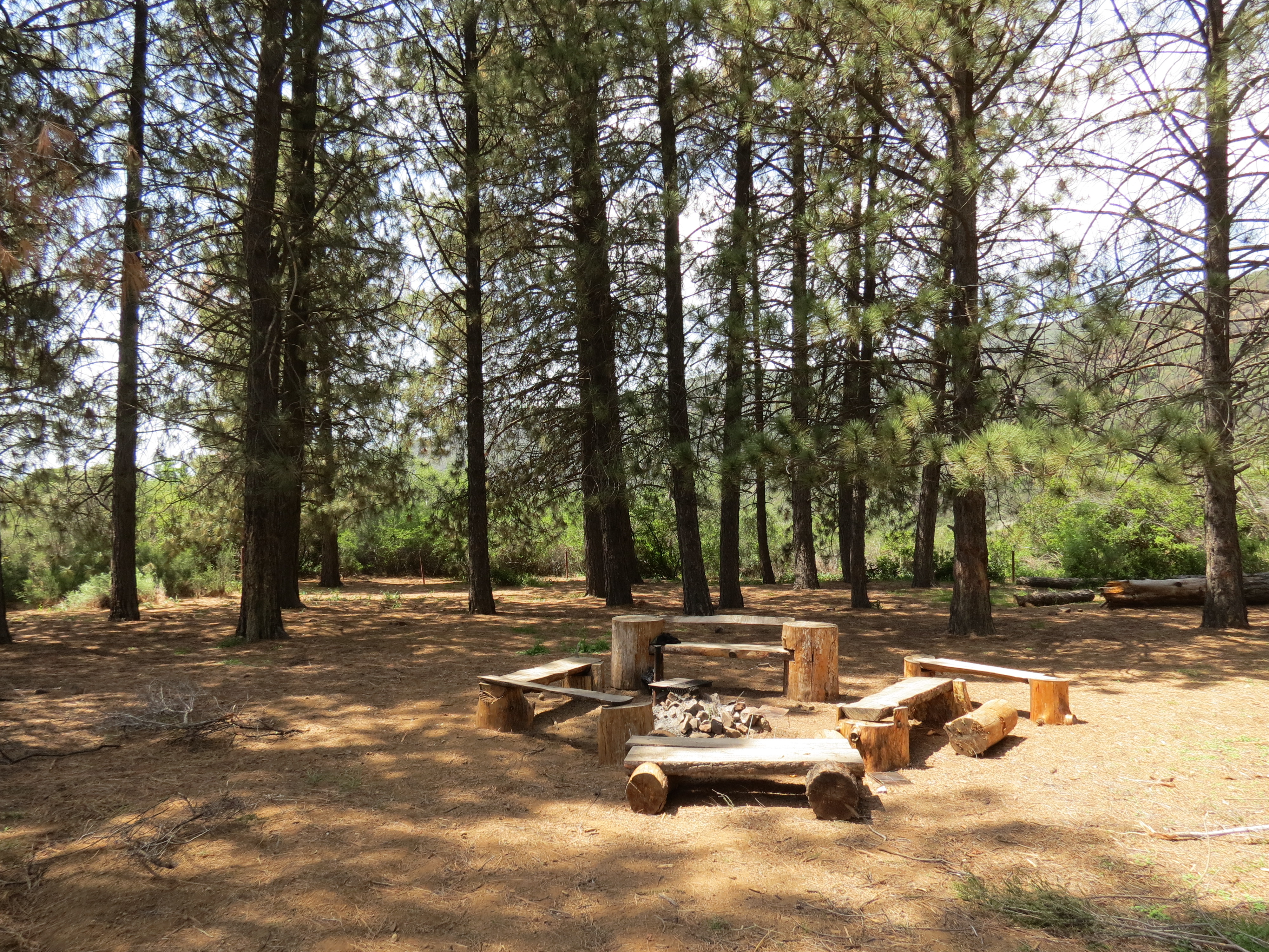
On your right is the western end of Orpet Park. From here, one can follow one of the paths that leads east through the southern half of the park and either continue to Moreno Road or turn north and cross Alameda Padre Serra and explore the northern half of the park. The park is open from sunrise to 10:00 p.m. and includes open grassy areas and picnic tables in both the halves of the park.
Originally called Hillside Park, Orpet Park was named for Edward Owen Orpet, who served as Superintendent of Parks for the City of Santa Barbara from 1921-1930 and established the 4-acre park to showcase plants that could be used for landscaping in our area.
Among his accomplishments, Orpet popularized the use of aloes in landscaping locally, encouraged the California Highway Department to use iceplant along roadways for erosion control, and successfully got plants to grow on the barren island in the middle of the Andrea Clark Bird Refuge.
In 1963, the park that he helped plant was renamed in his honor.
From Orpet Park, to continue towards Franceschi Park, follow Moreno Road north from Alameda Padre Serra to Lasuen Road. Turn right onto Lasuen Road and follow it a short way to Paterna Road, then continue east along Paterna Road.
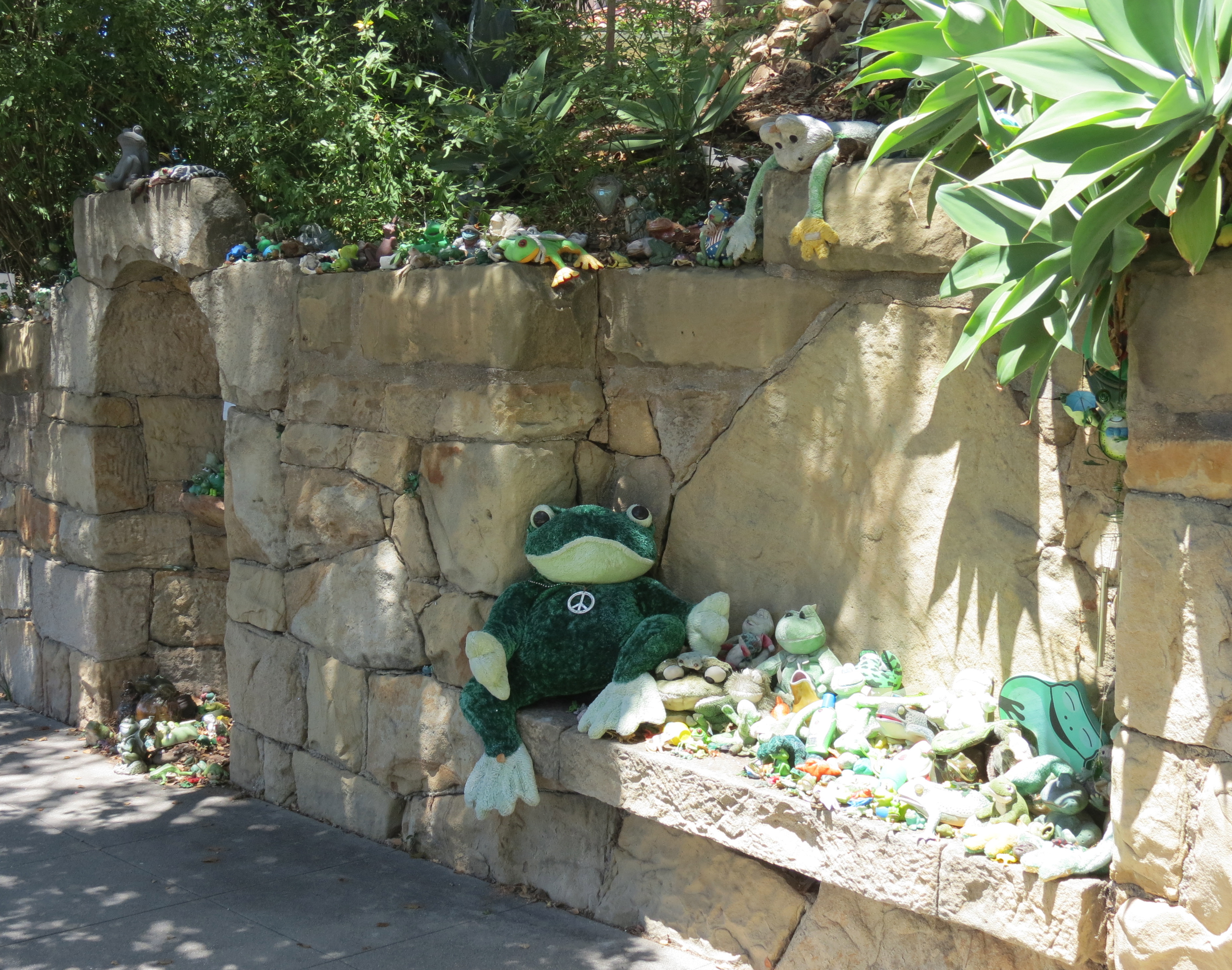
Frog Shrine
This route leads you past what’s known as the Frog Shrine on the left hand side of the road. It’s said that the first frog appeared here in 1989, and over the years, visitors have added their own figurines, stuffed animals and other tributes to frogs bringing the count of memorabilia well into the hundreds.
Continuing past the shrine, Paterna Road arrives at the intersection of Lasuen and Dover Roads. From here, continue a short way east along Dover Road and look for a set of stairs on your left.
These stairs lead through the lower half of Franceschi Park. There are a number of terraced paths through this part of the park, but by generally taking the steeper of any two routes you’ll find your way up to Mission Ridge Road.
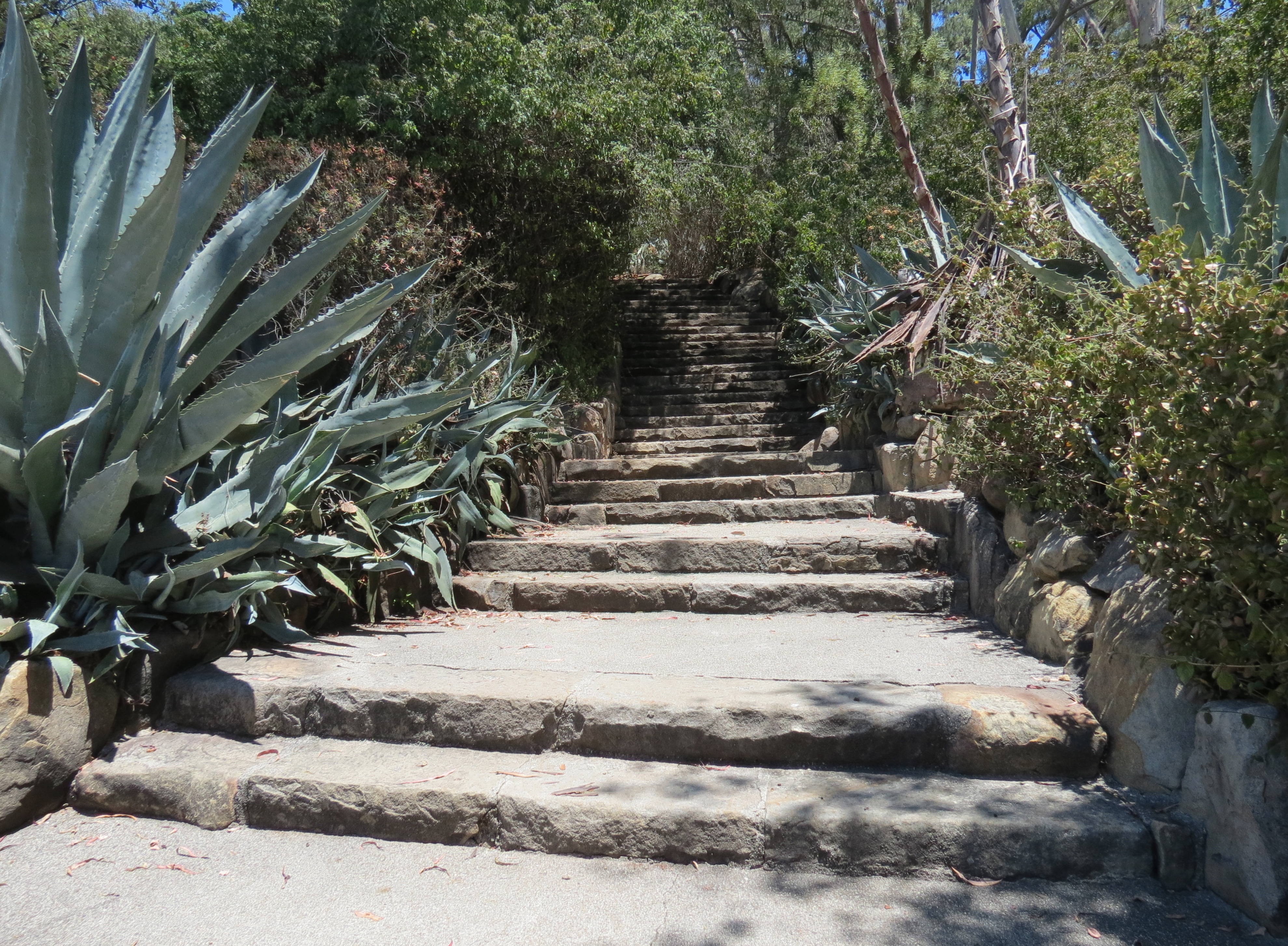
“Hidden” stairway along Dover Road
Continue east along Mission Ridge Road to Franceschi Road. From Franceschi Road, one can follow the access road that leads west to the main house, near the center of the park, or take one of the footpaths that parallel the road.
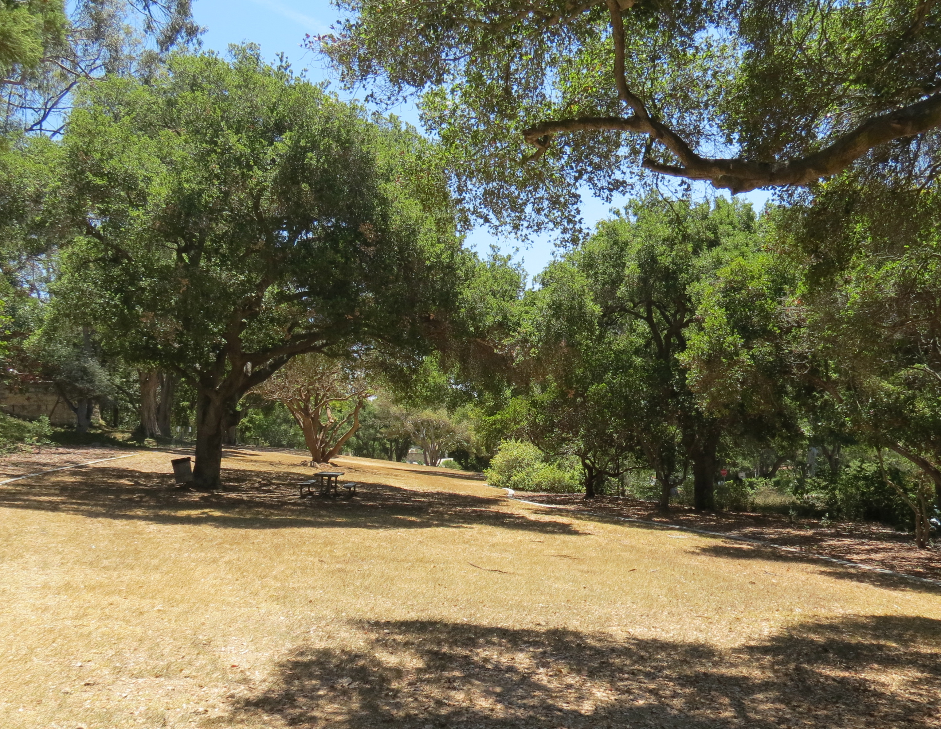
At the end of the access road one can find exceptional views out across the city of Santa Barbara and out towards the Channel Islands. Just below the access road are two picnic tables and a drinking fountain. Nearby are public restrooms, and to the left of the picnic area, overlooking the city, is what’s left of Franceschi House. The park is open from sunrise to a half hour after sunset.
The 15-acre park is named for Francesco Franceschi, who was a well known horticulturist and is credited with introducing hundreds of plants to our area for landscaping and cultivation, and was considered an early advocate of using drought tolerant plants.
Born in Florence, Italy in 1843 with the given name of Emanuele Orazio Fenzi, Franceschi moved to the United States in 1891 following an economic downturn it Italy, and changed his name to Francesco Franceschi.
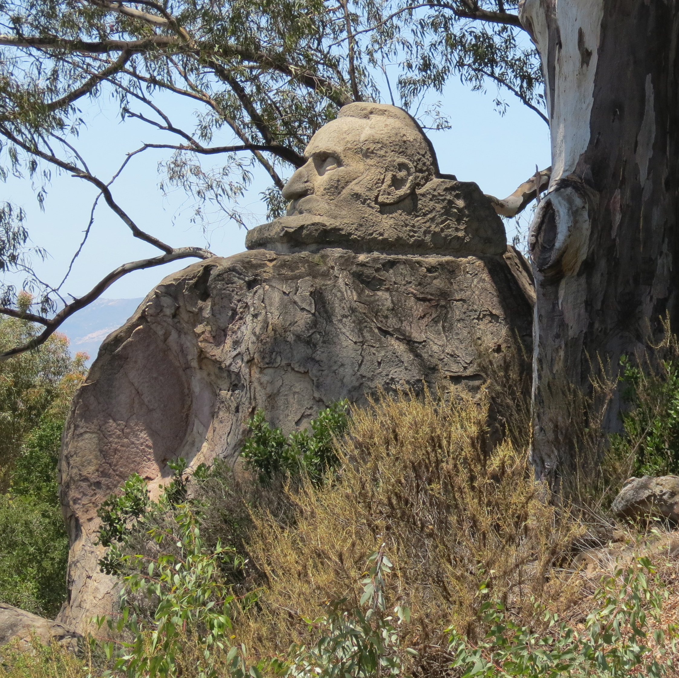
The carved sandstone head of Francesco Franceschi overlooks the city at Franceschi Park
In 1893, already passionate about plants, he moved to Santa Barbara and started an acclimatizing garden where he could study which plants from around the world could best be adapted to our Mediterranean climate, and how to cultivate and propagate them so they could be used commercially for landscaping and gardens.
In 1903, Franceschi’s wife, Cristina, purchased 40 acres of land along Mission Ridge Road in what is now known as the Riviera. On the property they built a two-story Craftsman style redwood house and named the site Montarioso, Italian for airy mountain. Here, Franceschi cultivated 10 acres with a variety of plants in order to continue his studies and showcase those plants that could best be adapted to our local environment.
In 1913, Franceschi accepted a job from the King of Italy to help introduce agricultural and ornamental plants in what was then the Italian colony of Libya, while other members of his family stayed behind to manage the Santa Barbara property. During this time portions of the 40-acre property were sold to offset operating expenses. Franceschi passed away in Libya in 1924.
In 1927, Alden Freeman purchased the house and two surrounding acres with the intent of creating a park to memorialize Franceschi and his work. He also bought back other parts of the property that had been previously sold. Freeman also added to the property the area below Mission Ridge Road with a larger vision of creating an open space with trails that would reach down to Milpas Street.
Freeman remodeled the house and covered the outside with plaques and medallions commemorating Franceschi, selected historical events, and other notable individuals. Freeman also commissioned a large carved sandstone head of Franceschi. The sculpture can still be found by starting from the end of the main access road and continuing west through the less developed part of the park.
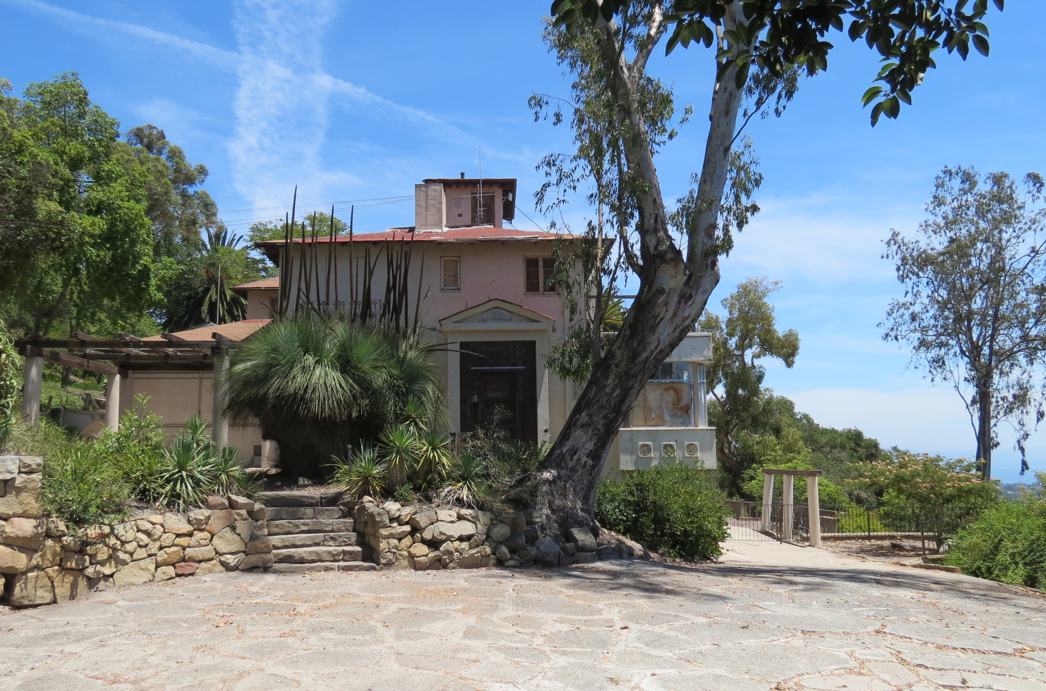
Franceschi House
In 1931, Freeman gave the property to the city of Santa Barbara for use as a park. Pathways were added throughout the park during the 1930s as part of a Works Project Administration (WPA) program.
And for a period of time, Franceschi House was used to teach classes on horticulture. However, over the years the house has fallen into disuse and is in need of repair. There have been various plans to renovate the building and turn it into an interpretive center, but lack of funding has left it in its current state, and closed to the public.
Nevertheless, Franceschi’s legacy endures, today many of the plants he planted can still be found in the eastern end of the park. And with some hunting around, one can find examples of rare palms, two specimens of grass tree from Australia, as well as pines from around the world including a chir pine from the Himalayas.
In addition to introducing plants to our area, Franceschi also helped introduce plants from our area to the rest of the world. He was the first to cultivate Santa Cruz ironwood on the mainland by bringing a sample from the island and learning how to propagate it for commercial use.
In many ways, both Orpet and Franceschi Parks offer an opportunity to reflect on the legacies and contributions of each of these men.
This article originally appeared in section A of the July 21st, 2014 edition of Santa Barbara News-Press.
Lagniappe
The inspiration for this article came from a Sierra Club hike I did that more or less followed this same route. But what moved it up on my list as something to write about was when I learned both parks were named after people who were interested in learning which plants from around the world could be successfully grown here and that the parks also served as demonstration gardens. The Santa Barbara Historical Museum proved to be an invaluable resource for digging deeper into the history of these two men and the histories of the parks.
A third, nearby park in the area I wasn’t able to weave into the article is Sylvan Park. This one-acre piece of land was also purchased in 1927 by Freeman and donated to the city. The park is located at the eastern end of Dover Road where it meets Alameda Padre Serra, and to quote the Santa Barbara Parks and Recreation website, is “a small neighborhood park overlooking the city and a good place for some quiet reading, an informal picnic, or a quick walk with a dog.”
My photo of Franceschi house was featured in the Spring 2017 issue of the National Trust for Historic Preservation’s Preservation Magazine, https://savingplaces.org/stories/santa-barbara-debates-franceschi-houses-future