Posted by: James Wapotich | October 22, 2014

Nature as Oracle

santa barbara nature vision quest trail

*

Nature As Oracle

In its wild state, the land can provide an unbroken connection back to the beginning of time. The native plants and animals, even the rocks and mountains have paths that lead from where they are now back through time to the mystery of creation.

Time spent on the land and in nature can serve as a powerful touchstone for reconnecting with our own origins and our own place in the larger world around us.

On Sunday, November 16th, I will be offering a one-day retreat on the land with my friend Maya Shaw Gale.

Since the time of the ancient ones, men and women have journeyed into nature to seek guidance and insight. Today, more than ever, we need to step outside the narrow trance of our intellect, technology and social structures to reconnect to the more expansive intelligence of the natural world. By slowing down and becoming receptive to the non-human realms, we open ourselves to a larger collective wisdom. Nature as mirror, metaphor and teacher can reveal to us our own true nature, and give us a direct experience of the sacred web of life we are part of.

Join us on the trails for a one-day journey out on the land and see what wisdom finds you through:

  • Body/mind & mindfulness practices that expand perception and awareness
  • A “vision quest” structure for seeking guidance
  • 3.5 mile roundtrip trail hike
  • Council circle sharing & shamanic teachings
  • An embodied experience of eco-community & interconnectedness

Guides:

Maya Shaw Gale is a Mind/Body Wellness Coach and poet, and leads workshops on Embodied Mindfulness, Creative Writing and Ecopsychology. mayashawgale@verizon.net (805) 882-1393

James Wapotich is the co-founder of Revelation Dreamwork, a Volunteer Wilderness Ranger with the Los Padres National Forest, and leads trips and retreats into our local backcountry. jwapotich@yahoo.com (805) 729-4250

1-day retreat is $75 per person – for more information regarding the hike contact Maya or James

Posted by: James Wapotich | October 22, 2014

Exploring the San Rafael Wilderness

hiking backpacking santa barbara trail los padres national forest san rafael wilderness manzana hurricane deck sisquoc

*

Exploring the San Rafael Wilderness

Free Slideshow Presentation with Q&A

Thursday, November 6th, 7:00PM

Karpeles Manuscript Library

21 W. Anapamu St., Santa Barbara, CA

This year marks the 50th Anniversary of the Wilderness Act. In our local area the first designated wilderness was the San Rafael Wilderness.

Created in 1968, the San Rafael Wilderness encompasses close to 200,000 acres of protected land that includes portions of the San Rafael Mountains, Hurricane Deck, Manzana Creek and the Sisquoc River. Here, within these natural lands you will find pine-covered mountains, hidden waterfalls, quiet potreros, Chumash village sites, and old homesteads.

Join local author James Wapotich in celebration of the 50th Anniversary of the Wilderness Act as he shares images and stories from his hikes through the San Rafael Wilderness. The presentation will include destinations that can be reached as part of a day hike or overnight backpacking trip, as well as those best seen as part of a multi-day backpacking trip.

James has hiked many of the trails in our local backcountry. He is a Volunteer Wilderness Ranger with the Forest Service, and is the author of the Santa Barbara News-Press hiking column, Trail Quest.

For more information regarding the talk, email me at jwaptotich@yahoo.com.

Posted by: James Wapotich | October 13, 2014

Trail Quest: Xtreme Hike to Little Pine Mountain

Sometimes it is easy to forget how fortunate we are, to not only have all these great trails nearby, but for many us to also be able to physically hike them.

Each year Cystic Fibrosis Foundation organizes and hosts Xtreme Hikes around the country to help raise funds and awareness for cystic fibrosis. And this year was the first time a hike was offered that made use of the trails in Los Padres National Forest.

The idea of the hike is to give the participants a challenge physically and philanthropically to help find a cure for cystic fibrosis.

Hiking backpacking Xtreme Hike Little Pine Santa Barbara Los Padres National Forest Santa Cruz Trail

Hikers returning from Santa Cruz Station

“It’s really about digging deep and challenging oneself.” Cole Jacobson, Assistant Executive Director, Orange County Chapter, Cystic Fibrosis Foundation told the News-Press. “When you push hard, you not only have a sense of accomplishment, but you’re able to get back to just enjoying the simplicities of life and the camaraderie of the people around you.”

Xtreme Hikes grew out of Cystic Fibrosis Foundation’s Great Strides event, which is the organization’s largest annual fundraising event, drawing in over a 100,000 participants through hundreds of walks across the country. Last year Great Strides raised over $43 million.

The Xtreme Hike to Little Pine Mountain was organized and hosted by the Orange County Chapter of Cystic Fibrosis Foundation. And was the first time the chapter put on such an event.

On Sunday, September 21st, 33 hikers met at dawn at Upper Oso Campground to begin the hike to the top of Little Pine Mountain and beyond. For the event there were two hike lengths and destinations to choose from. Hikers could either make the 12 mile roundtrip hike to Little Pine Mountain, or from Alexander Saddle continue down to Santa Cruz Camp for the longer hike of about 21.5 miles roundtrip.

Santa Cruz Trail Los Padre National Forest Xtreme Hike Santa Barbara

Hikers making their way towards Alexander Saddle

The day started out well with early morning fog, and lower temperatures than those experienced during the weeks leading up to the event. The hikers followed the Buckhorn-Camuesa Road to the beginning of Santa Cruz Trail, and continued along the trail to the turnoff to Nineteen Oaks.

Past the turnoff to Nineteen Oaks, the hike becomes more challenging as the trail gains 2,200 feet over the next 3.5 miles, before arriving at Alexander Saddle. The trail also has its rewards, from the saddle the views stretch south across the Santa Ynez Valley and north towards the San Rafael Mountains.

At Alexander Saddle, hikers were met by volunteers from Los Padres Forest Association (LPFA) who provided water and directions for the different hike options.

From the saddle, hikers either continued another half mile east towards Little Pine Mountain where they were met by another group of volunteers from LPFA, or they continued down the backside of Little Pine Mountain towards Santa Cruz Camp for the longer hike.

The hike down to Santa Cruz Camp was aided by cool breezes, and as hikers arrived at Santa Cruz Camp they were greeted by volunteers from LPFA who provided water and cold watermelon.

Xtreme Hike Los Padres National Forest hiking Santa Barbara Santa Cruz Trail

A group of Xtreme Hikers on their way back from Santa Cruz Station

Hikers for this event also participated in four monthly training hikes starting back in May. The first hike was along the San Gabriel River near Azusa to what’s referred to as the Bridge to Nowhere; a hike of about 10 miles roundtrip. The next one was a 9-mile loop hike at Crystal Cove State Park in Laguna Beach. The third was a challenging 14-mile hike to the top of Mount Wilson. And the last one was a 12-mile hike to the top of Mount Baldy.

Of the 33 participants for the Little Pine hike, 12 hikers completed the hike to Little Pine Mountain and back, and 21 completed the hike down to Santa Cruz Camp and back. The hikers, along with a number of other contributors, were able to raise close to $60,000 towards finding a cure for cystic fibrosis.

Cystic fibrosis is a life-threatening genetic disease that primarily affects the lungs and digestive system. There are an estimated 30,000 people in the United States that are affected by the disease. In the 1950s, few children with cystic fibrosis lived to attend elementary school. Since then, a great deal of progress has been made in understanding and treating the disease. That success has significantly increased both the length and quality of life for those with cystic fibrosis.

Among the participants on the Little Pine hike were two people with cystic fibrosis. Wes Parsel, who completed the longer hike down to Santa Cruz Camp and back, and Aimee Lecointre, who completed the shorter hike to Little Pine Mountain and back.

As Mr. Parsel, 26, explained, the disease affects patients to different degrees. For example he shared that he has about 75% of normal lung capacity while some patients with cystic fibrosis have 50% or less, and are more physically challenged by the disease.

“I’m fortunate, in being healthy and being able to do things like this.” Mr. Parsel shared. “There are many people with cystic fibrosis, who are in bed, or tied to oxygen, who wish they could have an experience like this. And so, it’s not lost on me how lucky I am to be out there hiking.” In preparation for the hike Mr. Parcel increased his treatment regimen and paid close attention to his diet.

Xtreme Hike Los Padres National Forest hiking Santa Barbara

Hikers near Little Pine Spring on their return from Santa Cruz Station

Established in 1955, Cystic Fibrosis Foundation has about 70 chapters and branches throughout the country. The foundation is actively working to find a cure for the disease and has taken an innovative approach that can best be described as venture philanthropy.

“The foundation provides seed money for treatments that we feel will positively benefit patients with cystic fibrosis.” Mr. Jacobson explained. “In the US we’ve been able to raise money and leverage it by directly funding pharmaceutical companies to develop drugs and therapies.” It’s a model that has proven very successful, and has many associated with cystic fibrosis optimistic that a cure can be found.

In addition to the volunteers and supporters who donated and participated in the Little Pine hike, the group was also supported locally by LPFA and outdoor retailer REI. LPFA helped design the route, clearing brush and removing downed trees along the trail, and also provided volunteers to staff the aid stations. REI helped spread the word about the hike, as well as the four training hikes leading up to the event.

The next Xtreme Hike for the Orange County Chapter will be in September 2015. For more information about the hike contact Shaina Flesser, sflesser@cff.org. And for information about Cystic Fibrosis Foundation and getting involved go to http://sca.cff.org/hike.

Map Little Pine Mountain Xtreme Hike Santa Cruz Trail Los Padres National Forest

Map courtesy Maps.com

This article originally appeared in section A of October 13th, 2014 edition of Santa Barbara News-Press.

Posted by: James Wapotich | September 30, 2014

Trail Quest: El Capitán to Refugio

With all the hot weather we’ve been getting, sometimes the best place for a hike is along the coast. One of the more scenic beach walks in our area is between El Capitán and Refugio State Beaches.

The hike between the two state beaches is about five miles round trip, and can be started from either end. In addition to coastal access, both sites also offer camping. El Capitán has over 130 campsites, including 5 groups sites, and Refugio has around 70 campsites, including 3 groups sites. Reservations can be made online. Both state beaches also feature a small convenience store where one can find a cold drink or snack. For more information about either State Beach go to www.parks.ca.gov.

The best time for the hike is during a low or minus tide. You’ll want to try to time the hike so that you’re at your halfway point when the tide is at its lowest as this will give you the best sense of what conditions to expect on the return hike.

El Capitan Refugio beach walk Santa Barbara hike

Coastal scenery near Cañada del Venadito

If you’re wanting to hike exclusively along the beach you will want to time your hike to a minus tide. However, one of the unique advantages of the hike from El Capitán to Refugio is Aniso Trail. The trail parallels the coast and provides access at several points along the way, offering a pretty reliable fallback route if the tides are against you.

The paved trail and bike path at one time connected El Capitán and Refugio State Beaches. Storm damage and erosion has closed the trail just west of El Capitán to Cañada del Corral, but the section from Cañada del Corral to Refugio remains open. Hopefully the damaged section of the trail will be repaired and again allow easy access between the two state beaches.

Because of their unique geologic history, our local Transverse Mountains, which include the Santa Ynez Mountains, actually run east-west. As a result, our coastline from Ventura to Point Conception also runs generally east-west. This can take some getting used to, especially if you’re used to thinking that the coastline ought to be to the west of everything, instead of to the south. Adding to the confusion is how Highway 101 is designated. For example, from Santa Barbara, northbound Highway 101 actually travels west, before turning north at Gaviota, and then ultimately connecting with destinations that are north of Santa Barbara.

map El Capitan Refugio State Beach walk hike Santa Barbara

Map courtesy Maps.com

To get to El Capitán State Beach from Santa Barbara, take Highway 101 North, past Goleta to the El Capitán State Beach exit and continue down into the park. If you’re wanting to start at Refugio State Beach instead, stay on the freeway, and continue to the Refugio State Beach exit. The drive to El Capitán from Santa Barbara is about 30 minutes.

Day use parking can be found at either State Beach, and, in both cases, is located near the beach access and convenience store. Day use parking is $10 per vehicle and the permit is valid at both parks.

For the hike from El Capitán, continue from the day use parking area down to the beach. If the tides are too high to hike along the beach, you can instead continue west from the parking area by following the paved trail along the bluff. The paved trail continues to the western end of the camping area and arrives at the beginning of Aniso Trail. And although this section of Aniso Trail is closed, just to your left is a set of stairs that lead down to the beach.

The beach stairs are about a half mile west of the beach access at El Capitán and are one of the first landmarks you’ll see when hiking along the beach.

El Capitan Refugio State Beach walk hike Santa Barbara

Monterey shale is seen along the beach between El Capitán and Refugio State Beaches

Wildlife along the coast can include a variety of shorebirds, as well as birds visiting from the coastal sage scrub habit on the bluffs above. Adding to the scenery are the exposed outcroppings of Monterey formation shale that the elements have weathered and sculpted.

Continuing west past the stairs, it’s roughly another half mile to what’s sometimes called Corral Beach, which is located where Cañada del Corral meets the ocean.

El Capitán takes its name from José Francisco Ortega, who served as the first commander or capitán at Santa Barbara Presido. Earlier in his career Ortega served as chief scout during Gaspar de Portolà’s second overland expedition through what was then Alta California. It was during that expedition that San Francisco Bay was discovered, and in his role as chief scout, Ortega was probably the first westerner to lay eyes on the bay.

In 1795, after 40 years of military service, Ortega retired and the Spanish Crown granted him a two-mile wide strip of land along the Gaviota Coast from just east of Point Conception to Refugio Canyon, roughly 26,500 acres. Ortega named the land “Nuestra Señora del Refugio” or Our Lady of Refuge. Three years after his retirement Ortega died in a fall from his horse near Refugio Beach.

In 1841, Ortega’s grandson, José Dolores Ortega, added an additional 8,800 acres to the family’s holdings with the acquisition of Rancho Cañada del Corral, which lay just to the east the land granted to his grandfather. This additional land included the area where El Capitán State Beach is now located.

Following several years of drought, Rancho Cañada del Corral was sold in 1866, and over the years the land was divided into smaller tracts and passed through a number of different owners.

Cañada del Corral beach El Capitan Refugio walk Santa Barbara

Secluded beach near Cañada del Corral

In 1953, the state of California purchased 111 acres of the former rancho to create El Capitán State Beach. In 1967, an additional 21 acres were added to the park. And in 2002, an opportunity arose to purchase El Capitán Ranch, which had also been part of the original Rancho Cañada del Corral. The purchase added to the park an additional 2,500 acres north of Highway 101. This northern section of the park offers additional hiking opportunities along the 12-mile long Bill Wallace Trail. The trail was named for former Santa Barbara County Supervisor and coastal protection advocate Bill Wallace.

Continuing west, past Corral Beach, the coast narrows to a small point which is only passable during a minus tide. Fortunately at Corral Beach one can access Aniso Trail as the trail is open from here all the way to Refugio State Beach.

Aniso is the Chumash word for seagull, and the trail is said to follow a trade route that existed along the coast connecting the Chumash villages of Qasil, located where Refugio State Beach is now, and Mikiw and Kuya’mu, which were located at Dos Pueblos Canyon. Also along this route was the village of Ajuahuilashmu, where El Capitan State Beach is now located. From the village of Qasil, another route led over the Santa Ynez Mountains to villages in the Santa Ynez Valley. In fact, Refugio Road more or less follows that same route.

Cañada del Venadito Refugio El Capitan beach walk Santa Barbara hike

Secluded beach near Cañada del Venadito

About a half mile west of Corral Beach, Aniso Trail arrives at Cañada del Venadito, where one can find another small beach to enjoy. Just west of this beach is another point that requires a minus tide to get around, and so depending on conditions you may find it easier to just continue along Aniso Trail to Refugio State Beach.

At Refugio State Beach it’s easy to see why the Chumash chose it as a village site, particularly if you make a short walk under the freeway to where you can see the full expanse of Refugio Canyon. Both the cove-like coast and access to the canyon make it an ideal location for settlement.

Regardless of how far you hike you’ll get to see some of the scenic beauty found along our local coastline.

This article originally appeared in section A of the September 23rd, 2014 edition of Santa Barbara News-Press.

long-billed curlews

A pair of long-billed curlews pause along the beach

Posted by: James Wapotich | September 21, 2014

Island Dreaming

Two years ago, while out hiking the trails, I had a number of owl encounters that were the inspiration for a series of collages I eventually made called Owl Dreaming. That same year I made several trips to the Channel Islands. In the summer I visited Santa Rosa Island and made a huge loop out to East Point through the Torrey Pines and back via Clapp Spring. And then also made the hike out to Lobo Canyon and back. A month later I visited San Miguel Island and hiked all of the trails there.

Those trips to the islands were the inspiration for this next series of collages, Island Dreaming. The idea that came to me was the feeling of washing up on an unexplored island and moving towards the interior…

etching engraving collage shipwreck

etching engraving collage valley canyon

etching engraving collage oaks owl

etching engraving collage dragonblood tree ruin

etching engraving collage water

etching engraving collage waterfall staircase

etching engraving collage fortress lab

etching engraving collage lab

etching engraving collage airship

If there is a metaphor here, for me, it’s that exploring the backcountry is a chance for us to meet the land on its own terms and through that process connect with our own ancestry on the land, and by extension our own innate wisdom. Each of us through our ancestors, if we go back far enough into our family tree, were native people connected to the land. And yet in our modern incarnations the land is largely unfamiliar to many of us and awaits rediscovery.

As the collage series developed I was drawn to the idea having the character eventually find an airship, not so much as a means of escape, but as a way to journey still further.

In some ways this is the strange blessing of technology, the tremendous amount of freedom it affords us. I can visit a trail behind Ojai one day, and the next day visit an area near Figueroa Mountain many miles away; and then a week later visit one of the Channel Islands. In fact, in just a few short years I have visited a huge variety of places in our local backcountry, something a couple hundred years ago that probably would’ve taken the better part of a lifetime.

Lagniappe

engraving collage

…possible preview for a forthcoming, still in the works, collage series…

Posted by: James Wapotich | September 9, 2014

Trail Quest: The Great Traverse, Part 2

Part of the beauty of Santa Barbara is the Santa Ynez Mountains found along the coast. And we’re fortunate to have so many trails that lead up into the mountain canyons behind Santa Barbara.

In addition to these front country trails are a number of connector trails and Edison Power Company access roads that can be used to hike from one canyon to the next. In fact, by utilizing these connector trails and roads one can craft an 18-mile hike across the front of the Santa Ynez Mountains from Stevens Park to Romero Canyon.

Fortunately, this route crosses Gibraltar Road, which makes it easy to break the hike into two sections. Both of which are best done as a shuttle trip, by either parking a second car at the end point or arranging for a ride.

The second half of the traverse from Gibraltar Road to Romero Canyon is about 7.5 miles, one way, and passes through Cold Spring, Hot Springs, San Ysidro, Buena Vista and Romero Canyons.

West Fork Cold  Spring Canyon hike trail Santa Barbara Montecito Los Padres National Forest

West Fork Cold Spring Canyon

Gibraltar Road starts in the foothills behind Santa Barbara, near Sheffield Reservoir, and makes its way up towards the top of the Santa Ynez Mountains. West Fork Cold Spring Trailhead is unsigned, but is located at a noticeable hairpin turn in the road. Parking is found in the pullout along side the road.

At the hairpin turn is a noticeable outcropping of Cozy Dell Shale. This rock formation, along with the rest of the Santa Ynez Mountains, trends east-west. Because the shale is softer and more easily eroded than the sandstone formations on either side of it, one often finds east-west trending side canyons through the shale formation, such as upper West Fork Cold Spring Canyon, that feed into the main canyons.

map Santa Barbara hike trail Cold Spring Hot Springs San Ysidro Buena Vista Romero Canyon Catway Gibraltar Road West Fork

Map courtesy Maps.com

From Gibraltar Road, West Fork Cold Spring Trail descends down into West Fork Cold Spring Canyon. In 2007, a section of the trail through the upper canyon was rerouted around slides and other damage caused by heavy winter rains in 2005.

As the trail reaches West Fork Cold Spring Creek it arrives at Cold Spring Tunnel. The tunnel, with its noticeable cement facade, was completed in 1905, and was built to tap the water that naturally seeps in the mountains and add it to the city’s water supply.

The trail continues past the tunnel, down along West Fork Cold Spring Creek crossing the creek several times as it approaches the confluence with Middle Fork Cold Spring Creek. Here, the canyon becomes larger and if you look closely on your left, just past a good size boulder, you can find the beginning of the off-trail route that leads up to Tangerine Falls. The hike to the falls from this intersection is about a mile roundtrip and does involve some rock scrambling.

Cold Spring Tunnel West Fork trail hike Santa Barbara Los Padres National Forest

Cold Spring Tunnel

From this intersection, West Fork Cold Spring Trail continues down the canyon. Here, the plants include California bay laurel, sycamore and maple trees, which help shade the trail.

At about the 1.75-mile mark, the trail arrives at the intersection with East Fork Cold Spring Trail. The intersection is marked, and there is a bench for resting. From here, continue to the left, along East Fork Cold Spring Trail. The trail follows the creek upstream briefly before making its way up a series of switch backs. The trail then rejoins the creek and passes a series of sandstone pools that can be inviting when they’re full.

Past the pools, the trail crosses the creek again, continuing to the right, and begins its climb out of the canyon. At about the 3-mile mark from Gibraltar Road, East Fork Cold Spring Trail arrives at an Edison access road and what’s referred to as Montecito Overlook. Here, the views extend out across Montecito and out towards the ocean and the Channel Islands.

From the overlook, continue east along the unpaved access road a short way, where two options for the traverse presents themselves. To the left, Cold Spring Trail continues uphill and leads to Hot Springs Connector Trail. To the right, the Edison access road descends down into Hot Springs Canyon and leads to Hot Springs Trail. And although both routes lead towards the site of the old Hot Springs Hotel, the route along the access road is longer by about a half mile and less shaded.

Continuing up Cold Spring Trail, look for Hot Springs Connector Trail on your right. The trail descends down into Hot Springs Canyon and then traces the northern side of the canyon. Here, the trail crosses a small side creek containing warm to hot water, and then rounds a bend, and crosses a second creek with luke warm water. To left, upstream from this second crossing, one can find the seeps for the hot springs. To the right, the trail leads past the foundation of the old Hot Springs Hotel.

Hot Springs Hotel Trail Santa Barbara hike Los Padres National Forest

The foundation and stairs from the old Hot Springs Hotel

The first 3-story hotel was built there in the early 1880s and stood until it burned down during a forest fire in 1920. The popular resort was rebuilt in 1923, and stood until it was burned down again in the 1964 Coyote Fire. Today, there are no pools to be found at the hot springs, and all that remains of the hotel are the sandstone stairs and foundation.

Just past the hotel site the trail arrives at an unpaved access road. It’s here, at this bend in the road, that the road changes names. To the south, down the canyon, the road is Hot Springs Trail and leads to Mountain Drive. To the east, it is the Edison access road and leads over towards San Ysidro Canyon.

At this intersection one has several options for the traverse. About a half mile south of the access road is McMenemy Trail. The trail essentially parallels the access road east to west and also connects Hot Springs and San Ysidro Trails. The access road is more direct, but sometimes a trail can feel more rustic than a road.

Continuing east along the Edison access road from the old hotel site, the road arrives at Saddle Rock Trail about a half mile later, which leads down to McMenemy Trail. About a quarter mile later the road arrives at Girard Trail, which also leads down to McMenemy Trail. These two trails offer additional alternate routes. Past Girard Trail, the access road descends down into San Ysidro Canyon.

Los Padres National Forest Santa Barbara day hike trail hiking East Fork Cold Spring Creek Canyon

Trees line seasonally dry East Fork Cold Spring Creek

At about the 4.5-mile mark from Gibraltar Road, the Edison access road arrives at San Ysidro Trail. From here, it’s about two miles roundtrip up to San Ysidro Falls. For the traverse, continue just a short way down San Ysidro Trail, which at this point is also an unpaved road. On your left you’ll spot another access road climbing east. This is the Edison access road that leads over towards Buena Vista Canyon.

The road climbs out of Santa Ysidro Canyon and ends overlooking Buena Vista Canyon, where it meets Buena Vista Connector Trail. It’s here that one can start to appreciate the roller coaster nature of the traverse.

The connector trail descends down towards Buena Vista Creek, where it meets Buena Vista Trail, which continues downstream towards Bella Vista Drive. For the traverse, continue to the left along the connector trail as it begins its climb out of Buena Vista Canyon.

About halfway out of the canyon, the connector trail arrives at another Edison access road. From here, continue east along the road. As the road clears Buena Vista Canyon, look for a side trail on your right. This short trail leads to an overlook with a bench, which offers views out across Summerland and Carpinteria.

Past the side trail, the access road continues east and eventually arrives overlooking Romero Canyon. From here, the road follows a side canyon down towards Romero Creek where it meets Romero Trail.

At Romero Trail, which is also an unpaved road at this point, turn right and continue a quarter mile down to the trailhead on Bella Vista Drive and the eastern end of the traverse hike.

The article appears in section A of the September 6th, 2014 edition of Santa Barbara News-Press.

Posted by: James Wapotich | September 2, 2014

Trail Quest: The Great Traverse, Part 1

If you have hiked more than a couple of our front country trails, or studied a local trail map, you may have noticed that many of the front country trails lead up different canyons into the Santa Ynez Mountains. You may have also noticed that many of these same trails have connector trails leading over to the neighboring canyons. This raises the question as to how many of these trails can one connect together to create a hike that traverses the front of the Santa Ynez Mountains.

It turns out that one can craft a route that stretches from Stevens Park all the way to Romero Canyon, a total of about 18 miles one way. This route is sometimes referred to as the Nine Trails Hike because it incorporates portions of nine front country trails.

In fact, in 1990, Patsy Dorsey created the Santa Barbara Nine Trails 35-mile Endurance Run. The course leads runners from the Jesusita Trailhead to the Romero Canyon Trailhead, and then back along the same route. This year’s run was held earlier in August, and the best time was an amazing 6:40:08.

9 trails hike run Los Padres National Forest Santa Barbara Tunnel Trail

Arlington and La Cumbre Peak are seen from Tunnel Trail

For hikers, the best approach is a shuttle trip. That is, starting the hike at one end and parking a second car at the other end or arranging for a ride. And, although the route can conceivably be hiked in a single day, it does involve a lot of up and down and can be strenuous as it climbs out of one canyon and down into the next. Fortunately, about mid-way through the hike the route crosses and follows Gibraltar Road, making this a natural place to break the hike into two sections.

The first section from Stevens Park to Gibraltar Road is about 9.5 miles long and makes use of Jesusita, Tunnel and Rattlesnake Trails.

A helpful map of the front country trails is A Hiker’s Guide to the Santa Barbara Front Country by Raymond Ford. The map includes most of the trails between State Route 154 and Summerland, and on the backside of the map, descriptives notes about the trails.

To get to the trailhead at Stevens Park, from Highway 101, take the Las Positas Road exit and continue north to State Street. Las Positas Road crosses State Street and becomes San Roque Road. Continue north on San Roque Road to Calle Fresno, and turn left. From Calle Fresno turn right on Canon Drive and continue to Stevens Park.

map Los Padres National Forest Stevens Park Jesusita Trail Inspiration Point Seven Falls Rattlesnake Gibrlatar

Map courtesy Maps.com

The park is open from sunrise to sunset. If you are planning on leaving your car after hours it’s best to park on a residential street outside of the park as the parking lot is gated when the park is closed.

From Stevens Park, the trail follows San Roque Creek upstream and leads through mostly oak woodland and riparian plants. The trail passes under Foothill Road Bridge, which is high above. Along the way, the trail passes a sandstone boulder set in the ground that has several mortars or grinding holes cut into it from the time when the Chumash were the only residents of the area.

As the trail continues past a flood control dam the views open up and one can see Cathedral and Arlington Peaks, and to the east, White Mountain.

At about the 1-mile mark, the trail from Stevens Park arrives at Jesusita Trail. Here, the hike continues up the canyon along Jesusita Trail.

Coast Live Oak Jesusita Trail Los Padres National Forest hike Santa Barbara

Coast live oaks shade the trail along San Roque Creek

Jesusita Trail can also be reached by continuing north along San Roque Road and crossing Foothill Road. The trailhead is just past Cater Water Treatment Plant.

About a half mile past the intersection with the trail from Stevens Park, Jesusita Trail branches, with Arroyo Burro Trail continuing to the left, and Jesusita Trail continuing up San Roque Canyon to the right.

At about the 2.25-mile mark from Stevens Park, Jesusita Trail joins the access road to Moreno Ranch. Please respect private property. Just past the ranch entrance, one can find a shaded picnic table and drinking fountain, amenities provided by the ranch for the benefit of hikers.

The well-marked trail passes briefly through the ranch before making its way up several small side canyons. As the trail continues its climb towards Inspiration Point it passes where the 2009 Jesusita Fire started.

The fire started when sparks from tools being used by two men engaged in unauthorized trail maintenance ignited nearby plants. The fire spread west to State Route 154 and east past Gibraltar Road, buring 8,733 acres. Regrowth and signs of damage from the fire can still be seen along much of the route.

As Jesusita Trail reaches the top of the canyon, it joins an Edison access road. From here, continue east along the unpaved road to where it appears that a trail crosses the road at a right angle. At this intersection Jesusita Trail continues to the left, down into Mission Canyon, while the short trail to the right leads to what is referred to as Inspiration Point. From Inspiration Point one is treated to views of the city and out towards the Channel Islands.

The hike continues along Jesusita Trail as it makes its way towards Mission Creek passing through mostly chaparral. At Mission Creek one can make a short side trip upstream to Seven Falls. The falls are a series of pools and cascades in the sandstone that have been cut by the creek. The side trip to the falls is about a mile roundtrip.

From the Mission Creek crossing, continue east along Jesusita Trail. The trail soon joins another Edison access road and quickly arrives at Tunnel Trail.

The beginning of Tunnel Trail is not marked, however at the junction, there is a sign nearby marking the beginning of Jesusita Trail. You’ll know if you’ve missed Tunnel Trail, as the Edison Road meets Tunnel Access Road, which is paved. Tunnel Access Road begins at the end of Tunnel Road and is an alternate way to reach both Tunnel and Jesusita Trails.

Tunnel Trail essentially climbs up the front of the mountains and is one of the tougher sections of the hike. The trail is largely unshaded, passing through mostly chaparral. The trail however does offer compelling views of Arlington and La Cumbre Peaks to the north, and the city and Channel Islands to the south.

Depression Drive Los Padres National Forest Santa Barbara hike Jesusita Tunnel Trail

Trail sign listing Depression Drive as a destination

Eventually Tunnel Trail finishes its long series of switchbacks, and starts to level out, rounding a corner in the topography.

At about the 7.75-mile mark from Stevens Park, the trail arrives at the intersection with Rattlesnake Connector Trail. Here, a Forest Service sign lists Depression Drive as one of the destinations along the trail.

Built during the 1930s, Depression Drive led from Santa Barbara over the mountains to Gibraltar Reservoir. The section of the road on the front side of the mountains later became known as Gibraltar Road.

Rattlesnake Connector Trail descends down into Rattlesnake Canyon where it meets Rattlesnake Trail. The hike continues to the left, up Rattlesnake Canyon, but a short detour down into scenic Tin Can Meadow can be rewarding.

Rattlesnake Trail Canyon hike Santa Barbara Tin Can Meadow

Tin Can Meadow, Rattlesnake Canyon

The meadow takes its name from the shack built there out of ceanothus branches and flattened tin cans by William O’Conner in 1900. The structure later burned down during a forest fire in 1925.

From the meadow, Rattlesnake Trail follows Rattlesnake Creek upstream. The trail then crosses the creek and begins its climb up to Gibraltar Road, offering views up towards Gibraltar Rock, a popular rock climbing destination.

The Rattlesnake trailhead along Gibraltar Road is unsigned and little more than a pull out. From here, it’s another 1.25 miles down Gibraltar Road to the West Cold Spring trailhead, and the beginning of the second half of the traverse.

The West Cold Spring Trailhead is also unsigned, but is recognizable in that the pull out is situated on a hairpin turn in Gibraltar Road and offers the first views east across Cold Spring Canyon towards Montecito Peak.

This article originally appeared in section A of the September 1st, 2014 edition of Santa Barbara News-Press.

Older articles can be seen by scrolling down or using the search feature in the upper right corner. Articles from the News-Press appear here a couple months after they appear in the News-Press.

Posted by: James Wapotich | August 25, 2014

Trail Quest: Coal Oil Point Reserve

Sometimes the best way to experience a place is through a docent led hike. Such hikes often include great information, history and anecdotes about a particular area. The downside of course is that you have to plan ahead in order to join the hike.

One place that offers the best of both worlds is Coal Oil Point Reserve. In 2011, the reserve installed 19 interpretive signs and created a series of podcasts, available on their website, to accompany the signs allowing, one to create their own interpretive hike. The reserve also offers two-hour docent led hikes on the first Saturday of the month at 10:00 a.m. Both items, plus a map of the reserve can be found under the tab for tours.

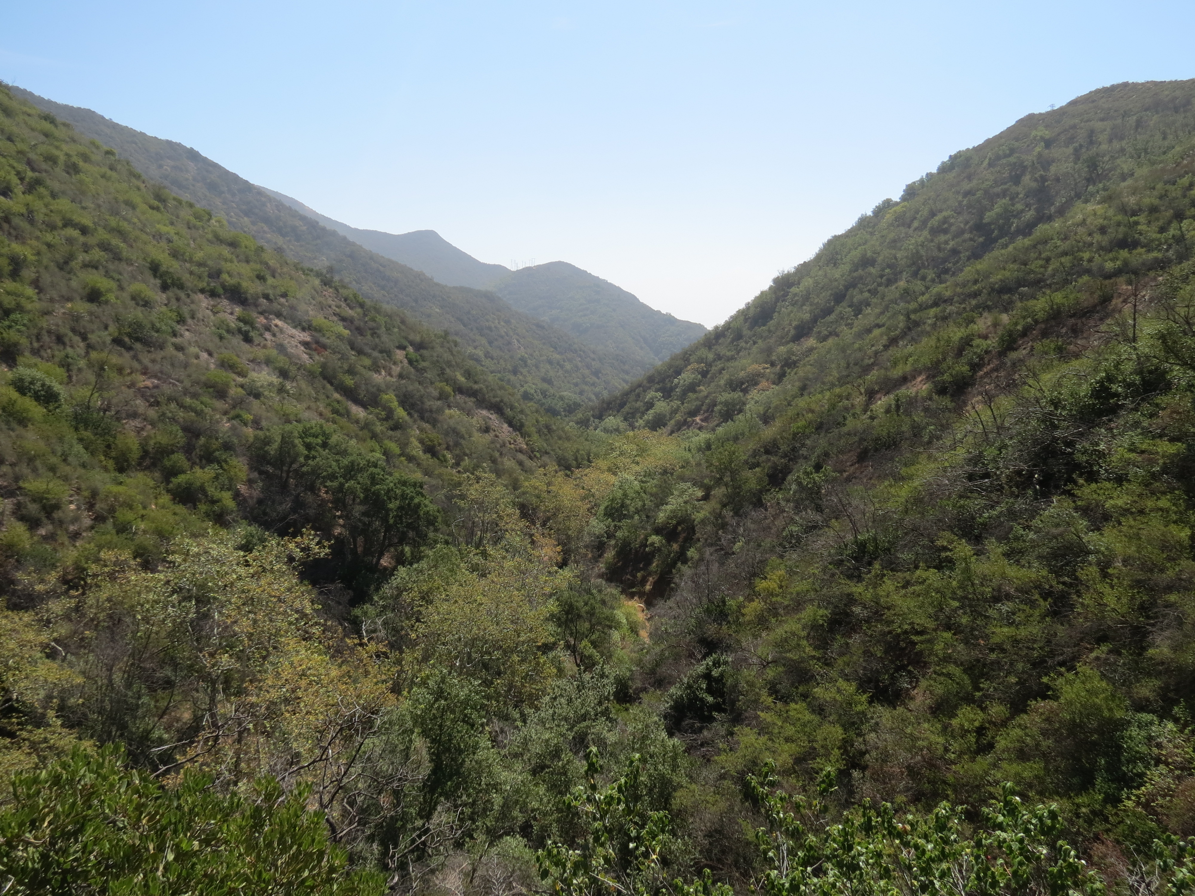
The three-mile loop hike starts from Coal Oil Point, and leads across Sands Beach and around Devereux Slough. The easiest place to start, in terms of parking, is from the west end of Isla Vista, which adds another mile roundtrip to the hike in order to reach Coal Oil Point.
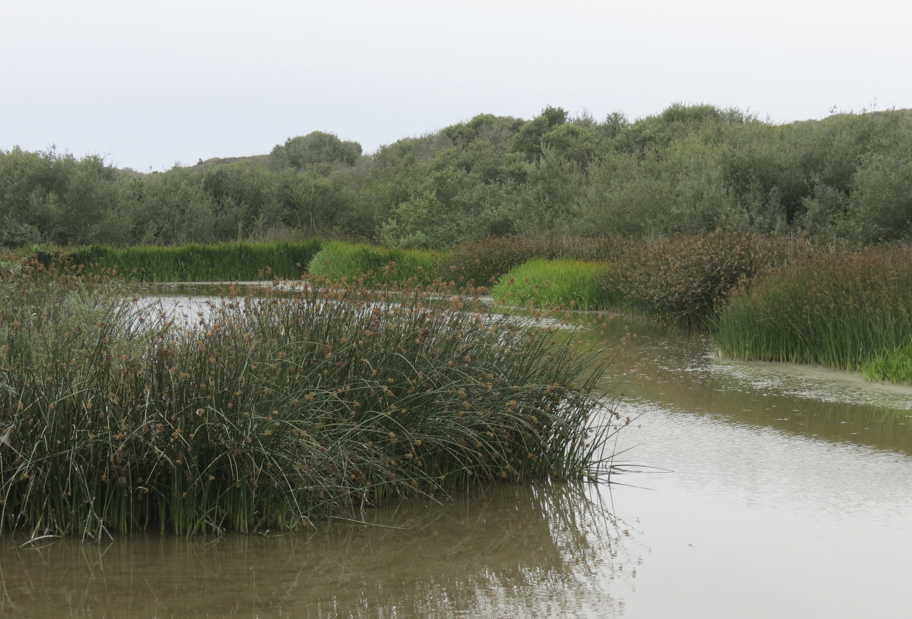
Devereux Slough Coal Oil Point Reserve Santa Barbara Goleta Isla Vista Hiking Trail

Devereux Slough

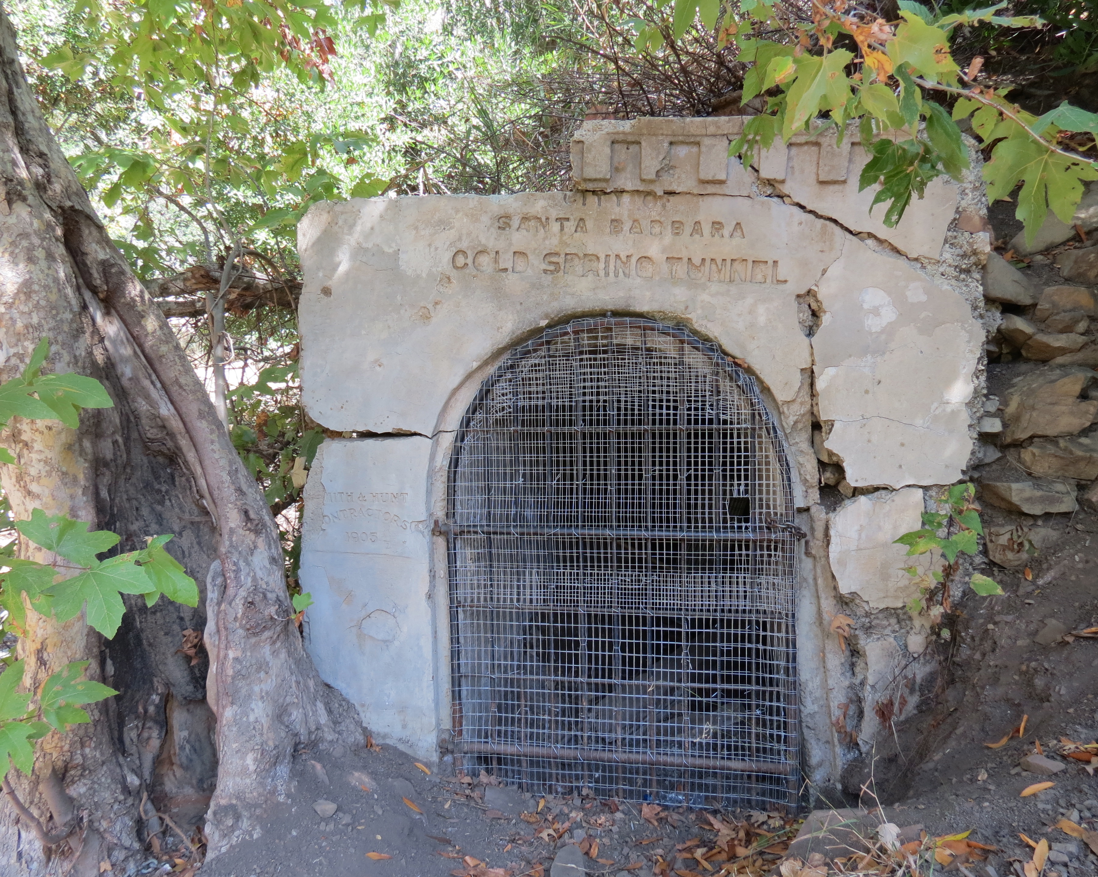
To get the trailhead from Highway 101, take the Glen Annie – Storke Road exit, and continue south along Storke Road to El Colegio Road. From El Colegio Road, turn right onto Camino Corto and follow it south to Del Playa Drive. Turn right onto Del Playa Drive, which ends at the trailhead and Camino Majorca, where parking can be found.

From the trailhead, continue west on the well-established trail along the bluffs toward Coal Oil Point. The trail leads through West Campus Open Space and about a half mile later, arrives at Coal Oil Point and the beginning of the interpretive hike.

The first sign describes the offshore kelp forest that one can see from the bluffs. The next three signs cover the history of the land’s usage from the Chumash to the present.

The Chumash, who lived along the coast from Morro Bay to Malibu and as far inland as the Carrizo Plain and Cuyama Valley, were the first to arrive 13,000 years ago. When the Spanish started settling the area in the 1700s, there were four Chumash villages located around Goleta Slough.

It’s likely the Chumash hunted and utilized the resources found around Devereux Slough, which at one time is said to have connected with Goleta Slough forming a single, large wetland.

map Coil Oil Point Reserve Isla Vista Goleta hiking trail Sands Beach Devereux Slough North Campus Open Space

Map courtesy Maps.com

In the early 1840s, the land surrounding Devereux Slough was deeded to Nicholas Den by the Governor of Alta California. The property changed hands several times, and in 1919, was purchased by Colonel Colin Campbell and his wife Nancy Lieter.

Campbell was drawn to the property because of the lagoon, and had visions of stocking it with fish and swans, and opening up the mouth of the slough to allow boats to sail in.

At Coal Oil Point, one can still see the granite cross that marks where Campbell was once buried after his death in 1923, as well as the brick pillars marking the entrance to what was then the family cemetery. The graves have since been moved elsewhere.

Colonel Colin Campbell Cross Coal Oil Point Sands Beach Isla Vista Goleta hike

Cross marking where Colonel Colin Campbell’s grave was once located

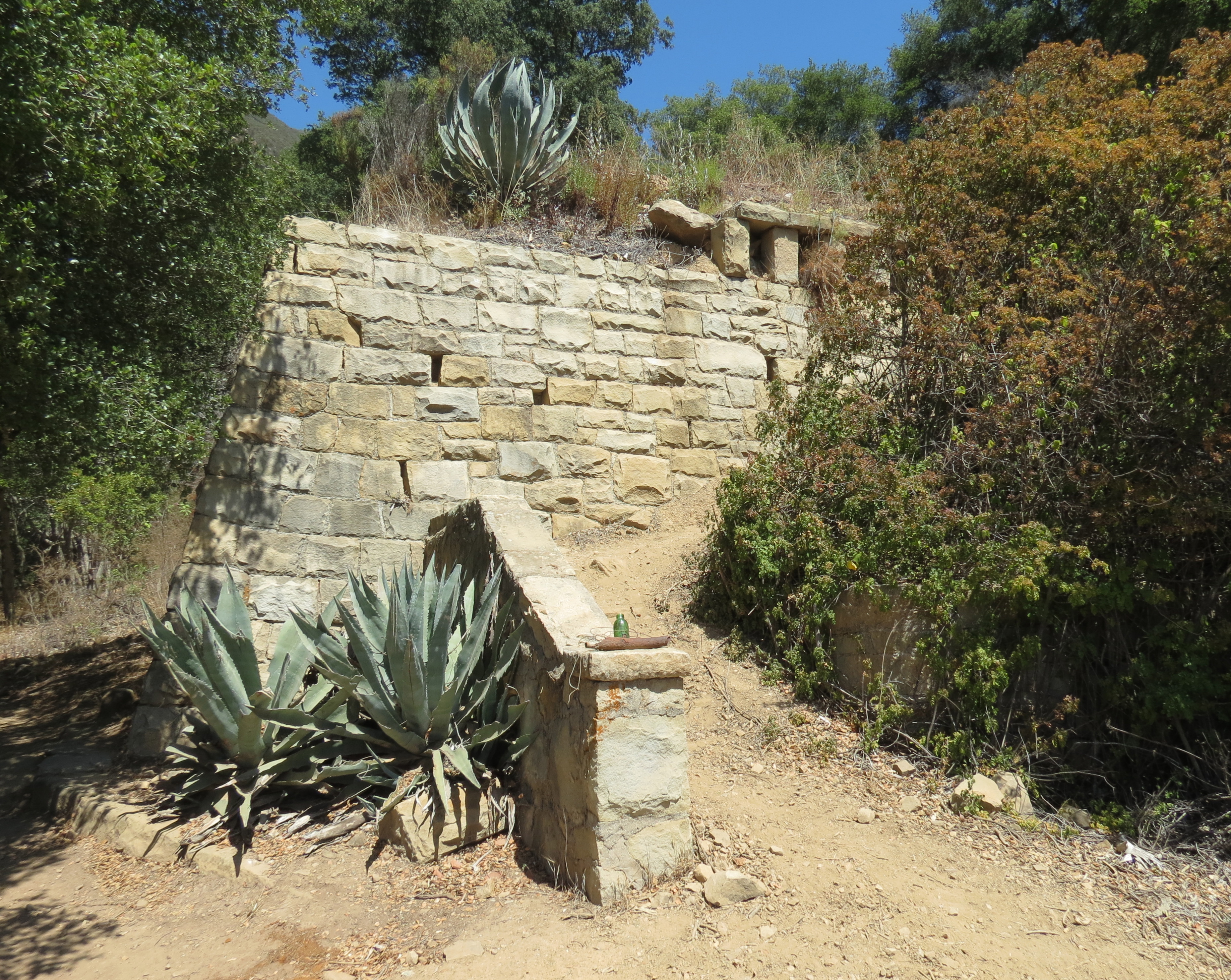
Other features from the Campbell Ranch that can be seen nearby are the dovecote, which was used to raise pigeons and doves, and the beach house located east of the point at the foot of the bluffs along the beach. Originally covered in abalone shells, what’s left of the stone structure is now covered with graffiti. The building was used by the Campbells to entertain guests and is said to have also been used to store bootleg liquor during prohibition.

In 1945, the 500-acre Campbell Ranch was purchased by Helena Devereux to create Devereux Ranch School. In 1967, much of the property was sold to the University of California; over the years the remaining parcels have been purchased by the University, with Devereux School now leasing space for its programs.

In 1970, 158 acres that were once part of the Campbell Ranch, including Devereux Slough, became Coal Oil Point Reserve. The University of California’s Natural Reserve System includes 37 sites throughout the state, representing over 130,000 acres of protected land. However, Coal Oil Point Reserve is unique in that it is open to the public for individual recreation and does not require one to fill out a visitor application.

Coal Oil Point takes its name from the coal oil seeps that occur offshore. These naturally occurring seeps bubble up from folds in the underlying ocean floor and form slicks on the surface of the water that congeal into tar balls that are then washed up onto the shore. Of the more the 1,200 documented seep locations in the Santa Barbara Channel, roughly half are located within 2-3 miles of Coal Oil Point.

West Campus Open Space UCSB Coal Oil Point Reserve hike trail Santa Barbara Goleta

Coal Oil Point is seen from the trail through West Campus Open Space

Continuing west, the trail passes the dovecote and descends down to Sands Beach. Here, the next three interpretive signs describe the coastal dunes and beach ecosystems, as well as the threatened western snowy plover and the work being done to protect its habitat.

In 1993, the Pacific Coast population of the western snowy plover was listed as threatened because of its declining numbers. And in 1999, the stretch of beach from Isla Vista to Ellwood was listed as critical habitat.

In 2001, Coal Oil Point Reserve created a management plan to protect the plover’s habitat and began Snowy Plover Volunteer Docent Program to help educate beach users about plovers and how to share the beach with them. Portions of the upper beach and dunes are now roped off from mid-March through mid-September.

The success of the program is encouraging and demonstrates that recreation and conservation can coexist. When the program started there were no nesting pairs left at Sands Beach. Since then, the number of hatchings reaching maturity has grown from zero to 40. Another benefit of the program is that the dunes themselves have also returned.

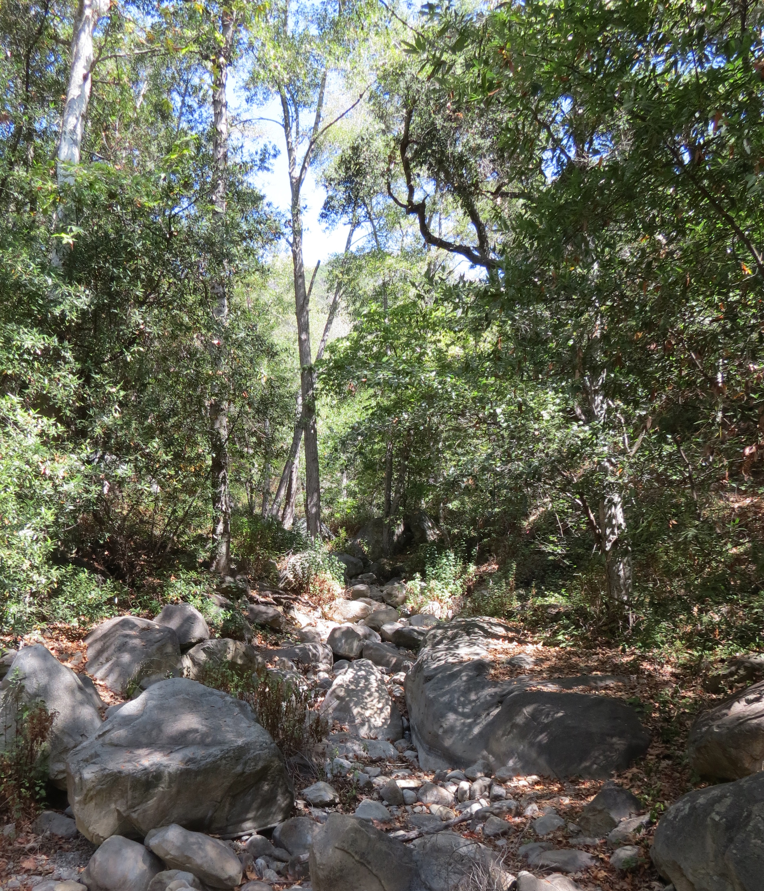
The hike continues west along the beach to the beginning of Pond Trail. Here, the hike turns north and leads through a section of dunes passing a freshwater pond. The pond, which is often full, is now completely dry, a reminder of the lack of rain this year.

Pond Coal Oil Point Reserve hike trail Goleta Isla Vista Sands

The Pond, now dry, at Coal Oil Point Reserve

In June, the 20-acre Tank Fire burned through part of the reserve including the the area around the pond. And it’s surprising to see how many of the plants have started to grow back with just the little rain we’ve received since the fire.

As the trail clears the burn area, it continues around the western edge of the slough offering views out across the slough and several more interpretive signs describing the restoration work and habitats found along the trail.

At about the 1.5-mile mark from Coal Oil Point, the trail arrives at Venoco Road. The hike continues east along the road, which also separates Coal Oil Point Reserve and North Campus Open Space.

In 1965, the northern portion of Devereux Slough was filled in to create Ocean Meadows Golf Course. Almost 50 years later the 63-acre parcel was purchased by the Trust for Public Land and gifted to the University. The University plans to restore the land, effectively extending the natural habitat of Devereux Slough. Now called North Campus Open Space, the property is open to the public from dawn to dusk.

Devereux Creek Slough Coal Oil Point Reserve Sands Beach hike Santa Barbara Goleta Trail

Devereux Creek

From Venoco Road, the hike continues around the eastern side of the slough, joining Slough Road, and eventually arriving at a point where the slough begins to narrow and form a channel to the sea. Even during this dry time of year there is still a small ribbon of water through the slough, and birding opportunities to be found. A nearby sign lists the different species of birds that inhabit or visit the slough.

From here, the hike continues along the eastern side of slough and returns to Coal Oil Point.

To learn more about Coal Oil Point Reserve, volunteer opportunities and docent led hikes, or to access podcasts for the interpretive hike, go to http://coaloilpoint.ucnrs.org.

This article originally appeared in section A of the August 18th, 2014 edition of Santa Barbara News-Press.

Older articles can be seen by scrolling down or using the search feature in the upper right corner. Articles from the News-Press appear here a couple months after they appear in the News-Press.

Western Snowy Plover Coal Oil Point Reserve Sands Beach

Western Snowy Plover

Posted by: James Wapotich | August 9, 2014

Nature As Oracle

Vision Quest Santa Barbara hike trails

*

Saturday, September 6th, from 9AM-4:30PM, Arroyo Hondo Preserve.

Since the time of the ancient ones, men and women have journeyed into nature to seek guidance and insight. Today, more than ever, we need to step outside the narrow trance of our intellect, technology and social structures to reconnect to the more expansive intelligence of the natural world. By slowing down and becoming receptive to the non-human realms, we open ourselves to a larger collective wisdom. Nature as mirror, metaphor and teacher can reveal to us our own true nature, and give us a direct experience of the sacred web of life we are part of.

Join us on the trails for a one-day journey out on the land and see what wisdom finds you through:

    • Body/mind & mindfulness practices that expand perception and awareness
    • A “vision quest” structure for seeking guidance
    • 3.5 mile roundtrip trail hike
    • Council circle sharing & shamanic teachings
    • An embodied experience of eco-community & interconnectedness

Guides:

Maya Shaw Gale is a Mind/Body Wellness Coach and poet, and leads workshops on Embodied Mindfulness, Creative Writing and Ecopsychology. mayashawgale@verizon.net (805) 882-1393

James Wapotich is the co-founder of Revelation Dreamwork, a Volunteer Wilderness Ranger with the Los Padres National Forest, and leads trips and retreats into our local backcountry. jwapotich@yahoo.com (805) 729-4250

1-day retreat is $75 per person.

To sign up or for more information please contact us.

Posted by: James Wapotich | August 5, 2014

Trail Quest: Oso Flaco Lake

To the north of Santa Barbara, along the coast near Santa Maria, is one of the largest remaining stretches of coastal dunes in California. Hidden amongst these dunes are several rare freshwater lakes.

Referred to as the Guadalupe-Nipomo Dunes Complex, this 18-mile long stretch of dunes extends from Rancho Guadalupe Dunes County Park to Pismo State Beach, and reaches inland in some places as much as three miles. And where Oso Flaco Creek meets the dunes a freshwater lake has formed.

The lake, located northwest of Santa Maria and west of Nipomo, is home to a surprising variety of plants and animals. The trail to the lake, and the boardwalk that crosses the lake and continues to the coast, provides a unique opportunity to see and experience the lake and the surrounding dunes up close. The hike to beach is about 2.5 miles round trip and the route followed is wheelchair accessible.

Oso Flaco Lake hike trail

Oso Flaco Lake

To get to the trailhead from Highway 101 in Santa Maria, take the exit for West State Route 166 which follows Main Street through Santa Maria and continues west towards Guadalupe. Continue on State Route 166 until it meets State Route 1.

From here, turn right onto State Route 1 and continue north towards Guadalupe. West Main Street continues and ends at Rancho Guadalupe Dunes County Park.

State Route 1 follows Guadalupe Street as it passes through Guadalupe, and a stop worth making in Guadalupe is a visit to the Dunes Center at 1065 Guadalupe Street. The center is a great resource for all things pertaining to the dunes. The center includes interpretive displays, as well as artifacts collected from the sets that were buried in the dunes where Cecil B. DeMille filmed his 1923 epic movie The Ten Commandments. The center is open from 10 a.m to 4 p.m., Wednesday thru Sunday. For more information about the Dunes Center go to http://dunescenter.org.

Continuing north past Guadalupe, stay on State Route 1. The road crosses the Santa Maria River by bridge and passes through farmland before arriving at Oso Flaco Lake Road. Turn left onto Oso Flaco Lake Road and continue west. The road ends at the parking area for the trail. Parking is $5 per day per vehicle. The park is open from sunrise to sunset. No pets are allowed.

Nearby camping is available to the north at Pismo State Beach, where campsites are available on a first come, first serve basis, and can be reserved up to seven months in advance.

Osprey Oso Flaco Lake hike trail

Osprey enjoying its dinner

Oso Flaco Lake Natural Area is in the southernmost part of Oceano Dunes State Vehicular Recreation Area (SVRA), which is managed by California Department of Parks and Recreation. And although Ocean Dunes SVRA is open to off highway vehicles, Oso Flaco Lake Natural Area is closed to OHV traffic and is separated by a buffer of open dunes.

Both the coast and the area around the lake can often be cooler, foggier, and even windier than the area further inland and so it’s best to be prepared and assess conditions at the trailhead.

From the trailhead, continue along the paved access road which leads through a surprisingly dense section of arroyo willows and other riparian plants that are supported by Oso Flaco Creek.

The road then arrives at the bridge that crosses the lake. The wooden boardwalk was built in the 1990s to redirect foot traffic away from the work being done to restore the lakeshore and dunes with native plants. From the bridge one is afforded a variety of views across the lake, as well as plenty of birding opportunities. Along the bridge are a several places with benches and interpretive signs including two that describe the birds that one might see at the lake, such as osprey, California least turn, barn swallows, and several species of ducks.

Oso Flaco Lake Gaspar de Portola Oceano Dunes SVRA Pismo Beach Guadalupe Nipomo trail hike

Upper half of Oso Flaco Lake

Oso Flaco Lake was first visited by Western Europeans when members of Don Gaspar de Portola’s overland expedition arrived at the lake in early September 1769. It’s said that men from the expedition spotted a bear along the shore of the lake, which they shot and cooked for dinner. The bear in question was somewhat lean or skinny. The next morning two members of the expedition became sick and died.

It’s said that the Chumash would sometimes hang out tainted meat in order to deal with a troublesome bear or predator. The poisoned meat, when eaten, would weaken the animal and impact its ability to compete for food, causing it to waste away. Oso Flaco is Spanish for skinny bear. Bears on occasional still visit the area.

Past the lake, the boardwalk continues through the back dunes, which are also filled with a rich variety of plant life. Here, one can find silver lupine, dune buckwheat, Blochman’s leafy daisy with its white and lavender flowers, and even dunes paintbrush with its salmon-colored flowers. The route through the dunes involves very little altitude gain or loss.

The dunes themselves owe their existence to a combination of factors. The process of dune building began roughly 18,000 years ago at the end of the last glacial period and continues today as sand is carried inland and deposited by the prevailing northwesterly winds.

Oso Flaco Lake Gaspar de Portola Oceano Dunes SVRA Pismo Beach Guadalupe Nipomo trail hike

The beach at Oso Flaco Lake Natural Area

The Santa Maria River also provides a significant amount of additional sediment to the area. Sediment from the river is deposited offshore forming sandbars during the winter. The sand is then washed up onto the beach during the summer where the wind carries it inland. Where there are plants anchoring the sand, the dunes become more stable; and where the plants have been removed or haven’t taken hold, the dunes are able to push further inland.

As the boardwalk nears the coast it arrives at an intersection. To the right, a short section of boardwalk continues towards a public restroom, and past that towards Oceano Dunes SVRA. And although the sights and sounds of OHV traffic may not be that interesting, there is a section of open dunes that is closed to OHV traffic, which acts a buffer between the two areas, that can be fun to explore.

From the intersection, the main boardwalk continues towards the beach. Another short section of boardwalk on the left leads to an overlook where, on a clear day, one can enjoys views to the south towards Mussel Rock and Point Sal, and to the north out across San Luis Bay.

The main boardwalk then ends, arriving at the beach. Beach access to the north is closed. However, one can extend the hike south along the beach and take in this stretch of pristine and rarely visited coastline.

The hike south along the beach crosses Oso Flaco Creek, and at about the 2-mile mark from the trailhead arrives at the beginning of Guadalupe-Nipomo Dunes National Wildlife Refuge.

Oso Flaco Lake Oceano Dunes hike trail Santa Maria

*

The refuge was established in 2000 to provide protected habitat for the endangered California least tern and the threatened western snowy plover, as well as a dozen other rare or endangered plants and animals.

The 2,553-acre refuge is open to the public. However, the only access in to the refuge is from the coast. And while one can hike along the beach year round, hiking inland is closed from March 1st through October 1st because of the nesting snowy plover.

The refuge extends along the coast for about 1.75 miles and inland about three miles. From the southern boundary of the refuge it’s another two miles to the Santa Maria River and Rancho Guadalupe Dunes County Park. A hike from the Oso Flaco Lake trailhead to the parking area at Rancho Guadalupe Dunes is about 11.5 miles roundtrip.

Regardless of how far you hike you’ll get to see some of the unique scenery found in our coastal dunes.

This article originally appeared in section A of the August 4th, 2014 edition of Santa Barbara News-Press.

« Newer Posts - Older Posts »

Categories