Posted by: James Wapotich | January 13, 2015

Trail Quest: Malibu Creek State Park

If you’ve ever watched the television series “M*A*S*H”, you may have noticed that the landscapes of South Korea portrayed in the series have an uncanny resemblance to the chaparral-covered hills of southern California. And as you probably surmised, like a lot of television shows and movies, the exterior shots were filmed here in southern California.

The “M*A*S*H” site is located in the Santa Monica Mountains, in what is now Malibu Creek State Park, but was previously owned and used by 20th Century Fox, who produced the show for CBS. The 7,881-acre park is located within Santa Monica Mountains National Recreation Area and is open to the public year-round. The hike to the “M*A*S*H” site from the trailhead is about 5 miles roundtrip. The trails in the park are also open to both equestrian and mountain bike use.

To get to the trailhead from Santa Barbara, take Highway 101 south towards Calabasas. Exit at Las Virgenes Road, and continue south on Las Virgenes Road, past Mulholland Highway to the entrance of Malibu Creek State Park on your right. Parking for day use is $12 per vehicle. Nearby car-camping is also available within the park.

MASH Goat Buttes Santa Monica Mountains Malibu Creek State Park hike trail movie ranch 20th Century Fox

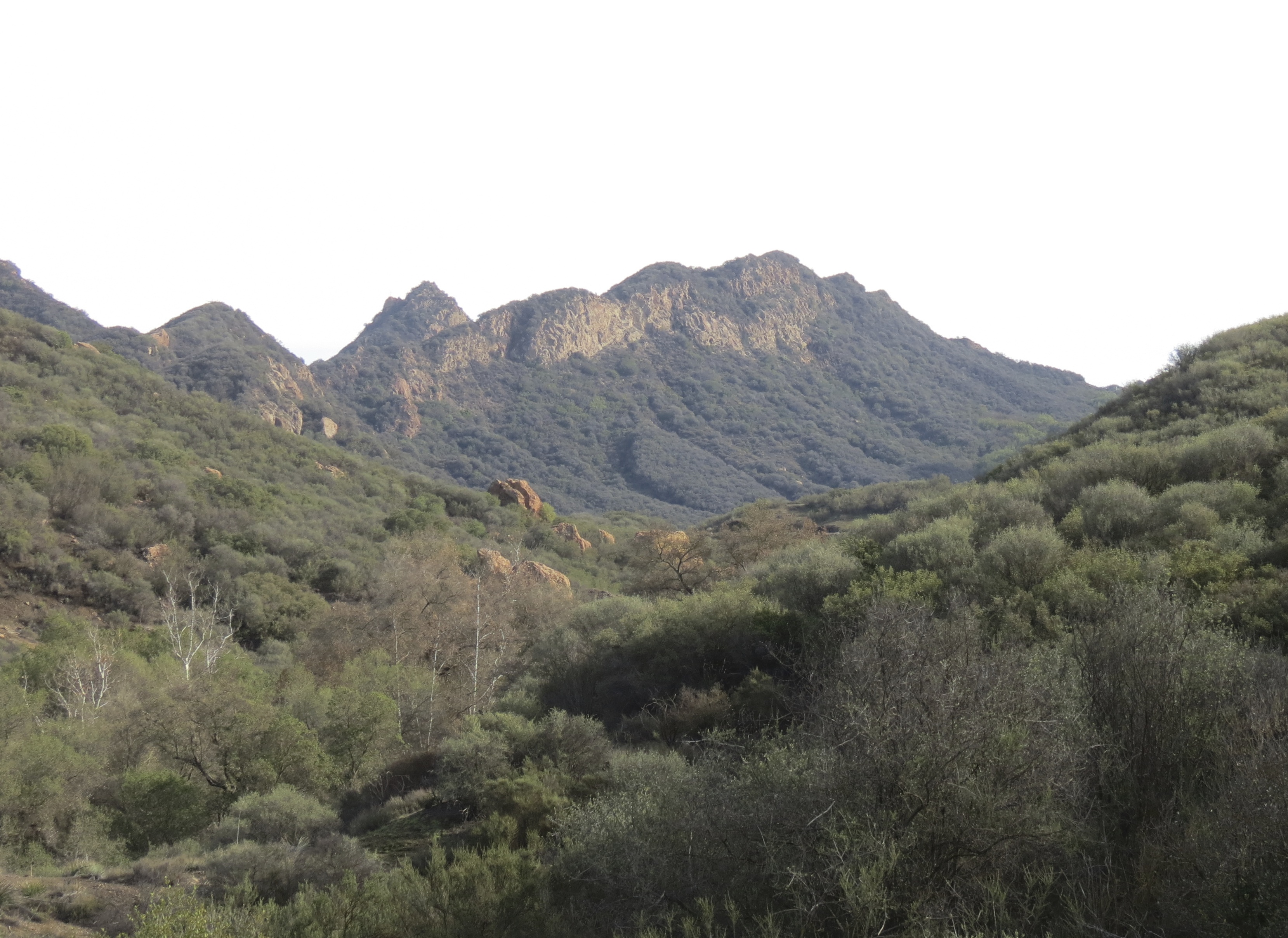
The iconic mountains from the title sequence for M*A*S*H (aka Goat Buttes, Santa Monica Mountains)

From the lower parking area, continue along Crags Road westward; the unpaved access road leads towards the Visitors Center and the rest of the park. The lower parking area is also near where the Chumash village of Talepop was located.

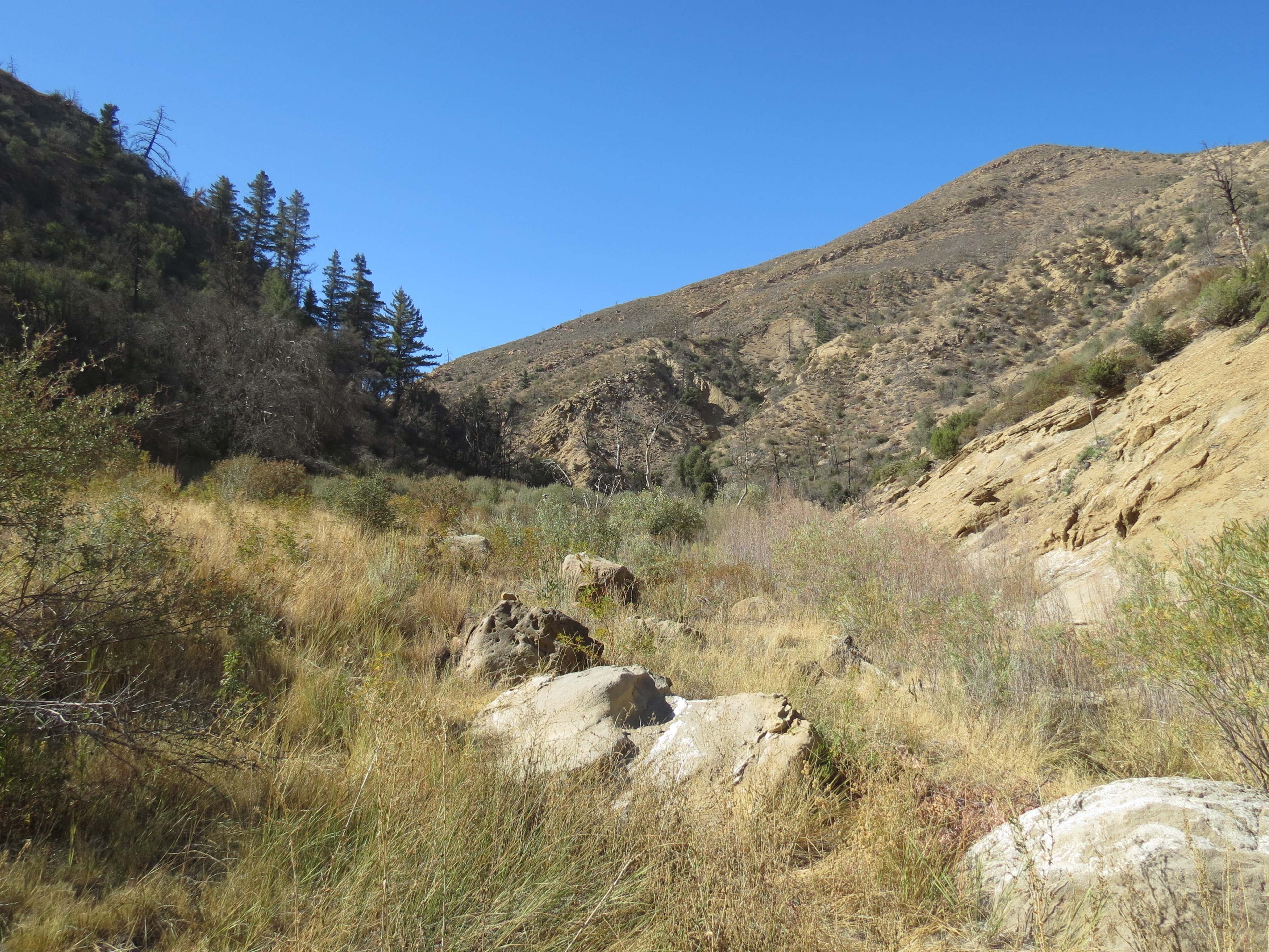
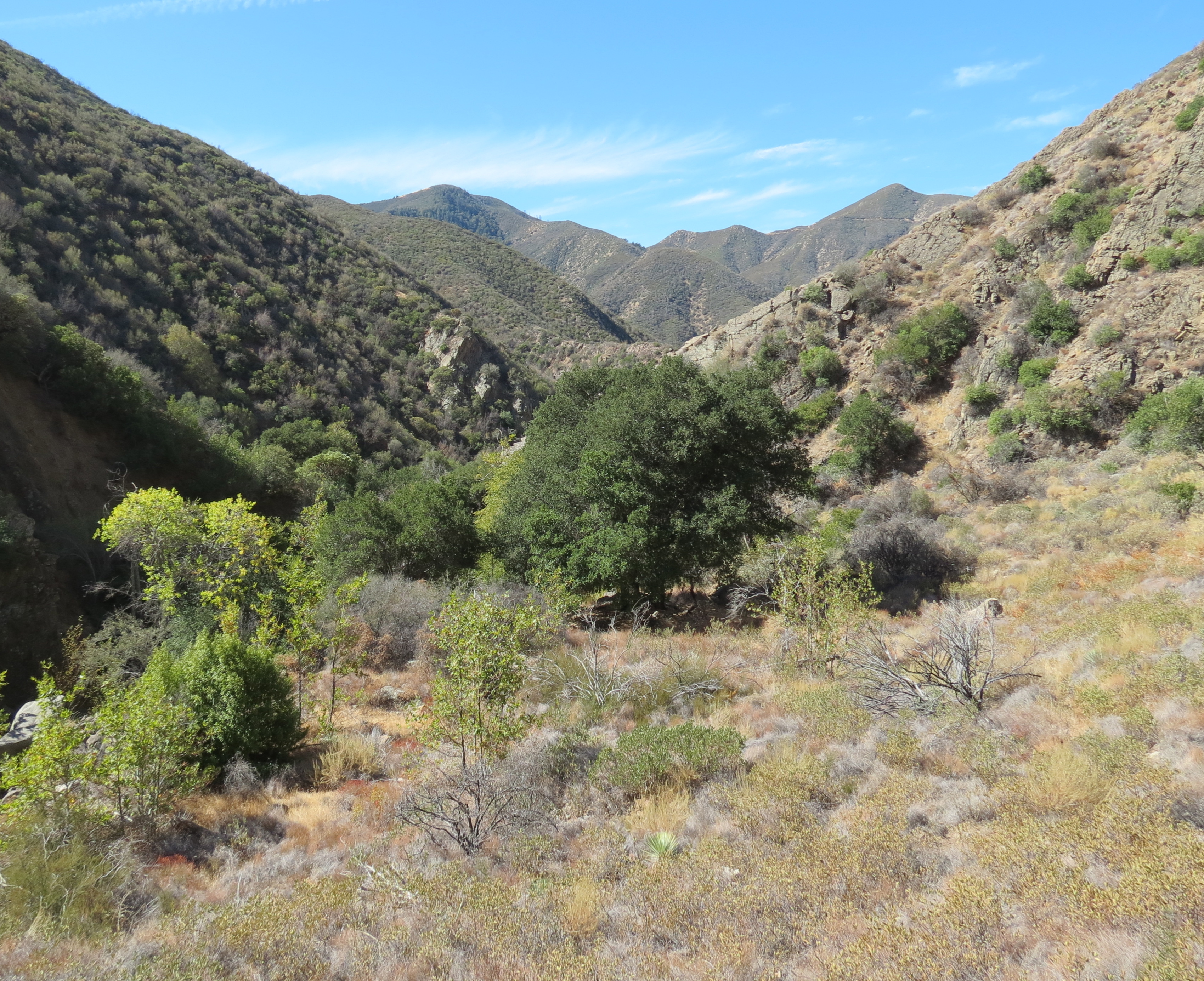
The hike along the unpaved road offers some great views of Malibu Creek framed by Goat Buttes. And it’s these weathered, rocky outcroppings of volcanic breccia and basalt that are part of the park’s visual appeal.

At about the 1-mile mark, the road arrives at the turnoff for the Visitor Center, located on the other side of the creek, across the bridge. The center is open from noon to 4 p.m., and includes interpretive displays on the natural history of the area.

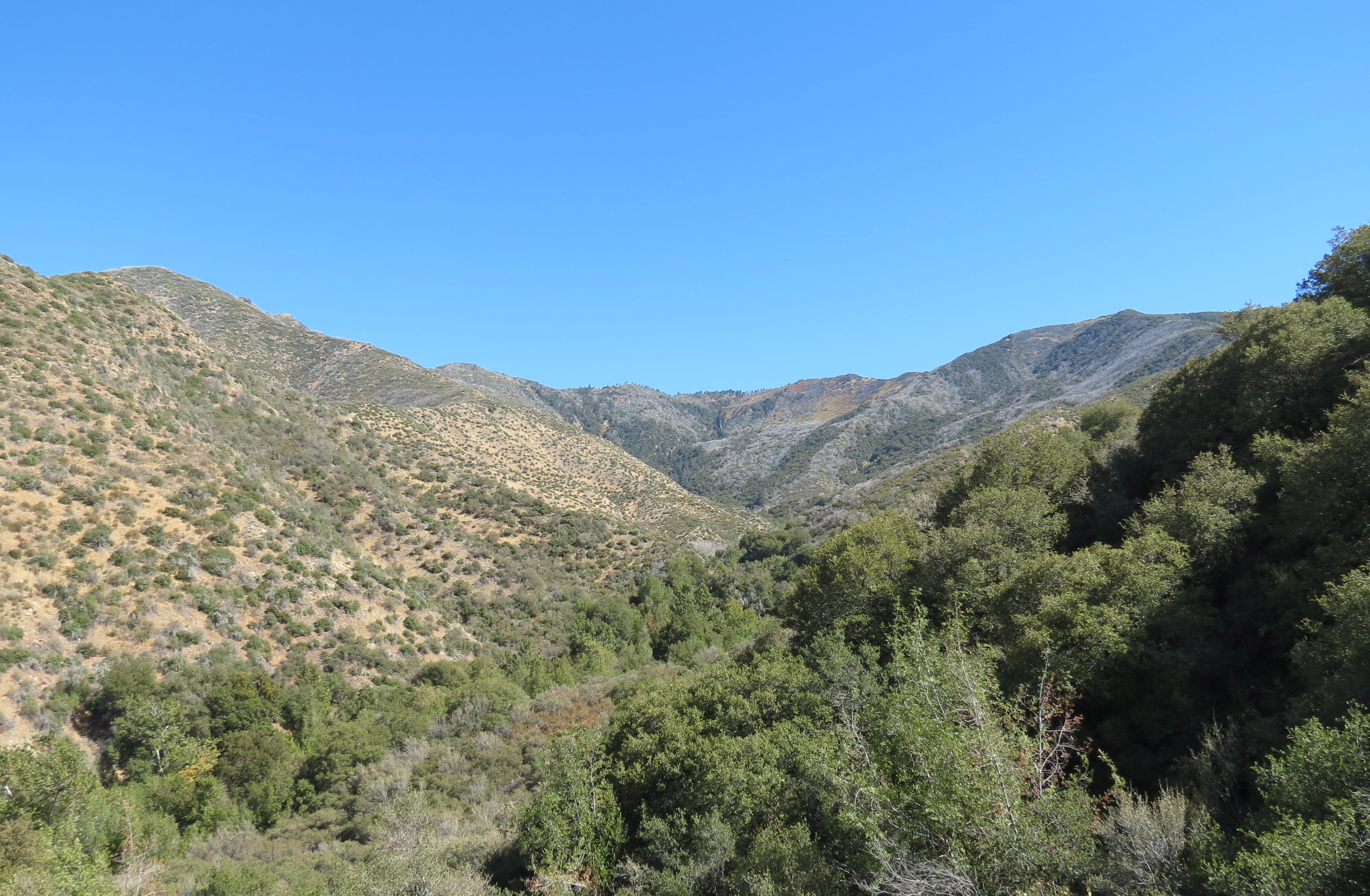
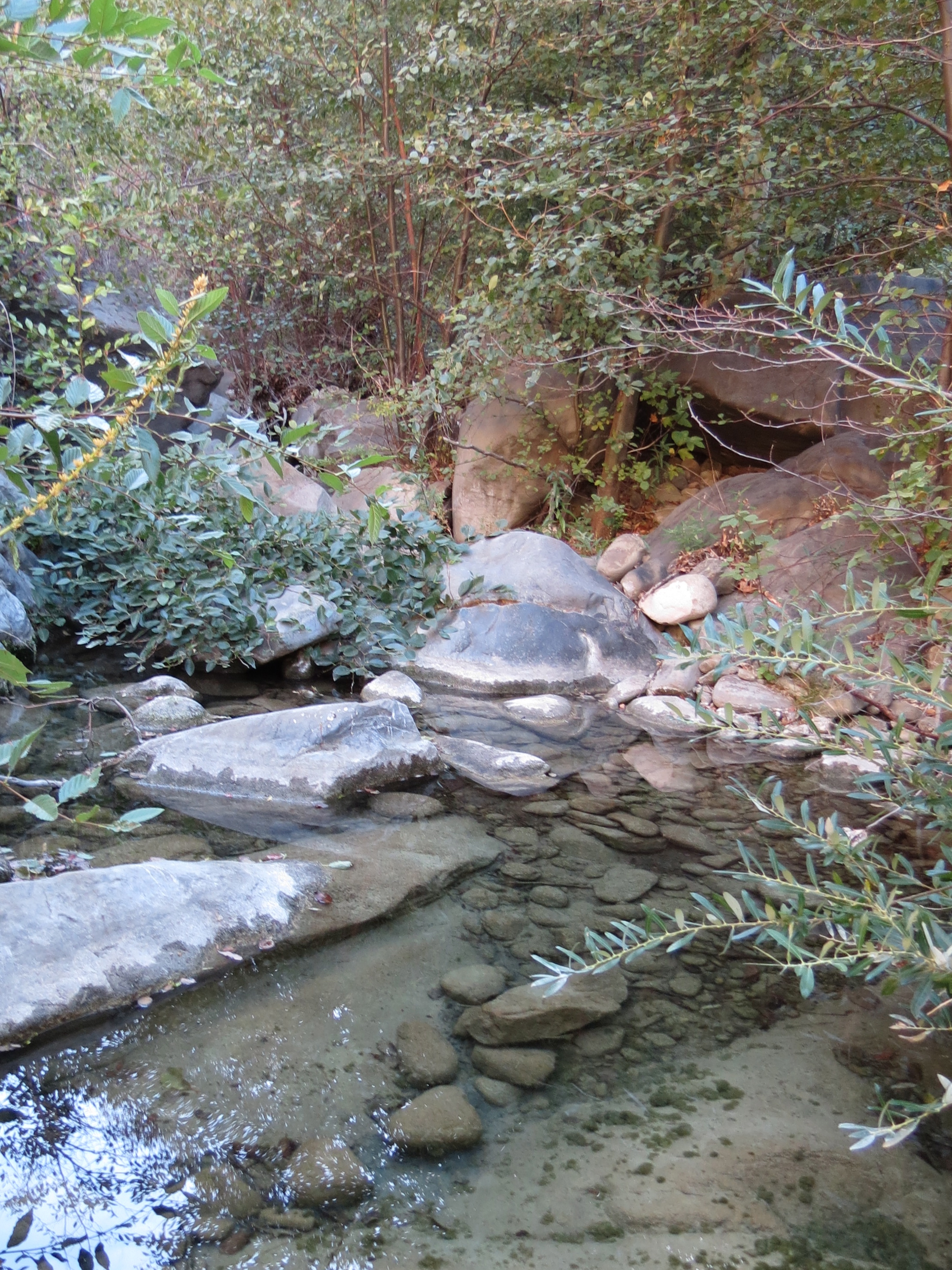
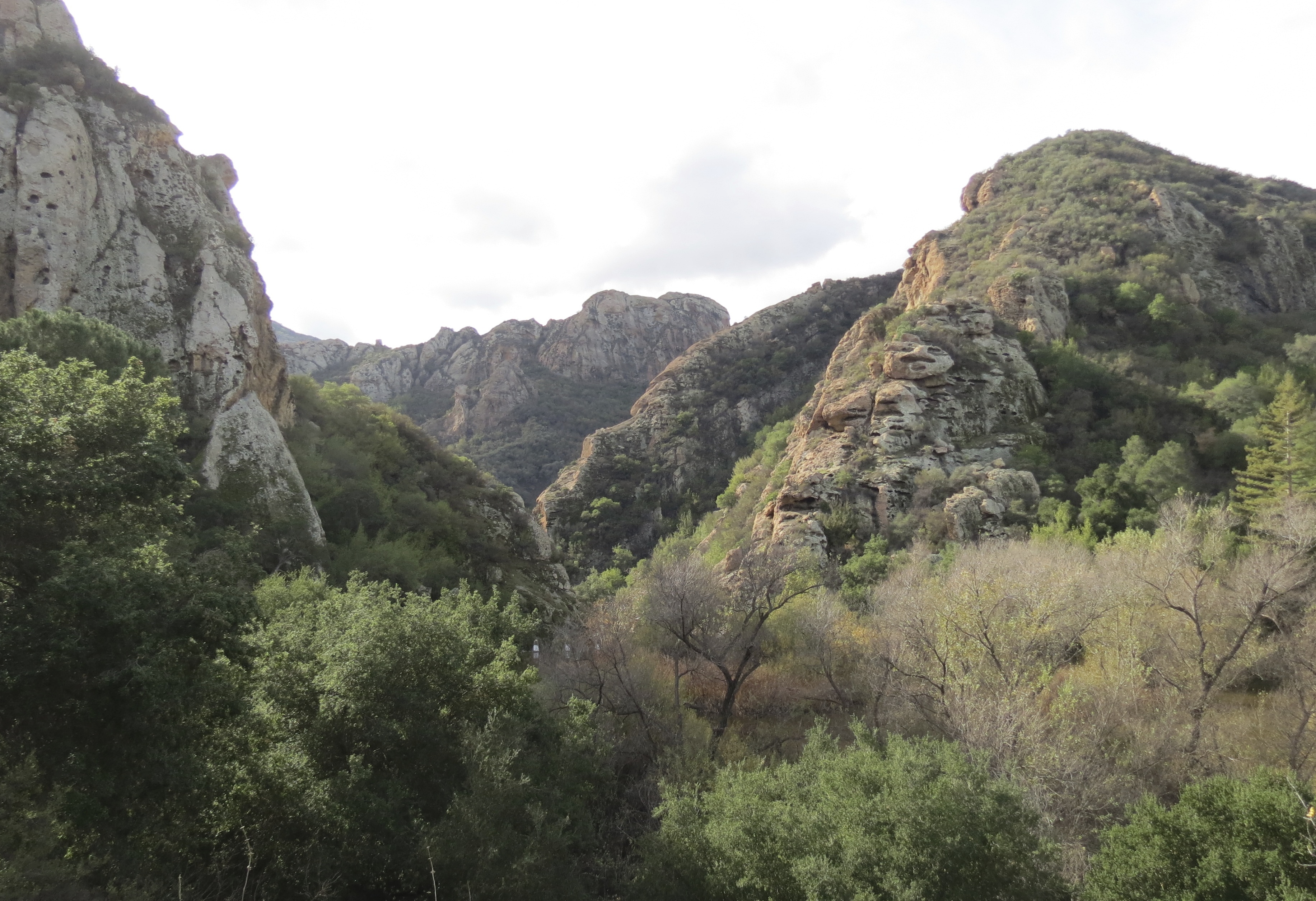
Just to the right, before the bridge, is the trail that leads upstream to Rock Pool. The site is a popular rock climbing destination located at the mouth of Malibu Gorge.

Goat Buttes Malibu Creek State Park MASH hike trail gorge

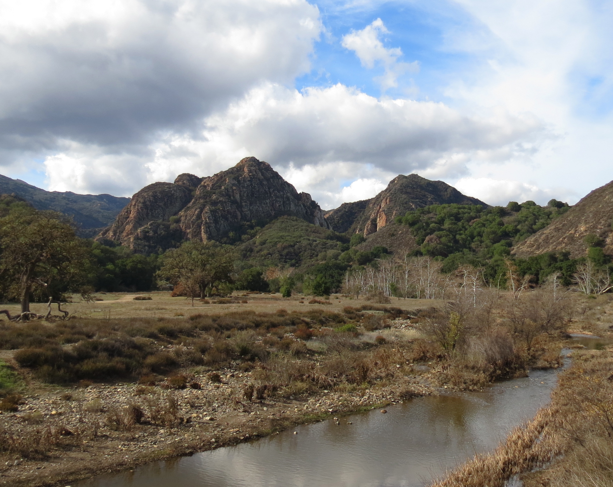
Goat Buttes frame a view of Malibu Creek

If you saw the first Planet of the Apes movie, you may recognize Rock Pool from the scene with the waterfall and pool that the astronauts swim in early in the story. Although here, the waterfall is conspicuously missing as it was artificially created for the 1968 film; it’s said that a dozen fire hoses hidden from view were used at the top of the large rock outcropping to create the effect.

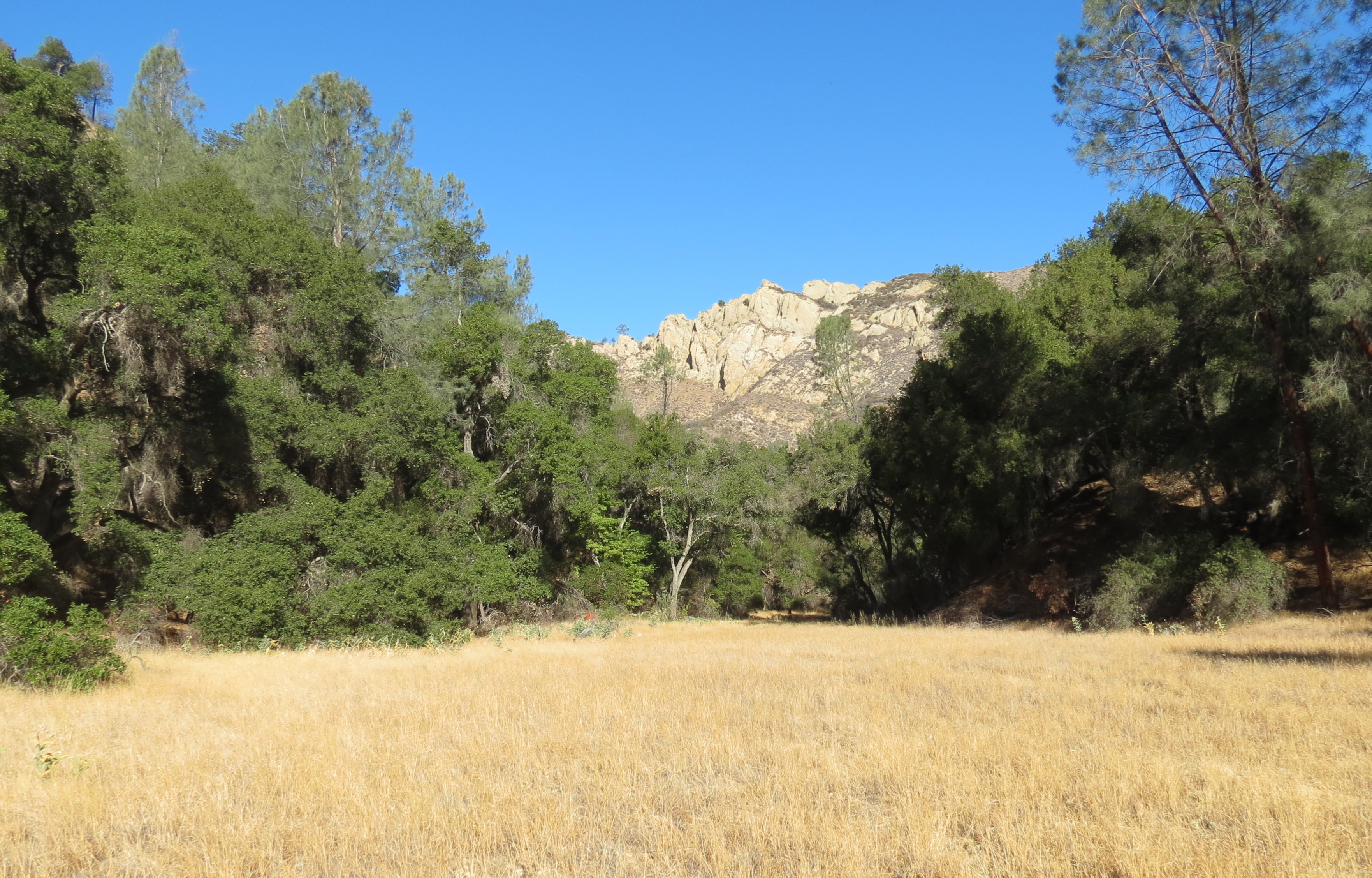
Past the turnoff to the Visitor Center and Rock Pool, Crags Road climbs somewhat, bypassing the gorge, before then descending back down towards Malibu Creek and Century Lake. The 7-acre lake is not immediately visible from the road. Like many man-made reservoirs in southern California it has filled with silt and sediment, and is smaller now than when it was originally created.

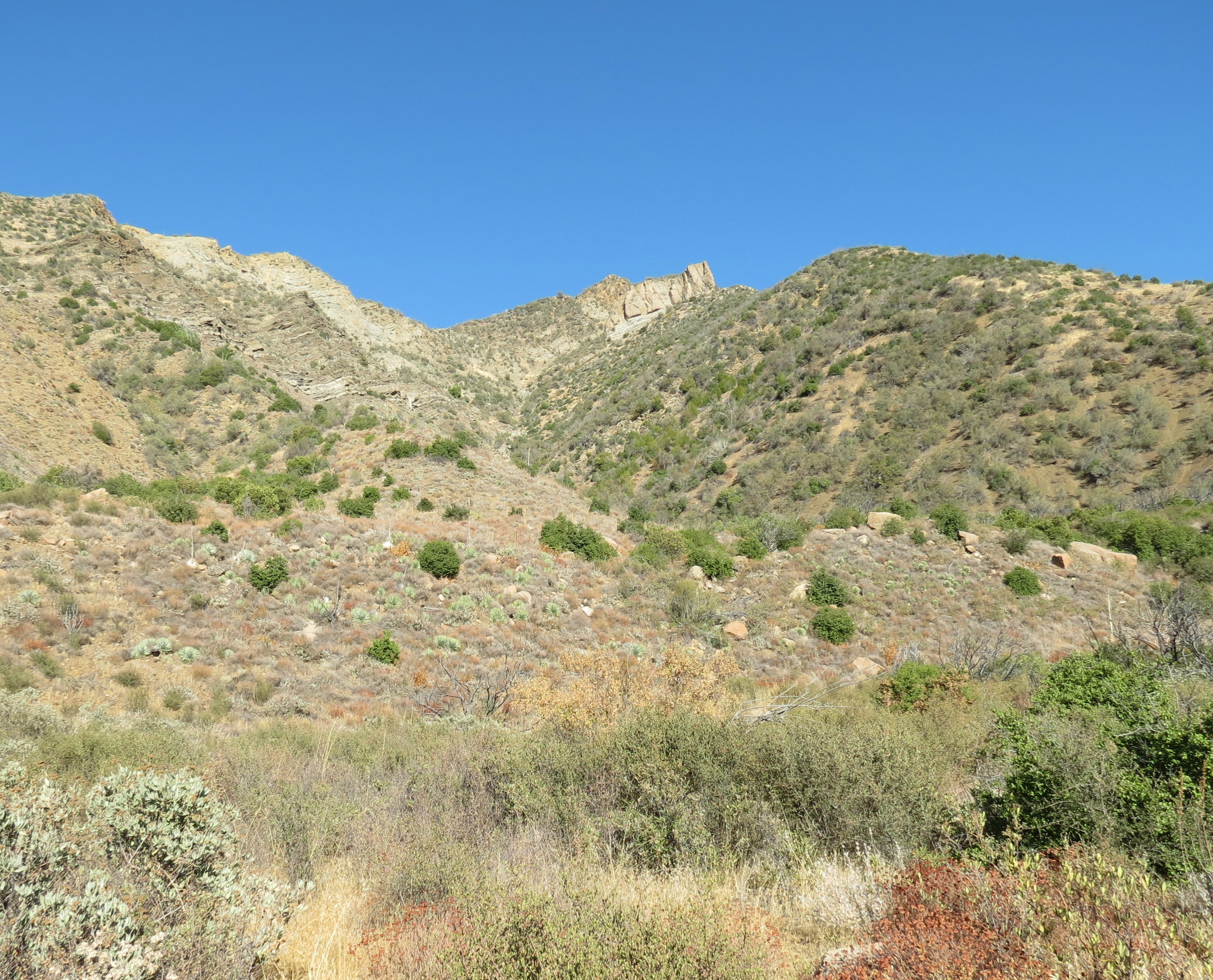
As the road levels out, it arrives at the turnoff for the unpaved road that leads around the eastern side of the lake. It’s here, at this intersection, that the simian village from Planet of the Apes was located. Nothing remains of the set, however an online image search will turn up comparison pictures of the set and the site today, with the most recognizable feature being Goat Buttes in the background.

Planet of the Apes Goat Buttes Santa Monica Mountains Malibu Creek State Park hike trail movie ranch 20th Century Fox

Goat Buttes near Century Lake and where the Simian Village set for Planet of the Apees was located

The trail around the eastern end of the lake is less than a quarter mile and offers some good views across the lake; the trail ends at the dam. The dam was built in 1910 by the Crags Country Club to attract waterfowl; the lake was also stocked with trout. The Country Club served as a hunting and fishing retreat for prominent businessmen. By 1936, the club, however, had ceased operations due to declining membership. Foundations from the club’s lodge can be found on the knoll, on the west side of Malibu Creek, overlooking Rock Pool.

Filming in the area began as early as 1919, with numerous silent films taking advantage of the diverse and dramatic scenery found in this stretch of the Santa Monica Mountains.

In 1946, 20th Century Fox bought the land and renamed it Century Ranch. And for almost to 30 years, the 2,000-acre “movie ranch” served as the backdrop for a long list of movies and television series including Viva Zapata and Daniel Boone.

MASH Goat Buttes Santa Monica Mountains Malibu Creek State Park hike trail movie ranch 20th Century Fox

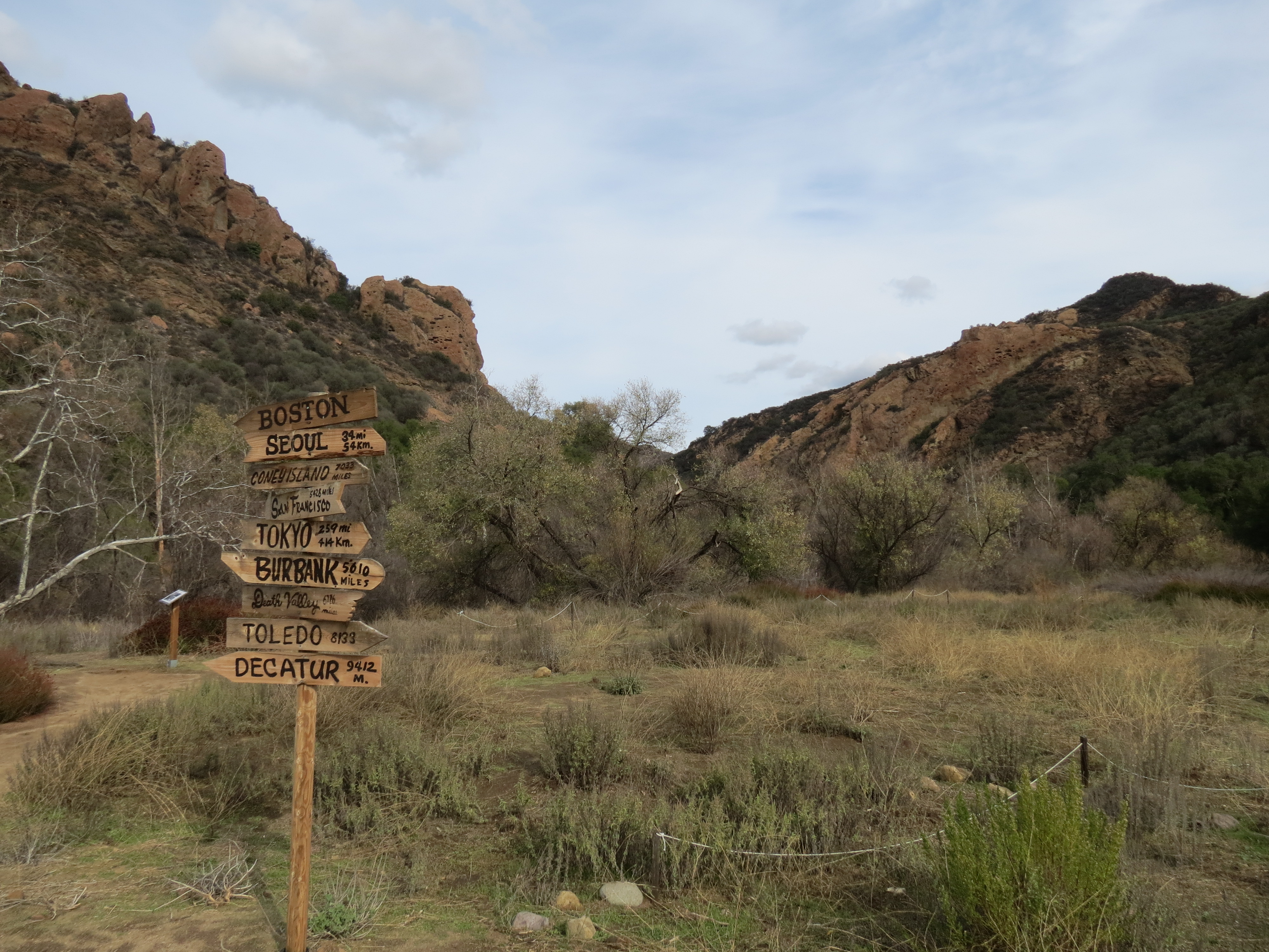
Signpost restored by volunteers outside of where the SWAMP was located

In 1974, the State of California purchased the ranch from 20th Century Fox, and expanded it with adjacent land purchased from the family of Bob Hope, and land owned by Ronald Reagan. In 1976, the park officially open to the public as Malibu Creek State Park. Filming, however, at the “M*A*S*H”. site continued until the final episode in 1983 under a special use permit.

Continuing past the turnoff to the eastern end of Century Lake, Crags Road continues upstream along Malibu Creek, and about a half mile later crosses the creek by way of a bridge. On your left is the beginning of Forest Trail, which travels along the south side of the lake. This scenic half-mile trail passes through redwoods that were said to have been planted around 1910; this trail also ends at the dam.

From the intersection with Forest Trail, Crags Road continues upstream becoming more of a trail, and about a half mile later arrives at the “M*A*S*H” site.

Both the 1970 movie “M*A*S*H”, and later, the television series “M*A*S*H” were filmed at the site. Both told the story of a group of army doctors and other personnel at the 4077th Mobile Army Surgical Hospital serving in South Korea during the Korean War. The popular television series ran from 1972-1983. When the final episode of “M*A*S*H” aired, it scored the highest viewership of any television series, a distinction that it retains to this day.

In October 1982, a brush fire burned through the park during the final stages of filming and destroyed the sets. The effect was later incorporated into the storyline of the final episode, which included a scene of the camp destroyed by a forest fire.

After the show ended, the only noticeable vestiges of the set that remained were a rusting ambulance and jeep, and the helipad area framed by the iconic view of the mountains that one sees in the title sequence of the show.

MASH hike Malibu creek State Park trail

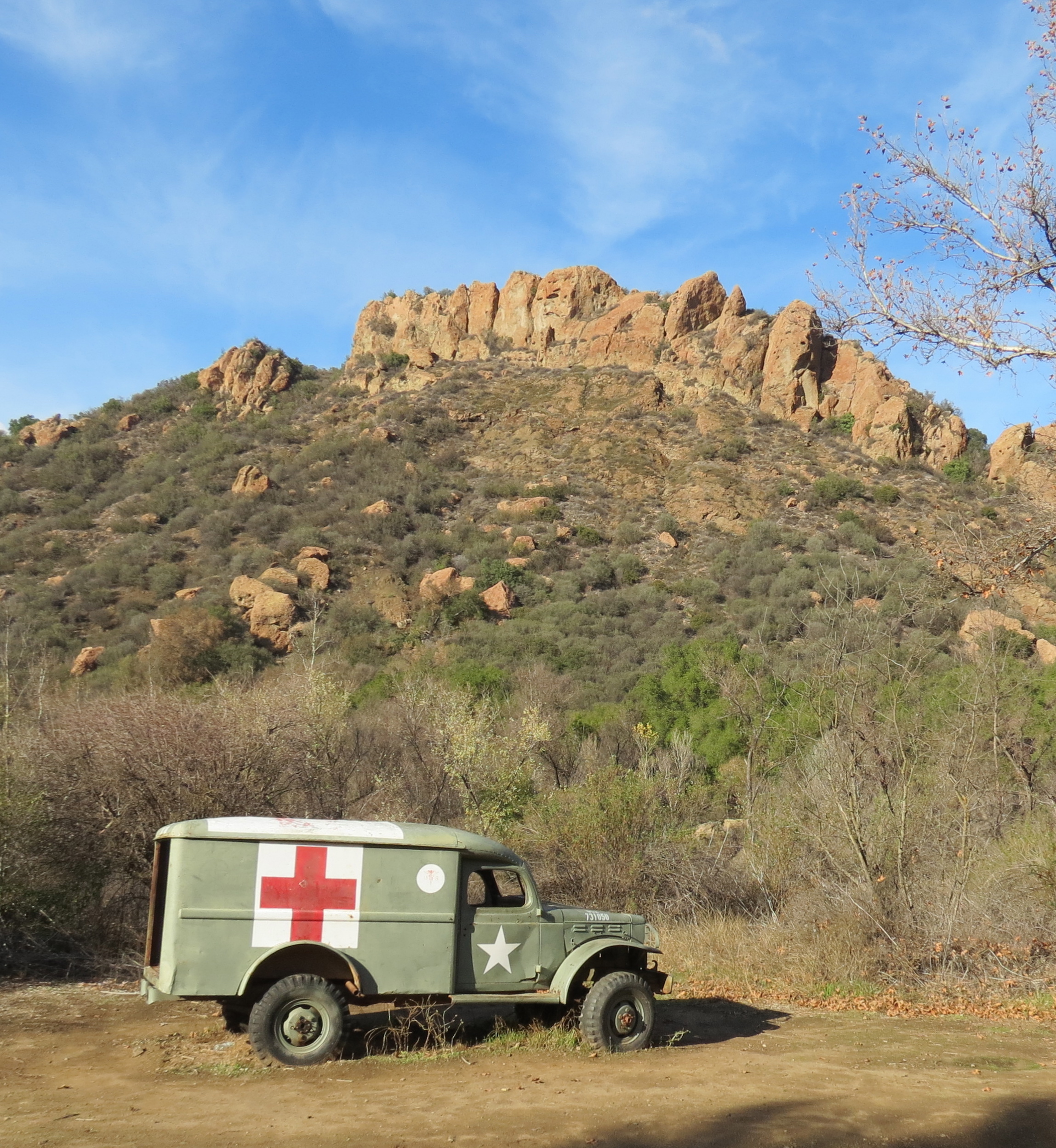
A restored ambulance at the M*A*S*H. site

In 2008, in preparation for the 25th Anniversary of the series’ finale, some additional features were added. A wooden sign post, matching the one in the television series was placed where it originally stood, just outside the “Swamp”. The “Swamp”, of course, being the tent where the surgeons portrayed in the show lived. As part of the restoration, ropes and stakes were added to mark the outlines of where many of the tents and buildings were located on the set. Interpretive signs were added, including one with a diagram of the set.

Surprisingly, the tents and buildings that made up the set were actually smaller than normal size, as the set was only used for exterior shots, with the majority of the interior scenes, and even some “outdoor” scenes filmed at 20th Century Fox’s studio in Century City. The exterior scenes were filmed in such a way to make the structures appear larger.

As part of the restoration, several picnic tables were also placed at the site for visitors; the tables are under a large wooden frame covered with camouflage netting, where the mess tent was located.

For fans of the show, the site provides an opportunity to connect with their favorite memories, and have a sense of how the show was filmed.

For more information about Malibu Creek State Park go to www.parks.ca.gov, and for information regarding docent led hikes go to www.malibucreekstatepark.org.

This article originally appeared in section A of the January 13th, 2015 edition of Santa Barbara News-Press.

Planet of the Apes Goat Buttes Santa Monica Mountains Malibu Creek State Park hike trail movie ranch 20th Century Fox

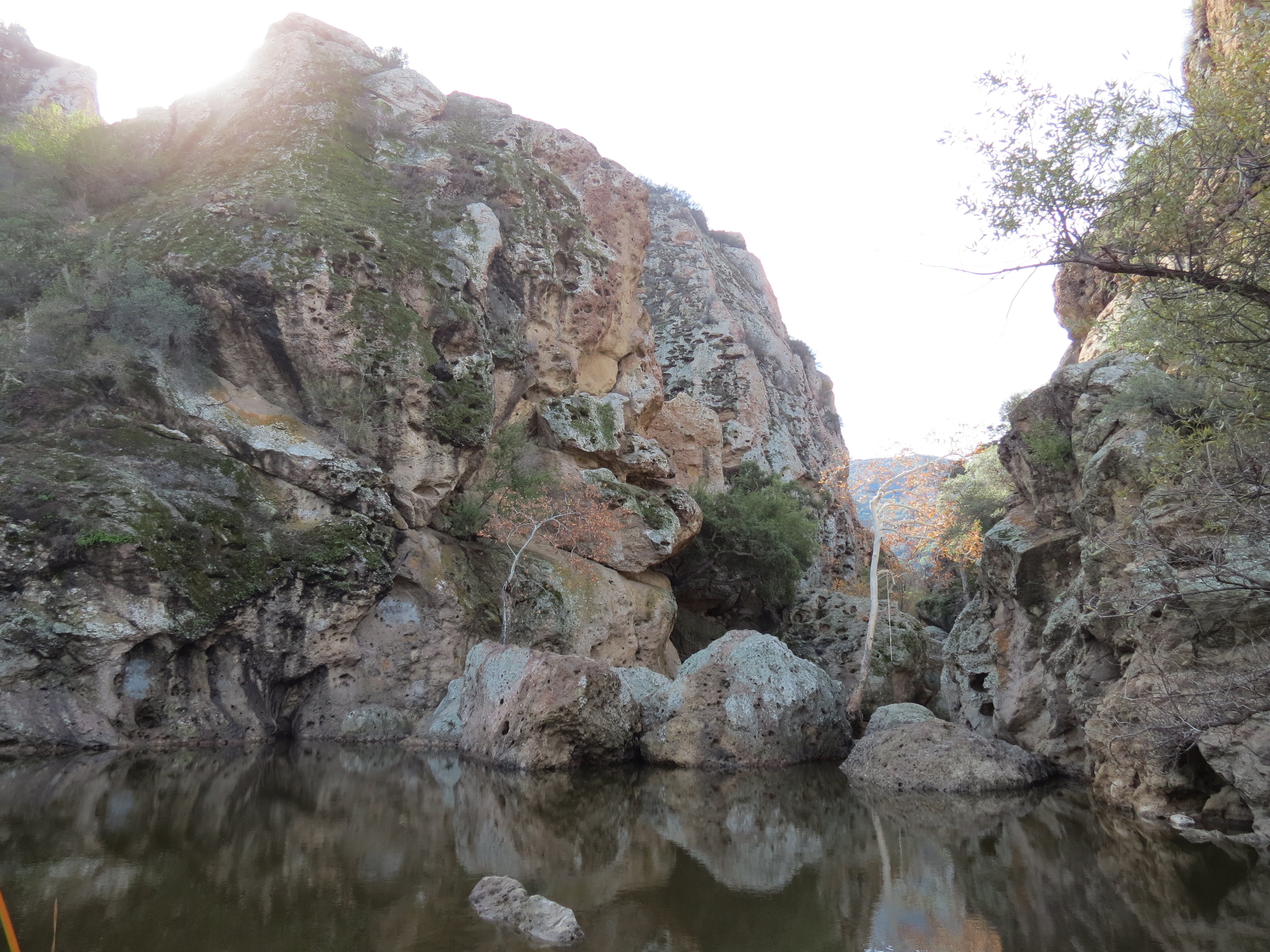
Rock Pool, featured in the 1968 movie Planet of the Apes

Posted by: James Wapotich | December 23, 2014

Trail Quest: Reyes Creek

Reyes Creek, and nearby Beartrap Creek, are just two of the many creeks one can find along the backside of Pine Mountain. In the lower elevations, along these creeks, one can find a rich mix of conifers, oaks, riparian plants and chaparral. Both creeks also support trail camps that generally have reliable water year round that can make for great backpacking, as well as day hiking destinations.

The hike through the canyons follows Gene Marshall-Piedra Blanca Trail. From the trailhead near Reyes Creek Campground, it’s about 3 miles to Upper Reyes Camp, 4.5 miles to Beartrap Camp, and 8 miles to Haddock Camp.

To get to the trailhead from Ojai, take State Route 33 north. The road follows Upper Matilija Creek, before traveling along the scenic Sespe River and arriving at Pine Mountain Summit. From here, State Route 33 descends down towards the Cuyama River and arrives at the intersection with Lockwood Valley Road. Turn right on to Lockwood Valley Road, and continue about 3.5 miles to the signed turnoff, on your right, for Camp Scheideck Road. Camp Scheideck Road continues over a small rise and descends towards Reyes Creek and Reyes Creek Campground.

Beartrap Creek Canyon Campground Gene Marshall Piedra Blanca Trail Sespe Wilderness Los Padres National Forest hike

Scenery along Beartrap Creek between Beartrap Camp and Haddock

Just before Reyes Creek Campground is the small community of Camp Scheideck. The site was first homesteaded in 1888 by Eugene Scheideck. Today, one of the highlights of the community is Reyes Creek Bar & Grill, which can make for a nice break from camp food.

At Reyes Creek Campground one can find a number of car camping sites on a first come first serve basis. An Adventure Pass is required to camp there, but is not required for parking at the nearby trailhead.

Both the creek and campground, as well as Reyes Peak, take their names from the Reyes Family.

map Reyes Creek Gene Marshall Piedra Blanca trail hike bear trap canyon

Map courtesy Maps.com

In 1851, Rafael Reyes established a ranch at the mouth of Reyes Creek along the Cuyama River. His family ran cattle at their ranch, Rancho Las Virgenes, near present day Agora Hills; however, a severe drought that year, led Rafael Reyes and his brothers to seek better grazing lands to the north. They drove 2,000 head of cattle and 1,000 horses over Tejon Pass and down Lockwood Valley to Reyes Creek.

In 1870, Mr. Reyes married Maria Ygnacia Ortega. Their eldest son, Jacinto Damien “J. D.” Reyes, would later serve as the area’s first forest ranger. J. D. Reyes served from 1900-1931 in what was then the Cuyama Ranger District, before retiring and moving to Ojai.

From Reyes Creek Campground, continue on the paved road that is on the west side of the camp and leads over a small rise to the beginning of Gene Marshall-Piedra Blanca Trail. The close proximity of the trailhead to Reyes Creek Campground makes it easy to explore the trail as part of a day hike while camping there. At the trailhead one can also find space for horse trailers, as the trail is suitable for pack animals.

Originally called Piedra Blanca Trail, it was renamed Gene Marshall-Piedra Blanca Trail in 1992, in recognition of Gene Marshall’s contributions to the Los Padres Condor Range and River Protection Act. The act, which passed that same year, established the Sespe, Matilija, Chumash, and Garcia Wilderness areas.

Reyes Creek Campground Bear Trail Sespe Wilderness Los Padres National Forest Gene Marshall Piedra Blanca

Fall colors along Reyes Creek

From the trailhead, the trail quickly crosses the unnamed creek that the trail follows for the first few miles. At times, the composition of plants can almost feel eclectic with juniper, cedar, interior live oak, willow, wild rose, and pine all growing along the canyon.

As the trail climbs out of the canyon towards a small saddle, it offers views back down the canyon towards the rolling hills of the Cuyama Badlands.

From the saddle, the trail descends a half-mile down towards Reyes Creek, and at the 3-mile mark arrives at Upper Reyes Camp. The camp has two sites, each with a grated stove. The first site is under a small stand of cedar trees; and the second, further up the trail, past the creek crossing, is under a large interior live oak. Water can be found in this section of Reyes Creek year round.

From Upper Reyes Camp, the trail climbs a series of switchbacks, and then continues towards the saddle near the top of Reyes Canyon. Along this stretch, one is treated to more great views of the canyon as well up towards Pine Mountain.

From the saddle, the trail descends down towards Beartrap Creek and crosses it, arriving at Beartrap Camp. The camp has five sites, two just downstream from the creek crossing, two in the relatively large open space under the cedars and ponderosa pines, and one more further upstream, just before another creek crossing. All five camps feature a grated stove, and although the creek flows intermittently in the fall, water can be found at or near each of the camps.

On older maps one will find the site listed as Beartrap #1. Beartrap #2 was located another mile upstream, and was washed away during flooding from heaving rains in the early 1970s.

Beartrap Creek Canyon Campground Los Padres National Forest Sespe Wilderness Hike Gene Marshall Piedra Blanca Trail

Beartrap Creek near Beartrap Camp

The camp takes its name from when grizzly bears roamed the backcountry, and was used by the Reyes Family who reportedly trapped grizzlies in the area in the late 1800s. By some estimates there were as many as 10,000 grizzly bears in California in the early 1800s, however as more people settled in the state, the number of grizzly bears was dramatically reduced through hunting and in some cases poisoning. In 1922, the last grizzly bear shot in the state was on a ranch in Tulare County in the Central Valley.

Today, the only bears in the canyon are black bears who make good use of the wild berries, and reliable water that can be found in the canyon.

Past Beartrap Camp, the trail becomes more overgrown, but is still easy to follow. During the fall the already scenic canyon becomes quite striking as the leaves on the willow and alder trees turn gold. In fact, one of the magical sections of the canyon is a long stretch that lead through almost exclusively alder trees.

Eventually the trail begins its climb out of Beartrap Canyon, and at about the 7.5-mile mark arrives at the top of the canyon.

From here, it’s roughly another half-mile down to Haddock Camp. Here, the trail follows the upper reaches of Piedra Blanca Creek, threading through mostly pines and cedar. At about the 8-mile mark, the trail arrives at Haddock Camp. The camp has three designated sites, each with a grated stove; there is also a fourth site just upstream from the camp. Water at Haddock Camp usually plays out by the summer, although one can sometimes find water a half-mile to a mile further downstream.

Haddock Camp is located at the intersection with Reyes Peak Trail. Reyes Peak Trail connects west over towards Reyes Peak and Pine Mountain Campgrounds, which can also be reached by road from State Route 33. Past Haddock Camp, Gene Marshall-Piedra Blanca Trail continues more or less downstream along Piedra Blanca Creek, leaving and returning to the creek a couple times before ultimately arriving at the Piedra Blanca Trailhead in Rose Valley.

Regardless of how far you hike you’ll get to see some of the rich scenery associated with the Pine Mountain range.

This article originally appeared in section A of the December 22nd, 2014 edition of Santa Barbara News-Press.

Haddock Camp Gene Marshall Piedra Blanca Trail hike Sespe Wilderness Los Padres National Forest

Scenery at Haddock Camp


Posted by: James Wapotich | December 6, 2014

The Backcountry Gourmet: The Search for Pomì Marinara Sauce

A while back I touted the wonders of Pomì Marinara Sauce in a post regarding “What I found at Ralph’s”. Within a year of that post, Ralph’s and everyone else stopped carrying Pomì Marinara Sauce, even though they still carried Pomì’s Strained and Chopped Tomatoes in the same style box. Every time I was in the store I’d check to see if it had returned. And any time I was in a new store I’d look to see if I could find it.

Obsessed? Perhaps, but for me spaghetti is just a great backcountry meal, especially on an overnight backpacking trip where weight isn’t as big an issue as on a multi-day trip.

In the interim I tried bringing spaghetti sauce in a Nalgene bottle hoping against hope that the smell of the sauce would eventually leave my bottle.

Then one day while shopping at Tri-County Produce, I just happened to notice that they had some sauces on the bottom shelf across from their freezer aisle. Not even sure what prompted me to look there having been in the store countless times before. But lo and behold on the bottom shelf was a box of the elusive Pomì Marinara Sauce. It had a new, redesigned label, but was still the same functional, sealed box that makes it perfect for backpacking trips. I quickly bought two boxes and thanked my good fortune. [And now almost a year later, I’ve noticed that Cantwell’s and Tino’s Italian Grocery now carry this magic sauce as well.]

Hiking Backpacking trail Santa Barbara Ventura Ojai Los Padres National Forest

*

Back in that original post I also touted Trader Joe’s Pre-Cooked Meatballs as the perfect addition to the sauce. However, since then Trader Joe’s stopped carrying pre-cooked meatballs. Recently I was able to find a worthy successor – Chef Aidells’ Pre-Cooked Meatballs, which come in a variety of flavors. Here, again the challenge becomes finding a store that actually carries them. Ralph’s at one time did, but now they become perplexed when confronted with the words “pre-cooked meatball”. In fact, the only two places where I’ve been able to find them in Santa Barbara is at Whole Foods and Lazy Acres. [Of course, now that I’ve made this post, I’ve noticed that most Ralph’s, Vons, and Albertsons have started carrying Aidells’ Pre-Cooked Meatballs in variety of flavors.]

Dinner rolls, red wine and parmesan cheese are good additions to this menu as well.

Buen Provecho!

Hiking Backpacking trail Santa Barbara Ventura Ojai Los Padres National Forest

Single serving red wine in easy to carry plastic containers

Posted by: James Wapotich | December 4, 2014

The Backcountry Gourmet: Raising the Bar

I’ll confess I have a love/hate relationship with energy bars. They’re an essential part of my gear. I bring them on almost every hike I go on because they can be the perfect mid-morning or mid-afternoon pick me up and provide that extra “traction” to press on. This is especially true when fighting the brush in the Dick Smith Wilderness, tackling the up and down roller coaster-like ridges in places such as Hurricane Deck, or fording numerous crossings along the likes of the Sisquoc River or Lower Manzana Creek. And yet, energy bars in all their various forms are also a food that one can easily get burned out on.

Over the years I’ve had many, many favorites come and go. Flavors that I couldn’t get enough like some new pop song, that then started to fade until I woke up one day unable to bear another assault on my taste buds. Here then are just a few of the ones I’ve sampled and cycled through.

Energy Bars Hiking Backpacking Santa Barbara Ventura

*

The one that started it all was Balance Bar’s Caramel Nut Blast. In fact, I believe the first bar I had was free, given to me by a friend…at any rate I was hooked. I couldn’t go on a trip without stocking up. But it wasn’t long before my taste buds grew weary, and I had to branch out to other Balance Bar flavors such as Honey Peanut and later its close cousin Yogurt Honey Peanut. Another favorite was their Almond Brownie, which I used to bring on every trip – now I can’t stand it.

Balance Bar later came out with one they called Chocolate Craze which was the official energy bar for a whole backpacking season before I became burned out on it. Just recently I’ve come full circle and started bringing Caramel Nut Blast again on trips.

Hiking Backpacking Santa Barbara Ventura

*

Needing to branch out further and diversify I started eating Luna bars even though a girl friend of mine insisted that these were strictly for women only. But by then the monkey had me and I didn’t care. I needed variety. Besides who’s going to see me out on the trails and care what kind of energy bar I’m eating? And so what if I feel like redecorating South Fork Cabin, fine. I was quickly hooked on Luna’s Chocolate Dipped Coconut, and at the time it was my new favorite – now I can’t stand it. I also tired several others for variety such as Nuts Over Chocolate, S’mores, and Carrot Cake, but now the only flavor I can still tolerate on a regular basis is Caramel Nut Brownie.

Most of these bars I was able to get at Trader Joe’s, but one day, after the Vons on Chapala closed, I started shopping at the Ralph’s on Carrillo…and for my sins I found what remains the largest selection of energy bars I’ve seen. About six feet wide and filled top to bottom with boxes and boxes of energy bars. Pure evil.

I dabbled at first with some of the old flavors I’d grown tired of and tried some different unheard of brands. And for a while I thought Zone Perfect had some great flavors to offer such as Dark Chocolate Almond, Double Dark Chocolate, Fudge Graham, and Chocolate Mint. Now I can’t stand any of them.

Then one day at Ralph’s I discovered PowerBar’s Double Chocolate Crisp and thought I’d found salvation at last. This seemed like the ultimate bar. I mean it had everything, chocolate, great texture, it was bigger than other bars, and it tasted good. I felt reinvigorated in my enthusiasm for energy bars and brought them on every trip, eating them almost exclusively – now, I can’t stand them.

Energy Bars Hiking Backpacking Santa Barbara Ventura Ojai

*

Around this same time Clif introduced its line of Mojo Trail Mix bars, the most bizarre of these are the ones that have pretzels mixed into them, but I digress. The early favorite was their Dark Chocolate Almond Coconut. Not only did it have a good mix of ingredients, but was different enough from the other bars I carried to create the illusion of variety. About this time, I also discovered that if you’re truly obsessed about bars, you can buy them by the box at Whole Foods and get 10% off, which is basically like getting a free bar. And although my passion for them has since faded, I still bring them on trips, probably because they vaguely remind me of gorp and are the least bar like of the alternatives.

The latest flavor sensation to weigh down my pack is PowerBar’s Caramel Peanut Fusion. With its candy bar like texture it is somehow able to slip under the radar of gnawing on the obligatory energy bar for sustenance, and at times almost seems like real food. Alight, palatable food.

I keep telling myself that one day I’ll make my own energy bars that are portable and taste good. I even have a couple recipes, but for now I’ll have to just keep trying new flavors – fortunately we live in a consumer culture that is all about new flavors and so it’s unlikely that I will run out.

chocolate hiking backpacking santa barbara ventura

*

While we’re on the subject of bars, another weapon in my arsenal against trail stupor is chocolate. And while I’m not a chocoholic, I’m am convinced that chocolate is some kind of miracle food. In addition to the lift from the caffeine and sugar, I often find myself feeling more focused and alert. I recently read that some people consider chocolate to be a brain food. All I know is that if it worked for the Aztecs and the Mayans in the jungles of Central America then it’s probably worth carrying in the wilderness.

Posted by: James Wapotich | December 1, 2014

Trail Quest: Hidden Potrero

Oso Canyon is one of many canyons associated with the San Rafael Mountains. A loop hike to Hidden Potrero is one of the ways to take in the rich scenery and geology that the canyon has to offer.

The hike to Hidden Potrero, along Buckhorn-Camuesa Road, is about 4.5 miles, and provides great views out across the canyon. An alternate route back, also 4.5 miles, can be made through Oso Canyon, and can include a quarter-mile side trip down to the site of an old mercury mine.

To get to the trailhead from Santa Barbara, take State Route 154 over San Marcos Pass to Paradise Road. Turn right onto Paradise Road and continue past the river crossing to Lower Oso Day Use Area. At Lower Oso, turn left and continue towards Upper Oso, along what’s referred to as Romero-Camuesa Road.

Hidden Potrero Buckhorn Camuesa Road Santa Barbara hike Los Padres National Forest

The meadow at Hidden Potrero Camp

A mile later, the road arrives at the turnoff for Upper Oso Campground. Stay to the right, and continue a short way to the locked forest service gate, which represents the trailhead. From here, Romero-Camuesa Road continues, unpaved, as a forest service access road, and is more commonly referred to as Buckhorn-Camuesa Road. Parking is found near the gate. An adventure pass is required park within the Lower Santa Ynez River Recreation Area.

From the trailhead, continue along Buckhorn-Camuesa Road. The road is popular with OHV (off highway vehicle) and motorcycle enthusiasts, and so you will need to be alert to this traffic while hiking along the road.

Buckhorn-Camuesa Road follows Oso Creek for the first .75 miles, and passes through what could be described as Oso Narrows. Here, the watercourse has cut through the exposed Matilija sandstone.

At the .75-mile mark, the road arrives at the official beginning of Santa Cruz Trail. From here, Santa Cruz Trail continues up Oso Canyon towards Nineteen Oaks; this is the return trail for the loop part of the hike.

From the Santa Cruz Trail junction, continue on Buckhorn-Camuesa Road as it starts to climb away from Oso Creek. The road makes a winding set of turns as it gains elevation, before starting to level out and parallel Oso Canyon. Here, one is treated to views out across the canyon towards Alexander Saddle and Little Pine Mountain.

It’s also here, looking down into the canyon, that one can more easily spot where the rock type transitions from Matilija sandstone to Espada Formation and into Franciscan rocks. The transition line also marks the location of Little Pine Fault, which uplifted the older Espada and Franciscan rocks. Tracing the canyon west to east, one can see where beige sandstone transitions to olive-gray Espada rocks, and then past that into the more varied geology of greenish-brown Franciscan and blue-green serpentine outcroppings.

serpentine oso canyon los padres national forest santa barbara hike trail

Serpentine rock

Both Franciscan assemblage and serpentine rocks are metaphoric, i.e. rocks that have been changed physically and chemically from exposure to high heat and pressure beneath the earth’s surface. Franciscan rocks were once sedimentary and igneous rocks on the floor of the Pacific Ocean, on what was then the Farallon Plate. Those rocks were metamorphosed through the process of subduction. Serpentine was formed beneath the earth’s crust and was changed as it rose to the surface.

As the eastern moving Farallon Plate subducted under the North American Plate, the Franciscan material was scraped off the Farallon Plate and added to the western edge of North America. As more and more of the Farallon Plate subducted under the North American Plate, it brought the Pacific Plate behind it into contact with the North American Plate.

However, unlike the Farallon Plate, the Pacific Plate was, and still is, moving northward. Instead of sliding under the North American Plate and forming a subduction zone at the plate boundary, the Pacific Plate is sliding north against it, creating a transform fault, i.e. the San Andreas Fault, where the two plates meet.

As the Pacific Plate moved north against the North American Plate, it picked up material from the North American Plate, which it dragged along with it. One of the blocks of land it picked up was the Transverse Mountains, which used to be down by San Diego. Over the course of time they were dragged northward and turned 90 degrees, arriving where they are now, just south of the San Rafael Mountains.

An interpretive guide for the geology of Oso Canyon can be found at, http://www.fs.usda.gov/Internet/FSE_DOCUMENTS/fsm9_034048.pdf. Included in the guide is a Dibblee-style geologic map of the area that can be helpful in identifying rock types and their transitions. Similar USGS geologic maps can be viewed online at http://ngmdb.usgs.gov/maps/mapview/.

Hidden Potrero Buckhorn Camuesa Road hike trail Santa Barbra Los Padres national forest

Hidden Potrero Camp is seen from a nearby hill-size outcropping of Franciscan Rock

At about the 2.75-mile mark, the road arrives at Camuesa Connector Trail, which leads down to the Santa Ynez River. Here, the Franciscan rocks become more apparent on the landscape. And as the road continues, it passes a large, exposed outcropping of serpentine rock.

About a half mile past Camuesa Connector Trail, look for a trail turnoff on your left. This is the beginning of the trail that leads down to Nineteen Oaks for the return part of the loop hike. The trail follows an old road cut that leads down towards the mine site. The trail is unmarked, but is recognizable by the metal sign that reads “No Motor Vehicles” and the fence across the trail, both of which are there to remind motorcyclists not to ride on non-OHV designated trails.

From here it’s roughly another 1.25 miles along Buckhorn-Camuesa Road to Hidden Potrero Camp. As you near the camp, you’ll see on your left a large outcropping Franciscan rock that forms a good size hill. Just past the outcropping is a side trail that leads through a small meadow and arrives at the campsite.

Hidden Potrero Camp was built in the late 1920s, and was used as a base camp when the road was being constructed. The word potrero is Spanish for pasture. The camp has two picnic tables and a metal fire ring.

Just a short way past Hidden Potrero Camp, Buckhorn-Camuesa Road branches. Camuesa Road continues eastward over towards Mono Campground, and Buckhorn Road continues north over the San Rafael Mountains.

Oso Canyon Nineteen Oaks Buckhorn Camuesa Road Hidden Potrero Los Padres National Forest Santa Barbara hike trail

Little Pine Mountain is seen from the old mine road that leads from the Buckhorn-Camuesa Road down towards Nineteen Oaks

For the hike back, return along Buckhorn-Camuesa Road to the beginning of the old mine road. The trail down to Nineteen Oaks follows the old road cut as it descends down towards Oso Creek. The trail is in generally good shape and offers views out across the canyon towards Little Pine Mountain.

About 1.25 miles from Buckhorn-Camuesa Road, the trail makes a 90 degree turn and continues towards Nineteen Oaks. At this turn, the old road cut continues straight, descending down towards Oso Creek and the mine site.

The trail down to the mine site is more overgrown and eroded, but is still easy to follow down to the creek. At the creek the trail disappears; however, at this point you’re almost at the mine site, which is across the creek. There is little to find at the site, and it’s a bit of a scramble to the top of the tailings leftover from the mine. At the top, one can find orange-colored metamorphic rocks associated with cinnabar deposits, similar to those found at the quicksilver mines along the Santa Ynez River.

From the turnoff to the mine, the main trail continues another quarter mile down canyon and arrives at Nineteen Oaks. The camp has two sites under the oaks, each with a picnic table and fire ring. Past the camp, the trail arrives at the intersection with Santa Cruz Trail.

Turn left onto Santa Cruz Trail and continue downstream. Here, the trail passes through more intriguing rock features, such as red-banded chert, serpentine and blue schist, before transitioning back into Matilija sandstone. The trail then arrives back at Buckhorn-Camuesa Road, which leads back to Upper Oso.

This article originally appeared in section A of the December 1st, 2014 edition of Santa Barbara News-Press.

Posted by: James Wapotich | November 24, 2014

Trail Quest: Lobo Canyon

Santa Rosa Island is the second largest of the four islands off our local coast. The island covers 83 square miles and is home to a number of rare and unique plants and animals found only on the Channel Islands.

Of the different hikes available on Santa Rosa Island, the hike through Lobo Canyon is considered by many to be one of the nicer; and with its diversity of plants, the canyon offers a glimpse of what the rest of the island might’ve looked like when the Chumash lived there.

One of the easier ways to visit to Santa Rosa Island is through Island Packers out of Ventura, www.islandpackers.com. Island Packers offers regular boat trips to all five of the islands within Channel Islands National Park.

Lobo Canyon hike trail Santa Rosa Island Channel Islands National Park

Lobo Canyon Greenery

Santa Rosa, unlike the other islands in the park, can also be reached by air. Channel Islands Aviation, www.flycia.com, offers regular flights to Santa Rosa Island from Camarillo.

Camping on Santa Rosa Island can be found at Water Canyon Campground, about 1.5 miles from the landing pier. The campground has 15 campsites, each with a covered wooden-wind break and picnic table. The campground has potable water, and includes modern restrooms and even a solar shower.

The hike to Lobo Canyon from Water Canyon Campground is about 11 miles round trip.

From Water Canyon Campground, return to the landing pier, and aim for the red barn inland from the pier. Behind the barn is the beginning of Smith Highway, which heads out towards Lobo Canyon.

Banana Slug Santa Rosa Island Channel Island National Park

One of many banana slugs that were seen crossing the trail

Channel Islands Naturalist Corp offers free docent led hikes on the islands, and on Santa Rosa will often led a hike through Lobo Canyon. They even provide a ride out to the canyon, which can save you close to four miles on the hike out, and make it easier to explore more of the island if you choose to hike back on your own.

From the barn, Smith Highway quickly crosses Windmill Canyon, before then climbing away from the coast and offering views back out across the ranch buildings, Bechers Bay, and, further to the east, Santa Cruz Island.

The Northern Channel Islands were first settled close to 13,000 years ago by the Chumash, with the oldest known site on Santa Rosa Island in Arlington Canyon.

Lobo Canyon Santa Rosa Island hike trail Channel Islands National Park

Willow trees line a section of Lobo Canyon

In 1542, Juan Rodríguez Cabrillo’s expedition visited the islands heralding the arrival of the Spanish. By 1822, the last remaining Chumash on the island were removed, their numbers already reduced from the introduction of Western diseases and the impact of the Mission system.

In 1844, a Mexican land grant gave the island to the Carrillo Family, who developed the first ranching operation there, marking a turning point in the island’s ecology.

Fifteen years later, portions of the island were sold to the More Family, who expanded sheep ranching on the island. During the second half of the 1800s up to 80,000 sheep roamed the island. Severe overgrazing from the sheep eliminated much of the native plant cover and created ideal conditions for introduced non-native grasses to thrive, effectively confining native plant habitats to steep canyon walls and cliffs.

Today, non-native plants account for about 25 percent of the total plants species on the island, and physically cover close to 70 percent of the island, mostly in the form of grasses and weeds.

Lobo Canyon hike trail Santa Rosa Island Channel Island National Park

Wind- and Water-sculpted sandstone and siltstone are part of the rich scenery found in Lobo Canyon

In 1902, Walter Vail and J. W. Vickers purchased land from the Mores and began replacing the sheep with cattle. By 1930, Vail & Vickers owned the entire island and were running as much 9,000 head of cattle. The ranch also imported Roosevelt elk and Kaibab mule deer to the island.

In 1980, Channel Island National Park and Channel Islands Marine Sanctuary was established. In 1986, the National Parks Service purchased Santa Rosa Island from Vail & Vickers, who retained a 25-year lease on the ranch complex, and were also issued permits to continue their ranching and hunter operations.

In 1998, the cattle were removed following the settlement of a lawsuit brought by Environmental Defense Center over concerns of the ongoing ecological damage from grazing livestock. Earlier in 1992, the last of the introduced pigs were removed.

And in 2012, when Vail & Vicker’s 25-year lease ended, the elk and deer were removed. Horses from the ranch however, were allowed to remain and live out the rest of their lives.

With almost all of the non-native grazing animals now removed from the island, many of the native plants are starting to reestablish themselves, marking a return from the damage done from nearly 150 years of ranching.

Santa Rosa Island Fox Carrington Point Channel Island National Park hike trail

A Santa Rosa Island Fox savoring the sun near Carrington Pasture

At about the 1.25-mile mark from the barn, Smith Highway arrives at the turnoff to Carrington Point and what’s sometimes referred to as Carrington Pasture. It’s here, that one can sometimes find the horses grazing.

Further out towards the point, is the site where the nearly complete remains of a pygmy mammoth were discovered in 1994. Now extinct, Channel Island pygmy mammoths descended from Columbian mammoths who swam out to the islands during the ice ages in search of new places to forage.

During the last ice age, when the sea level was some 350 feet lower than today, the four islands off our coast were part of a larger, single island called Santarosae. This “super island” was close to four times the size of the land area of the islands today, and its closest point was just 4-5 miles from the mainland.

The other remaining land mammals on the island are Santa Rosa Island fox, deer mouse and spotted skunk.

At about the 3-mile mark from the barn, Smith Highway arrives at the edge of Lobo Canyon, and here you can start to see some of its unique features. The road descends down into the canyon to the signed trailhead. Nearby, under the oaks, are two picnic tables. From here, it’s another 1.5 miles down to the coast through the canyon.

As the trail makes its way through the canyon one becomes immediately aware of the rich amount of plant life. Lobo Canyon is one of nine canyons on the island that have at least some water in them year round. The other eight are Water, Old Ranch House, San Augustin, Wreck, La Jolla Vieja, Arlington, Soledad, and Cow Canyons.

Lobo Canyon trail hike Santa Rosa Island Channel Islands National Park

Pocket Beach at the Mouth of Lobo Canyon

The availability of water makes the canyon feel like a hidden oasis. Here, a variety of riparian plants thrive including toyon, coast live oak, willow, cottonwood, cattails, blackberry and horsetail. During wetter times of the year one can sometimes find banana slugs along the trail. In fact, with all of its greenery and the presence of flowing water, sections of the canyon could even be described as lush.

Adding to this beauty, is the canyon itself. Over the millennia the creek’s course has cut through the layers of sandstone and siltstone, creating an intriguing landscape of wind- and water-sculpted rocks and canyon walls.

In fact, Lobo Canyon with its rich scenery of sculpted rocks and vibrant plants can be so engaging, that it’s easy to forget that one is even on an island. An effect which makes arriving at ocean and the mouth of Lobo Canyon that much more magical.

Here, one can find a small pocket beach framed by the blue waters of the ocean, and on clear day enjoy views towards the mainland, and west towards San Miguel Island.

From the mouth of Lobo Canyon, one can extend the hike west a half-mile over to Cow Canyon. An informal trail along the bluff and exposed sandstone leads over to another small pocket beach at the mouth of Cow Canyon.

Lobo Canyon is just one of the many hidden treasures one can find on our local Channel Islands.

This article originally appeared in section A of the November 24th, 2014 edition of Santa Barbara News-Press.

Posted by: James Wapotich | November 16, 2014

Trail Quest: Skunk Point

Santa Rosa Island is the second largest of the Channel Islands after Santa Cruz Island, and is one of the four northern islands off our coast. Like the other Channel Islands, Santa Rosa is home to a number of rare and unique plants and animals.

The island offers a variety of hiking opportunities. In fact, it’s not possible to see all of the island in a single visit. Fortunately, Santa Rosa offers some of the nicest camping accommodations of any of the islands in the park, making it an attractive place visit more than once. And although Water Canyon Campground is about 1.5 miles from the landing pier and does require one to carry their gear, the campground includes potable drinking water, picnic tables, modern restrooms, and even a solar shower. However, during the drought the shower is closed. Each of the campsites includes a two-sided wooden windbreak, as Santa Rosa can sometimes be windy.

One of the more popular hikes on the island is a visit to the Torrey pines. This hike can be extended by continuing past the pines towards Skunk Point, which can include a visit the wreck of the Jane L. Stanford.

Torrey Pines Skunk Point hiking backpacking Santa Rosa Island Channel Island National Park

Skunk Point is seen from the ridge above the Torrey Pine Grove

The hike to the Torrey Pines from Water Canyon Campground is about 4.5 miles roundtrip. And the longer hike to Skunk Point is about 9 miles roundtrip.

One of the easier ways to reach Santa Rosa Island is through Island Packers out of Ventura, www.islandpackers.com. Island Packers offers regular boat trips to all five of the islands within Channel Islands National Park.

The boat ride to Santa Rosa Island is about three hours and typically passes along the south side of Santa Cruz Island on the way out, and the north side on the way back providing some great scenery along the way. In fact, as the boat approaches Bechers Bay and the landing pier on Santa Rosa, one can see on their left both Skunk Point and the Torrey pines, offering a unique opportunity to preview the hike route.

Santa Rosa, unlike the other islands in the park, can also be reached by air. Channel Islands Aviation, www.flycia.com, offers regular flights to Santa Rosa Island from Camarillo. In fact, the landing strip along coast is near Water Canyon Campground.

Water Canyon Beach Santa Rosa Island Channel Islands National Park Camping

Water Canyon

From the pier, it is about 1.25 miles along Coastal Road to the turnoff to Water Canyon Campground. The route passes the historic ranch buildings, and landing strip before arriving at a four-way intersection. To the right, the trail continues up to Water Canyon Campground, and to the left, provides access down to Water Canyon Beach.

It is from this intersection that one also begins the hike toward Skunk Point. Continuing east, Coastal Road descends down into Water Canyon, and true to its name, the creek does have water in it. Here one can also find a trail along the creek down to Water Canyon Beach.

Coastal Road then climbs back out of the canyon and arrives at the intersection with Wreck Road on the right, which continues over to the south shore.

Continue along Coastal Road, which follows the marine terrace that stretches from the pier towards Skunk Point. The wave-cut terrace was formed when then sea level was higher than it is today; however, the sea level was not necessarily as high as the terrace is now, as the land has also risen over time.

Torrey Pines hike trail Santa Rosa Island Channel Islands National Forest

Santa Cruz Island frames a view of Torrey Pines

At about the 1-mile mark, just past the turnoff to Black Rock, Coastal Road arrives at the beginning of Torrey Pines Trail. This mile-long trail makes a loop up through the pines and rejoins Coastal Road a half mile further east, and makes for an easy addition to the hike to Skunk Point.

From Coastal Road, Torrey Pine Trail climbs the ridge line between two side canyons as it transitions its way into the pines. Along the way, look for a small grove of Santa Cruz Ironwood on your right. Both the ironwood and Torrey pines are relict plants from a time when southern California was cooler and more humid. Ironwood trees at one time were found along the coast as far north as Washington, but now only occur naturally on some of the Channel Islands, favoring the cooler north-facing slopes.

Similarly, the Torrey Pines, at one time, also had a wider range along the coast. Today they are considered the rarest pine in the United States, with only two native populations remaining, one on Santa Rosa and the other at Torrey Pines State Natural Reserve, near San Diego.

However, another theory regarding the presence of the pines on Santa Rosa that has been offered is that the Chumash planted the pines there as food source for the pine nuts. And it is interesting to consider which of the plants and animals on the island may have been brought by the Chumash and which ones arrived on their own. For example, it’s been suggested that the island fox descended from gray foxes that the Chumash brought with them from the mainland. Another theory holds that the gray foxes were carried out on driftwood during the last ice age. At that time, the sea level was lower and the four islands off our coast were part of a larger, single island called Santarosae, and the distance to the mainland was only five to six miles.

Regardless of how the foxes and pines got there, their presence are one of the highlights of a visit to Santa Rosa.

Santa Rosa Island Fox Channel Islands National Park

A watchful Santa Rosa Island fox

As the trail threads its way through the pines, it offers views out towards Santa Cruz Island, before descending down a series of switchbacks to rejoin Coastal Road.

About a quarter mile further along Coastal Road, the road passes Torrey Pines Road, on the right, before arriving at the turnoff for Skunk Point, on the left.

From the turnoff, the trail continues east along the bluff before descending down to the beach. Near the far end of the beach, one can find what’s referred to as Jane’s Knees. These knees, or braces, are part of the wreck of the Jane L. Stanford and served to tie the ship’s deck to the side of its hull. They appear now almost like a line of small, weathered tree trunks in the sand amidst the other driftwood.

Jane's Knees Skunk Point Santa Rosa Island Channel island National Park Jane L. Stanford

Jane’s Knees

The Jane L. Stanford was a wooden four-masted barkentine vessel that was launched in 1892. The vessel carried lumber across the Pacific, and later served as a fishing barge. In 1929, it was struck by the Humboldt, a passenger steamer, during foggy conditions in the Channel. Beyond repair, the boat also didn’t sink, proving itself to be a navigation hazard. The Coast Guard then towed it out to Skunk Point, where it was blown up, with parts of the vessel eventually washing ashore.

Past this first remnant of the wreck, the route leads over a small rise before arriving at the open expanse of wind driven sand at Skunk Point. Out along the sandy point, one can find the 80-foot long section of timbers bound with iron pins that formed the vessel’s keelson, now looking like a long spine submerged in the sand. The wreck is one of close to 150 that are found in the National Park and adjoining National Marine Sanctuary.

The open, sandy section of Skunk Point is closed to hiking from March 1st through September 15th to protect the threatened snowy plover. Skunk Point is named for the island spotted skunk, which is found only on Santa Rosa and Santa Cruz Islands.

Regardless of how far you hike you’ll get to see some of what makes Santa Rosa Island a unique destination.

This article originally appeared in section A of the November 16th, 2014 edition of Santa Barbara News-Press. Next week’s article will be on Lobo Canyon.

Posted by: James Wapotich | November 10, 2014

Trail Quest: Rancho Nuevo Trail

This year not only marks the 50th Anniversary of the Wilderness Act, but the 30th Anniversary of the California Wilderness Act, which created Dick Smith Wilderness.

Dick Smith Wilderness was the second area designated as wilderness in the southern Los Padres National Forest, after San Rafael Wilderness. Located in an area between San Rafael Wilderness and State Route 33, Dick Smith Wilderness encompasses 64,700 acres of our local backcountry.

The wilderness is named for Richard J. “Dick” Smith, who was a local writer, photographer, sculptor, naturalist, and conservationist. Born in Minnesota in 1920, he worked for a Minneapolis paper while attending school. In 1948, during a vacation to Santa Barbara, he was inspired to move to California; and was hired by Santa Barbara News-Press, where he served as promotions manager, staff artist and reporter.

Rancho Nuevo Trail Los Padres National Forest Santa Barbara hike trail Dick Smith Wilderness

Hikers make their way up Rancho Nuevo Canyon

During his tenure he covered stories concerning the backcountry including the forest fires, and wrote an outdoors column titled “Nature Notes”, as well as other related features and articles.

A self-trained naturalist, he spent much of his free time exploring the Santa Barbara backcountry, becoming a well-known authority on the California condor. He was the author with Robert Easton of California Condor: Vanishing American.

He also helped build support for the creation of San Rafael Wilderness. Dick Smith passed away in 1977, and in 1984, Dick Smith Wilderness was named in his honor.

One of the more remote and least visited wilderness areas in our local backcountry, Dick Smith Wilderness has less than 50 miles of total trails, and provides a unique opportunity to see an area of California that has remained largely unchanged.

map Dick Smith Wilderness Rancho Nuevo Los Padres National Forest

Map courtesy Maps.com

There are three main entry points into Dick Smith Wilderness, the Indian-Mono Trailhead near Mono Campground behind Santa Barbara, and in the Cuyama Valley near State Route 33, Santa Barbara and Rancho Nuevo Canyons.

Recently, in celebration of the 50th Anniversary of the Wilderness Act, Los Padres ForestWatch hosted a series of ten hikes in Los Padres National Forest, each to one of the ten wildernesses found within Los Padres National Forest.

For Dick Smith Wilderness, the group organized a hike through Rancho Nuevo Canyon to Deal Junction that included Susan Soria, Dick Smith’s daughter. The hike along Ranch Nuevo Trail to Deal Junction is about 4.5 miles roundtrip.

To get to the trailhead from Ojai, take State Route 33 North, past Pine Mountain Summit, and into the Cuyama Valley. Continue past Lockwood Valley Road, and look for the signed turnoff on your left for Rancho Nuevo. From, here the unpaved access road heads west, and crosses Cuyama River, which is typically dry most of the year except for in the spring. Past the river crossing, the road branches, with the road to the left ending at Rancho Nuevo Campground and the trailhead for the hike to Deal Junction.

Rancho Nuevo Canyon Trail Dick Smith Wilderness Los Padres National Forest

Rancho Nuevo Canyon

From the trailhead, the trail follows Rancho Nuevo Creek upstream and quickly enters Dick Smith Wilderness. The trail is in good shape, and as it continues it passes through a strikingly scenic canyon. The canyon is shaped by steep sandstone cliffs on one side and dotted with big cone spruce. The trail then levels out before arriving at Deal Junction.

Deal Junction Camp is situated on a small flat above the confluence of Deal and Rancho Nuevo Creeks. The camp features a fire ring and grated stove, but no picnic table. Upstream along Rancho Nuevo Creek, one can continue another 3.5 miles to Upper Rancho Nuevo Camp for a longer hike. As the trail continues upstream it becomes more overgrown. Water is typically only available at the camps in the spring.

At Deal Junction, Susan Soria shared stories and anecdotes about her father and his love of our local backcountry. She also related that during the hike she could easily imagine her father regularly stopping, as he often did, along the trail with his binoculars or camera to study a particular plant or animal, or even the view itself.

“He was always very curious about what he was seeing, and would come back from his trips and pull out his reference materials and start looking things up and making notes.” Ms. Soria told the News-Press. “He had hundreds of these long reporters’ notebooks that he’d filled.”

“He also enjoyed the people he encountered out on the trails and made friends with a lot of them. They were kindred souls, who shared the same feeling he had about the backcountry.”

Rancho Nuevo Canyon Trail hike Dick Smith Wilderness Los Padres National Forest

Susan Sonia and a group of hikers explore Rancho Nuevo Canyon

The Rancho Nuevo Canyon hike was hosted by Los Padres ForestWatch. An organization that was started in 2004 by a group of concerned citizens to help preserve and protect the national forest. At that time, there were two main issues that served as the catalyst for the group. The first was a proposal for increased oil drilling within the national forest, Los Padres National Forest is the only national forest in California that has commercial quantities of oil and gas. And the second was that the forest service was in the process of revising and updating their management plan for the forest.

“Our concern was that plan seemed to favor development and resource extraction more than outdoor recreation, land conservation and wildlife protection.” Jeff Kuyper, Los Padres ForestWatch Executive Director told the News-Press.

“One of the things that is different about a National Forest, than, for example, a National Park, is that National Parks are managed for recreation and preservation, so you’re not going to see mining, oil drilling, cattle grazing, or logging there. But those things are allowed in a National Forest, and the companies that want to do those things put pressure on the Forest Service to gain more access to public lands. We wanted to serve as a counter balance to that, and serve as a voice for the forest and wildlife, and the people who use it for recreation.”

The group now serves as the only watch dog organization focused solely on Los Padres National Forest. The group actively tracks issues and proposed projects that affect the forest, and is currently working on ensuring that oil drilling that occurs in the forest or near sensitive condor habitat is being done in an environmentally responsible way. Other areas of concern are over-grazing on public lands, and habitat damage from off-road vehicles riding illegally off trail or along non-designated routes.

The group also hosts a wide range of volunteer projects, from pulling out abandon barbwire fence along the Carrizo Plain, removing trash from the now closed Cherry Creek target practice area, cleaning up abandoned marijuana grow sites, and removing invasive plants and other habitat restoration projects. They’ve also organized projects to clean up micro-trash at different sites throughout the forest to help protect the endangered California condor, which often bring back micro-trash to their nests and mistakenly feed it to their young.

On Sunday, November 16th, the group will be celebrating their 10th anniversary with an event open to the public in Santa Barbara. To learn more about their upcoming events, volunteer opportunities, or to become a member, go to www.lpfw.org.

This article originally appeared in section A of the November 3rd, 2014 edition of Santa Barbara News-Press.

Deal Junction Rancho Nuevo Trail Los Padres National Forest hike Dick Smith Wilderness

Deal Junction

Posted by: James Wapotich | November 2, 2014

Trail Quest: Manzana Creek, Part 2

This year marks the 50th Anniversary of the Wilderness Act. When the act was signed into law by President Lyndon B. Johnson on September 3, 1964, it set aside 9.1 million acres of land in 54 areas that became designated wilderness.

The act also created a way for additional federal land to be set aside as wilderness and permanently protected from development. Today there are over 750 designated wilderness areas within the United States, representing about 5% of the total land area of the United States.

In the southern Los Padres National Forest, there are eight designated wilderness areas spread out over San Luis Obispo, Santa Barbara and Ventura Counties. Of these, the first to be protected was San Rafael Wilderness in Santa Barbara County.

Horseshoe Bend Manzana Creek trail Los Padres National Forest Santa Barbara day hike hiking backpacking

Part of the meadow at Horseshoe Bend

San Rafael Wilderness encompasses close to 200,000 acres, including much of the San Rafael Mountains, Manzana Creek, Hurricane Deck, and the upper Sisquoc River.

One of the easier places to visit San Rafael Wilderness is from the trailheads near Nira Campground, along Manzana Creek. The creek originates along the backside of San Rafael Mountain and travels roughly 20 miles downstream to the confluence with Sisquoc River.

Near Nira, one can find trailheads that lead both upstream and downstream along the creek. The hike downstream includes four trail camps that one can visit.

To get to the trailhead from Santa Barbara, take State Route 154 over San Marcos Pass, and continue past Lake Cachuma to Armour Ranch Road, on your right.

From Armour Ranch Road, turn right onto Happy Canyon Road. Happy Canyon Road leads through ranch land before climbing out of the valley and arriving at Cachuma Saddle. At Cachuma Saddle, Happy Canyon Road meets Figueroa Mountain Road, becoming Sunset Valley Road, and continues down the backside of the San Rafael Mountains.

Manzana Schoolhouse Camp Map Horseshoe Bend Potrero trail hike Coldwater Nira San Rafael Wilderness Los Padres National Forest

Map courtesy Maps.com

Sunset Valley Road passes Davy Brown Campground and, about a mile later, arrives at Manzana Creek and the trailhead for the section of Manzana Trail that leads downstream towards Manzana Schoolhouse. About a half mile past the trailhead, Sunset Valley Road ends at Nira Campground.

Camping can be found at Davy Brown, which has 13 campsites, and at Nira, which has 11 campsites. Both campgrounds are on a first come, first serve basis and require an adventure pass to camp there.

Parking for the hike downstream can be found at the trailhead; the parking area is large enough for horse trailers. The trail is in generally good shape and suitable for horseback riding.

From the parking area, the trail crosses Davy Brown Creek and enters San Rafael Wilderness.

Manzana Creek Trail hike Los Padres National Forest San Rafael Wilderness

Scenery along Manzana Trail

Manzana Trail then rides above Manzana Creek for the first 1.25 miles before dropping back down to the creek, and arriving at Potrero Camp. The camp has two sites both along the creek. The camp takes its name from the nearby Potrero Trail, which leads up to Hurricane Deck.

Past Potrero Camp, Manzana Trail follows the creek the rest of the way down to Manzana Schoolhouse, crossing the creek more than 30 times and providing ample opportunity to get to know the different plants that thrive along this riparian corridor.

At about the 2.75-mile mark, the trail arrives at Coldwater Camp. The camp has two sites and takes its name from the pools just upstream from the camp that typically have water in them, even in the fall and during drier years such as this one.

In contrast with the hike upstream from Nira, the hike downstream includes more open, grassy areas as the canyon widens on its way down towards Sisquoc River.

At about the 4.5-mile mark, the trail arrives at Horseshoe Bend. Here, one can find three campsites in the long meadow to the right off of the main trail. The camp takes its name from the horseshoe-shaped meadow that may have been formed by the creek before it worked its way through the nearby sandstone formation, where the creek passes today.

About a half-mile below Horseshoe Bend the trail arrives at an unpaved ranch road that traces the boundary between San Rafael Wilderness and a private inholding within the National Forest. Please respect private property at all times.

The inholding is part of what was once the Davis Homestead and is a remnant from the late 1800s, when there were roughly 200 settlers living along the upper Sisquoc River and its tributaries.

Manzana Schoolhouse Creek trail hike Los padres national forest San Rafael Wilderness

Manzana Schoolhouse

These settlers were drawn to the area with the promise of land under the Homestead Act. That act, which passed in 1862, provides an interesting perspective on how our perceptions of the land have changed over time. Within the Homestead Act was the stipulation that in order to acquire land under the act, one needed to “prove up” their claim by building a home, making improvements to the land, and farming it for a minimum of five years.

In many ways the act was a reflection of a cultural value articulated in the late 17th century by English philosopher John Locke, who felt that nature on its own provided little value to society, and that it’s the labor we expend in the creation of goods that gives those goods their value. And by extension the labor expended on the land is not only what gives it value, but is the basis of ownership, because that labor belongs to us. In other words, for the land to have value it must be developed.

By the mid-18th century and new perspective began to emerge through the writings of Henry David Thoreau and later John Muir, who held that the land had an intrinsic value beyond the development of its resources. Through his writings and activism, Muir gave a voice to the perspective that what was needed was less development, and that the intangible benefits of nature need to be valued and preserved.

This shift is reflected in the words of the Wilderness Act itself, which states, “A wilderness, in contrast with those areas where man and his own works dominate the landscape, is hereby recognized as an area where the earth and its community of life are untrammeled by man, where man himself is a visitor who does not remain.”

Horny Toad Lizard Manzana Creek Trail Los Padres National Forest San Rafael Wilderness

A horny toad lizard enjoys the sun along Manzana Creek

In this regard, San Rafael Wilderness, with its homesteads sites, Chumash cultural sites and undeveloped wilderness, offers a unique opportunity to reflect on the various approaches to land use and the different relationships we can have with the land.

Continuing downstream along Manzana Creek, at about the 6.25-mile mark, Manzana Trail arrives at the junction with Sulphur Spring Trail, which leads to the top of the San Rafael Mountains.

A half mile further downstream, Manzana Trail arrives at the site of Dabney Cabin. The cabin was constructed from nearby alder trees and creek rock, and served as a fishing retreat for the Dabney Family. Currently, there is flowing water at the site, and it is one of the few places along Manzana Creek where one can find water during the drier times of the year.

At about the 8.5-mile mark, the trail arrives at Manzana Schoolhouse Camp. The camp has six sites under the oaks, next to the creek. On the mesa, above the confluence of Manzana Creek and Sisquoc River, is the one room schoolhouse that served the early settlers of the area from 1895-1902.

Each of the campsites along Manzana Creek has a picnic table and either a metal fire ring or grated stove. In the springtime, when the creek is fully flowing, water can be found at all of the camps.

Castle Rock Manzana creek trail los padres national forest hiking backpacking santa barbara

Castle Rock frames seasonally dry Manzana Creek

From Manzana Schoolhouse one can journey still further into the San Rafael Wilderness along Sisquoc River Trial.

Regardless of how far you go you’ll get to see some of what makes San Rafael Wilderness a unique area within our local backcountry.

This article originally appeared in section A of the October 27th, 2014 edition of Santa Barbara News-Press.

Water Report: currently, the are a series of standing pools just upstream from Coldwater. Water is flowing at the Dabney Cabin site, i.e. water is flowing in the creek two crossing above and two crossing below the cabin.

Posted by: James Wapotich | October 26, 2014

Trail Quest: Manzana Creek, Part 1

This year marks the 50th anniversary of the Wilderness Act. The act created a way for federal land to be permanently protected from development.

When President Lyndon B. Johnson signed the act into law on September 3, 1964, he commented, “If future generations are to remember us with gratitude rather than contempt, we must leave them more than the miracles of technology. We must leave them a glimpse of the world as it was in the beginning, not just after we got through with it.”

In its wild state, the land can provide an unbroken connection back to the beginning of time. The native plants and animals, even the rocks and mountains have paths that lead from where they are now back through time to the mystery of creation.

Time spent on the land and in nature can serve as a powerful touchstone for reconnecting with our own origins and our own place in the larger world around us.

Manzana Creek trail hike San Rafael Mountain Wilderness Los Padres National Forest Big Cone Spruce

San Rafael Mountain and the headwaters of Manzana Creek are seen from Big Cone Spruce Trail

In the words of author and environmentalist Wallace Stegner, “Something will have gone out of us as a people if we ever let the remaining wilderness be destroyed…We simply need that wild country available to us, even if we never do more than drive to its edge and look in.”

When the Wilderness Act was signed it set aside 9.1 million acres as designated wilderness, a total area less than that of Vermont and New Hampshire. The act also created a process for designating additional federal lands as wilderness. In the 50 years since the passage of the act, close to 110 million acres of land have been set aside as protected wilderness, an area larger than California.

In our local area, San Rafael Wilderness was the first land to be protected under the act. When it was formed in 1968, it encompassed 149,170 acres of our local backcountry. In 1992, an additional 48,210 acres were added.

If the Central Coast Heritage Protection Act introduced in Congress earlier this year by Representative Lois Capps is passed, all eight of the wilderness areas in the southern Los Padres National Forest would see an increase in size, including an additional 41,000 acres for San Rafael Wilderness.

One of the easier places to visit San Rafael Wilderness is near Nira Campground along Manzana Creek. The creek flows some 20 miles from its headwaters near San Rafael Mountain down to its confluence with Sisquoc River. And the trailheads near Nira Campground provide a good jumping off point for hikes that lead both upstream and downstream along the creek.

map los padres national forest manzana creek trail san rafael wilderness lost valley nira big cone spruce white ledge ray's camp narrows fish

Map courtesy Maps.com

To get to Nira from Santa Barbara, take State Route 154 north over San Marcos Pass and continue past Cachuma Lake to Armour Ranch Road, on your right.

From Armour Ranch Road, turn right onto Happy Canyon Road. Happy Canyon Road leads through ranch land before climbing out of the valley and arriving at Cachuma Saddle. Here, Happy Canyon Road meets Figueroa Mountain Road and becomes Sunset Valley Road, which ends at Nira Campground. The drive is about 1.5 hours from Santa Barbara.

Nira Campground was built in 1937 and takes its name from NIRA, National Industrial Recovery Act. The campground has 11 campsites, each with a fire ring and picnic table. All of the camps are on a first come first serve basis, and an adventure pass is required to camp there.

The hike upstream from Nira, starting along Manzana Trail provides for a variety of hiking and backpacking opportunities. Along Manzana Creek there are six different camps that one can visit. Manzana Trail is in generally good condition and is suitable for horseback riding as well.

Parking for the hike upstream is found at the campground, and the parking area is large enough for horse trailers.

Manzana Creek supports a rich corridor of riparian plants that threads its way through the surrounding chaparral. Along the creek one can find bay laurel, willow, sycamore, and alder. And along the trail, coast live oak, gray pines and even juniper.

Manzana Creek trail hike San Rafael Wilderness Los Padres national forest

Some flowing water can still be found in Manzana Creek

At the 1-mile mark, the trail arrives at Lost Valley Camp. The camp is located near the beginning of Lost Valley Trail, which leads to the top of Hurricane Deck.

The trail then climbs above the creek, and continues through chaparral before returning down to the creek and arriving at Fish Camp. The camp is about 2.5 miles from Nira and is located just above the confluence of Fish Creek and Manzana Creek. In the springtime a swim hole can be found just below the confluence.

Past Fish Camp, the canyon widens, and after crossing the creek, the trail continues above the creek before returning back down to the creek, and arrive at Ray’s Camp. The camp is about 4.5 miles from Nira and is named for local author and trail advocate Raymond Ford.

From Ray’s Camp, the trail continues upstream another mile and arrives at Manzana Camp. And at the about the 7-mile mark, the trail arrives at Manzana Narrows Camp, which has four campsites.

Each of the campsites along Manzana Trail above Nira has a metal fire ring, and in most cases a picnic table.

In the spring when the creek is flowing all of the camps along Manzana Creek have access to water. In the summer and fall, and during drier years, the creek becomes intermittent. Currently the only water along Manzana Trail, above Nira, is between Manzana Camp and Manzana Narrows, with flowing water just below Manzana Narrows Camp.

Manzana Narrows Creek trail hike Los Padres national forest San Rafael

Scenery along Manzana Trail between Manzana and Manzana Narrows Camp

Continuing upstream from Manzana Narrows, Manzana Trail arrives a quarter mile later at the intersection with White Ledge and Big Cone Spruce Trails. To the left, White Ledge Trail climbs out of Manzana Creek drainage and leads over towards Sisquoc River and South Fork Station. To the right, Big Cone Spruce Trail continues upstream along Manzana Creek towards Big Cone Spruce Camp.

Both the trail and camp take their name from the big cone spruce that grow along the canyon. The trail is more overgrown than Manzana Trail, but is still followable. Currently there is water flowing intermittently in the creek, and near the camp.

At about the 9.25-mile mark from Nira, the trail arrives at Big Cone Spruce Camp. The camp has two sites, each with a grated stove and picnic table. The first site is fairly easy to find and located near a spring. To reach the second site, continue a short way upstream along Big Cone Spruce Trail and look for a side trail on your left that leads to the camp.

Big Cone Spruce trail hike Los Padres National Forest San Rafael Wilderness

Scenery along Big Cone Spruce Trail

Just past the turnoff to the second campsite, Big Cone Spruce Trail crosses the creek one last time, before starting its 1.25-mile climb towards to the top of the San Rafael Mountains and McKinley Fire Road. The trail quickly leaves the shady confines of the canyon and continues through the more exposed chaparral. The trail is steep, but does offer views to the east of San Rafael Mountain and the headwaters of Manzana Creek, and to the north, views of Hurricane Deck and Sierra Madre Mountains.

At the top of trail is a picnic table that has been placed there for the benefit of weary travelers. To the east, less than a mile further along McKinley Fire Road is McKinley Spring Camp where one can find reliable water.

Regardless of how far you hike you’ll have a chance to explore Santa Barbara’s first wilderness area.

This article originally appeared in section A of the October 20th, 2014 edition of Santa Barbara News-Press. Manzana Creek, Part 2 will cover the rest of Manzana Trail down to Manzana Schoolhouse.

Water Report: currently, upstream from Nira along the trail one doesn’t find water until about halfway between Manzana Camp and Manzana Narrows, and then intermittent pools and flows. Standing water only at the Narrows, but good water just below camp. Water in two of the crossings towards Big Cone Spruce, but only standing water at the crossing at Big Cone Spruce Camp #1. The spring is flowing at the camp and lots of evidence of bear activity at the muddy, wet hillside where the springs is located. Water in the creek just past Big Cone Spruce Camp #2.

« Newer Posts - Older Posts »

Categories