Posted by: James Wapotich | February 5, 2018

Trail Quest: Yellow Banks, Santa Cruz Island

We’re probably always surrounded by more wildlife than we actually see or notice, but somehow on Santa Cruz Island, maybe because there are less distractions, and of course plenty of foxes, it can become a little easier to see wildlife in action.

Santa Cruz Island is the largest of the four islands directly off the coast from Santa Barbara. The islands are home to more than 140 species of plants and animals found nowhere else in the world, including the island fox and Santa Cruz Island scrub jay.

The island offers year-round camping and lends itself well to hiking with a variety of trails and old ranch roads to explore.

The easiest way to reach the island is through Island Packers out of Ventura, www.islandpackers.com, which offers regularly scheduled boat rides to all five of the islands within Channel Islands National Park.

As part of my three-day trip with friends and family, I plan to hike over towards Smugglers Cove and continue to Yellow Banks. From the campground it’s about seven miles roundtrip to Smugglers Cove and another three miles roundtrip to Yellow Banks.

A map of the trails, as well as hiking and camping information can be found on the Channel Islands National Park website, www.nps.gov/chis.

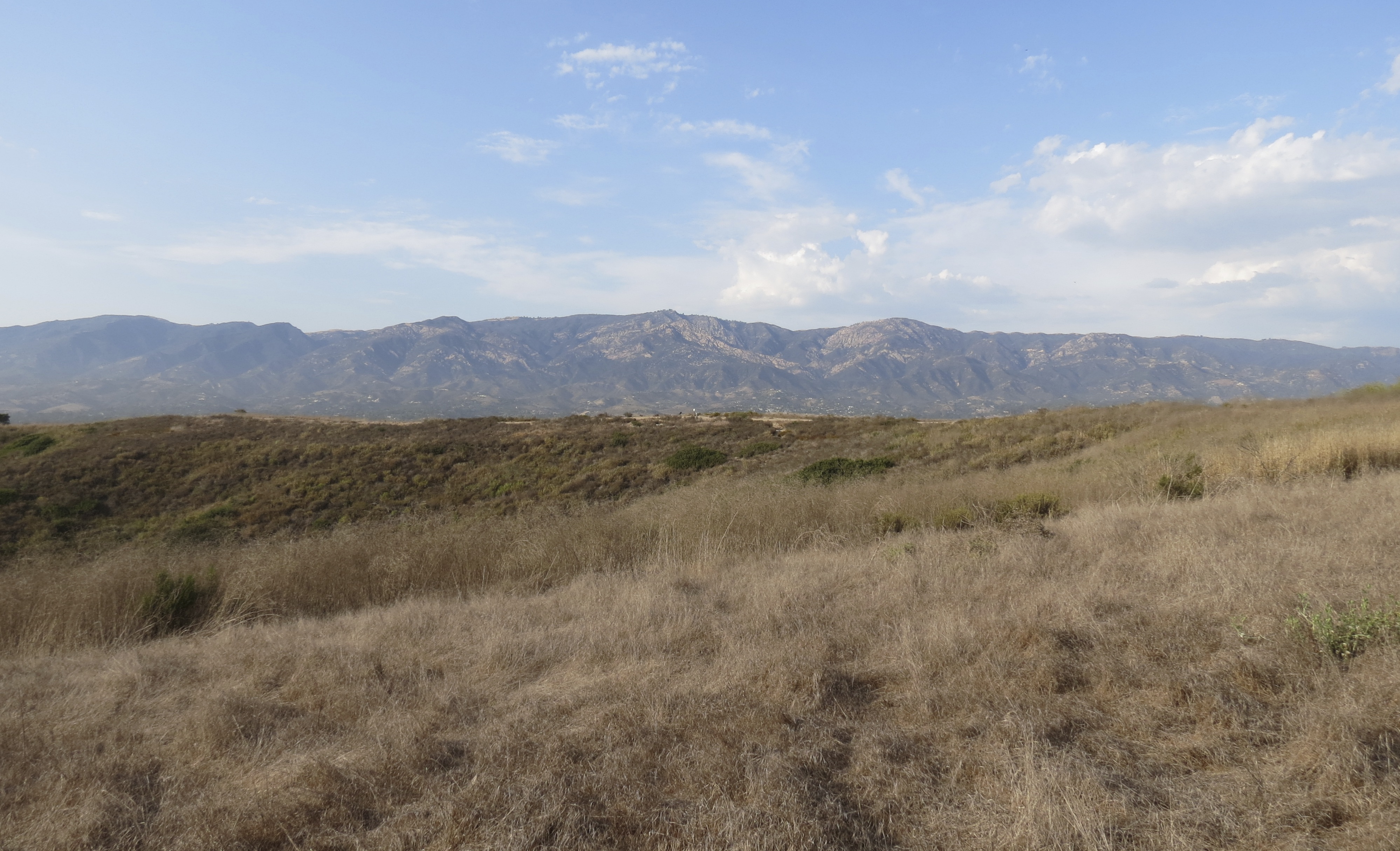
From the landing pier, we make our way past the old ranch buildings to Scorpion Campground. Both the lower and upper campgrounds are nestled under non-native eucalyptus trees that line the floor of Scorpion Canyon. The trees provide welcome shade as much of the eastern end of the island is grassland and chaparral.

As we settle into our campsite, I hear the distinctive cry of a scrub jay and spot a blue flash darting over to the next tree. A pair of Santa Cruz Island scrub jays are busy foraging on the eucalyptus trees for insects.

Island scrub jays are found only on Santa Cruz Island. They are a third larger than their mainland relative and have brighter and more vibrant coloring. Other birds that can also be observed on the island include hummingbirds, morning doves, flickers, sparrows, and house finches.

Both lower and upper campgrounds have potable water and restrooms. All of the sites have picnic tables, as well as metal storage boxes to keep food and belongings safe from inquiring ravens and foxes, which regularly visit the campgrounds.

During the orientation at the pier, the ranger cautioned us not to leave packs unattended as both ravens and foxes are keenly aware that visitors bring with them food and both are adept at opening up gear and tents and scattering the contents about.

He also emphasized the importance of not feeding foxes, as cute as they are, because it significantly undermines the foxes ability to remain wild and not become dependent on people.

The island fox is found on six of the eight Channel Islands and has made a remarkable recovery. In 1999, with dwindling numbers, a captive breeding program was started along with other measures to protect the fox. With growing success, captive breeding was ended in 2008; and in 2016, the fox was removed from the endangered species list.

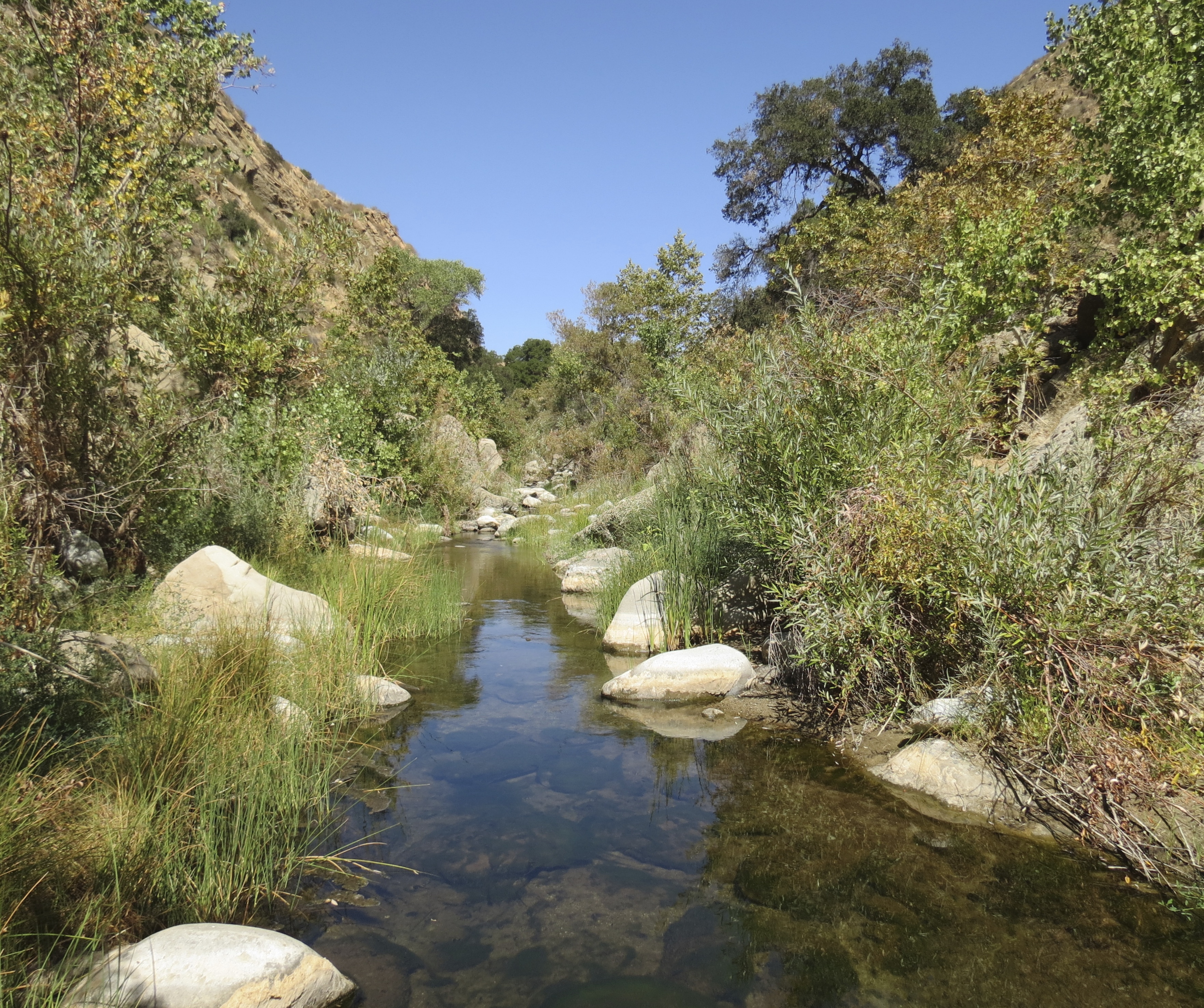
On the second day, I set out for Smugglers Cove and points beyond since I have the whole day to work with. From the upper campground, the trail continues up Scorpion Canyon.

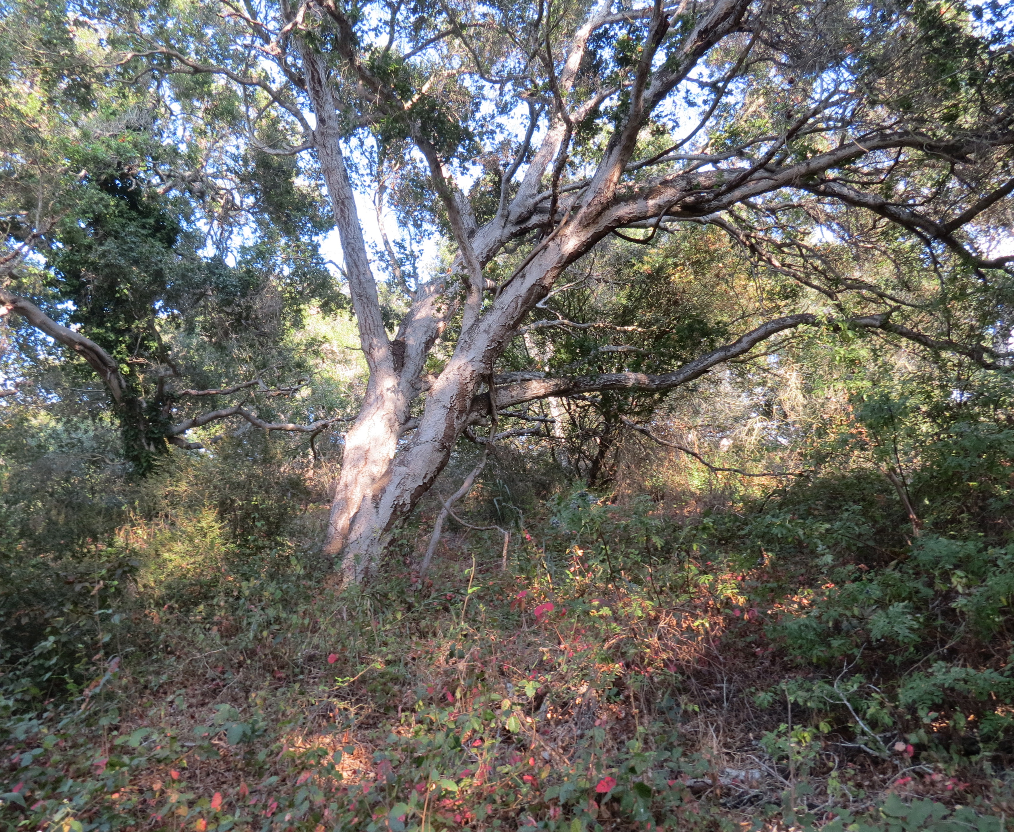
Just past the last campsite, I spot a well-worn side trail leading into the creek and decide to follow it. Across the creek from me are several large toyon bushes laden with ripe, red berries, similar to those I’ve seen elsewhere on the island.

I return to the main trail and continue up the canyon; a few moments later I hear a rustling sound behind me. Turning back, I spot a fox eating berries in the tall toyon bush I had just been standing in front of.

Returning to the creek, I watch as the fox maneuvers itself amongst the branches to get at the ripe berries. On the ground are numerous piles of fox scat, suggesting that this is a popular spot with the foxes.

Island foxes are related to grey foxes found on the mainland. The island fox is a third smaller in size; both foxes are the only North American canines that can climb. The foxes are also both omnivores. Island foxes will eat deer mice, crickets, and a variety of berries when available.

Sensing this fox might be there for a while, I continue up the canyon, passing several more foxes along the way.

The previous day I had been reflecting on the different approaches to immersing in nature. While I enjoy sitting in one place and observing what’s around me, my wanderlust often takes me on long treks where I get to see the landscape unfold and change over the course of the hike.

Both have their merits but I sometimes wonder what it would be like to spend even more time in one place. Of course, the long hike ultimately wins out, but the climbing fox just outside camp makes a compelling argument for not needing to travel far to see interesting things.

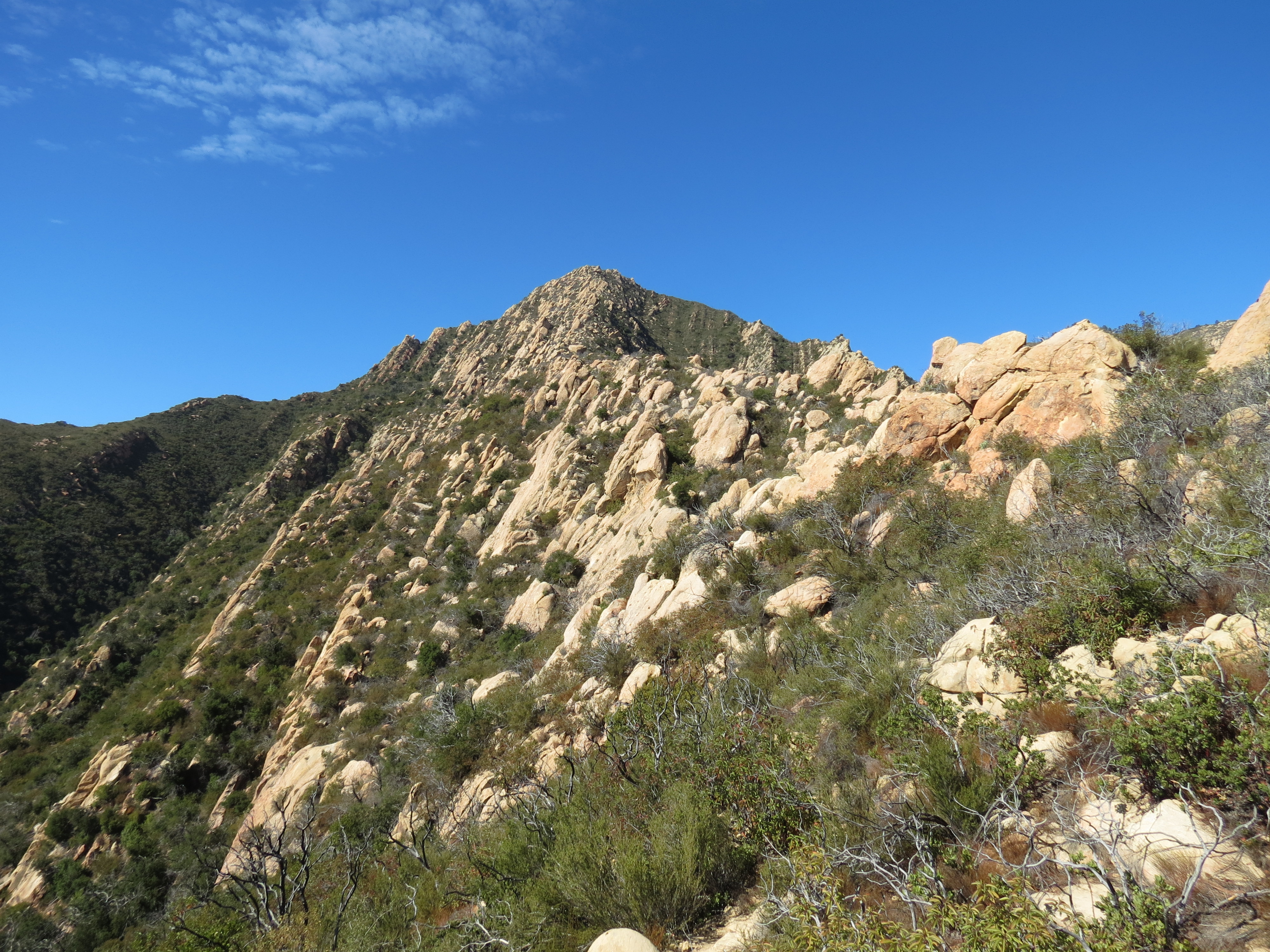
The trail continues another quarter-mile up the scenic canyon, before beginning it’s climb out of the canyon.

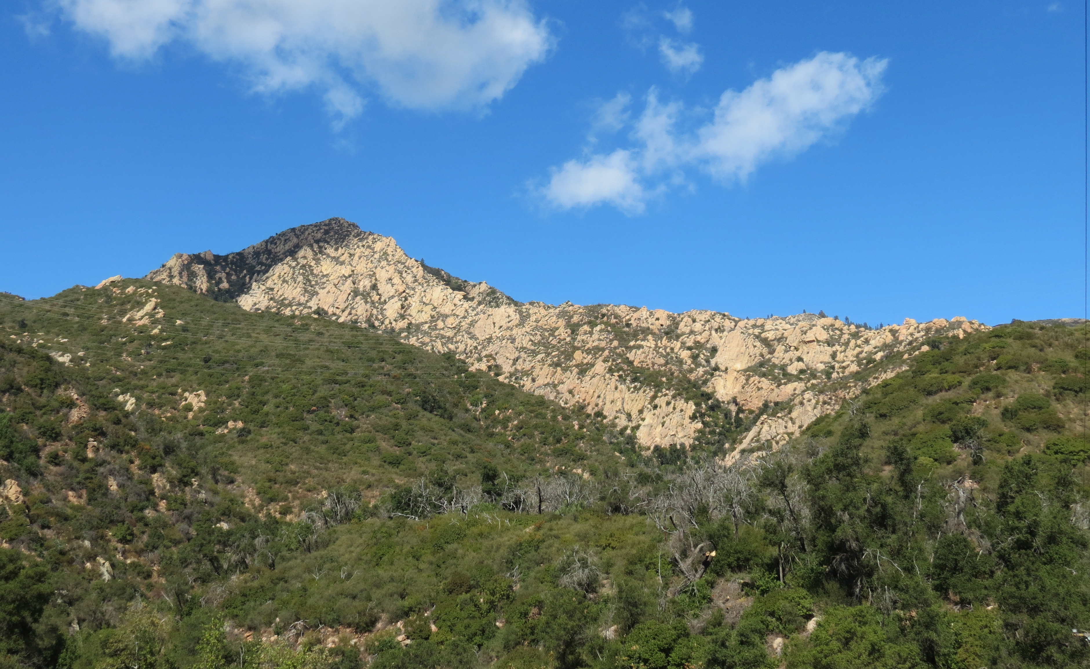
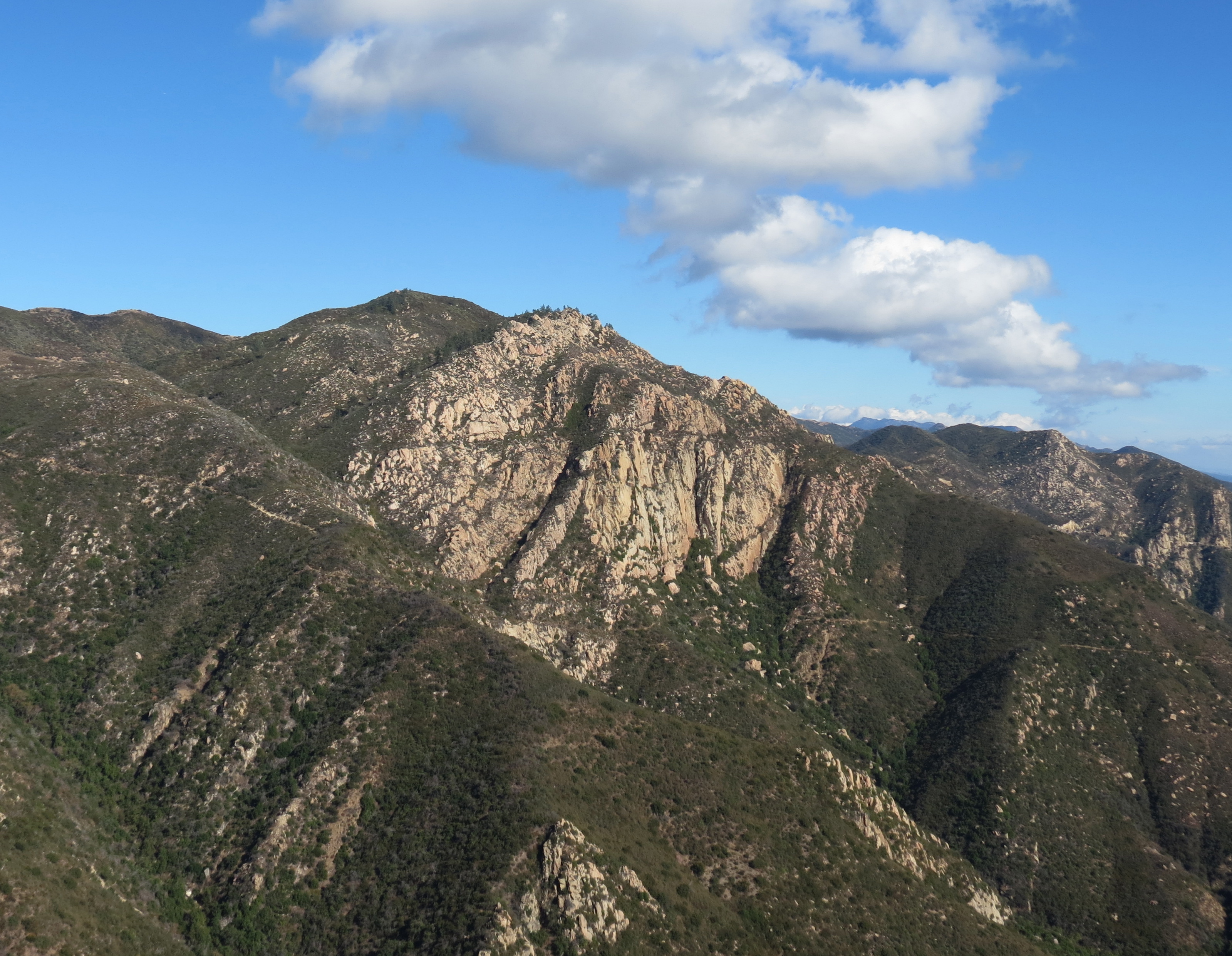
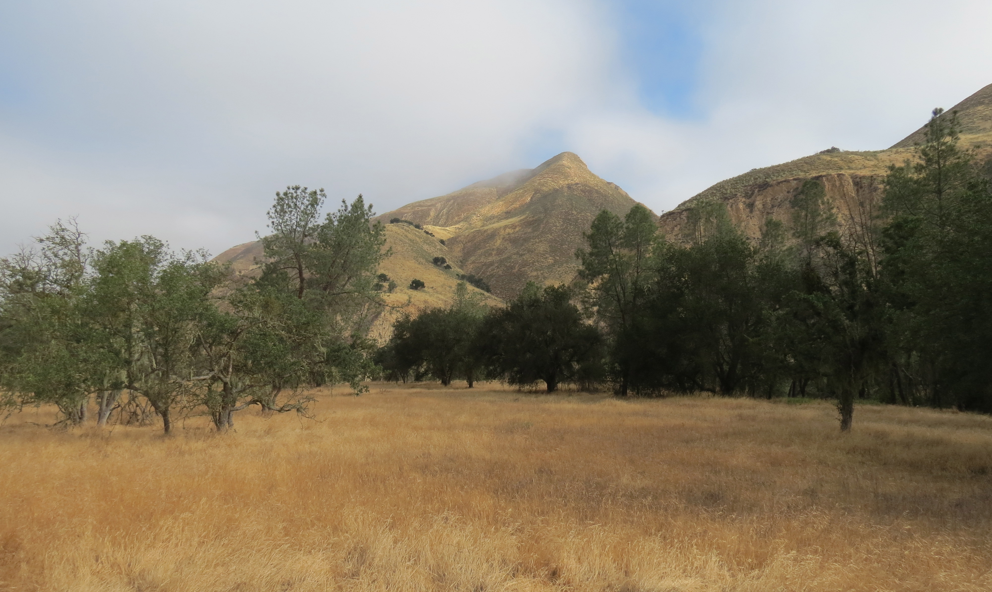
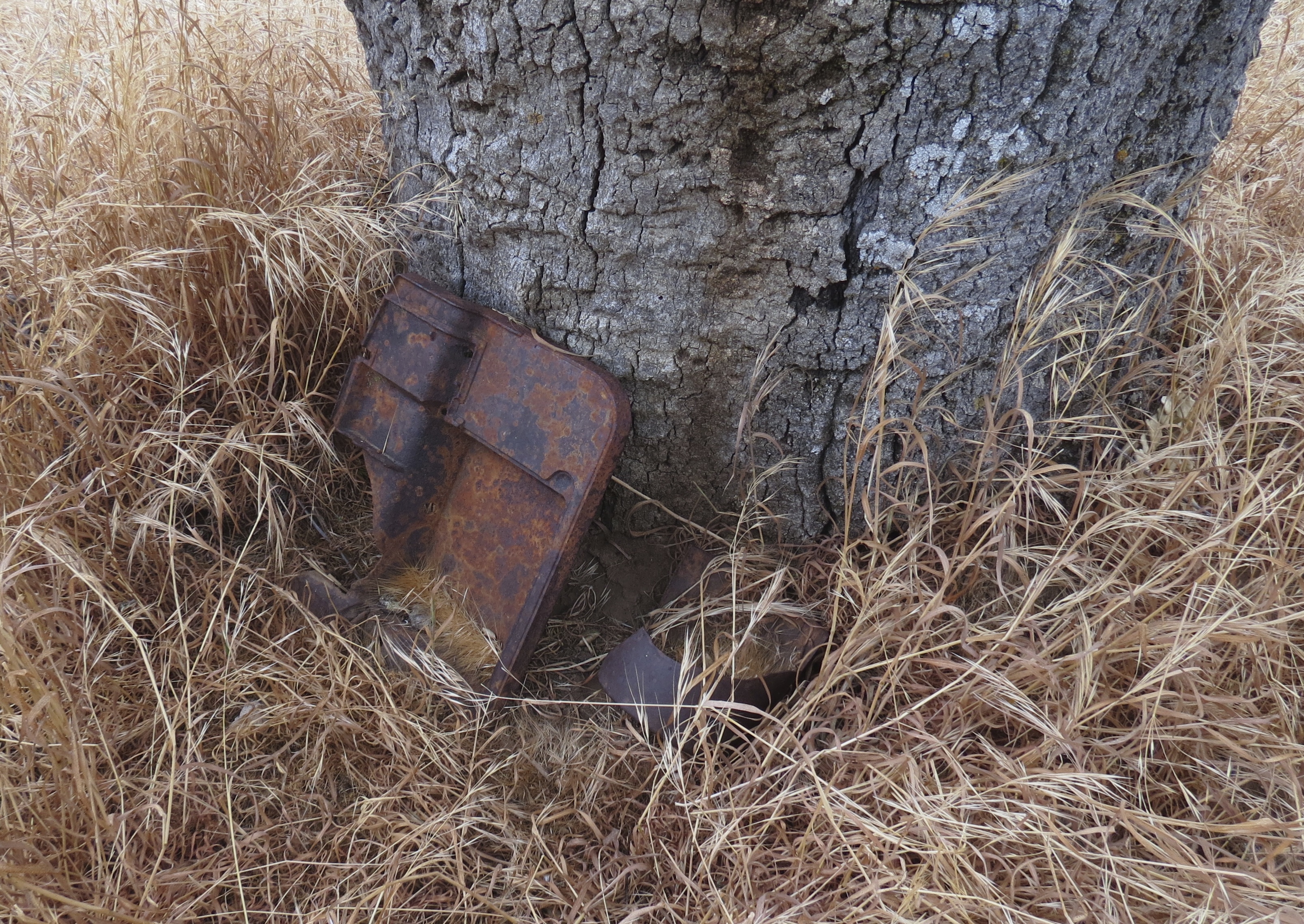
At about the 1.5-mile mark, the trail meets Montañon Trail. At the intersection are the remains of an old oil well.

Most of the the trail junctures on the island are well-marked. From this juncture, the trail to the right continues up towards the Montañon Ridge. To the left, it continues another half-mile, where it meets Smugglers Road, which comes up from the pier and leads over to Smugglers Cove.

Continuing towards the south shore, the road eventually crests a rise in the terrain revealing the balance of the hike. From here, I can see the trail wind its way down to Smugglers Cove. To the east, Western Anacapa Island comes into view.

As the road continues its descent it passes through a stand olive trees planted in the late 1800s.

Near the beach is a stand of eucalyptus trees, also a remnant from the ranching days. The trees provide shade for the picnic tables where there are plenty of foxes to keep me company while I stop to rest.

The tide is out and so I wander down the sandy beach to see how far I can get. At the far end, the beach becomes rocky, but as I press on I can see a way to clamber over the point and continue on to Yellow Banks.

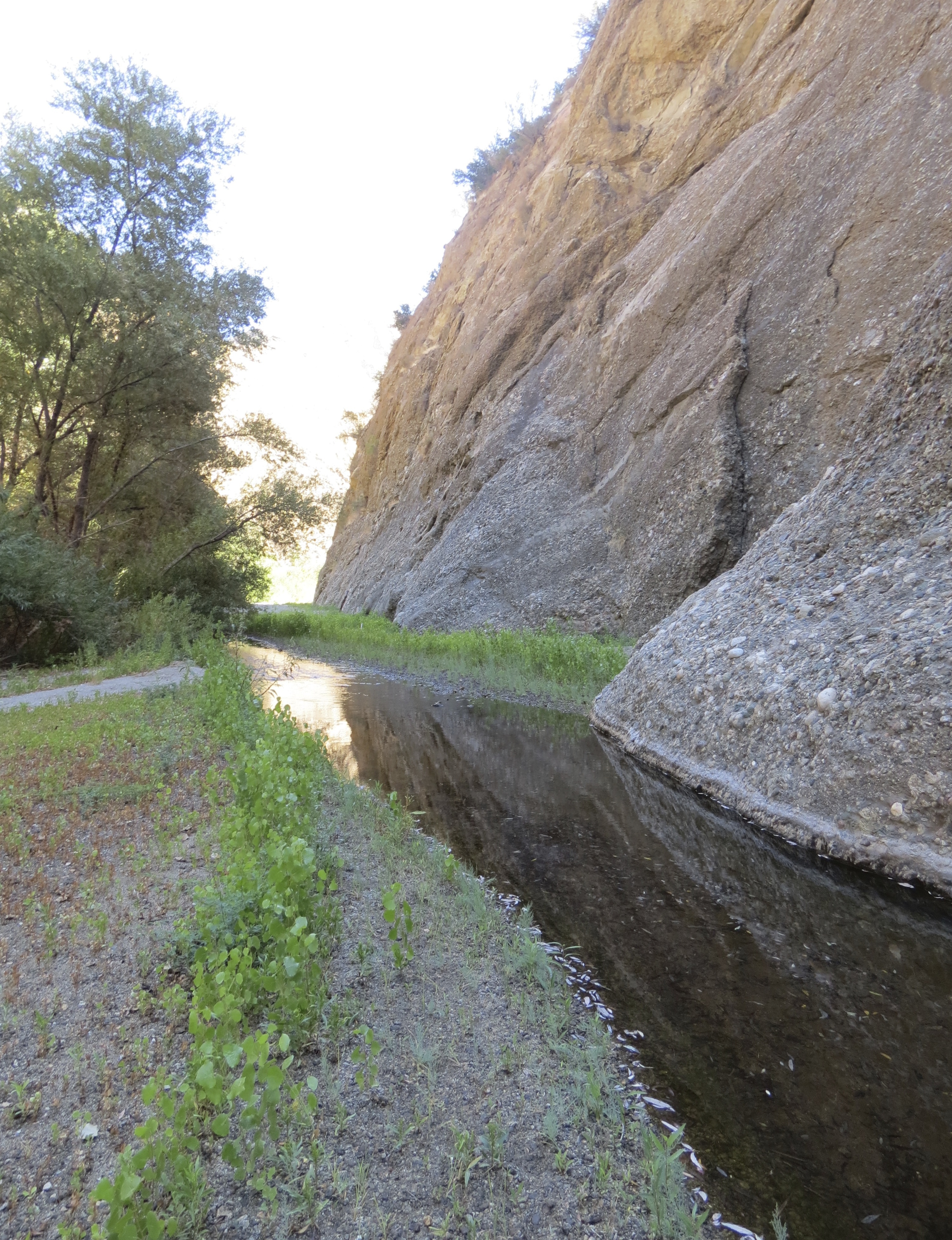
The beach at Yellow Banks stretches out about a half-mile and unlike Smugglers Cove is covered in cobblestone. The ongoing action of the surf pushes against the stones creating essentially a long wall, which I walk along the top of.

Yellow Banks takes its name from the outcroppings of Monterey shale visible even from offshore that have a distinctive yellow color. I hike down the beach as far as the mouth of Cañada de Aguaje. On the way back I pass the same fox I’d seen earlier foraging amongst the rocks; this time it watches me as I wander by.

From the beach, I make my way up the hillside and join the long ranch road that loops back over to Smugglers Cove and continue on towards Scorpion Campground, retracing my route as the sun sets.

Even hiking in the dark is different on the island, there are no bears or mountain lions to worry about and any mysterious rustling sounds are likely from a fox.

On the last day, before returning to the mainland, I check the wildlife cameras I’d set out in the dry creek near camp. Viewing the images on my digital camera I can see where a fox has been very interested in several rocks along the side of the creek. It also looks like the motion-activated camera has taken a lot of “blank” photos, maybe from the wind moving through the brush.

Back home, viewing the images on my computer, a different story emerges. Noticing subtle changes between the “blank” photos, I zoom in to discover that the camera captured images of Santa Cruz Island deer mice.

During the night, the fox had visited the creek bed. In the exact spot where it had been sniffing around, 30 minutes later two mice pop up and boldly scamper about. The scene repeats itself several times throughout the night, with the fox unsuccessfully catching any mice.

The photos add to the sense that our islands are busy with activity, even when we’re not around or stop to notice.

This article originally appeared in section A of February 5th, 2018 edition of Santa Barbara News-Press.

Santa Cruz Island fox climbing tree toyon Channel Islands National Park hike Scorpion Canyon

A Santa Cruz Island Fox feasting on toyon berries

Santa Cruz Island fox climbing tree toyon Channel Islands National Park hike Scorpion Canyon

*

Smugglers Cove hike Santa Cruz Island Channel Islands National Park

Smugglers Cove

Yellow Banks hike Santa Cruz Island Channel Islands National Park

Yellow Banks is seen in the late afternoon light

Santa Cruz Island fox napping Channel Islands National Park

A Santa Cruz Island fox settling in for a nap

Scorpion Anchorage Santa Cruz Island Channel Islands National Park

Anacapa Island frames a view overlooking Scorpion Anchorage

Western Anacapa from Santa Cruz Island Smugglers Road Cove hike trail Channel Islands National Park

Western Anacapa Island is seen from Smugglers Road


A Santa Cruz Island fox Yellow Banks Channel Islands National Park

A Santa Cruz Island fox watches at Yellow Banks

Posted by: James Wapotich | January 24, 2018

Trail Quest: Gifford Ranch Trail

Located in the canyons and mountains north of the Cuyama River is a little known trail to the old Gifford Ranch.

The hike to the ranch site is about five miles roundtrip. The hike can be extended with a loop up to the top of the mountains that traces the east and west sides of Gifford Canyon, which adds another five miles roundtrip and includes views of the Carrizo Plain.

There is little shade along the route and so the best time to go is during the late fall and winter when temperatures are cooler. The trails are open to mountain bikes and horses and there is adequate space for horse trailers at the trailhead. A topographic map is recommended to help follow the different jeep and ranch roads.

Gifford Ranch Trail hike cuyama Highway 166 conglomerate stone outcropping Los Padres National Forest

Outcroppings of conglomerate stone are seen along the trail

To get to the trailhead from Santa Barbara, take Highway 101 north to Santa Maria. Continue past Santa Maria to the exit for State Route 166 East and take State Route 166 towards New Cuyama.

There is no sign marking the turnoff to the trailhead, instead look for Rock Front Ranch. Just past the ranch, State Route 166 crosses the Cuyama River and arrives at the turnoff for the trailhead on the left. A short dirt road leads to the unpaved parking area where there is a sign for the trailhead.

From the trailhead, the trail follows a small side canyon eastward, which it then climbs out of. Continuing east, it passes above private ranch land separated by a fence.

The trail then arrives at a wire gate strategically placed between two oaks. Just past the gate the trail passes an outcrop of conglomerate stone and continues eastward.

Gifford Ranch Trail map Los Padres National Forest Gillam Spring Highway 166 New Cuyama hike

Map courtesy Maps.com

The trail then crests a rise overlooking Gypsum Canyon and drops down into the canyon where it meets the old Gifford Ranch Road that came up from State Route 166. Over the years the road through the canyon has become more of a single-track trail, but is still easy to follow.

Nearing the ranch site, a dilapidated cattle chute appears on the right. In the distance, I can see a dozen cows resting under the trees near where the ranch house used to be. They look at me and quickly decide to clear out, heading up the ranch road to the right that leads up towards a water tank.

Gifford Ranch was purchased by California Department of Fish and Wildlife to help provide habitat and water for tule elk.

What remains of the ranch house is the cement foundation, which now has non-native trees growing up through it. Nearby are the rusted remains of a stove, refrigerator, and other household fixtures.

Continuing towards the cattle trough, which is the main attraction for the cows, I pass an array of old farm equipment. The trough is fed by a nearby water tank, which likely receives water from Gifford Spring, located further up the canyon. There is a steady drip of water into the trough that could be gathered and filtered for drinking.

Gifford Ranch Trail cattle chute hike los padres national forest cuyama valley

An old cattle chute is seen at the Gifford Ranch site

From the ranch site the hike can be extended by making a loop up to the top of the mountains and following the old jeep roads that trace the east and west sides of Gifford Canyon.

I opt for the west side of the canyon, which in the end proved to be the lesser of two evils. Both routes have steep sections but the east side is somehow more unrelenting in its arrangement.

From the ranch site, the trail crosses the dry creek, passing a small hay barn and corral as it begins its steady climb up the western side of Gifford Canyon to the top of the mountains. The trail is generally easy to follow leading through first wild grasses dotted with oaks before transitioning into chaparral, where the route is kept open in large part by the cattle.

Roughly two miles from the ranch site, the trail crests the top of the ridge where it arrives at a locked gate with a no trespassing sign. From here, the trail continues east, briefly following the fence line, before continuing along the top of the mountains passing through mostly chamise.

From the top of the mountains, the views extend north out across the Carrizo Plain towards the Temblor Mountains. The elevation is not high enough to see all of Soda Lake, but I can see glimpses of its currently blue waters. To the east the Caliente Mountains and Caliente Peak can be seen, and, to the south, the Cuyama Valley and Sierra Madre Mountains.

As the trail continues along the ridge it starts to lose elevation, transitioning from chamise back into grasses and oaks.

Enjoying the downhill, I somehow miss the turnoff that leads down the east side of Gifford Canyon and back to the ranch site. It isn’t until I’m a little east of the ridge that it becomes apparent. Debating whether to double back or not, I decide to press on since the easy to follow jeep road I’m on leads towards Gillam Spring, which I was planning on visiting anyway.

Caliente Peak Mountains Gifford Ranch Trail Cuyama Valley hike Los Padres National Forest

Caliente Peak and the Caliente Mountains are seen from the trail

The side trip to Gillam Spring adds an additional four miles roundtrip to the hike. I’ve already been keeping a strong pace to try to fit all 14 miles into the available daylight, but needing to look for the return trail will take extra time.

The trail towards Gillam Spring continues east before then turning north. In the distance I can see the jeep road descending into a small canyon and climbing over a hill. I press on aware that every foot of downhill will be slower going uphill on the way back.

From the top of the next hill, the trail essentially descends all the way down to Gillam Spring. I decide to make the most of it by upping my pace.

Just as the the trail starts to level out, I spot three cows in a small ravine off to the side of the trail. Their coloring seems wrong; they’re brown, but something seems odd. They look up and their ears also seem a little wrong. Without breaking stride I think maybe they’re wild boars, but they’re too big to be boars and slightly smaller than cows. I wonder if I should stop and look, but the jeep road has already descended such that I can no longer see them, besides why take time to look at cows.

A little further down I spot three deer staring at me and just past them a half-dozen flickers burst into flight. The jeep road descends a little more and then meets another ranch road. On the other side of the road is a large watering hole fed by Gillam Spring.

I continue along the road to the left and then follow a cattle trail down to the trough that is my ultimate destination. The spring-fed trough has a steady drip similar to the one at the Gifford Ranch site and could also be filtered for drinking.

On the hike back out I pause at the spot where I’d seen the three cows. On the ground is bear scat from a couple months ago and it dawns on me the three cows might’ve actually been bears, a mother and two good size cubs.

oak Gypsum Canyon Gifford Ranch Trail hike los padres national forest cuyama valley

An oak is seen along the trail in Gypsum Canyon

From the top of the ridge, I back track to where the turnoff ought to be for the return hike. Hiking out along the eastern ridge of Gifford Canyon, I spot the well-defined jeep road below and follow it back up to the top where it quickly fades amongst the wild grasses. I decide to add a pile of stones to mark the turnoff for the next visitor.

Following the jeep road back down it rapidly descends along the ridge, veering off at one point through wild grasses to join the more-established ranch road coming up from the ranch site. The road is refreshingly level and I relax thinking the worst of it is over.

However, the road soon rounds a corner and immediately resumes its vigorous descent. In the distance I can see it also climbs one last hill before arriving at a water tank and returning to the ranch site.

At the base of this last hill, I notice a cattle trail leading into the canyon above the ranch site. I figure the cows would likely favor a more direct route to the trough, and remember seeing a similar trail heading up the canyon behind the ranch house ruins. The trail not only proves to have a much more reasonable descent, but also provides a nice change of scenery.

From the ranch site, I retrace my route back to the trailhead, arriving just before dark.

This article originally appeared in section A of the January 22nd, 2018 edition of Santa Barbara News-Press.

Posted by: James Wapotich | January 8, 2018

Trail Quest: Through smoke and fire

It started December 4, near Santa Paula, far away from Santa Barbara. Within five days the Thomas Fire had reached Santa Barbara County, driven by strong Santa Ana winds and in some cases burning through brush that hadn’t been burned in more than 50 years. A week later it was bearing down on Santa Barbara. Families were evacuated and thousands of firefighters were mobilized as we watched and waited, hoping for the best and preparing for the worst.

It wasn’t until the fire reached the burn scars from the 2008 Tea and 2009 Jesusita Fires that it started to stall out near Santa Barbara. It’s somewhat ironic to consider that we were in part saved by those previous fires. With less easy to burn fuel, combined with the efforts of fire crews creating fuel breaks and burning back fires, the Thomas Fire was effectively stopped on the frontside of the mountains, but continues to burn in the backcountry. Full containment is predicted for early January.

Now the largest California wildfire in recorded history, the Thomas Fire in many ways has changed how we’ve come to view wildfires.

In its first seven days the Thomas Fire burned more than 230,000 acres during December; it took the 2007 Zaca Fire seven weeks to burn the same amount of land during the middle of summer. It seems like we’ve gone from one large fire every couple of years in the tri-county area to sometimes two or three fires in a single year.

Each of these fires have left a mark on the landscape and in many of our lives.

When the Zaca Fire burned more than 240,000 acres, its growth through the backcountry was hard for me to keep hearing about. Every time the news reported the fire reaching yet another camp or trail, it was like hearing about another great painting being destroyed. Some were places I’d visited and loved, others were places I hadn’t visited and now would never get to see in their pristine state.

Monitoring the progress of this new fire as it threatened people’s homes and moved towards the city, I found myself unwilling to give it all of my attention, preferring to balance the scenes of destruction with activities that were more enriching.

In my own life, I have seen enough loss. My father passed away when I was six, leaving me, my sister, and my mom to carry on the best we could. Those events unknowingly set me on a lifelong journey to overcome the pain of that loss. A path that included wanting to avoid feeling pain; wanting to blame myself and the world around me for the pain; as well as wanting to eliminate the causes of pain in the world.

And while those steps were part of my own personal process, what ultimately allowed me to begin healing was actually feeling the pain, grieving the loss, and rebuilding my life. And that grief work was just that–work. I’ve often likened it to physical therapy, where the day to day gains seem minuscule, the timeline for recovery seems endless, and the necessity of going through it seems unfair.

What helped me stay with it and gave me inspiration was the belief that things could truly be better, that a feeling of wholeness could return.

One of the models for me of that is nature. Nature is unstoppable in its ability to renew itself. Life will find a way to not only survive, but when given the opportunity will flourish and thrive.

If I had lost my home or a loved one to this fire, my grief would be more immediate and might take years for me to process. There is no way to measure the loss of a loved one and it is difficult to put into terms the impact of losing’s one home or seeing a neighbor lose theirs.

Most of us were fortunate enough to not lose our home or someone close to us to the fire, thanks in large part to the evacuations and the effort of our fire fighters.

Nevertheless, many of us may still feel grief coming up. Our sense of safety has been shaken and our lives disrupted, particularly those who were evacuated or left because of the air quality. And while things are slowly returning to normal, the angst and anxiety from the fire may have restimulated memories of past fires and other losses in our lives. Outside of the cities, there is the loss of habitat and the impact on the plants and animals that can also be hard to define.

There is no right or wrong way to grieve. And it’s important, as part of our process, to ultimately reach for renewal. To find ways to return to celebrating what is still living.

The day after the fire reached the burn scar of the Tea and Jesusita Fires, I felt a sense of relief. Optimistic that the worst of the fire was over and the imminent threat to life and property had passed, I went for a hike on the backside of Figueroa Mountain.

It felt good to be out in nature and breathing some fresh air after being cooped up indoors and living under a cloud of smoke and uncertainty.

Halfway down the trail, I found a dead band-tailed pigeon laying on the ground. There were no visible injuries and it couldn’t have been there for more than a few hours. Although I wondered about the circumstances of its death and was saddened by its passing, I was more overcome by its beauty.

I felt like I could almost breathe in the rich, iridescent colors of its green neck feathers. As I admired the precision of the grey and blue feathers on its wings and tail, I found myself marveling at how the arrangement of these forms and features somehow gave it the power of flight. Cradling the bird in my hands, I could easily imagine it flying amongst the oaks and moss-covered pines, plying the little canyon and sipping water from the nearby creek in the timelessness of the mountains.

I wanted to be able to bring it back to life so it could continue being the magnificent creature it was. At the same time I could sense the forest pulsing around me. The sound of running water, the activity of other birds, and the subtle wind through the trees, all part of something larger and unending. Here, even in its humble passing, the bird had given me a great gift, reminding me of the aliveness of the world in the midst of loss.

While I was saddened by the impact of the Zaca Fire, having now hiked many of the trails within burn area, I can see that nature has indeed returned. There are places that are again filled with life. That’s not to say the impact isn’t still being felt, it will be a long time, if ever, for the pines to return to the fullness they once enjoyed, but nature itself is still moving forward.

Now, when I hike through burn areas, I see and acknowledge the devastation and damage around me, but I’m more drawn to the new growth. I look for chaparral plants sprouting back from their root burls, wild flowers blooming abundantly in the ash-enriched soil, and fresh animal tracks on the charred earth. These things tell me that not everything is lost and life will return.

If we give all our attention to destruction and despair and leave no room for hope or joy, we rob ourselves of the ability to renew ourselves and our grief can become endless.

Nature, through its power of renewal, can help us remember, that in addition to acknowledging and grieving our loss, when we are ready we can also rebuild our lives and return to celebrating and participating in the life around us.

In the words of Native American elder and medicine man Nicholas Black Elk, “It may be that some little root of the sacred tree still lives. Nourish it then, that it may leaf and bloom, and fill with singing birds.”

This article originally appeared in section A of the January 8th, 2018 edition of Santa Barbara News-Press.

Posted by: James Wapotich | December 18, 2017

Trail Quest: Hans Christian Andersen Park

Nestled in Solvang is a charming 52-acre park that’s close to the heart of town, but has enough undeveloped open space to offer a sense of being on a pleasant country walk.

The park is shaped by the contours of Adobe Canyon. There are essentially two trails in the park, one on each side of the canyon, that can be used to make a loop hike that’s about a mile roundtrip. The hike can be combined with a visit to Solvang.

To get to the park from Santa Barbara, take State Route 154 over Santa Marcos Pass and continue towards the intersection with State Route 246. Follow State Route 246 to Solvang, turn right onto Atterdag Road, and continue to the park.

Hans Christian Andersen Park hike trail Solvang Santa Ynez Valley

Scenery in Hans Christian Andersen Park

The park entrance is marked with a decorative castle arch. Just inside is a miniature water wheel. Here, the road branches. To the right is the skate park, as well as several group picnic areas under the oaks along the creek.

For the hike, stay to the left as the road continues a short way to the parking lot near the kids play area and more picnic sites. The paved road ends at the parking lot, but an unpaved access road continues past the tennis courts where there is additional parking, which is also suitable for horse trailers. Park hours are from 8 a.m. to sunset.

From the paved parking area, look for a trail on the east side of the canyon, on your left as you enter the park. The trail climbs away from the parking area and offers views towards the backside of the Santa Ynez Mountains. The trail passes through oak woodland as it leads behind the tennis courts.

The trail then arrives at the unpaved parking area past the tennis courts and continues along the gated, unpaved access road. This lower half of the park is less developed and has more of the characteristics of an open space.

The road crosses the creek and here one can find the most variety of native plants in the park. In addition to coast live oak and valley oak, there is elderberry and coyote bush, and in the riparian areas, wild rose, willow, and some poison oak.

decorative water wheel Hans Christian Andersen Park hiking trail solvang santa ynez valley

A decorative water wheel is found near the entrance to Hans Christian Andersen Park

As the road arrives at the drainage detention basin it meets the trail that runs along the western side of the canyon. From here, continue along the access road as it follows the creek downstream to the end of the park.

As I was walking through this section, I started to imagine that it could be the sort of place that deer might visit. Crossing the creek to explore off-trail I did find deer bones and later learned that mountain lions have occasionally been sighted in the park. Mountain lions primarily feed on deer.

The unpaved road ends where it meets State Route 246, which is also the park boundary.

Adobe Creek, which runs through the park is currently dry and even filled with acorns in some places. I imagine during the spring, when it’s flowing over the water-carved sedimentary rocks, it can make for a picturesque setting. The creek joins the Santa Ynez River a quarter of a mile below the park, which is likely the route larger animals would take to reach the park.

Returning back to the trail juncture, the route along the western side of the canyon feels more like a single-track trail. The trail overlooks the tree-lined creek and meets the signed spur trail leading up to the Skytt Mesa residential neighbor.

From here, the main trail continues and arrives at one of the group picnic areas; it’s lush green lawn providing a marked contrast to the drier landscape around it. From the picnic area a paved road leads across the creek and back to the parking lot to complete the loop.

Hans Christian Andersen Park was created in 1970, when the county of Santa Barbara obtained the land from the Skytt and Cornelius families. When the City of Solvang was incorporated in 1985, the park became part of the city, which now manages it.

The park is named after Hans Christian Andersen, the famous Danish author who is best known for his fairy tales, including “The Emperor’s New Clothes”, “The Little Mermaid”, and “The Ugly Duckling”.

Acorns adobe creek Hans Christian Andersen Park hiking trail Solvang Santa ynez valley

Acorns fill Adobe Creek in Hans Christian Andersen Park

Solvang got started in 1911, when a group of Danes envisioned creating a town for Danish immigrants. They purchased close 10,000 acres of land in the Santa Ynez Valley that could be subdivided into plots for farms and homes with the hope of creating a Danish colony in California. They named the town Solvang, which translates as “sunny field” and placed ads in Danish-language newspapers. Most of the people who bought land and settled there were Danish, either from the midwest, Denmark, or elsewhere in California.

Profits from the sale of the land was used to build a Danish-style folk school, which later became Atterdag College, and served as the community’s cultural center.

In 1947, the town was featured in Saturday Evening Post magazine, which brought national attention to Solvang as a destination for visitors with its unique cultural history. In response, the people of Solvang felt that the appearance of their town should more closely reflect their Danish heritage.

While several earlier buildings and homes utilized Danish architectural elements, notably Bethania Lutheran Church, it wasn’t until 1947 and the construction of Copenhagen Square that these elements became more widely embraced. Older buildings were remodeled and new construction continued the trend. Danish windmills were built; there are now four throughout the town. Main Street was renamed Copenhagen Drive and Solvang eventually became known as the Danish Capital of America.

The town still retains much of its old world charm and on several occasions members of the Danish Royal family have visited Solvang.

Hans Christian Andersen Park hike trail Solvang

Coast live oak and valley oak add to the scenery at Hans Christian Andersen Park

A walk in Solvang can be a nice compliment to the hike and no trip to Solvang would be complete with stopping to at least have some aebleskivers.

The word itself means “apple slices” and it’s said that traditionally aebleskivers had apple filling. Today, these spherical wonders are sometimes described as pancake balls as they’re made from batter similar to pancakes and waffles. Served hot, they come topped with raspberry jam and powdered sugar.

The treat can also serve as a fun reward, either before or after the hike, depending on whichever provides the greater motivation.

This article originally appeared in section A the December 18th, 2017 edition of Santa Barbara News-Press.

acorns adobe creek hans christian andersen park solvang

*

Lagniappe

This is another hike idea I stumbled across looking at google maps. Earlier in the year I was looking something up and noticed a bunch of open space preserves in San Luis Obispo County that I’d never heard of, but could easily see because they were shown in green. It occurred to me to pan south and “fly over” Santa Barbara County and see if there was anything there I hadn’t seen before or didn’t know about.

In looking at Solvang, I was struck by a good size swath of green right in the heart of the developed landscape labeled Hans Christian Anderson Park. A quick google search revealed that there were even some trails there. It wasn’t until I got to the park entrance that I realized that I’d actually been there before, but had never ventured into the southern, more open part of the park.

Because of Solvang’s unique history, it seemed that even if the hike wasn’t that long I’d have enough to write about for the article. But the real impetus that moved the hike up on my list was the Thomas Fire, which effectively closed many of the trails and because of the smoke made many hikes along the coast less appealing. There was also just something comforting in the idea of offering a simple hike in Solvang in the midst of the uncertainty the fire was creating.

Posted by: James Wapotich | December 18, 2017

Trail Quest: Arlington Peak

From downtown Santa Barbara, one can view the triangular, almost pyramid-shaped features of Arlington Peak, which takes its name from the once famous Arlington Hotel. Above the peak, at the top of the Santa Ynez Mountains, is La Cumbre Peak.

The hike to the summit of Arlington Peak is one of the more challenging front country hikes in Santa Barbara and should not be taken lightly. The off-trail route is not maintained by the forest service and requires route-finding, rock scrambling, and being able to pace oneself.

The hike is about four miles roundtrip, but don’t expect to hike at your usual pace. Plan instead on using the better part of the day. There is little shade and no water along the route. Continuing over to Cathedral Peak adds another mile roundtrip.

The trail starts from the end of Tunnel Road in the foothills behind Santa Barbara. Parking is found along Tunnel Road where permitted. This is a popular trail and you may end up parking a quarter to a half-mile from the trailhead. Please be considerate of the people who live here while parking and accessing the trail.

From the trailhead, continue along the paved access road that leads up Mission Canyon. As the road rounds the last corner before arriving at Mission Creek, Arlington Peak comes into view, along with what’s affectionately known as the Dragon’s Back, which is the ridge the off-trail route follows on its way to the peak.

The access road crosses Mission Creek by way of a bridge and arrives at Mission Tunnel, which gives Tunnel Road its name. The four-mile long tunnel through the mountain was built in 1911, and carries water from Gibraltar Reservoir to Santa Barbara.

From here, the road continues unpaved, rounding a corner and branching. Stay to the left as the road soon arrives at the beginning of Tunnel Trail, which leads to the top of the Santa Ynez Mountains and East Camino Cielo Road. Stay on the access road and look for where Jesusita Trail leaves the road and continues towards the creek.

Where Jesusita Trail crosses the creek is the beginning of the off-trail route that leads to Seven Falls, as well as Arlington Peak.

Continue up the creek and immediately look for a use-trail on your left, which also immediately branches, stay to the left as this route will quickly, if not somewhat steeply get you up on the ridge that separates Mission Creek from one its tributaries. In fact, the off-trail route to the peak, essentially follows the ridgeline between these two drainages the entire hike, threading its way through chaparral and sandstone boulders.

At about the 1.25-mile mark, the trail arrives at the next juncture. Here, a nearby boulder offers views down towards Seven Falls, where heavy rains during the ice ages have helped carve out deep pools in the sandstone. The use-trail to the right leads to the three pools above Seven Falls, while the use-trail to the left continues towards Arlington Peak.

From this juncture, the trail becomes more sincere about climbing uphill to get to the peak. After this initial push, the trail crosses an outcropping of rock where the trail appears to branch. It’s here that many people get lost on the return hike. To the left, the use-trail to Arlington Peak continues, while to the right, an informal route follows a gully down to Mission Creek, where it arrives upstream from Seven Falls.

An important route-finding skill while hiking is to occasionally pause and look back at the way you’ve come, as the route can often appear significantly different from this perspective.

From the rock outcropping, the trail veers westward and levels out some before joining the Dragon’s Back. The feature is aptly named as the route weaves its way through large outcroppings of sandstone boulders that loom overhead and give the feeling of walking between the fins on a stegosaurus’ back or more poetically, a dragon’s back.

Views to the north here, include La Cumbre Peak and to the east what’s sometimes referred to as White Mountain. Looking down into Mission Canyon, one can spot the three pools above Seven Falls.

Coulter pines began to appear along the route as the trail becomes more challenging in terms of route-finding and rock scrambling as it makes the final, long push to the top of what starts to feel like a very large rock pile.

From the top of Arlington Peak the views extend down along the coast to Point Mugu, out across the city towards the Channel Islands, and up the coast past Goleta.

Arlington Peak takes its name from the famous Arlington Hotel, Santa Barbara’s first luxury hotel. It’s said the staff referred to the rocky area as Arlington Crags and the name carried over to the peak.

The hotel was built in 1875, under the direction of Colonel William Wells Hollister, who named it after Robert E. Lee’s Arlington Mansion, a compromise with other investors who wanted to call it the Robert E. Lee Hotel.

Built about a mile from the sea, to be away from the fog and damp air, the three-story, 90-room hotel and its grounds covered an entire city block bordered by State, Victoria, Chapala, and Sola Streets. It’s location also prompted the building of Santa Barbara’s first paved road, State Street, which stretched from Stearn’s Wharf to the hotel.

Initially, the hotel struggled financially, but flourished under the management of Dixie Thompson. Thompson helped promote Santa Barbara’s recreational opportunities by arranging stagecoach rides to Montecito’s Hot Springs and over the pass to Mattei’s Tavern. He also built a stable and offered horseback rides into the mountains, including Mission Canyon.

Presidents Harrison, McKinley, and Roosevelt each stayed at the hotel when they visited Santa Barbara.

In 1909, a fire destroyed most of the hotel. The only portion that was saved was the Annex, which had been added in 1887, to provide additional accommodations.

The hotel was rebuilt in the popular Mission Revival style and reopened In 1911. The new, larger hotel was touted as fire-proof, but unfortunately was not earthquake proof. During the 1925 Earthquake, the 60,000 gallon water tank in one of the hotel’s two towers, intended to support fire suppression, began to sway. The tower collapsed, killing two of the guests.

Although not completely destroyed, the hotel was underperforming financially and instead of being rebuilt was razed. In 1931, Arlington Theatre was built on the site, retaining the name of the hotel.

At the corner of Sola and Chapala Streets one can still find the stuccoed arch from the second Arlington Hotel, which served as the entrance to the hotel’s garden. Santa Barbara Public Market, which replaced Vons, is where the Annex was located.

From Arlington Peak, the use-trail continues over to Cathedral Peak. The route follows the ridge connecting the two peaks and is comparatively easy to traverse leading almost to the top of the peak. A quick scramble up a side trail is required to reach the summit.

The views from Cathedral Peak are comparable to Arlington Peak and include Barger Peak to the west. Looking north one can see the continuation of the use-trail towards La Cumbre Peak as it climbs more or less in straight line to the top of the mountains.

This larger hike adds another two miles roundtrip and is just as challenging as the hike to Arlington Peak. To continue from Cathedral Peak, follow the use-trial west along the ridge, until you reach the end of the rocky outcroppings. Here, the trail turns sharply right and continues downhill through a small forest of ceanothus and holly-leaf cherry, before continuing over a low hill and arriving at the base of the mountain.

From here, the trail continues steeply uphill, requiring more rock scrambling, until it crests the spur ridge that connects over towards La Cumbre Peak Day Use area. From here, an access road leads to the top of La Cumbre and the old lookout tower.

An alternate route for the return hike is to continue east along East Camino Cielo Road to the top of Tunnel Trail for a loop hike. This route adds another 2.5 miles to the hike overall, but can be less strenuous and offers great views out across the canyon towards Arlington and Cathedral Peaks, which can round out the sense of accomplishment from visiting all three peaks.

This article originally appeared in section A of the December 4th, 2017 edition of Santa Barbara News-Press.

Arlington Peak Dragon's Back Mission Canyon Cathedral La Cumbre hike trail Santa Barbara Los Padres National Forest

Arlington Peak and the Dragon’s Back are seen from the access road in Mission Canyon

White Mountain Santa Ynez Mountains Arlington Peak Cathedral La Cumbre Mission Canyon hike trail Santa Barbara Los Padres National Forest

White Mountain and the Santa Ynez Mountains are seen from the route to Arlington Peak

Arlington Peak Dragon's Back Cathedral La Cumbre hike trail Santa Barbara Los Padres National Forest

View towards Arlington Peak from the off-trail route

Cathedral Peak Arlington La Cumbre trail hike Santa Barbara Los Padres National Forest

The summit of Cathedral Peak is seen from the off-trail route

layout rebuilt arlington hotel santa barbara

Grounds and layout of the second, rebuilt Arlington Hotel, bordered by State, Victoria, Chapala, and Sola Streets.

Posted by: James Wapotich | November 27, 2017

Trail Quest: Nordhoff Peak

From the top of Nordhoff Ridge, the remains of the old lookout tower at Nordhoff Peak offer sweeping views of the Ojai Valley and out towards the Channel Islands. The hike starts from Ojai and leads through mostly chaparral along a historic trail that dates back to the early 1900s.

The hike along Pratt Trail to the peak and back is about 12 miles round trip and can make for a satisfying workout, gaining over 3,500 feet on the way up. A shorter hike can be made by turning around at Valley View Camp, which is seven miles round trip. The trail is mostly unshaded and there is currently no water along the route, so plan accordingly.

To get to the trailhead from Santa Barbara, make your way to Ojai. From downtown Ojai, follow Signal Street north to the signed turnoff for the Pratt and Foothill trailhead. The unpaved road continues towards Stewart Canyon Debris Dam and the parking area for the trailhead. The last section is particularly bumpy so it’s best to slow down when entering the parking area.

From the parking area, the trail leads through mostly chaparral as it continues up Stewart Canyon. This first portion of the trial follows an easement, weaving its way through various private properties. Please stay on the trail and respect private property.

The trail then crosses the creek and briefly follows a paved road before arriving at a locked access gate. Here, the road becomes unpaved and enters Los Padres National Forest. Near the gate is a large sign with a map showing the network of trails directly behind Ojai, including Pratt Trail.

Continuing along the unpaved road, the trail quickly passes a water tower and arrives at the next creek crossing. On the left, is a single track trail which follows the western side of the creek. The trail is marked with a sign as Pratt and Foothill Trails. A little further up, the trail branches with Foothill Trail heading west over to meet Cozy Dell Trail, while Pratt Trail continues north, rejoining the access road about a quarter of a mile from where it left the road.

You can also just stay on the access road, which quickly meets the eastern extension of Foothill Trail that leads over towards Gridley Trail. The road then meets the single track trail and continues up the canyon where it joins Fuel Break Road. Stay to the left and follow Fuel Break Road as it starts to climb up the mountain. Here, the chaparral continues to become a little more diverse. In addition to ceanothus and laurel sumac, are toyon, chamise, black sage, and even some California black walnut.

At at about the 2-mile mark, Fuel Break Road arrives at a small saddle overlooking Cozy Dell Canyon. Here, the trail branches again. The unpaved access road continues down into Cozy Dell Canyon, while Pratt Trail continues the rest of the way as a single track trail to the top of the mountains.

From the saddle is a great view of the eastern end of the Santa Ynez Mountains. Both the Santa Ynez and Topatopa Mountains are part of the Transverse Range. Nordhoff Ridge is the westernmost end of the Topatopa Mountains and so this view also highlights where one set of mountains ends and the other begins. Flowing between these two set of mountains is Ventura River.

Continuing up the mountain, Pratt Trail offers better and better views of the surrounding area as it winds its way up through more chaparral.

The trail was built was built by Ranger George Bald in the early 1900s, and it’s an impressive feat considering the steepness of the mountain, the terrain and brush, and the tools available for the job at that time. The trail was financed by Charles M. Pratt, who was the President of Standard Oil and had a winter home in what was then the town of Nordhoff.

George Bald originally moved to the Ojai Valley in 1886. Five years later he married and moved to Washington State. In 1900, he returned to the Ojai Valley, and in 1902, become one of the first rangers for the newly created Pine Mountain and Zaca Lake Forest Reserve, the forerunner to today’s Los Padres National Forest.

Bald’s territory included the Ojai Valley and much of what is now Sespe Wilderness. He patrolled and helped maintain trails such as Gridley, Horn Canyon, and Red Reef, which are still in use today. Bald retired from the forest service in 1921; his son, Howard Bald, would later serve as the first ranger for the Ojai Ranger District.

At about the 3.5-mile mark, the trail arrives at the turnoff for Valley View Camp. Here, the rocks transition from Matilija sandstone to more easily eroded Juncal formation material, which has helped create a small basin in the upper canyon. Tucked down in along the creek, behind a wall of sandstone, is Valley View Camp.

The camp is situated under a canopy of coast live oak and California bay laurel and can make for a great place to stop along the hike, particularly on a hot day. During the spring, the creek is often flowing and the site can also make for a good backpacking destination. The camp features a metal fire ring and has about enough room for one tent.

The creek, even when dry, creates a respite from all the chaparral. Found in this pocket of riparian plants are sycamore, willow, maple, horsetail, wild rose, and even a stand of now dry Humboldt lilies. Across the creek, up on the hill, is a lone big cone Douglas-fir watching over the camp. Bear scat along the trail and bear sign on some of the trees add to the sense of being in the wilderness while resting just above Ojai.

Past the turnoff down to Valley View Camp, Pratt Trail continues towards the top of the mountains, tracing the upper edge of Cozy Dell Canyon before arriving at Nordhoff Ridge Road. To the east, one can see the remains of the lookout tower in the distance. Nordhoff Ridge Road runs along the top of the ridge and can be accessed with a four-wheel drive or off-highway vehicle from Rose Valley Campground with a permit from the forest service. Permits can be obtained by calling or visiting the Ojai Ranger District office. Access is free, but is subject to current weather and road conditions.

From the top of Pratt Trail, continue east along Nordhoff Ridge Road about a mile to the side road that leads to the top of the peak, where one can find the steel tower left from the lookout.

Built in 1935, Nordhoff Peak Lookout stood a watchful eye over the backcountry until it was burned in the 1948 Wheeler Fire. The lookout was replaced with one from another mountain and stood there until the 1970s, when it was burned in another fire. The forest service removed the damaged building, leaving just the metal tower and base seen today.

Underneath the tower is Tower Camp, which features a picnic table and metal fire ring.

From the peak, the views to north include Dry Lakes Ridge, Pine Mountain Ridge, and portions of Sespe Wilderness, but the real panorama is to the south. Extending out across the Ojai Valley, the views include the eastern end of the Santa Ynez Mountains, Lake Casitas, Channel Islands, Oxnard Plain, Santa Monica Mountains, Santa Susana Mountains, Santa Paula Ridge, and Topatopa Bluff.

Nordhoff Peak takes its name from the town of Nordhoff. In 1874, real estate developer Roys Gaylord Surdam laid out the town in the lower valley. He named it Nordhoff in honor of Charles Nordhoff, who had written favorably about California in his popular book, “California for Health, Pleasure and Residence”.

In 1917, the town of Nordhoff changed its name to Ojai; the word is derived from a Chumash word that means moon, or valley on the moon.

From Nordhoff Peak, one can either retrace their route back to the trailhead, or make a larger loop by returning along Gridley Trail and using the networks of trails behind Ojai. The larger loop adds about four miles round trip to the hike.

This article originally appeared in section A of November 27th, 2017 edition of Santa Barbara News-Press.

Stewart Canyon Valley View Camp Pratt Trail hike ojai Los Padres National Forest Nordhoff Ridge
Upper Stewart Canyon is seen from Pratt Trail
Nordhoff Lookout Tower Camp ridge ojai hike jeep Los Padres National Forest
Nordhoff Tower
Posted by: James Wapotich | October 31, 2017

Trail Quest: Ellis Apiary

Piru Creek, in Sespe Wilderness, is one of the more remote watercourses in our local backcountry. The trail to Ellis Apiary is unmaintained and access to the beginning of the trail requires a lengthy hike that further discourages visitors.

The area is best visited as part of a backpacking trip or a combination of mountain biking and hiking to help overcome the access issues. The beginning of the trail is about 5.5 miles from the nearest public access in Lake Piru Recreation Area. From there, Ellis Apiary is about 2.25 miles along what was once Cobblestone Trail.

Lake Piru is reached from Santa Barbara by taking Highway 101 south to Ventura. Continue on State Route 126 towards Valencia. From State Route 126 turn left onto Main Street into Piru and continue through town. Main Street turns into Piru Canyon Road and continues up Piru Canyon, passing Santa Felicia Dam, before arriving at the Lake Piru Recreation Area entrance gate.

My girlfriend and I are fortunate to know someone who owns property near the beginning of the trail and we were able to visit the area as part of a day hike.

Lake Piru Recreation Area is open to the public. There is a $10 per day use-fee to park at the lower lot, which is about a mile from the entrance. From here, it’s about seven miles to the beginning of the trail to Ellis Apiary. During the summer, typically from mid-May to mid-September, the first locked gate is open and it’s possible to drive in as far as the Juan Fernandez boat launch, eliminating another mile and a half. Parking at the boat launch area is $13 per day.

Past the boat launch area, the paved road arrives at a second locked gate. From here, the road continues along the western side of the canyon offering views out across Piru Lake before arriving at Pothole Trail.

Currently, the Forest Service is working with United Water Conservation District, which manages the recreation area, to develop a plan that will provide visitor access to the Pothole trailhead. Once finalized, this will make the hike to the beginning of Cobblestone Trail less than three miles.

Past Pothole Trail, the road continues to the now closed Blue Point Campground and the third locked gate. Blue Point Campground was closed during the 1990s to protect the endangered arroyo toad.

Past Blue Point Campground, the road continues unpaved, crossing Piru Creek twice and passing through private property before arriving at the last locked gate. Please respect private property.

A short ways past the gate the road branches. The road to the left leads to the beginning of Agua Blanca Trail. To the right, the road continues towards Ellis Apiary.

The road crosses Agua Blanca Creek and then Piru Creek twice before ending at the next crossing and a large debris pile.

We had read that other hikers had to contend with wading through water and pushing through brush on their way up the creek and so weren’t sure what we would find.

As we step down to the creek, leaving the road behind, there is an electric feeling in the moment. A dozen little frogs scamper into the clear, flowing water as we advance. The exposed sand and gravel bed in the middle of the creek is dotted with plants sprouting up and the vitality of the canyon feels palpable.

On the other side of the creek, we find a use-trial that follows what was likely Cobblestone Trail and enter Sespe Wilderness. The canyon then narrows with towering walls of conglomerate stone. Here, the trail appears to end, having nowhere to go but up the middle on the creek.

I spot a faint opening in the willows and try my luck, but it quickly becomes a little too dense. My girlfriend has continued up the creek and so I backtrack and join her to look for another route out of the creek.

I know from experience that most trails, even a use-trail, will want to stay out of the creek as much as possible. And while it’s tempting to abandon looking for the trail and just hike up the creek, finding a trail can often save time in the long run.

On this premise, I cut through another thin spot in the willows, leaving the creek, and stumble on what appears to be a continuation of the route I had just tried, but is now more manageable. The route hugs the edge of the rock wall and carries us up to the next crossing where it appears to continue.

In this fashion we began to calibrate our senses to finding the overgrown route, which does start to become more apparent. The use route alternates between following the sandy, willow-lined edge of the creek and threading through narrow lanes in the riparian plants that are growing in the dry channels next to the creek. The feeling of mystery and weaving through plants, adds to the sense of adventure. I try not to think about what the route looks like in the spring time when the creek is really flowing.

As we continue, the canyon starts to open and the route becomes a little less demanding. I’m hopeful that we might even make it all the way to Piru Gorge, which is two miles past Ellis Apiary and stretches for nearly a mile in length.

The trail continues to improve as it moves onto a flat above the creek that features a couple of pine trees. Here, we find the remains of a hydraulic gold-mining operation. Gold mining along Piru Creek dates back to the late 1800s, when the Castaic Mine operated further upstream past what is now Pyramid Lake.

Past the mining site, the trail drops back down into the creek but does reappear further upstream crossing another large flat. The trail then rounds a corner and arrives at a stand of coast live oaks surrounded by wild grasses.

Here, tucked under the oaks, is Ellis Apiary Camp. The site does not look like it’s been used in a long time. Its most striking feature, seeming almost of out place, is a pedestal barbecue stove, complete with chimney and extendable plates on each side.

The site once served as the location for a beekeeping operation.

At one time, Cobblestone Trail continued past the camp, upstream to the confluence with Turtle Creek. From there, it made a large loop along the north side of Cobblestone Mountain, passing long forgotten camps such as Halfway Spring and Cobblestone, before tying back into the upper reaches of Agua Blanca Creek.

Continuing upstream, we find a shady place along the creek to stop for a late lunch. I later learn the plant growing right along the creek at our picnic spot is dogbane or Indian hemp. The plant grows mainly near streams in shady, moist areas, preferring sandy or gravelly soil.

The Chumash used both dogbane and milkweed to make cordage, even referring to dogbane as red milkweed, because of the plant’s reddish-brown stalks. The plant was harvested in the fall. The stems were cut open and the long silky fibers removed, which could then be twisted into string to make cordage.

In her book, Chumash Ethnobotany, Jan Timbrook notes the Chumash used dogbane for a variety of purposes. Fishing nets, net bags for carrying things, and tump lines for carrying large loads could all be made from dogbane. The fiber string could be used to sew things together, ranging from buckskin bags to creating ceremonial regalia such as feathered capes, skirts, and headbands. The material was also used in the construction of tomols, or wooden-plank canoes, to lash the planks together.

After lunch, we press on, still finding an intermittent use route; however, hiking the length of the gorge and returning before dark is starting to look unrealistic. I had anticipated this outcome, but choosing not to see just a little bit more of the backcountry is always a little heart-breaking. Fortunately, at the very next creek crossing, we find a great swim hole as a consolation prize.

The hike back proves easier as we retrace our route to the beginning of the trial, vowing to come back another day and explore more of the canyon.

This article originally appeared in section A of the October 23rd, 2017 edition of Santa Barbara News-Press.

Piru Creek Narrow Conglomerate stone Sespe Wilderness Los Padres National Forest hike

First set of narrows along Piru Creek several crossings above the confluence with Agua Blanca Creek

Piru Creek Sespe Wilderness Los Padres National Forest hike Cobblestone Mountain Trail

Piru Creek

Ellis Apiary Camp Cobblestone Mountain Trail Turtle Creek Sespe Wilderness Los Padres National Forest hike

“winged” stove at Ellis Apiary

Piru Canyon Sespe Wilderness Los Padres National Forest

Piru Canyon

Posted by: James Wapotich | October 30, 2017

Trail Quest: Elings Park

Located along Los Positas Road and Cliff Drive, Elings Park is the second largest park in Santa Barbara County after Cachuma Lake Recreation Area. The 230-acre park is less than 15 minutes from downtown Santa Barbara.

Elings is also the largest privately-funded park in the United States. The land is leased from the city and managed and maintained through private donations and user fees.

While a lot of people may be more familiar with Elings Park because of its tennis courts, baseball diamonds, soccer fields, and picnic areas, the park also has a fair amount of hiking trails.

Most of the trails are in the undeveloped southern portion of the park also known as Elings Park South. The network of trails lends itself well to hiking and mountain biking, and can be used to create a variety of loop routes that let you explore the park and the views it has to offer. Most of the trails are generally well-used and maintained.

Elings Park South hike trails Santa Barbara Mesa

The Santa Ynez Mountains frame a view in Elings Park South

A large loop through Elings Park South is about three miles. The hike can be extended into the more developed northern part of the park along Veterans Memorial Walk and through the various nearby picnic areas and overlooks, which add roughly another half-mile round-trip.

Starting from the parking area for Elings Park South, one can make a counter-clockwise loop around the park. The parking area is reached from Cliff Drive near Los Positas Road. The park is open from 7 a.m. to sunset, and a map showing some of the trails can found at http://www.elingspark.org. A Google satellite view of the park will also show the various routes.

From the parking area, head eastward as the trail makes a loop behind the fields of Monroe School. The route leads through a mix of native and non-native plants. Among the native plants are coyote bush, coastal sagebrush, lemonade berry, and coffee berry. Among the non-native plants are fennel and castor bean.

The trail then leads up the large hill that dominates the southern portion of the park, climbing a series of switchbacks. Gaining elevation, the views extend out across Cliff Drive towards Douglas Family Preserve and the Channel Islands.

The trail then crests the hill. As more trails begin to appear, stay to the right. The route leads towards Calle Andalucia, which is an alternate way to access the park, along with Calle Montilla and West Valerio Street.

Just past Calle Andalucia, there is stand of flannel bush, purple sage, and matilija poppies, which may have been planted, since most of the native habitat is either coastal sagebrush or oak woodland.

The trail then arrives at Calle Montilla and the top of the ridge. Here, the views open up across the city towards the Santa Ynez Mountains. At Calle Montilla is an unpaved access roads that follows the ridge, offering options for a shorter loop hike.

From the Calle Montilla entrance, the route descends down towards the more developed northern part of the park and arrives at the parking area at the end of Jerry Harwin Parkway. The parking area can also be accessed from Las Positas Road, as well as on foot or bike from the end of West Valerio Street.

From the parking area, it’s a short way down the road to the beginning of Sierra Club Trail for the return portion of the loop. Just before Sierra Club Trail and the playing fields is George Bliss Drive, which leads up to Veterans Memorial Walk and the picnic areas.

Terrace of Remembrance Veterans Walk Elings Park hike trail Santa Barbara

Terrace of Remembrance

Veterans Memorial Walk was completed in 1997, and honors the 98 servicemen from Santa Barbara County who died in the Vietnam War. The walk ends at the Terrace of Remembrance, which honors servicemen who died in all other conflicts and wars since the Civil War.

Past the Terrace of Remembrance, the path continues uphill to Godric Grove, which is one of the more scenic picnic areas. The nearby Wells Fargo Amphitheater also offers views out across the city.

From Godric Grove continue back along George Bliss Drive, taking in the various overlooks and picnic areas, and returning to Jerry Harwin Parkway.

The history of Elings Park dates back to 1965, when the city landfill at the site became full and was subsequently closed. Shortly afterwards, Jerry Harwin, chairman of the Santa Barbara Parks and Recreation Commission and other city officials began looking at how to convert the 97-acre site into a park for recreational use.

In 1977, the City Council approved the development of the site as a park, including the various proposed sports facilities. Several years later, the non-profit Las Positas Park Foundation was created and began fundraising to make the park a reality.

The park was officially opened in 1985, and named Los Positas Park. In 1991, it was renamed Las Positas Friendship Park.

In 1994, the park foundation agreed to purchase the adjoining 133 acres to the south from Society of Jesus, the Jesuit organization which owned the property. The land comprised what is now Elings Park South.

In 1999, Dr. Virgil Elings donated $1.5 million to complete the purchase and support park improvements. Elings was the co-founder of Goleta-based Digital Instruments. He had just recently taken up paragliding and was inspired to help the park purchase the land. His former wife, Betty Wells, later donated another $800,000. In recognition of the family’s support of the park, it was renamed Elings Park. The B.P. Moser Trust also donated $460,000 towards the purchase.

Today, the privately-funded park serves close to a quarter of a million visitors a year. Its recreational facilities include three baseball diamonds, two soccer fields, a BMX bike track, and six tennis courts. Godric Grove and several other areas can be rented for weddings. The park also has a program for off-leash dog use.

Through these various usage fees, along with grants and donations, the park foundation funds ongoing maintenance and improvement projects. In 2014, the park began charging an entrance fee on weekends to further support the park’s operating costs. Annual parking passes are also available.

Elings park south hike trail Santa Barbara

Coast live oak along the trail in Elings Park South

Continuing with the larger loop hike, Sierra Club Trail starts from Jerry Harwin Parkway and makes its way back to the top of Elings Park South. The trail quickly branches with the two routes connecting near the top.

Stay to the right at the first juncture. Here, Sierra Club Trail leads through a small stand of coast live oak. At the next juncture, also stay to the right, which leads to the far end of the unpaved access road along the ridge and arrives at Jim Vanyo overlook.

From here, follow the access road east, turning right again when it branches. The side road continues towards Moser Meadow and passes the beginning of the trails that trace the western edge of the park.

The overlook and circular stone bench at Moser Meadow provides views towards Arroyo Burro County Beach Park and the ocean, as well as any paragliders that may be taking off.

Near the overlook is the access road used by paragliders that connects back down to the parking area for Elings Park South. Paralleling the road are the high and low routes that loop around the southwestern corner of the park.

The low route descends down towards Las Positas Road and leads through the most diverse amount of native plants in the park. At the intersection of Las Positas Road and Cliff Drive, the route also offers opportunities to continue over to Arroyo Burro County Beach Peak and Douglas Family Preserve for additional hiking and loop opportunities.

The high route offers views out towards Arroyo Burro Open Space and the surrounding area, and is further from the sounds of Las Positas Road. The two routes eventually meet and continue back over to the parking area to complete the loop.

For more information about Elings Park and the recreational opportunities it has to offer, or to reserve a picnic area, make a donation, or become a volunteer go to http://www.elingspark.org.

This article originally appeared in section A of the October 9th, 2017 edition of Santa Barbara News-Press.

Posted by: James Wapotich | October 30, 2017

Trail Quest: Sisquoc Trail Survey

The sky is still overcast as we leave camp, delaying at least the heat of the day. It is the last volunteer trail project of the season before temperatures in the backcountry become unbearable. The project is based out of Manzana Schoolhouse Campground, which is located at the confluence of Manzana Creek and Sisquoc River.

It’s the morning of the second day and the volunteers are being divided into groups to tackle various projects organized by Los Padres Forest Association.

One group makes their way back up Manzana Trail to clear brush, picking up where they left off the day before. Another group is tasked with clearing the bypass trail that leads around one of the private inholdings, and a third group is heading out along Sisquoc Trail to cut out several large trees that have fallen across the trail.

I’ve been invited to join Joan Brandoff and Jim Blakley. Their task is to survey sections of Sisquoc Trail between Manzana Schoolhouse and Water Canyon Camp to ensure that no significant archeological resources will be adversely affected by trail maintenance.

Roberts Flat Sisquoc Trail San Rafael Wilderness Los Padres National Forest hike Jim Blakley homestead Joan Brandoff archeologist

Roberts Flat

Earlier in the year, Mr. Blakley had surveyed the trail, backpacking in along Jackson Trail to Sycamore Camp and hiking Sisquoc Trail down to Manzana Schoolhouse. He had run out of time to thoroughly visit several places between Water Canyon Camp and Manzana Schoolhouse and was returning to survey the sites he’d missed.

Joining him is Ms. Brandoff, who worked as an archeologist for the Forest Service from 1973-2009, starting with Monterey Ranger District and later becoming Heritage Program Director for Los Padres National Forest. It was through the Forest Service that she met Mr. Blakley’s father, E. R. “Jim” Blakley. Mr. Blakley Sr. had done extensive research on the homesteads along Sisquoc River, interviewing settlers and their descendants; gathering old photos of homesteads; and visiting the different sites.

In some ways, Mr. Blakley’s interest in backcountry history grew out of his father’s work. “He had not paid as much attention to the rock art sites he had visited,” Mr. Blakley told the News-Press, “and later recruited me to go hunt them down and gather more precise information when he got too old to go himself and verify what he remembered seeing.”

“It then made sense to share what I found with the Forest Service.” he added, which is how he got know Ms. Brandoff, the Forest Service archeologist at the time.

Roberts homestead Sisquoc Trail San Rafael Wilderness Los Padres National Forest Jim Blakley archeolgocial survey

Stove parts from the Roberts homestead

In preparation for the survey, they had gathered the available information from the Forest Service for the different sites along the route to verify and update that information with what we find.

Our route leads across Manzana Creek and up onto what’s known as Roberts Flat, one of the many terraces, or benches, overlooking the floodplain of the river.

Roberts Flat is cut by several dry creek channels that drain Hurricane Deck. As we approach the first side canyon I remember reading Mr. Blakley Sr. had noted that stove parts from the Roberts homestead could be found leaning against an oak tree. Having been through the area several times without ever finding them, I mention it off-handedly to Mr. Blakley.

He hasn’t heard that detail, but from previous visits has a sense of where the site should be. As we near the area, he makes a bee-line to the exact oak where the stove parts are located, as if the answer was already written in his DNA.

We pause here, while Mr. Blakley notes the location and takes measurements and photos of the stove parts for the site record that will be created when we return. We then search the area for other evidence of the homestead but come up empty.

Henry Irving Roberts was the son-in-law of Hiram Preserved Wheat, who was the de facto leader of the homesteading community along Sisquoc River and Manzana Creek. In the late 1800s a group of settlers, largely interrelated through marriage, headed out from Santa Maria and lived here until the early 1900s.

Sisquoc Trail follows sections of the old road built and maintained by the homesteaders.

Sisquoc Guard Station San Rafael Wilderness Los Padres National Forest Jim Blakley Joan Brandoff archeology survey

Jim Blakley and Joan Brandoff take notes and measurements at the Sisquoc Guard Station site

Our next stop is what’s left of Sisquoc Guard Station. The administrative cabin was built in 1910, and is said to have been made with wood salvaged from the homesteads. The site was used by backcountry rangers and is off the main trail near a side canyon with a spring. The structure collapsed in 1983, and was never rebuilt.

The site record for the cabin isn’t very detailed and so we take extra time to do a thorough survey, noting the plants and topography, taking measurements and recording various features, as well as creating a diagram of the area.

The information gathered from these site records is put into a database so researchers and resource managers can access it without necessarily visiting the site.

“We talk so much about resources.” Ms. Brandoff reflected. “There are renewable resources like the water, plants, and animals. And then there’s non-renewable resources, things that you can’t grow back again, like cultural resources.”

Cultural resources provide us a richer understanding of our local heritage and the people who came before us. However, time and the elements can degrade site features. And unfortunately artifacts both historic and prehistoric have been removed by people, starting with the first explorers and homesteaders, and including modern-day visitors.

Older site records often describe items at sites that are no longer there.

Not only is it illegal to remove artifacts from federal land, it reduces the contextual experience of a site.

“If you can go out and find parts of the plow, or old cooking equipment that was there, or other parts of the settlers’ lives,” Ms Brandoff added, “it enhances the experience, more than just coming up to the remains of a chimney.”

Chumash tools arrowheads drills chert Sisquoc River San Rafael Wilderness Los Padres National Forest archeology cultural resources survey

Spent chert core used for making stone tools

While hiking along the trail, I would often observe Mr. Blakley scanning the trail corridor, looking for what he called lithics. The term means stones, however, in this context specifically refers to stone material that has been intentionally worked.

No Chumash sites were found along the route we surveyed, however, Mr. Blakley did find what they both described as a spent core along the trail. The small piece of chert was left over from a larger nodule of material that was used to produce stone tools such as arrowheads, scrappers, and drill points. Pieces of material would’ve been cleaved from the original rock, and the chips and flakes worked further to produce different tools.

Chipped stone scatters are one of the more common remnants of Chumash activity in the backcountry, however they do not always indicate that a site was a village or camp. They can also be found where a native person was sharpening or creating new tools, for example, while waiting and watching for game.

Men were not the only ones who made stone tools as Ms Brandoff pointed out. “Women also needed sharp tools to cut basketry materials and it is not uncommon to find chipped stone scatters near bedrock mortars.”

In this case it’s likely the person carrying the spent core had gotten all the useful material they could from it and either discarded it or lost it.

Placing the item back where he found it, Mr. Blakley notes its description and location, but does not create a site record. There would need to be additional pieces or other artifacts nearby to record it as an archeological site.

Root Cellar Lucien Forrester homestead Sisquoc River San Rafael Wilderness Los Padres National Forest Joan Brandoff archeology survey

Joan Brandoff surveys the remains of Lucien Forrester’s root cellar

Eventually our route leads across Sisquoc River, and we arrive at an open flat on the north side of the river. Here, the trail branches. To the left the trail follows the old road cut as it continues above the river. To the right, an off-trail route follows the river rejoining the trail further upstream.

Near the intersection are the remains of William Henry Spitler’s homestead. In his research, Mr. Blakley Sr. noted that Spitler had an apple orchard near his cabin. Today, all that can be found are the hearth stones. The fruit trees were likely swept away by the river during heavy rains.

From here, we opt to follow the use-trail route along the river and include it in our survey, since it will also take us past the homestead of Lucien Forrester, which lacks a site record.

At the site we find remnants of Forrester’s root cellar, a rectangular stone wall with oak saplings now growing in the center. Root cellars were used in the days before refrigeration to keep vegetables, fruits, and preserves cool. Along with chimneys, or hearth stones, root cellars are some of the more common remnants from the homesteading period still found in the backcountry.

Past the Forrester site we visit two more homestead sites before returning to camp. The next day we make our way back to the trailhead and head home. The information we’ve gathered will be added to what the Forest Service has on file and this particular section of trail is now clear for trail maintenance projects.

This article originally appeared in section A of the September 25th, 2017 edition of Santa Barbara News-Press.

Posted by: James Wapotich | September 23, 2017

Navigating Wilderness

Navigating Wilderness

*

Navigating Wilderness skills class map reading route finding edible and medicinal plants tracks tracking hiking backpacking Mike Kresky Lanny Kaufer

*

Navigating Wilderness
Saturdays, Oct. 28-Nov. 18

Learn from local experts how to read the landscape and trails, and become more familiar with the native plants and animals of our area through this immersive class.

The Santa Barbara and Ojai backcountry offers more than 500,000 acres of designated wilderness and hundreds of miles of trails to explore, and yet often the biggest obstacle to venturing out on the land or going deeper into nature is simply having the skills and confidence to get started.

Through this immersive four Saturday workshop, you will learn how to read the landscape and trails; become more familiar with the edible and medical plants of our region; learn about the animals of our area and how to recognize their tracks; and build skills and awareness that allow you to feel more at home in the woods.

Each class takes place outside, on one of our local trails, and provides a mix of hands on instruction, immersive exercises, and council sharing circles that allows for learning on many levels.

Reading the Landscape
October 28th, 9AM-2PM

Learn how to orient yourself to the local landscape, read the topography, and create your own mental maps. Discover how to navigate the backcountry without the use of a compass or GPS; and learn to remove the word lost from your vocabulary.

Edible and Medicinal Plants
November 4th, 9AM-2PM

Venturing out onto the land is even more rewarding when we take time to develop a meaningful connection with nature.

Join local plant expert Lanny Kaufer as we learn about the edible and medicinal plants in our area. Many of these plants were first used by the Chumash and have a rich ethnobotanical history.

Plants are great teachers of how to adapt to a particular place and move with the seasons. Learn how to recognize a number of our native plants; where to find them; and their different uses.

Animal Tracks and Tracking
November 11th, 9AM-2PM

Our backcountry is home to a rich variety of animals that often goes unseen by us. Join local tracker and naturalist Mike Kresky as we learn about these animals and their relationship to the land. Learn how to recognize some of the common tracks of our local mammals, birds, and even reptiles.

Tuning into the wildlife around us can deepen our awareness of place and through our senses connect us to the aliveness of the natural world.

Routefinding
November 18th, 9AM-2PM

Many of our local trails are overgrown, particularly those off the beaten path.

Learn how to read the trails, practice route-finding, and develop your own sense of “body radar” to help you navigate in the wilderness. We will work with how to create a trail narrative and interpret the landscape, and begin to see nature as an ally and how to hone and trust your senses.

Guides:

James Wapotich is a Volunteer Wilderness Ranger with the Forest Service and the author of the Santa Barbara News-Press hiking column, Trail Quest. He leads guided hikes and has hiked many of the trails in our local backcountry.

Lanny Kaufer regularly leads Herb Walks and Nature Hikes in Ojai and Santa Barbara and recently celebrated his 40th year of teaching people about edible and medicinal plants. He has studied with William LeSassier and has led herb walks with the late Chumash plant expert Juanita Centeno and Dr. Jim Adams of the USC School of Pharmacy. www.herbwalks.com

Mike Kresky is an accomplished naturalist and wildlife tracker. He co-authored the field guide Animal Tracks and Scat of California and has completed the intensive Kamana Naturalist Training Program. He leads workshops on tracking and has explored much of the local backcountry.

All four Saturday classes take place on our local trails.

To sign up or for more information, please contact:
James (805) 729-4250 jwapotich@yahoo.com

Workshop is $175 per person, or bring a friend and both $150 each.
Must be able to comfortably hike 2-3 miles

« Newer Posts - Older Posts »

Categories