Posted by: James Wapotich | May 1, 2017

Trail Quest: Coldwater Camp backpacking trip

With the arrival of spring, now is a great time to head out onto the trails for backpacking. Winter rains have helped to revive the backcountry, and camps that were without water because of the drought are once again viable destinations for camping.

Within our local backcountry are a range of places to visit, some of which lend themselves well for easy overnight backpacking trips.

I was recently asked to lead a backpacking class to help introduce people to our trails and natural history, and was joined by my friend of mine, who is also an avid backpacker and naturalist.

The class met three Saturdays in a row, followed by an optional overnight backpacking trip to allow the participants to put into practice the skills they had learned. Each class took place on a different trail and covered a range of topics including orienteering, maps, gear, basic first aid and self-care, route-finding, trip planning, and nature connection.

There were eight participants in the class, and the destination the group selected was Coldwater Camp along Manzana Creek in the San Rafael Wilderness.

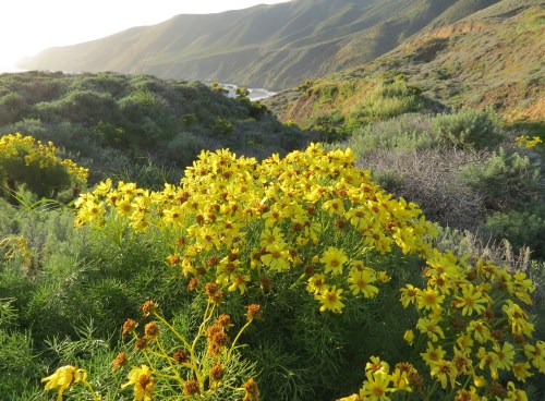
Coldwater Camp is about 5.5 miles roundtrip from the trailhead and typically has year round water.

The trailhead is reached from Santa Barbara by taking State Route 154 over San Marcos Pass to Armour Ranch Road. Turn right onto Armour Ranch Road, and follow it to Happy Canyon Road. Turn right onto Happy Canyon Road, and follow it all the way to the trailhead. Happy Canyon Road leads through scenic ranch land before climbing out of the Santa Ynez Valley. At Cachuma Saddle, it meets Figueroa Mountain Road and continues down towards Manzana Creek, changing names and becoming Sunset Valley Road.

The trailhead for lower Manzana Creek is about a half-mile before Nira Campground, which is at the end of the road. The trailhead is along Manzana Creek with a large, unpaved parking area.

We met at the trailhead. The overnight backpacking trip in some ways was the culmination of the class, and everyone was energized about getting out and doing some camping. After a brief safety review of the different hazards along the trail including, rattlesnakes, ticks, and poison oak, we set out for Coldwater Camp.

From the trailhead, Manzana Trail rides above the creek for the first mile and a quarter before descending back down to the water and arriving at Potrero Camp. The camp has two sites each with a picnic table and fire ring.

While at Potrero Camp, my friend and I invite the participants to name the different plants we could see around us that they had learned in class. The group quickly identifies manzanita, hummingbird sage, ceanothus, grey pine, and sycamore, as well as some their attributes.

In a previous class, one of the participants shared the realization that learning about the plants and animals in our local area helped to make wherever we went feel more familiar. He also observed that it made being outdoors that much more engaging.

In many ways connecting with nature is the doorway to having a more immersive experience of the outdoors and a deeper appreciation of how everything is woven together.

At the first creek crossing, I find myself noticing how well the group works together. Winter rains have raised the water level of the creeks, requiring some care in crossing. Watching our diverse group in action, I’m reminded how it’s sometimes easier to find a sense of belonging out in nature and be more accepting of different ability levels and personalities.

Our group included a couple from Germany, who recently moved to Santa Barbara; already avid hikers, they were interested in getting into backpacking, as well as just becoming more familiar with our local area. A former Army medic and his fiancé, a former Navy hospital corpsman, joined to learn more about backpacking. Two other women included a local business owner wanting to get outdoors more and an avid hiker wanting to start backpacking. The men included a speech therapist and musician, who wanted to get back into backpacking, as well as an adventurer, who had been backpacking for more than 40 years, but was interested in meeting other outdoor-minded people.

On the other side of the creek, near the junction with Potrero Trail, we take time for some map review. During the three-week sessions, we learned how to read and navigate the landscape without the use of a GPS or compass.

From Potrero Camp, we continue downstream along the trail weaving around the healthy, vibrant poison oak; stopping to admire the bear sign on a couple of sycamore trees; and making our way through the different creek crossings.

By midday, we arrive at Coldwater Camp. The camp has two sites each with a picnic table and metal fire ring. The group fans out into the meadow surrounding our camp and sets up their tents. After lunch, we day hike the mile and a half down to Horseshoe Bend Camp.

While hiking down the trail and taking the lead, I hear what sounds like a rattlesnake. I jump off to the side of the trail, away from the snake. From a safe distance, we stop to admire the healthy-looking snake. No longer feeling particularly threatened, the snake stops rattling at us. And then, tired of being the center of attention, the snake slithers off into the brush, rattling along the way as if to let us know the day was going just fine before all the commotion.

At Horseshoe Bend we enjoy the relatively deep swim holes along the creek. At one point, we watch a western pond turtle patrol the largest pool. Seemingly at ease with the number of visitors to its home, the turtle would swim out into the middle of the pool and back, and then along the rocky edge of the swim hole, putting on quite a show for us.

Arriving back at Coldwater Camp, we start to gather firewood. Under a large coast live oak, I demonstrate something I learned in the Boy Scouts. The leaves of coast live oak are shaped such that rainwater is directed away from the trunk, creating a relatively drier area under the canopy of the tree. By tugging on the dead branches that haven’t fallen yet, you can tell if they are dry enough to gather as firewood. When other wood is wet from the rain, this wood is still mostly dry and can be used to get a fire started.

After gathering enough firewood, we set about building a fire and making dinner. We settled on spaghetti and meatballs for the shared meal. In honor of the couple from Germany, for dessert we decided on s’mores, which apparently are unique to the United States as a quintessential aspect of camping.

Following dinner, we are treated to some fine ukulele music from one of the participants, before heading off to bed. We agree to wake up early in the morning and head out on the land for two hours of solo time as a nature connection experiment.

In the morning, my friend and I offer some suggestions about how to more easily tune into one’s senses and the environment before the group disperses out onto the landscape to find their spot.

When the time is up, we call them back, and form a circle for a group discussion about the experience. One woman shared that she found being alone on the land uncomfortable, which brought to light the challenges women can face when hiking and backpacking on their own. Others shared how at first they didn’t know what they’d do in one place for two hours, but by the end of the experiment wished they could’ve stayed out longer and spent the whole day immersed in nature, citing the sense of peace and wonder they felt while being out there.

After breakfast, we packed up our gear and shared our appreciations for the group and the time we spent together. Several of the participants shared that they were already planning their next backpacking trip, excited to put their new skills to use and appreciative of the new found confidence they had about exploring our local trials on their own.

We then give thanks to the land for hosting us and begin the hike out. We make a stop at Potrero Camp for one last dip in the swim hole below camp before returning to civilization.

This article originally appeared in section A of the April 10th, 2017 edition of Santa Barbara News-Press..

Posted by: James Wapotich | April 8, 2017

Backpacking Made Easy

backpacking class Santa Barbara wilderness trails hiking skills trail instruction

*

backpacking class Santa Barbara wilderness trails hiking skills trail instruction

*

Back by popular demand we will be offering a second session of Backpacking Made Easy.

Through this class, you will learn the basic skills and awareness to set out on our local trails and craft your own backpacking trips. Many of these skills can also be used for day hiking as well.

This class is unique in that it takes place on our local trails. As the best place to learn something is in the context in which it applies, in this case outdoors. You’re also probably interested in backpacking because you want to get out on the trails and experience nature more. 

In general, the class covers three main areas: wilderness navigation; nature connection; and gear/trip planning.

Our approach to wilderness navigation is also somewhat unique. You will learn route-finding and orienteering skills that are not dependent on having a GPS or compass. While we do use these tools on occasion, knowing how to navigate without them can help build the confidence to hike anywhere.

Nature connection is also a big part of our time out on the land. For many of us, the whole point of carrying gear out into the wild is to immerse ourselves in the elements and feel a deeper sense of connection with the natural world around us.

We will cover the gear basics and provide insights into how to evolve your own gear set. You don’t need to buy the latest gear in order to head out into the backcountry; what’s more important is to have the basics covered so that you can get out there and get started.

Backpacking Made Easy
April 29 – 13

Santa Barbara and Ojai are home to a variety of incredible backpacking destinations, and yet, often the biggest obstacle is simply having the knowledge and skills to get started.

Through this immersive workshop, you will learn the basic skills needed to comfortably explore and enjoy our local trails.

Hot springs, waterfalls, epic views, and unspoiled wilderness are just some of the rewards for those who are willing to make the journey.

Each class takes place outside, on one of our local trails, and provides a mix of hands on instruction, immersive exercises, and council sharing circles that allows for learning on many levels.

Lay of the Land
April 29th 9AM-3PM

Learn how to orient yourself to the local landscape, and begin learning the skills and awareness that will help you remove the word lost from your vocabulary. Become familiar with maps and creating your own mental maps. Learn about the different gear options and how to choose equipment that suits you.

Nature Connection
May 6th 9AM-3PM

Venturing out onto the land is even more enjoyable when we take time to develop a meaningful connection with it.

Learn to see the natural world around you as an ally, rather than an obstacle to overcome, and shift your hikes from feeling like endurance contests to journeys of discovery. And learn how to feel at home in the woods. Practical skills include trail navigation, menu planning, personal care and basic first aid skills.

Pathfinding
May 13th 9AM-3PM

Many of our local trails are overgrown, particularly those off the beaten path. Learn how to read the trails, practice route-finding, and develop your own sense of “body radar” to help you navigate in the wilderness. Practical skills include trip planning, campsite evaluation, water assessment, and camp set up.

Optional Free
Overnight Backpacking Trip
May 20-21

For those who are interested, we will help organize a free, optional backpacking trip. Here’s a chance to put all these great skills to use, and build on the material covered so far.

Length of the hike and destination for the overnight trip to be determined according to current conditions and the capabilities of the participants.

Guides:

James Wapotich is a Volunteer Wilderness Ranger with the Forest Service and the author of the Santa Barbara News-Press hiking column, Trail Quest. James leads guided hikes and has hiked many of the trails in our local backcountry.

Maya Shaw Gale is a mindfulness and nature-based Life-Coach and creator of Inner Nature/Outer Nature and Women in the Wild vision quest retreats. Maya has backpacked in the Sierras, Nepal, and our local backcountry.

Sierra Boatwright is a UC Certified California Naturalist, council facilitator, and nature connection guide, as well as an alumna of Pacific Crest Outward Bound School.

Workshop is $225 per person, or bring a friend and both 20% off.
Limit 12 students. Must be able to comfortably hike 3-4 miles.

To sign up or for more information please contact:

James (805) 729-4250 jwapotich@yahoo.com

Posted by: James Wapotich | April 8, 2017

Exploring Channel Islands National Park

Channel Islands National Park Wilderness Hiking Speaker Series Santa Barbara

*

Exploring Channel Islands National Park

Free Slideshow Presentation with Q&A

Thursday, April 20th, 6:30PM
Faulkner Gallery – Santa Barbara Public Library
40 East Anapamu St., Santa Barbara, CA

Just off the coast, the Channel Islands represent a unique world unto themselves. With their diverse plants and animals, some of which are found nowhere else in the world, the islands have been referred to as the Galapagos of North America.

The islands within Channel Islands National Park include Anacapa, Santa Cruz, Santa Rosa, San Miguel, and Santa Barbara, and all five offer hiking and camping opportunities.

Join local author James Wapotich as he shares images and stories from his hikes and backpacking trips on the Channel Islands. James has hiked on all five of the islands within the national park and is the author of the Santa Barbara News-Press hiking column, Trail Quest.

For more information call (805) 729-4250 or email jwapotich@yahoo.com

Wilderness Hiking Speaker Series

This talk is part of the new monthly Wilderness Hiking Speaker Series hosted by the Santa Barbara Public Library. The talks are the third Thursday of the month and feature topics related to hiking, backpacking, and our local natural history.

The next upcoming talk is Thursday, May 18th, featuring Lanny Kaufer speaking on the Edible and Medicinal Plants of the Santa Barbara Region. Lanny is celebrating his 41st year of leading Herb Walks in Ojai and Santa Barbara, and brings with him a wealth of knowledge about our local plants and their uses.

Posted by: James Wapotich | April 4, 2017

Trail Quest: Point Sal State Beach

West of Santa Maria, along the coast, is one of Santa Barbara County’s more remote beaches. The beach is roughly ten miles roundtrip from the trailhead, which adds to the sense of it being the reward at the end of a long journey.

Point Sal State Beach covers 80 acres of land including the beach and out to the point. The area features plants and some unique geology that are more reminiscent of the Channel Islands than the mainland. 

To get to the trailhead from Santa Barbara, take Highway 101 north towards Santa Maria. Exit at Clark Avenue and continue west, passing through the town of Orcutt, to State Route 1. To right onto State Route 1 and continue north towards Guadalupe. From State Route 1, turn left onto Brown Road, which ends at the trailhead. Parking is found along the side of the road.

Point Sal State Beach Santa Maria hike trail Casmalia Hills

Point Sal State Beach

The trail to Point Sal is open from sunrise to sunset. Most of the route is unshaded and there is no water or amenities along the trail or at Point Sal Beach so plan accordingly. No bikes or horses are allowed on the trail. 

From the trailhead, the hike follows an unpaved access road that winds its way out of Corralitos Canyon, and over the Casmalia Hills, before then continuing down towards the beach.

At the beginning of the hike, the hillsides are mostly covered in non-native grasses. However, as the hike continues the patches of chaparral become more and more expansive. Amongst the plants present are coastal sagebrush, coyote brush, black sage, poison oak, and blackberry. 

With the arrival of spring and many of the plants in bloom, one can also spot gooseberry, bush monkey flower, and paint brush. Further along the trail, where the hillsides seem to retain more moisture, there is even hummingbird sage and wood mint, or hedge nettle.

As the trail rounds a wide bend in the road, on its climb to the top of the Casmalia Hills, it passes through a drier feeling section. Here, the hillsides are dominated in places by black sage. Also along the road is chaparral sunflower, lupine, and ceanothus. The diversity of plants easy dispelling what at first glance can look like nothing more than grassy hills and sagebrush. 

At about the 1.5-mile mark, the trail starts to level out as it approaches a cattle guard. Here, along the left side of the road, are brodiaea, or blue dicks, with its purple flowers, long-beaked stork’s bill, with its light pink flowers, and surprisingly, chocolate lilies. 

Chocolate lilies can also be seen in the San Rafael Mountains along Figueroa Mountain Rain. The plant blooms in March and April, and its brown, or chocolate-colored, flowers are what gives the plant its name. Other members of the lily family that grow in our area are mariposa lilies and the rare Ojai fritillary.

Giant Coreopsis Point Sal State Beach hike trail

Giant Coreopsis are seen along the trail

From the cattle guard, the trail crosses over the top of the Casmalia Hills, passing still more chocolate lilies, before arriving at the Vandenberg Air Force Base Gate. 

Originally Point Sal was accessible by vehicle from Brown Road, passing through the northernmost corner of the base. However, in 1998 winter storms damaged the road and it has been closed since. In 2008, an agreement was reached with Vandenberg Air Force Base that allows hikers to access the road and continue down to the state beach. The base reserves the right to close or restrict access, for example when there’s a missile launch. To check whether access is open or not go to www.vandenberg.af.mil/home/point-sal-access.

Past the gate, the access road is paved almost all the way down to the beach, roughly 2.5 miles. The road continues across the top of the hills, before rounding a bend bringing Point Sal into view.

From here, one can trace the line of Point Sal Ridge down to the ocean, as well as see part of the beach. A little further down the road, the views open up to the south. Here, one can see Purisima Point, parts of Vandenberg Air Force, and beyond that Mount Tranquillon and Point Arguello. 

The road makes a long, winding descent down to the coast, passing through hillsides dotted with chaparral, with purple sage now taking the place of black sage.

The road eventually arrives at a second gate. Here, the route down to the beach continues to the right, passing a stand of giant coreopsis, currently in bloom with its bright yellow flowers. A familiar sight on Anacapa Island, where it grows in abundance, giant coreopsis grows along the Pacific Coast from Northern Baja California to as far north as San Francisco. 

Coreopsis is in the sunflower family and can grow to around four feet in height. The plant blooms in the spring, typically from March to May. The flowers and leaves eventually fall off, leaving just the dry stems, giving it the appearance of miniature, barren-looking tree.

The road eventually arrives at the bluffs overlooking the beach. By continuing to the right, there is an informal route that can found that often is often washed out, but with some scrambling, does provides a way to reach the beach.

Point Sal State Beach hike trail Santa Maria

Point Sal is seen from the trail

The pristine beach is about a half-mile long and is one of the highlights of the hike. Swimming, however, is not recommended because of the strong riptides. 

At the far end of the beach one can find outcroppings of ophiolite, a unique and somewhat rare rock type. Ophiolite is a section of the earth’s oceanic crust and underlying upper mantle that has been uplifted and placed on the land. 

The ophiolite at Point Sal is part of the Coast Range Ophiolite, which appears from Santa Barbara County north to San Francisco. It has been suggested that the material was formed at a mid-ocean spreading center, roughly 165 millions years ago during the Jurassic Period. When it was formed, molten rock, or magma, penetrated into the seafloor, where the material either cooled and solidified below the surface, or erupted, forming pillow lava where it met the ocean. 

Portions of the Channel Islands were also formed by submarine volcanic activity, but are much younger geologically.

In studying the magnetic signature of the ophiolite, geologists have determined that it was formed near the equator. Through the movement of plate tectonics it was carried north when Pangaea began to break up and the continents started to drift apart. As part of the Farallon Plate, the material eventually became attached to the western edge of North America. 

When the eastern moving Farallon Plate collided with the North American Plate, the denser Farallon Plate slid under the lighter continental plate. The resulting subduction, volcanic activity, and uplift created the forerunners of the Sierra Nevadas. Essentially acting like a giant, slow-moving conveyor belt, material, including the ophiolite, was scraped off the Farallon Plate as it subducted under the North American Plate and was added to the western edge of the continent.

As the Farallon Plate continued to subduct under the North American Plate the movement bought in behind it the Pacific Plate. However, instead of sliding underneath the North American Plate, the northward moving Pacific Plate began sliding laterally against it, creating a transform fault, which we know as the San Andreas Fault. The shift brought an end to the mountain building and accretion associated with subduction. 

Typically ophiolite is recycled along with other material through the process of subduction. However, because of the path it ending up taking, the ophiolite at Point Sal managed to escape being subsumed back into the earth, providing an unique opportunity to study a section of ancient oceanic crust and learn more about it.

Past the rocks there is no maintained trail or particularly easy route over or around the rocks, even during low tide. But the beach itself provides ample reward for the hike and the satisfaction of having visited a remote corner of Santa Barbara County.

This article originally appeared in section A of the April 3rd, 2017 edition of Santa Barbara News-Press.

Posted by: James Wapotich | March 27, 2017

Trail Quest: Potrero John Trail

Our recent rains have not only helped bring the waterfalls back to life, but have also inspired the plants to get an early start on spring. Potrero John Creek originates near the top of Pine Mountain Ridge, carving a canyon down the mountain on its way towards Sespe River and includes a scenic waterfall along the way.

I thought it’d be interesting to invite local plant expert Lanny Kaufer to join me for the hike. Lanny has led Herb Walks and Nature Hikes in Santa Barbara and Ojai for the past 41 years and was excited about revisiting the canyon and seeing the falls.

The hike to the falls is about six miles roundtrip and follows the creek most of the way, passing through a mix of riparian and chaparral plants.

After picking Lanny up from his home in Ojai, we continue along State Route 33 to the trailhead. The road follows North Fork Matilija Creek before climbing out of the canyon and continuing towards the turnoff to Rose Valley. Past Rose Valley Road, State Route 33 descends down towards Sespe River and follows it upstream towards Sespe Gorge.

Lanny Kaufer Herb Walks Ojai Edible and Medicinal Plant Potrero John Canyon Trail Falls hike

Lanny pauses at one of the cascades along the trail

Potrero John Canyon is the second canyon on the right just past Sespe Gorge. Parking is found in the pullouts along the road.

On our drive, Lanny talked about Tending the Wild, by M. Kat Anderson, a book he is currently reading. The book dispels the narrative of California’s native peoples as hunter-gathers, wandering the landscape, opportunistically looking for food, and instead shows them as stewards, actively tending the wild plants and resources they used. As an example, Lanny offered that when the Chumash harvested brodiaea, or blue dicks, which have an edible bulb, they likely replanted the smaller bulbs and cleared the area around the plants so they would grow back in the same place more vigorously and abundant the following year.

As we hit the trail, one of the first plants that grabs our attention is chaparral white thorn ceanothus growing abundantly along the trail. The plant with its distinctive pale, whitish bark grows at higher elevations and has yet to show its purple flowers. The plant is distinct from the big pod ceanothus we saw in North Fork Matilija Canyon, along the drive, which was already in bloom with white flowers. The flowers of ceanothus can be rubbed together to produce a lathery soap.

The beginning of the canyon is narrow and shaded. In addition to ceanothus, we see manzanita and yerba santa amongst the chaparral plants, and along the creek we can see mule fat, willow, poison oak, and mugwort.

The next plant we stop at is big cone spruce, also known as big cone Douglas fir. I watch as Lanny walks around the tree. He is looking to see if there are any new needles growing, offering that they are a rich source of vitamin C and have sour, but nutty taste. He concludes, however, that it’s still a little early in the year, and we probably won’t start seeing fresh needles until April.

At the next crossing, we spot several patches of giant stinging nettles. Lanny points out that it is the only native nettle in our area, adding that it is also one of the most nutrient rich plants on the planet. Carefully picking a leaf, he demonstrates how to eat the fresh leaves without getting stung. Taking the leaf and crushing it between his fingers, he rolls it into a ball, pinching hard to deflate the little hairs on the leaves that cause irritation. I do the same, before eating some; the taste reminds me a little of miner’s lettuce, which is also growing along the trail.

Nettles can also be cooked, or steamed, which wilts the hairs on the leaves, eliminating their stinging properties. The leaves are said to be best when they’re young and tender. However, Lanny cautions that once they start to flower it’s risky to eat them, because the leaves begin to produce gritty particles, or cystoliths, that can get into the kidneys and cause kidney stones.

Still, the idea of foraging for a snack in the wild is appealing. Foraging is defined as gathering plants for personal use, any more than that is considered harvesting. A permit is required to harvest plants in the National Forest.

Potrero John Canyon Trail Falls Ojai hike

Potrero John Canyon

Just past the third crossing, the trail enters Sespe Wilderness. As we continue up the canyon, we can hear a group of Steller’s jays excitedly conversing as they flit from tree to tree. In the distance, we can hear the canyon wren’s distinctive descending call that sounds like laughter.

After another crossing, Lanny stops at a small herbaceous plant along the trail and asks me if it reminds me of another plant we’ve seen earlier. Studying the plant, I notice that its dried leaves are still clinging to the stalk similar to mugwort, which proves to be the correct answer.

Lanny points out both plants are in the genus Artemisia, as is sagebrush. This particular member of the genus Artimesia, is wild tarragon. The plant is similar to French tarragon used in gourmet cooking but doesn’t have the same richness of flavor. Nevertheless, can make for a handy seasoning while camping.

Continuing past the wild tarragon, we arrive at a patch of Great Basin sagebrush, also in the genus Artemisia. The plant is related to coastal sagebrush that’s found closer to the coast. The range of Great Basin sagebrush extends inland and takes its name from the Great Basin between the Sierras and Rocky Mountains, where it also grows. The plant can be used to make a liniment to treat muscle pain topically.

Lanny Kaufer Herb Walks Ojai great basin sagebrush potrero john trail canyon los padres national forest sespe wilderness

Lanny studying an example of Great Basin sagebrush

As we continue, the canyon starts to open up. In the distance, we can see Pine Mountain Ridge.

Potrero John Canyon is named after John Powers, who lived in the area during the early 1900s, and grazed his cattle in the canyon. Potrero is Spanish for pasture or meadow.

We pass through several potreros surrounded by mostly chaparral. The south-facing canyon proving favorable to ceanothus, chamise, white sage, yerba santa, and other chaparral plants.

Pausing at a particularly healthy specimen, Lanny points out that yerba santa is Spanish for holy herb. Noting that while the Spanish generally didn’t value the plant knowledge the Chumash people had developed, they were impressed by yerba santa. The plant could cure ailments of the lung and respiratory system, including tuberculosis, far more effectively than any plant the Spanish knew, bestowing upon it the accolade of holy herb.

At about the 1.75-mile mark, we arrive at the unsigned turnoff for Potrero John Camp. The camp is across the creek from main trail and tucked under several large interior live oaks. The camp features a grated stove and fire ring and makes for an easy overnight backpacking destination. After pausing for lunch, we continue up the canyon towards the falls.

Potrero John Falls waterfall Sespe Wilderness hike trail backpacking ojai los padres national forest

Potrero John Falls

Past the camp, the trail sees less use and is more overgrown. The trail is generally still easy to follow, although some of the crossings can prove confusing.

The trail favors the west side of the canyon and becomes more shaded as it narrows, eventually narrowing to the point where there is no more room for a trail. From here, it is a short ways to the falls up the creek.

Scrambling over the rocks and rounding a corner in the canyon, we arrive at a point overlooking a small cascade. Just above it is the main falls. We make our way to the base of the falls and take in the crystal clear waters flowing across the tall rock face. The blueness of the sky set against the falls seems impossibly deep and rich.

Sitting there taking in the scenery, feeling the warmth of the sun, and listening to sounds of the water, my mind begins to wander. I find myself imagining a landscape altered by the Chumash over thousands of years, as they tended the plants they used. And I wonder if the groupings and concentrations of edible and medicinal plants I see in the backcountry today are actually remnants of their activity.

Lanny Kaufer regularly offers Herb Walks and Nature Hikes in Santa Barbara and Ojai and will be featuring a walk along Potrero John Trail later in the spring. For more information or a calendar of upcoming events go to www.herbwalks.com.

This article originally appeared in section A of the March 27th, 2017 edition of Santa Barbara News-Press.

Posted by: James Wapotich | March 20, 2017

Trail Quest: North Tunnel Trail

In January, Gibraltar Reservoir reached full capacity and began spilling over for the first time in six years. The arc-shaped dam was built in part against a large outcropping of sandstone where the river narrows. As water leaves the spillway it flows over the sandstone creating a waterfall comparable to those elsewhere in the backcountry.

The shortest route to the dam is from the Red Rock Trailhead at the end of Paradise Road. However, the same rains that have brought our creeks and waterfalls back to life, have also closed Paradise Road at the first crossing of the Santa Ynez River. The wide, flowing river has made the crossing impassable to vehicles.

Fortunately, there is an alternate route down to the dam from the top of the Santa Ynez Mountains that leads through Devil’s Canyon. The hike starts off along North Tunnel Trail and is about eight miles roundtrip.

Gibraltar Reservoir dam trail full los padres national forest

Gibraltar Reservoir between Gidney Cove and the Sunbird Quicksilver Mine

I had already been wanting to see the reservoir spilling over and getting to hike through Devil’s Canyon added to its appeal.

North Tunnel Trail is reached from Santa Barbara by taking Gibraltar Road to the top of the Santa Ynez Mountains, where it meets East Camino Cielo Road. Turn left onto East Camino Cielo and continue towards the first access road on the right. Parking is found along the beginning of the access road.

Sometimes referred to as Angostura Pass Road, the gated access road leads to the beginning of North Tunnel Trail and down to the dam. Past the locked gate, the views open up dramatically out across the Santa Ynez Valley towards the San Rafael Mountains. Here, the various summits from Figueroa Mountain to Madulce Peak can be seen. The burn area from the Rey Fire is also visible on the landscape.

The unpaved road then rounds a corner and Gibraltar Dam comes into view. Even from here, I can see the water flowing over the spillway. Just past the bend, is the beginning of North Tunnel Trail, which is hard to spot now that the trail sign is gone.

From the road, the trail continues down the backside of the Santa Ynez Mountains, leading through a mix of chaparral, including ceanothus, chamise, manzanita, scrub oak, and toyon. The trail is overgrown in places, but still easy to follow.

The trail is mostly exposed, however there is a patch of shade where the trail passes through a small stand of madrone. More common now to northern California, the tree is a remnant from the last ice age when our area was much cooler and wetter. Madrone is often found on the north side of the Santa Ynez Mountains, near the top.

The trail briefly shifts onto a small south-facing ridge. Here, the additional sunlight has created opportunities for yerba santa, white sage, and yucca to grow. Passing through the brush, I can see that the rain combined with warmer weather has also been exciting for the local ticks and brush several off me as I continue.

At about the two-mile mark, the trail arrives at a three-way intersection. Here, North Tunnel Trial ends. To the left Matias Trail continues over towards Arroyo Burro Road, and to the right Devil’s Canyon Trail continues towards Gibraltar Dam.

The trail descends into a side canyon, passing through several grassy areas dotted with coastal sagebrush and lined with shooting stars in bloom. Further down, blue dicks, or brodiaea, are also in bloom. On one of the flowers I spot a shy, yellow spider crab that maneuvers its way around the plant each time I try to get a closer look.

The trail becomes more shaded as it starts to follow the flowing creek in the canyon. There are no other footprints along the trail. Part of the charm of Devil’s Canyon is the sense of enclosure, cut off from the visual reference of the San Rafael Mountains or even the reservoir, it is a place unto itself.

Continuing through the canyon I can see bear sign, or scratches, on several of the trees, that add to the sense of remoteness.

The trail then arrives at the confluence of the side creek and the main creek through Devil’s Canyon. Here, alder trees line the watercourse, suggesting that this section of the creek flows year round. I continue downstream along the trail under a canopy of oaks.

Having seen Humboldt lilies along a couple other trails on the backside of the Santa Ynez Mountains, I’m hopeful that there are some growing in this canyon. I spot several along the trail, before stumbling across an unusual sight. Surrounding a single cluster of California bay laurel are more than a dozen lilies sprouting up near the trees.

After a number of creek crossings, the trail arrives at the unpaved access road that comes up from the Red Rock Trailhead. From here, the road follows Devil’s Canyon down to the confluence with the Santa Ynez River.

Supported by water from the overflowing reservoir, the river is striking in its fullness, covering completely the trail that leads to the other side. As I continue along the access road towards the dam, the spillway comes into full view. Here, water from the reservoir is pouring over the rock face forming a good size waterfall.

Completed in 1920, the dam was the first along the Santa Ynez River. Its original storage capacity was 14,500 acre feet of water. Over the years, sediment filled the reservoir reducing its capacity by almost half. In 1948, the height of the dam was raised 23 feet, bringing the reservoir back to roughly its originally capacity. Today, after almost 70 more years of sedimentation, the reservoir’s capacity is just 5,272 acre feet, which is why it didn’t take long to fill with water. In comparison, Lake Cachuma has a capacity of more than 190,000 acre feet.

From here, the access road continues above the dam and leads to an overlook that provides additional views of the spillway. Nearby, is a picnic table under a couple of pine trees, next to a quonset hut, that provides shaded views out across the reservoir.

Appreciating the shade, I take a quick lunch at the table and assess the time. I have enough daylight to hike over to Gidney Cove and back out, but not enough to visit the Sunbird quicksilver mine. I know my pace will improve along the access road and decide to revisit the topic at Gidney Cove.

The access road continues eastward another mile and then branches. Here, Angostura Pass Road continues to the top of Santa Ynez Mountains where it meets the trailhead. To the left, Gibraltar Trail continues around the reservoir, eventually meeting North Cold Spring Trail.

I continue along Gibraltar Trail, which follows an old access road around the cove towards the mine. The road makes a wide descending switchback, offering views out across the cove, before then heading towards Gidney Creek. The cove is remarkably placid and quiet, giving the area an almost eerie feeling. I don’t hear the creek until I’m almost upon it.

Continuing past the creek, the road starts to climb as it rounds the far side of the cove offering additional views of the reservoir. At the far side of the cove, I realize that I’m probably just a mile from the mine, and if I keep a steady pace I can make it to the mine and back and only have to hike the last hour in the dark.

As I continue along the road, several more sweeping views out across the reservoir come into view, including one more at the mine where the river flows into the reservoir.

Quicksilver was first mined at the site in the 1860s, and then on and off over the years as the demand and favorable pricing for quicksilver ebbed and flowed. Sunbird Mining Company was the last such venture, which started in the 1960s, and closed in the 1990s. A fence now surrounds the abandoned structure for safety.

After taking in the views, I hasten my return back to the trailhead.

This article originally appeared in Section A of the March 20th, 2017 edition of Santa Barbara News-Press.

Posted by: James Wapotich | March 20, 2017

Trail Quest: Rose Valley Falls

With all the great rain we’ve been receiving, now is a perfect time to tour some of the many waterfalls and cascades our local mountains have to offer.

I had already been wanting to revisit Rose Valley Falls in the mountains behind Ojai, but had been waiting for more water to bring them back to life. Said to the be the tallest waterfall in Ventura County, the two-tiered waterfall flows down the backside of Nordhoff Ridge.

The hike to the lower falls from Rose Valley Campground is less than a mile roundtrip. The trail is shaded with fairly easy terrain, which also makes it a great hike for kids.

The falls in the video in order are Lower Rose Valley, Upper Rose Valley, three cascades in a side creek along Lion Canyon Trail, West Fork Lion Falls, first cascade past East Fork Lion Camp, and just above that “Spruce Falls”.

The trail to the falls is also near Rose-Lion Connector Trail, which can be used to hike over to Lion Canyon, where there are two more smaller waterfalls. This longer hike is about 6.5 miles round trip and leads past two trails camps that provide opportunities for overnight backpacking trips.

To reach the trailhead from Santa Barbara, make your way to Ojai, and continue north on State Route 33. State Route 33 leads through North Fork Matilija Canyon and eventually climbs out of the canyon. Just as the road levels out, it arrives at the turnoff for Rose Valley Road.

Continue east on Rose Valley Road to the turnoff for Rose Valley Campground, which is at a four-way intersection. To the left, the road leads down to Lower Rose Lake. Straight ahead, Rose Valley Road continues towards Middle Lion Campground, as well as the Piedra Blanca Trailhead along Sespe River. To the right, the road continues to Rose Valley Campground.

Continuing towards to the campground, I pass Upper Rose Lake and can see the upper falls in the distance. I park along the road with the other cars at the beginning of Rose-Lion Connector Trail and walk a short way up the road to the campground.

Rose Valley Campground has nine sites each with a picnic table and fire ring. The sites are $20 per night through Parks Management, the new concessionaire. The sites are on a first come, first served basis.

The trail to the falls is at the far end of the campground and is in good shape. The trail leads through a mix of riparian and chaparral plants as it follows Rose Valley Creek. Along the route are several side trails down to the creek that lead to small pools and cascades.

The trail ends at the base of lower Rose Valley Falls. Here, the cascading water is spread out over a large rock face forming a number of rivulets. In the summer, there are often crimson columbines growing along the face of the lower falls.

In the short time I was there I watched a number of people attempt to reach the upper falls by scrambling up the unstable rocky slopes on either side of the lower falls. The people who had the most success were those who went back down the trail and found a route on the right hand side of the canyon. Several people have died and others have been injured trying to reach the upper waterfall, which makes it not worth attempting when there are easier places to visit in our backcountry.

Returning to the parking area, I continue next along Rose-Lion Connector Trail, which leads over to Lion Canyon where there are two smaller, but satisfying waterfalls to be found.

The connector trail crosses Rose Valley Creek just upstream from Upper Rose Lake, so I make a quick detour downstream to take in the views. The man-made lake captures water from the creek and its tributaries and is framed by Pine Mountain Ridge in the distance.

As the trail continues, it follows a side creek that also feeds the lake, passing several small ponds lined with willows, before transitioning into mostly chaparral. Here, the rains have helped transform the exposed and sparse feeling area into a renewed little canyon with an idyllic stream waiting to be rediscovered.

The trail eventually crests a small saddle and descends into Lion Canyon, following another flowing side creek on the way down to Lion Creek. Again, I’m given pause at how the addition of water to the landscape adds to the sense of vitality and expansiveness all around me, and makes each turn in the canyon seem more animated.

At about the 1.5-mile mark, the trail arrives at Lion Creek. The creek is flowing well, and I have to continue downstream a bit just to find a place to cross. The trail then meets Lion Canyon Trail. From here, it’s about a mile and a quarter down the canyon to Middle Lion Campground, which can be reached from Rose Valley Road.

As I continue up the canyon, my eye is drawn to the dense stands of willow that line the creek, their leaves and buds currently giving the plant a colorful gold and reddish appearance.

Along the trail I pass a small side creek on the left that forms a small pool next to the trail. Scrambling up the nearby rocks to get a better view of the creek, I can see a series of three small cascades in the rocky canyon below.

At about the two-mile mark, the trail arrives at a signed four-way intersection. Lion Canyon Trail continues straight ahead, eventually climbing out of the canyon and continuing up to Nordhoff Ridge. To the right is the side trail to West Fork Lion Camp, and to the left is the side trail to East Fork Lion Camp.

With the sky becoming more overcast, I decide to hike to West Fork Lion Camp first, knowing that I’ll probably spend more time in East Fork Lion Canyon. The side trail follows West Fork Lion Canyon upstream. As I continue, I’m surprised that there are no Humboldt lilies sprouting up along the trail. Last year there were close to 20 along the trail, so either they haven’t started yet or they’re taking a year off.

After roughly a half-mile, the side trail arrives at West Fork Lion Camp. The camp is right along the trail and features a grated stove and fire ring. Across the creek is another smaller campsite with a grated stove, and just downstream from that there’s an ice can stove in a small clearing.

Past the first campsite, the trail continues across the alder-lined creek and then starts to fade. From here, it’s a short hike upstream to the falls. The falls form a chute over an exposed outcropping of conglomerate rock. The cobblestone-looking material was originally deposited during the Cretaceous period as a mixture of loose rock and finer material that fused over time and was later uplifted with the mountains.

I pause here for a quick lunch. The air is cool and I’m glad I brought a down vest. The wool cap I found earlier along the trail proves helpful, but the sunglasses I found at West Fork Lion Camp…not as helpful.

Back at the four-way intersection, I next follow the side trail that leads up East Fork Lion Canyon, entering Sespe Wilderness. The trail crosses the creek several times, and with the higher water it proves challenging to keep my boots dry.

After roughly a half-mile, the side trail arrives at East Fork Lion Camp. The camp has two sites, each with a grated stove and fire ring. The larger, more spacious site is under two large big cone spruce. The site was originally called Spruce Falls Camp.

The trail continues past the camp, before arriving at the first cascade. Here too, the water is flowing over conglomerate rock, only instead of a single large outcropping, it’s a series of huge boulders made of conglomerate rock.

After a short bit of rock scrambling I arrive at the base of the falls, which prove to be the highlight of the day. Here, four separate channels in a row are flowing across a large rock face into a single pool. The water is crystal clear and the sights and sounds are so engaging that I regret not bringing camping gear to have more time to enjoy the canyon before heading home.

This article originally appeared in Section A of the March 13th, 2017 edition of Santa Barbara News-Press.

Posted by: James Wapotich | March 20, 2017

Trail Quest: Tangerine Falls

With all the great rain we’ve been getting, our waterfalls are finally flowing once again. And not just mere trickles like the past five or six years, but actual rushing, roaring water tumbling over rock walls and filling the canyons with energy.

The largest, and perhaps best, of the front country waterfalls is Tangerine Falls in Cold Spring Canyon. The waterfall has been largely non-existent since the drought but is now in full force and promises to continue flowing for some time.

The hike up to the falls is about three miles round trip and involves a fair amount of rock scrambling once off the main trail.


To get the trailhead from Highway 101, take Hot Springs Road exit, and continue north along Hot Springs Road to East Mountain Drive. Turn left onto East Mountain Drive and continue to where the road crosses Cold Spring Creek. Parking is found along the side of the road on both sides of the crossing.

Cold Spring Trail starts along the right side of the canyon, passing through mostly oaks with California bay laurel mixed in and chaparral plants coming down from the side of the canyon.

At about the quarter-mile mark, the trail branches, just below the confluence of Cold Spring and East Fork Cold Spring Creeks. To the right, Cold Spring Trail follows East Fork Cold Spring Creek upstream, before eventually climbing out of the canyon and continuing towards Montecito Peak and the top of the Santa Ynez Mountains. To the left, West Fork Cold Spring Trail crosses the creek and continues along the left side of the canyon, following Cold Spring Creek upstream towards the turnoff to Tangerine Falls.

Standing at this first crossing, I’m given pause. The water level requires more of a leap than I’m willing to make. I push upstream, following East Fork Cold Spring Creek, until I find a collection of boulders in the creek that I can hop across. I continue over the wedge of land separating the two creeks, squeezing past the poison oak with its glistening leaves. After finding a place to cross Cold Spring Creek, I tie back into West Fork Cold Spring Trail and continue up the canyon.

With so much water in the creek, I can already feel my excitement at seeing the falls.

The trail is well-shaded. passing through a mix of coast live oak and California bay laurel. From the trail, I can see sycamore and maple in the canyon below. The trail is in good shape, particularly given the recent rains. There are no major slides and no downed trees.

Already, there are some wildflowers in bloom. Milk maids with their white flowers line parts of the trail, as does non-native sour grass, or oxalis, with its yellow flowers.

Having become accustomed to the drought, it is only slowly sinking in that there is water continuously flowing along the length of the canyon. As I slow down to take in this new awareness, I can smell the moist earth beneath my feet and see the newly washed leaves on the trees and bushes. And I can imagine the rainwater making its way down to their roots, providing an infusion of relief from the drought.

As the trail rounds another corner in the canyon, Tangerine Falls comes into view. In the distance, I can see water tumbling over the rocks, forming an electric white line of energy coursing down the canyon.

The trail soon arrives at the turnoff for Tangerine Falls, which is now marked with a sign thanks to a recent project by the Boy Scouts, who installed signs along many of the front country trails east of Gibraltar Road.

The trail juncture is just above where West Fork Cold Spring Creek joins the main creek. To the left, West Fork Cold Spring Trail follows West Fork Cold Spring Creek and continues towards Gibraltar Road. To the right, the off-trail route to Tangerine Falls, crosses West Fork Cold Spring Creek and then continues up Cold Spring Creek, sometimes referred to as Middle Fork Cold Spring Creek.

The off-trail route to the falls is unmaintained and requires rock scrambling. As it continues along Cold Spring Creek, it quickly arrives at a second trail juncture, this one without a sign. The trail on the left, which is at a right angle to the creek, leads above the waterfall.

As I continue along the trail that follows the creek upstream to the falls, I notice a half-dozen Humboldt lilies. Having already seen a dozen so far, I start to count them. In all, there are close to 50 lilies sprouting up along the trail, recognizable with their green leaves growing in a ring around a fairly straight stalk.

Humboldt lilies are considered rare to endangered because of their limited distribution. However, where they do grow, there are sometimes several more plants nearby. They prefer partially shaded canyons and the north slopes of mountains. Humboldt lilies bloom in June, showing orange flowers with maroon spots; and when flowering, the plant can reach as much as eight feet in height.

The trail then crosses the creek. Here, a large outcropping of Coldwater sandstone on one side of the canyon provides a narrow channel for the water to race through, effectively providing the experience of following a cascading mountain stream.

Past the second crossing, the trail leads through a section lined with mostly California bay laurel, before arriving at another rock outcropping. Here, the informal route to the falls scrambles over the outcropping and arrives at a medium-sized cascade.

The canyon then narrows still further, as the use-route transitions into mostly rock scrambling. The route continues up the west side of the creek and is normally dry, even when the creek is flowing. However, because of the volume of water currently in the creek, a side channel is now flowing directly down the use-route, adding to the sense of literally climbing up the creek to the falls.

The use-route then moves past where the water is flowing in and soon arrives at an overlook that provides some impressive views up towards the falls in all their glory.

To get to the base of the falls, I scramble down into the creek and aim for the one place narrow enough to hop across, and then slowly make my way up the sloped rock face. I’ve scrambled up this surface before, but not when it’s completely wet. I make a point of taking my time, not wanting a free ride back down to the creek. At the base of the falls, the spray coming off the cascading water is so strong that it’s like standing in a light rain, so I retreat back behind a nearby rock to take in the views without getting soaked before working my way back down to the creek.

Tangerine Falls takes its name from the orange and rust-colored minerals that have built up on the face of the falls and in the creek, which gives the waterfall a slight orange cast. The effect is more evident when the water level is lower.

On the way out, because there’s still some daylight, I decide to hike up the trail that leads above the falls. The trail climbs away from the creek and follows the contours of the canyon up to the outcropping of Coldwater sandstone that defines Tangerine Falls. The trail does not provide access to the top of the falls, but does offer views down into the canyon, including out towards Tangerine Falls.

Just past the outcropping of sandstone, the trail rejoins the creek and continues through the upper canyon towards an old homestead site. This section of trail sees fewer visitors than the canyon below and feels more like backcountry trail. There are even scratch marks made by black bears on several of the trees.

Returning to the trailhead, I can’t help but think this is going to be a good year for backcountry adventuring and enjoying the natural splendor of our local mountains.

The article originally appeared in Section A of the March 6th, 2017 edition of Santa Barbara News-Press.

Posted by: James Wapotich | March 20, 2017

Trail Quest: Snowshoeing at Mount Pinos

On a recent visit to Colorado to see family, I went snowshoeing for the first time and noticed that it wasn’t that much harder than hiking. Inspired by the experience, I was reminded that Mount Pinos often has snowpack in the winter, sometimes lasting into the spring, and is also much closer to Santa Barbara than Colorado or even the Sierras.

This year’s strong rains have already delivered the best snow since 2011, adding to Mount Pinos’ appeal as a winter destination.

Feeling like I needed an accomplice for this trip, I invited my friend Casey to come along. Casey is an avid motorcyclist and outdoor enthusiast and so I figured a snowshoeing adventure would likely capture his interest, which it did.

Mount Pinos snowshoe cross-country skiing Inspiration Point Trail Los Padres National Forest southern California

Scenery near Inspiration Point Trail

In researching the idea, I was surprised to discover that there are no snowshoe rental companies anywhere near Mount Pinos. Fortunately Mountain Air Sports in Santa Barbara has them available for just $10 a day. They also rent cross-country skis and other winter sports equipment.

Mount Pinos is roughly two and a half hours from Santa Barbara. Rather than bear all that driving in one day, we opted to head out the evening before and car camp at Reyes Creek Campground.

The quickest route to Mount Pinos from Santa Barbara is to take Highway 101 south to Ventura, and from there take State Route 126 east towards Santa Clarita where it meets Interstate 5. Continue north on Interstate 5 and exit at Frazier Mountain Park Road. Follow Frazier Mountain Park Road to Cuddy Valley Road, which leads towards the top of Mount Pinos and the trailhead.

However, in terms of reaching Reyes Creek Campground, the shorter route is the back way through Ojai along State Route 33.

Snow-covered pines Mount Pinos Snowshoe southern california frazier park los padres national forest

Snow-covered pines at Mount Pinos

After picking up Casey in Carpinteria, we took State Route 150 towards Ojai. While driving along State Route 33 past Ojai, the rain that was supposed to be over starts to become more steady. At Pine Mountain summit there are snow flurries mixed in with the rain. I was already feeling anxious about the roads being icy at Mount Pinos and the rain isn’t helping. The good news, however, is that it’s also probably adding a fresh dusting of snow to the mountains.

Continuing on State Route 33 down the backside of the mountains, we arrive at Lockwood Valley Road and head towards Reyes Creek Campground. Arriving shortly after 8 p.m., we set up camp before heading over to Reyes Creek Bar & Grill for dinner.

An adventure pass is required to camp at Reyes Creek Campground, but it is otherwise free. Campsites are on a first come, first-served basis, and during the off-season such as now most of the sites are available. With all of the vacation homes near Mount Pinos, both in Frazier Park and Pine Mountain Club, another option for overnight accommodations is to check Airbnb.

In the morning, we enjoy a hearty breakfast at the bar and grill and learn that the current owners after nine years are selling the place, which is said to date back to 1891.

From Reyes Creek Campground, we continue along Lockwood Valley Road to Cuddy Valley Road, and from there make the drive towards the top of Mount Pinos and the trailhead.

The road up the mountain is clear and free of ice. We are still required to carry snow chains but don’t need to use them. The two gates along the road are also open. For current road conditions, check with either Fort Tejon California Highway Patrol or Kern County Public Works Department.

As we pass McGill and Mount Pinos Campgrounds, which are currently closed for the winter, we start to see cars parked by the side of the road and people playing in the snow. The road ends in a large parking area near Chula Vista Campground, where we see even more people out for the day enjoying the snow.

During the summer months this same parking area is often filled with telescopes as Mount Pinos is a premier star-gazing destination because of its clear skies and distance from the light of large cities.

At the far end of the parking area is Mount Pinos Nordic Base, which is used by Southern California Nordic Ski Patrol. Started in 1977, the volunteer ski patrol works in partnership with Los Padres National Forest patrolling the mountain most weekends from mid-November through April.

Mount Pinos winter snow shoeing

*

Radiating out from the base is a network of cross-country ski trails between the different campgrounds and the summit of Mount Pinos. The routes are also open to hiking and snowshoeing and vary in degree of difficulty, depending on whether they’re level and marked. A map of the trails can be purchased at the base.

The main route to the summit of Mount Pinos is west along a 1.5 mile unpaved access road. However, with all the open space provided by the snow cover, we decide to head north, cross-country through the pines. We quickly tie into one of the ski trails and follow it briefly, before cutting west towards Mount Pinos.

The snow pack in places is as much as two to three feet deep. Many of the trees are covered in snow, with some looking like they’ve been in the flocking booth at a Christmas tree lot. While on other trees the accumulated snow has formed a sort of lace-like pattern on the branches.

The day is sunny and much of the snow on the trees is melting. At one point we find several trees covered in icicles from the thawing and refreezing that takes place.

The snow has also made for some good tracking. There are fresh rabbit, squirrel, deer, and fox tracks. At one point we follow a coyote track as it meanders through the trees.

As we continue off-trail through the pines, we tie into the trail to Inspiration Point. The cross-country ski route is marked with metal blue diamonds attached to the trees and proves easy to follow, taking us to an impressive overlook. Here, the views extend northeast towards the snow-covered southern Sierras.

Tumamait Trail Mount Pinos Chumash Wilderness snowshoeing cross-country skill southern california los padres national forest

Scenery along Tumamait Trail

Past Inspiration Point, we follow the unmarked route that leads up to the first large meadow and connects with the unpaved access road that leads to the summit.

Mount Pinos is the tallest mountain in our local area with an elevation of 8,831 feet. From the summit, looking south and southwest it’s possible to see most of the tall mountains and peaks in our area, as well as out to the Channel Islands.

After a late lunch, we continue west along Tumamait Trail. The trail is named for Chumash elder Vincent Tumamait, who helped to revive and preserve Chumash culture by sharing stories and dances through his public lectures and school presentations.

The trail descends from Mount Pinos, following a series of switchbacks down to a small saddle. However, in its snow-covered state, most people have cut more or less straight down the mountain.

From the saddle, the trail continues along the top of the mountains. As the number of tracks in the snow quickly diminishes, the snow-covered trail becomes much harder to find. Guided by the landscape and my memory from the last time I was here, we make our way towards Sawmill Mountain. There are no other tracks at the summit.

Sawmill Mountain Mount Pinos snow shoeing Tumamait Trail winter sports

Snow-covered summit at Sawmill Mountain

Sawmill Mountain is about a mile and three-quarters from Mount Pinos, and is the next tallest mountain with an elevation of 8,818 feet. At the summit is a ten-foot high, artfully arranged pile of stones.

We had hoped to make it as far as Sheep Camp, but while snowshoeing is similar to hiking, our pace has been slowed by the shoes and hiking through snow that would sometimes give way. Rather than attempt to retrace our route entirely in the dark we opt to make Sawmill Mountain our return point.

We arrive back at Mount Pinos just as the sun is setting, with the light on the snow giving the landscape a purple cast. From there, we hike the snow-covered road under the stars. In spite of a full day’s activity, we’re still inspired to talk about returning and exploring the trails we didn’t get to hike.

This article originally appeared in Section A of the February 20th, 2017 edition of Santa Barbara News-Press.

Posted by: James Wapotich | February 9, 2017

Backpacking Made Easy

Backpacking class instruction workshop Santa Barbara hiking trails Los Padres National Forest wilderness

*

Backpacking class instruction workshop Santa Barbara hiking trails Los Padres National Forest wilderness

*

Through this class, you will learn the basic skills and awareness to set out on our local trails and craft your own backpacking trips. Many of these skills can also be used for day hiking as well.

This class is unique in that it takes place on our local trails. As the best place to learn something is in the context in which it applies, in this case outdoors. You’re also probably interested in backpacking because you want to get out on the trails and experience nature more. 

Past participants have said: “James and Sierra make a perfect team. They made the richness of the backcountry accessible to me, even though I started with very little experience. They helped open me to a level of connection with nature I had never experienced.”

“The best part was the combination of practical skills and teaching with the nature connection, as the two together inspired the confidence that I can do this.”

In general, the class covers three main areas: wilderness navigation; nature connection; and gear/trip planning.

Our approach to wilderness navigation is also somewhat unique. You will learn route-finding and orienteering skills that are not dependent on having a GPS or compass. While we do use these tools on occasion, knowing how to navigate without them can help build the confidence to hike anywhere.

Nature connection is also a big part of our time out on the land. For many of us, the whole point of carrying gear out into the wild is to immerse ourselves in the elements and feel a deeper sense of connection with the natural world around us.

We will cover the gear basics and provide insights into how to evolve your own gear set. You don’t need to buy the latest gear in order to head out into the backcountry; what’s more important is to have the basics covered so that you can get out there and get started.

Backpacking Made Easy

March 11 – 25

Santa Barbara and Ojai are home to a variety of incredible backpacking destinations, and yet, often the biggest obstacle is simply having the knowledge and skills to get started.

Through this immersive workshop, you will learn the basic skills needed to comfortably explore and enjoy our local trails.

Hot springs, waterfalls, epic views, and unspoiled wilderness are just some of the rewards for those who are willing to make the journey.

Each class takes place outside, on one of our local trails, and provides a mix of hands on instruction, immersive exercises, and council sharing circles that allows for learning on many levels.

Lay of the Land
March 11th 9AM-3PM

Learn how to orient yourself to the local landscape, and begin learning the skills and awareness that will help you remove the word lost from your vocabulary. Become familiar with maps and creating your own mental maps. Learn about the different gear options and how to choose equipment that suits you.

Nature Connection
March 18th 9AM-3PM

Venturing out onto the land is even more enjoyable when we take time to develop a meaningful connection with it.

Learn to see the natural world around you as an ally, rather than an obstacle to overcome, and shift your hikes from feeling like endurance contests to journeys of discovery. And learn how to feel at home in the woods. Practical skills include trail navigation, menu planning, personal care and basic first aid skills.

Pathfinding
March 25th 9AM-3PM

Many of our local trails are overgrown, particularly those off the beaten path. Learn how to read the trails, practice route-finding, and develop your own sense of “body radar” to help you navigate in the wilderness. Practical skills include trip planning, campsite evaluation, water assessment, and camp set up.

Optional Free
Overnight Backpacking Trip
April 1-2

For those who are interested, we will help organize a free, optional backpacking trip. Here’s a chance to put all these great skills to use, and build on the material covered so far.

Length of the hike and destination for the overnight trip to be determined according to current conditions and the capabilities of the participants.

Guides:

James Wapotich is a Volunteer Wilderness Ranger with the Forest Service and the author of the Santa Barbara News-Press hiking column, Trail Quest. James leads guided hikes and has hiked many of the trails in our local backcountry.

Sierra Boatwright is a UC Certified California Naturalist, council facilitator, and nature connection guide. An alumna of Pacific Crest Outward Bound School, Sierra has backpacked in the Appalachians, Sierras, and our local backcountry.

Workshop is $225 per person, or bring a friend and both 20% off.
Limit 12 students. Must be able to comfortably hike 3-4 miles.

To sign up or for more information please contact:

James (805) 729-4250 jwapotich@yahoo.com

« Newer Posts - Older Posts »

Categories