Posted by: James Wapotich | February 9, 2017

Hiking Santa Barbara’s Wilderness Trails

Hiking Backpacking Santa Barbara Wilderness Trails Los Padres National Forest

*

Hiking Santa Barbara’s Wilderness Trails

Free Slideshow Presentation with Q&A

Wednesday, March 1st, 7:00PM
Karpeles Manuscript Library
21 W. Anapamu St., Santa Barbara, CA

Santa Barbara County is home to more than a quarter million acres of designated wilderness. Within these wild lands are waterfalls, quiet meadows, homestead sites, and miles of trails to explore. This talk will highlight a number of backpacking and day hike routes through this rich and ever changing landscape that’s right next door to where we live.

Join local author James Wapotich as he shares images, stories, and trail conditions from his treks through our local backcountry. James has hiked many of the trails in the southern Los Padres National Forest. He is a Volunteer Wilderness Ranger with the Forest Service, and is the author of the Santa Barbara News-Press hiking column, Trail Quest.

For more information call (805) 729-4250 or email jwapotich@yahoo.com

Posted by: James Wapotich | February 7, 2017

Trail Quest: Hiking above Seven Falls

One of the things I enjoy about hiking is never knowing exactly what I will find out there. Even a well-planned hike can have serendipitous turns. With all the recent rain, I was inspired to visit the three pools above Seven Falls in Mission Canyon.

While most people stop at the more famous Seven Falls, there are three additional waterfalls further up the canyon. The hike to Seven Falls is about three miles round trip, and the hike to the upper pools is about four miles round trip, and both require some rock scrambling.

To get to the trailhead from Santa Barbara Mission, continue on East Los Olivos Street as it become Mission Canyon Road. Follow Mission Canyon Road as it joins Foothill Road continuing to the right, before turning north at the fire station. The road then branches with Tunnel Road starting on the left and Mission Canyon Road continuing on the right towards Santa Barbara Botanic Garden. Follow Tunnel Road to the end. Parking is found along the road. Please be mindful that this a residential neighborhood.

Arriving at the trailhead around noon, I quickly realize the first challenge in reaching the falls is going to be finding a parking place. I optimistically drive to the end of the road hoping for an open spot, but come up empty handed. Eventually I find a place a half-mile back down the road.

I quickly hike up the paved access road that serves as the first part of the trail. It seems unusually warm for still being winter. The road then rounds a corner in the canyon and crosses Mission Creek by way of a bridge. It feels good to finally see some water flowing in the creek. The road then curves away from Mission Creek and meets an unpaved Edison access road.

I continue to the left on the road, as it passes the beginning of Tunnel Trail, which leads to the top of the Santa Ynez Mountains. A short way further, Jesusita Trail leaves the access road and returns back into the canyon, arriving at Mission Creek.

From here, Jesusita Trail continues on towards Inspiration Point, while the hike to Seven Falls and the upper pools continues off trail along the creek. Almost immediately on the left is an informal trail that leads up to the western edge of the canyon. This route leads above Seven Falls and is also used to reach Arlington and Cathedral Peaks.

There is no official trail to Seven Falls, but enough people hike here that an informal use route can be found. The trail is at times overgrown and generally favors the left side of the canyon, until the canyon narrows and the route returns to the creek. Depending how you count them, there are seven cascades and pools where the creek has carved its way through the sandstone.

While it is possible to rock climb past Seven Falls to reach the upper pools, it’s easier to backtrack and take the trail along the ridge and rejoin the creek above Seven Falls.

Originally, I had planned to visit Seven Falls first, but given the number of people, I decide to save it for later and make my way up the ridge trail.

I soon arrive at the first trail juncture. Nearby is a large rock outcropping that provides a view of Seven Falls in the canyon below. I climb out on the rock and confirm what I already know; there are a lot of people in the canyon today.

As I step back on the trail I notice a woman about my age standing at the intersection looking at the two trail options. She asks if I know where the different trails lead, and I offer that the trail to the left leads up to Arlington Peak and follows the rocky ridge we can see from where we’re standing. I add that the route is mostly exposed and requires a fair amount of scrambling over boulders. The trail to the right leads above Seven Falls and follows the creek up to three additional waterfalls. I suggest that the hike along the creek is more interesting and mention it’s where I’m headed as well, as if to substantiate my claim.

Intent on my destination, I press on at my original pace, but start to sense that she’s opted for the same trail I’m on. Having been to the upper pools a number of times, both alone and with friends, I realize I could shift gears and let her catch up since she’s never actually been to the falls before.

She introduces herself as Megan and says that she’s visiting from Los Angeles. An avid hiker, her friends had suggested Seven Falls, but none of them wanted to hike. I nod empathetically. I regularly hear people share the reason they don’t hike more is they don’t have anyone to go with, and appreciate that she didn’t let that stop her.

We continue along the trail as it makes its way above Seven Falls. The trail then drops back to the creek and arrives at the first obstacle along the route. Before us is a huge boulder, on one side is a rock face and on the other is a picturesque waterfall graced by a single sycamore tree.

As we approach this first challenge, which requires a little rock climbing, I imagine she’s may be having second thoughts about hiking with someone she’d just met and is probably wondering just what sort of hike she’d signed up for. I quickly mention I have a girlfriend to dispel any concerns that I might be some lonely hiker looking for a date. I add that my girlfriend has been to the upper falls with me before, reassuring her there is only one other place requiring modest climbing, and aside from that the hike doesn’t require any special abilities other than hiking and rock scrambling.

This seems to help. We climb past the first obstacle and continue upstream. There is no real trail, but there are several places where the different use routes converge and take on the appearance of a trail.

Eventually we arrive at the first of the three pools above Seven Falls. The pool is actually part of a double cascade, with a lower and upper pool. This is the second place along the hike that requires some modest rock climbing.

We follow the route along the left side of the creek that most people take, which places us overlooking the first pool. Here, the best route is one that follows a long horizontal seam, or crack, in the sandstone. It is a simple matter except for the height. I quickly scamper along the route, having been there a number of times. Megan hesitates and for a moment I debate whether I’m making her more nervous by trying to help. She then comes to the realization that she’s over thinking the matter and effortlessly traverses the seam, and we continue past the second waterfall.

A short while later we arrive at the uppermost pool. The pool is unique in that the waterfall has carved out a deep basin in the sandstone. There is already a group of people at the pool and it’s evident that the normally deep basin is silted up from the recent rains. The silt has effectively rendered the natural water slide formed by the waterfall unusable.

After resting and taking in the scenery, we retrace our route back down to Jesusita Trail. We thank each another for a fun hike and go our separate ways. I notice I am feeling the satisfaction that comes from having witnessed someone move past their hesitation to have a new experience in nature, and hope that my presence somehow helped to encourage that.

Two days later, I go back during the week to experience the canyon without so many people. I make a quick hike up to Seven Falls, savoring the sight of the pools filled with flowing water, before continuing to the three upper pools.

This time around I’m struck by how the water has subtly gone down in just two days and wonder just how long the creek will continue to flow. While sitting at the uppermost pool I hear a Steller’s jay cry out, a bird I often find near reliable water, and recall that at least this particular pool usually has water year round.

This article orginally appeared in Section A of the February 6th, 2017 edition of Santa Barbara News-Press.

Posted by: James Wapotich | February 1, 2017

Trail Quest: Wildlife camera tracking with David Lee

One of the joys of being out in nature is seeing wildlife. However, animals tend to have their own interests and priorities, which don’t necessarily include being seen by us. This is particularly true of mammals such as bears, mountain lions, foxes, bobcats, and coyotes, which either avoid people or generally don’t stick around once they’re spotted.

Learning to recognize the tracks and signs of different animals is one way to get a sense of who’s out there and what they’re up to. Tracking can provide a connection to the animals in their natural environment, but does require the ability to interpret what you’re seeing.

Another technique that is becoming more popular is the use of wildlife cameras, or camera tracking, which provides a way to photograph animals in their natural state, particularly when humans aren’t around. 

Grey Fox David Lee wildlife camera tracking trapping Ventura River Preserve Ojai Valley Land Conservancy

Grey fox photographed at Ventura River Preserve, image courtesy David Lee

Also known as camera trapping, because the camera captures images of the animal, the technique was first pioneered in the late 1890s by George Shiras. His original cameras used trip-wires and flash bulbs to capture images on film. His photos were later published in National Geographic. 

It wasn’t until the 1990s that cameras became available with infrared detection and no longer required the use of a trip-wire. With the advent of digital cameras, wildlife cameras have become easier to use and more affordable, creating new opportunities for not only scientific research but also amateur photography.

As an avid backpacker, I always thought it’d be fun to take wildlife cameras with me into the backcountry. Recently, I joined a class offered by local wildlife biologist David Lee. The class was hosted by Ojai Valley Land Conservancy, which manages preserves in the Ojai Valley and along the Ventura River.

Mr. Lee’s first introduction to camera tracking was in Bozeman, Montana. After finishing graduate school in the early 2000s, he participated in a field survey of rare carnivores. The presence-absence study used both tracking and wildlife cameras to verify and estimate the number of wolverine and lynx in the study area.

Currently, Mr. Lee lives in Ventura and works as a senior biologist for Davey Resource Group. His job often takes him out into the field for environmental surveys, where he gets to see a fair amount of wildlife. However, about four years ago, he realized that he was missing a sense of connection to the larger mammals in our area, which are seen less frequently, and decided to get back into camera tracking.   

David Lee ventura wildlife guru camera trapping tracking

David Lee demonstrating how to set up a wildlife camera

“I started putting cameras up in the Ventura Hills area just to have a view into the lives of these animals.” Mr. Lee told the News-Press. “Many of them only come out at night and are hard to see any other way than with a camera.” Some of the animals he’s photographed include coyote, skunk, grey fox, bobcat, mountain lion, and deer.

Next he began working with local preserve managers to do volunteer wildlife monitoring. At Ventura River Preserve, he placed a camera along Sycamore Creek, selecting a spot next to a reliable water source, and eventually captured an image of a ringtail. Although common to our area, ringtails are generally nocturnal and often go unnoticed.

Another technique he uses to select a camera location is to “fly over the site” using Google Earth and study the landscape looking for likely animal corridors. For example, in looking at a canyon in Ventura River Preserve, he noticed what appeared to be a route through the brush, leading from a meadow to a stream. He then went out to the site and found bear scat, antler rubs, and other tracks along the route. Hoping to get pictures of black bears or mountains lions, when he checked the camera several weeks later, he was surprised that one of the best shots was of a grey fox.

Mr. Lee recommends selecting sites that don’t see many visitors, so that the camera can be left out for an extended period. “Generally, the rule is the larger the animal, the less frequently you’ll see them, because they have larger home ranges. A smaller animal like a skunk or opossum might pass your camera on a nightly basis, while a mountain lion, especially a male, might only pass through the area once a month.”

“Wildlife cameras can also help identify wildlife corridors and favored habitat, providing data that can help focus conservation efforts.” Mr. Lee added, “Once you start getting some good photos, it’s worth sharing them online at inaturalist.org, which contributes to the collective knowledge of that species.”

While it can take time to get a great photo, he admits sometimes you get lucky. One night, while visiting his family’s rural property in Lompoc he set up a camera in the rain on their driveway. The next morning, he had an image of a mountain lion passing by.

Prices for wildlife cameras range from $100-$1,000. Most are lightweight, battery-operated, and can take a combination of color videos and still photographs. They use motion and infrared detection to trigger the camera and the images are stored on a memory card. There’s even a model that will email you pictures if there’s cell reception and let you remotely change settings.

ringtail cat david lee wildlife camera tracking trapping ventura river preserve Ojai Valley land conservancy

Ringtail photographed at Ventura River Preserve, image courtesy David Lee

In terms of nighttime photography, the three basic camera types are no glow infrared, low glow infrared, and white flash. Each has its pluses and minuses. White flash cameras let you take color photos at night, but can be seen by other people, which can be a problem in unsecured locations. Low glow cameras emit a red light that can also be seen. The light does not seem to disturb most animals. No glow cameras are virtually unnoticeable. Both low glow and no glow cameras only produce black and white images at night.

Selecting a site can be a bit of an art form. Being able to recognize the tracks and scats of the animals you want to photograph can be helpful in identifying a good location. Animals will often leave scat at trail junctures which can indicate whether or not a trail is used frequently. Water sources are also good locations, particularly during the summer or when there’s a drought, as they can help draw in and concentrate wildlife activity. Lastly, being able to imagine how an animal might travel through an area and see the landscape from its perspective can be helpful in determining the best placement for the camera. 

Once you’ve selected a site, you’ll want to find a tree on which to mount your camera. Place the camera 8-10 feet from the target area and about three feet above the ground, which is the right height and distance for most of our local wildlife.

Mr. Lee recommends using a mounting bracket instead of strapping the camera directly to the tree; this allows you to freely angle the camera as needed. You’ll also want to secure the camera with a cable lock to protect your investment.

Next do a series of test shots walking past the camera. Here’s where having a camera with a view finder makes things easier, otherwise you’ll need to find a way to view the images in the field. There are adapters that let you connect the memory card to your smartphone, or you can sometimes put the card in your digital camera and view the images there.  

After it’s completely set up, Mr. Lee suggests taking a picture of the camera and its location and writing down the settings. This will help you later when reviewing pictures to improve on your results.

Even before you head out to the field, you’ll want to set the camera up in your garage or backyard, and test it at night, to get familiar with the settings and placement.

After that, it’s a combination of skill and luck as to what you’ll find. “That’s one of the things that makes it fun.” Mr. Lee reflected, “You never know what you’re going to get until you put a camera out there. You might get nothing, or you might get a really amazing shot.” 

Mr. Lee’s next presentation on wildlife camera tracking is March 2nd, at Carpinteria Public Library. 

This article originally appeared in Section A of the January 30th, 2017 edition of Santa Barbara News-Press.

Posted by: James Wapotich | January 23, 2017

Trail Quest: Refugio to Gaviota, Part 2

The Gaviota Coast extends west from Goleta towards Point Conception. The largely undeveloped stretch of coastline provides numerous opportunities to explore some of southern California’s more remote and scenic beaches.

Along the Gaviota Coast are three state beaches that provide direct access to the coast, as well as camping and other recreational opportunities. Heading west from Goleta they are El Capitan, Refugio, and Gaviota.

When the tides are low enough it’s possible to hike between the different state beaches. The hike from Refugio to Gaviota is about 9.5 miles one way and is best done as a shuttle hike. The area can also be explored by starting at either end and hiking as far as the tides permit before turning back.

Gaviota Coast beach walk hike low tide Refugio Arroyo Hondo

Scenery along the Gaviota Coast

To get to Refugio from Santa Barbara, take Highway 101 west. Continue past the exit for El Capitan State Beach to the exit for Refugio State Beach. To reach Gaviota State Park, continue further up the coast. Currently, the turn off for Gaviota is closed and you will need to continue to the exit for State Route 1 and double back. Parking is found at both Refugio and Gaviota and is $10 per day for day use.

From Refugio, head down to the beach, and continue west around the point that defines the cove at Refugio. The point is one of the more narrow sections along the hike and serves as good indicator whether the rest of the route is passable. Ideally, you’ll want to time your hike to be midway at the lowest point of the tide. A minus low tide is best in that it affords one the best opportunity to complete the hike at a reasonable pace.

About a mile from Refugio, the route leads around another point and the views open up dramatically to the west. From here, one can spot in the distance the train trestle at Arroyo Hondo.

At about the 4.5-mile mark, roughly midway through the hike, one arrives at Arroyo Hondo. Here, the beach is also narrow, but improves as you continue towards Gaviota. Behind the trestle is the arch bridge that served as the original route for Highway 101 across the canyon. The bridge can visited from the nearby Vista Point along Highway 101. From the Vista Point, there is also an informal access down to the beach.

The exposed rocks along the coast at Arroyo Hondo offer some of the best tide pooling along the hike. Here, one can find sea anemones, mussels, limpets, chitons, black turban snails, and a fair amount of starfish.

The long beach walk also affords an opportunity to observe our local shorebirds. Overhead, California brown pelicans regularly flyby in formation. At the water’s edge are long-billed curlews and sanderlings foraging, and of course plenty of seagulls. Depending on what’s washed ashore, one can also find turkey vultures scavenging along the beach.

As the hike continues west, its rounds a number of points on the way to Gaviota. While most of the canyons and points seem to alternate, Cañada de Molina, about 1.5 miles west of Arroyo Hondo, is unique in that the sycamore-lined creek flows out almost at the point.

At about the 7-mile mark from Refugio, the coast rounds another point and Gaviota Pier comes into view. As the hike continues, it arrives at Cañada San Onofre, which is recognizable by the freestanding outcropping of Monterey shale that can be seen at the mouth of the creek.

The coast rounds one final point, before arriving at the mouths of Cañada Alcatraz and Cañada del Cementerio. The two creeks meet the ocean next one another, and both have unique and somewhat forgotten histories.

In 1897, Alcatraz Asphalt Company built a plant and pier at the site to process asphalt. The company’s owner, William F. Crocker, part of the San Francisco banking family, had leased the oil rights to Sisquoc Ranch, where the asphalt was located near La Brea Creek. Two pipelines were built between the sites, one that carried liquid asphalt to the coast, and another that carried naphtha to the mine, which was used to liquify asphalt. Four years later operations ceased when cheaper sources of asphalt were developed in Carpinteria and where UCSB is now.

When oil was discovered south of Santa Maria in the early 1900s, the site was converted to an oil refinery. It was owned by various oil companies over the years, and later served as a marine terminal. Tanks at the site can be seen from the freeway near Mariposa Reina.

Just west of Cañada Alcatraz is Cañada del Cementerio. In 1774, the De Anza expedition, following the route established by Portolà five years earlier, passed through the area. Here, they found a deserted Chumash village and its cemetery, and named the site El Cementerio.

In December 1900, the canyon become our own local version of Promontory Summit when the railroad along the coast was finally completed. For years there existed an unserviced section between Santa Margarita and Ellwood known as “The Gap”. Due to terrain and the resistance of some landowners it wasn’t until 1900 the Southern Pacific line was completed, providing direct service between Los Angeles and San Francisco.

About a mile past Cañada Alcatraz, one arrives at Gaviota. On August 24th, 1769, the Portolà expedition camped here while on their way to Monterey. When they arrived, there was a Chumash village of about 300 people called Onomyo, which the Spanish named San Luis Rey de Francia. It’s said that when a soldier looking for firewood shot a seagull the site became known as Gaviota, Spanish for seagull.

Serving as a scout in the expedition, José Francisco Ortega, later help found the Santa Barbara Presidio and served as its first commandant from 1782-1784. In 1795, Ortega retired from military service. The previous year he had been awarded a land grant from the Spanish Crown, which he named Rancho Nuestra Señora del Refugio, Our Lady of Refuge.

The grant covered 26,529 acres from Refugio to Cojo Bay, and inland into the Santa Ynez Mountains. Over the years, the grant was broken up and sold off by his heirs.

During the 1850s, the Hollister and Dibblee families acquired most of land that was part of Ortega’s original land grant, as well as Rancho San Julian to the northwest.

William Welles Hollister, moved to California in the early 1850s, and established a successful sheep ranching operation in Monterey County. After he sold the operation, he moved to Santa Barbara County, where he began purchasing land, including property in Tecolote Canyon, which he named Glen Annie, after his wife, Hannah Annie James Hollister. The road leading to their ranch is now known as Hollister Avenue.

Albert and his brothers Thomas and Henry Dibblee arrived in Santa Barbara County around the same time as Hollister and also began purchasing land.

Seeing mutual advantage, the Hollisters and Dibblees formed a partnership. Together they ran one of the largest sheep ranching operations in the state, controlling close to 140,000 acres of land in Santa Barbra County.

As part of their ranching operation along the coast they built a wharf at Gaviota in 1874, near where the current pier is now. The pier was later destroyed during a storm in 1912.

Over the years, the facilities at Gaviota were expanded to include a stage coach station, inn, and general store that also served as a post office. When the railroad arrived, the site became a railway station.

In the late 1880s, the Hollisters and Dibblees dissolved their partnership and divided up their holdings.

In 1926, the county of Santa Barbara purchased 8.8 acres of land around the beach for a county park, and in 1951, built a new pier. The pier suffered storm damage in 2014, and is currently closed.

In 1952, the county deeded the park to the State of California, but maintained the campground under a lease until 1969. In 1964, the state acquired additional land expanding the park into the Santa Ynez Mountains, and three years later purchased the land around Las Cruces.

Today, Gaviota State Park encompasses 2,787 acres and has over 30 miles of trails. The site features 39 campsites, although currently the park is only open for day use; the campsites are scheduled to reopen in March. For more information about the park go to http://www.parks.ca.gov.

This article originally appeared in Section A of the January 23rd, 2017 edition of Santa Barbara News-Press.

Posted by: James Wapotich | January 17, 2017

Trail Quest: Refugio to Gaviota, Part 1

The Gaviota Coast from Goleta out towards Point Conception is one of the more scenic sections of coastline in our area. It is rich with history and offers numerous opportunities for long, quite beach walks. The coastline runs parallel to the Santa Ynez Mountains, and the different canyons and contours create a variety of points and coves to explore.

The are three state beaches along the coast that provide direct access to the beach, as well as camping and other recreational opportunities. Heading west from Goleta, the first is El Capitán, followed by Refugio, and then Gaviota. When the tides are low enough it’s possible to hike between the different sites.

The hike from Refugio to Gaviota is about 9.5 miles. The easiest way to set up the hike is as a shuttle trip and the best time to go is when there’s a minus low tide. One can also start at either end and hike as far as the tide permits and then turn back. It’s best to time your hike so the lowest point of the tide is roughly midway through your hike.

Refugio State Beach Tajiguas Gaviota Coast hike Santa Barbara Goleta

View looking west near Tajiguas Beach

To get to Refugio State Beach from Santa Barbara, take Highway 101 north and continue past El Capitán State Beach. Take the exit for Refugio State Beach and continue into the park. Day use at the park is $10.

The first people along the coast were the Chumash, with sites dating as far back as 13,000 years ago. The Chumash had a number of villages along the Gaviota Coast at different points in their history. The village of Qasil was located along Refugio Creek, near where the state park is now.

The village likely served as a trading port between the islands and the interior, with Chumash tomols, or wooden plank canoes, carrying goods back and forth between Santa Cruz Island. From Qasil there was a trail over the mountains to the villages in the Santa Ynez Valley. There was also a trade route along the coast to Mikiw and Kuya’mu in Dos Pueblos Canyon. Another route likely went up the coast to Osomyo, where Gaviota State Park is now.

In 1542, Juan Rodríguez Cabrillo was the first European to sail up the coast of California, stopping at the Channel Islands. However, the first overland expedition wasn’t until 1769, when Gaspar de Portolà set out to establish an overland route to Monterey. The expedition had already traveled from Baja California to reach San Diego and continued north through what is now southern California passing through Santa Barbara and along the Gaviota Coast on the way to Monterey.

Tajiguas Beach Gaviota Coast Refugio walk hike Santa Barbara Goleta

Tajiguas Beach

In the expedition, serving as scout, was José Francisco Ortega, who had been recruited by Portolà. Ortega was a Spaniard living in Baja California. A former soldier, he was serving as the mayor of a mining community when Portolà asked him to re-enlist.

Ortega was one of the first Europeans to see San Francisco Bay, and later founded the Presidio in Santa Barbara in 1782, serving as its first commandant. In 1795, he retired from the military.

The previous year the Spanish Crown had awarded him a land grant, which he named Rancho Nuestra Señora del Refugio, Our Lady of Refuge. The grant extended along the coast from Refugio to Cojo Bay, and inland into the Santa Ynez Mountains, covering 26,529 acres. Ortega built his home near Refugio Creek. When he passed away in 1798, his descendants inherited the grant.

In addition to cattle and farming, it’s said that one of the main activities of the ranch was smuggling. Prior to Mexico’s independence from Spain, only Spanish ships had permission to trade along the coast. Ships from other nations wanting to engage in trade needed to find secluded places and willing participants for their commerce. Refugio Bay proved an ideal location, and with the limited supply of goods available legally, the Ortegas became one of the wealthiest families in California.

In 1818, Hippolyte Bouchard, a privateer in the service of the newly independent Argentine Republic, sailed to Monterey, where he looted and burned the city. Bouchard had heard of Ortega’s wealth and continued down the coast to take it. However, the Ortega’s had been tipped off of his arrival, hid their valuables, and fled over the mountains to Mission Santa Ynez. Finding little to take, Bouchard burned the Ortega’s home and killed their livestock. When the Ortegas rebuilt their adobe it was further inland.

Over the years, the original land grant was broken up and sold. In the early 1900s, the land at Refugio Creek was acquired by Stephen and Jessie Rutherford.

During the 1920s, with automobiles becoming more common and people visiting the coast, the Rutherfords saw a business opportunity. They built cabins for rent and a store at the beach, and also planted the long row of palms trees still seen there today.

In 1950, the Rutherfords sold the land to the State of California, and 13 years later it became a state beach.

Today, Refugio State Beach has 69 reservable campsites, including three group sites, as well as picnic areas and a convenience store. Reservations can be made at http://www.parks.ca.gov.

For the beach hike, head west along the coast, rounding the point that defines the cove at Refugio. The rocky point is one of the narrowest along the hike, and a good indicator of whether the rest of the route is passable. The coast near Arroyo Hondo, roughly halfway, is another narrow point between Refugio and Gaviota. By starting 2-3 hours before the tide is at its lowest and keeping a reasonable pace, it is possible to make it all the way to Gaviota.

The main rock type along the coast is Monterey shale, and through one section, with a little imagination the large pieces of eroded rock can look like fallen Roman columns. Amongst the crevices of these rocks one can find numerous striped shore crabs hiding out.

The low tide also offers an opportunity to see some of the marine life that is often hidden by the water. Along the hike it’s possible to see mussels, limpets, chitons, and sea anemones on the exposed rocks.

After about a mile, the hike rounds a point and the views open up dramatically to the west. The scenery extends along the coast and is framed by the Santa Ynez Mountains. In the distance one can spot the train trestle at Arroyo Hondo.

About a mile later, one arrives at Tajiguas Creek. The creek passes under the freeway and railroad through a cement tunnel, and so the main landmark here is a large, lone eucalyptus tree next to the beach. On August 23, 1769, Portola’s expedition camped along Tajiguas Creek on their way up the coast.

Another mile further is Arroyo Quemada, which is easier to identify. Here, the canyon is more open and one can see houses overlooking the beach. Please respect private property.

Continuing along the coast, the beach begins to narrow as it approaches Arroyo Hondo, however there is a long cement retaining wall that can be used if the tides are against you.

At about the 4.5-mile mark from Refugio, one arrives at Arroyo Hondo. Across the canyon is a large railroad trestle, as well as the bridge that served as the original route for Highway 101. The bridge can also be visited from the Vista Point along Highway 101. There is an informal access from the Vista Point down to the beach.

Arroyo Hondo was the last parcel of land from the original Nuestra Señora del Refugio grant to pass from the Ortega family. The property was sold in 1908 to the Hollister family. In 2001, the Hollisters sold the land to the Land Trust for Santa Barbara County, which now manages it.

From here, it’s another five miles to Gaviota State Park. The route becomes even more scenic and a little easier in terms of the tides. There are still some rocky points, but overall they’re not as narrow as the area near Arroyo Hondo and the point at Refugio.

This article originally appeared in Section A of the January 16th, 2017 edition of Santa Barbara News-Press.

striped thin-line shore crab gaviota coast refugio state beach walk hike

A striped or thin-lined shore crab watches from the rocks

Posted by: James Wapotich | January 9, 2017

Trail Quest: The Big Three

Many of the tallest mountains in Santa Barbara County are located in the San Rafael Mountains. Big Pine Mountain is the highest with an elevation of 6,827 feet. In the vicinity of Big Pine Mountain are Madulce Peak (6,536’), West Big Pine (6,490’), and Samon Peak (6,227’). These four mountains are referred to as the Big Four by peak baggers.

San Rafael Mountain is the second highest mountain in Santa Barbara County with an elevation of 6,593 feet; nearby are McKinley Mountain (6,182’) and Santa Cruz Peak (5,570’). These three summits are collectively referred to as the Big Three.

The hike visiting all three summits from Cachuma Saddle is about 31.5 miles round trip and is best done as part of backpacking trip.

San Rafael Mountain 100 peaks hike trail wilderness Mission Pine Los Padres National Forest snow

The top of San Rafael Mountain is seen from Mission Pine Trail

To get to the trailhead Santa Barbara, take State Route 154 north and continue past Lake Cachuma to Armour Ranch Road. Take Armour Ranch Road to Happy Canyon Road, and follow Happy Canyon Road to Cachuma Saddle.

At Cachuma Saddle, there is a four-way intersection, to the left is Figueroa Mountain Road. To the right is McKinley Mountain Road, and straight ahead Happy Canyon Road turns into Sunset Valley Road, which continues towards Nira Campground.

It is already raining when I arrive at the large parking area at Cachuma Saddle. The rain is predicted to continue into the next morning. However, nighttime temperatures are supposed to drop below freezing at the higher elevations, which means the rain will likely turn to snow. So for a little bit of hardship I might get to enjoy snow-covered mountains.

McKinley Mountain Mission Pine Trail 100 peaks hike backpacking Los Padres National forest snow

McKinley Mountain is seen from Mission Pine Trail

From Cachuma Saddle, I set out along McKinley Mountain Road. The unpaved, gated forest service road follows the top of the San Rafael Mountains all the way to McKinley Saddle, which is the jumping off point for the three different summits.

After about four miles, the road arrives at metal water tank; next to it is a trough and picnic table. The water tank makes a natural windbreak and so I pause here for a moment to get out of the rain. I try the faucet on the spring-fed tank that fills the horse trough. It’s dry – another victim of the drought.

The road is fairly level for the next couple of miles, arriving at an impressive stand of big cone spruce. From here, the road becomes much more serious about gaining elevation as it continues towards the juncture with Big Cone Spruce Trail, which leads down to Manzana Creek.

Santa Cruz Peak Fire Trail hike 100 peaks Los Padres National forest

Santa Cruz Peak is seen from McKinley Mountain

I eventually arrive at McKinley Spring Camp, which is about 8.5 miles from the trailhead. The camp is situated in a grove of canyon live oak and has a grated stove, fire ring, and two picnic tables, as well as a generally reliable water source.

Rather than start a fire or cook in the rain, I just set up my tent, savor the rest of my sandwich from lunch, and settle in for the night.

In the morning, good fortune prevails. The camp is covered with one to two inches of freshly fallen snow. Breakfast proves easy to make, and I set out for McKinley Saddle.

The first tracks I see in the snow are from a grey fox who visited camp. From the road, I can see several deer paths through the chaparral, and am surprised by just how many rabbits there are in the backcountry, their tracks being the most numerous.

Mission Pine Trail hike San Rafael Wilderness Los Padres National Forest snow

Snow covered pines are seen from Mission Pine Trail

McKinley Saddle is about a half-mile from camp. At the saddle is a three-way intersection, with each route leading to a different peak. To the right is the half-mile trail up to McKinley Mountain; to the left is the beginning of Mission Pine Trail, which leads towards San Rafael Mountain; and in the middle, dropping down from the saddle, is Santa Cruz Peak Fire Trail, which leads towards Santa Cruz Peak.

I decide to visit Santa Cruz Peak first, since it’s the furthest from the saddle, about 8.5 miles round trip. The peak is not on the main ridge of the mountains, but instead on a spur ridge running off it to the south.

From the saddle, Santa Cruz Peak Fire Trail drops down into a small basin, before climbing back up to the ridge that connects over to Santa Cruz Peak. The trail looks like an old bulldozer line that was used for fire suppression or as a fuel break. It is overgrown in places, but generally easy to follow.

The trail levels out some as it approaches the unnamed peak next to Santa Cruz Peak. The trail wraps around it as it heads down towards Romo Potrero and Santa Cruz Trail. I follow the trail briefly, arriving at the fuel break I saw from the saddle that climbs over the peak.

About half-way up the fuel break, I notice that it branches and follow a second fuel break that cuts sideways towards Santa Cruz Peak. The route leads over to a mini saddle between the two peaks.

From the mini saddle, I follow the use trail that leads up Santa Cruz Peak. The trail threads through canyon live oak, before transitioning into chaparral, where it becomes more overgrown and harder to follow. As I push through the brush, I spot a cairn, which leads to another, and then another marking a route along the southeastern side of the peak that leads to the top.

At the summit, amongst the sandstone rocks, is the peak register – two tin cans painted red and nested together with a little notepad inside to record one’s name.

From the peak, the panoramic views include West Big Pine, the backside of Little Pine Mountain, the Santa Ynez Mountains, and Channel Islands. I add my name to the register and return to camp.

While the idea of peak bagging has probably around as long as there has been mountains to climb, the first official list of peaks over 5,000 feet in Southern California dates back to 1946. That was the year Weldon Heald climbed his 100th peak and resolved to encourage other Sierra Club members to participate in his 100 Peaks Game. In 1955, the Los Angeles Chapter of Sierra Club added it as an official activity. The original list included 188 peaks.

Over the years the list has grown and changed, as some peaks have been delisted, while others have been added. Currently, there are 281 peaks on the list, with 15 of them in Santa Barbara County. The list can be seen at www.hundredpeaks.org..

The next morning, I return to McKinley Saddle and make my way towards San Rafael Mountain, which is about 3.5 miles roundtrip from the saddle. I follow Mission Pine Trail east as it enter San Rafael Wilderness. The trail is still covered in snow and climbs along the backside of the mountains, briefly joining the ridge, before continuing along the back San Rafael Mountain.

The trail then crests the ridge and from here it’s a very short side hike to the top of San Rafael Mountain. The views to the south are similar to Santa Cruz Peak, but to the east stretch out past Big Pine Mountain towards Mount Pinos. To the north, I can see snow-dusted Peak Mountain, the highest peak in the Sierra Madre Mountains.

On the hike back to McKinley Saddle, the snow is already starting to disappear along the more exposed sections of the ridge.

From the saddle, I follow the fuel-break which serves as a trail to the top of McKinley Mountain. Here, the views also extend out across the backcountry and towards the islands, but McKinely Mountain offers the best views out across Lake Cachuma and the Santa Ynez Valley.

At the summit are a few remains from McKinley Mountain Lookout. The lookout was built in 1935, and was later destroyed in a windstorm and removed by the forest service in 1974. The mountain is named for President William McKinley.

From McKinley Mountain, I begin my return back to Santa Barbara. On the hike out I find myself wondering about the other peaks over 5,000 feet hidden away in Santa Barbara and Ventura Counties.

This article originally appeared in Section A of the January 9th, 2017 edition of Santa Barbara News-Press.

MIssion Pine Trail hike snow San Rafael Wilderness Los Padres National Forest

Snow covered ridge is seen from Mission Pine Trail

Posted by: James Wapotich | January 2, 2017

Trail Quest: Five places to explore in 2017

With a brand new year underway, now is the perfect time to start setting one’s intentions for the coming year, which, of course, includes hiking. Fortunately, we are blessed to be surrounded by so much natural beauty, and have an amazing amount of access to the outdoors with the mountains, beach, and islands all relatively close by.

In fact, with hundreds of different trails to choose from in Santa Barbara and Ventura Counties it can be hard to know where to start. And so it’s important remember that just getting out there is often the best part of the journey. Maps can be a great resource for dreaming up places to visit. Asking hikers for their favorites destinations can also lead to learning about new trails to explore.

While it’s tempting to list the most popular trails in our area, or the ones best suited for beginners, here are five hikes that provide a sampling of what our area has to offer.

Matilija Falls West trail hike access creek ojai Los Padres national forest

Matilija Falls

Matilija Falls

One could easily fill up their weekends just visiting the waterfalls in our area. There are more than a dozen picturesque waterfalls in Santa Barbara and Ventura Counties alone. And while we are in need of rain to bring them back to life, one waterfall worth visiting this year regardless of the drought is Matilija Falls.

For the past six years, access to the waterfall has been in question. In 2010, the owner of the land the trail passes through to reach the falls decided to block public access. In 2015, a coalition of conservation groups and trail users filed a lawsuit to restore access, arguing the trail had been in use for more than a century. This past fall, an agreement was reached with the landowner that permanently restores access to the falls.

The hike to falls is about 9.5 miles roundtrip and is perhaps best saved for the spring when the falls will be at their fullest for the year.

To get to the trailhead from Santa Barbara, make your way to Ojai and continue north on State Route 33 to Matilija Canyon Road. Matilija Canyon Road follows Matilija Creek upstream and ends at the locked gate that serves as the trailhead. Parking is found in the pullouts nearby. The trailhead is about an hour from Santa Barbara.

From the trailhead, continue along the road past the houses. Please respect private property. Stay on the unpaved road, past the trailheads for North Fork Matilija and Murietta Trails. At about the 1-mile mark, the road arrives at Blue Heron Ranch. From here, continue up the main canyon on the ranch road another mile, which ends at the creek.

From here, the route become less distinct and follows the creek upstream to the falls, requiring rock scrambling and offering several appealing swim holes along the way. As the hike continues, it passes a side canyon that contains West Falls, before arriving at Matilija Falls.

monarch butterflies coronada main grove eucalyptus ellwood mesa goleta hike trail

Monarch butterflies gather on eucalyptus trees near Devereux Creek at Ellwood Mesa

Ellwood Mesa

A little closer to home is a hike for all ages, and the best time to visit is now. From mid-November through mid-February, monarch butterflies overwinter amongst the eucalyptus trees at the mesa. The orange and black butterflies can found by the thousands clustered together on the trees.

The hike to the main grove is about a mile roundtrip and can be extended by continuing past the grove and exploring the various trails on Ellwood Mesa or accessing the beach.

To get to the trailhead from Santa Barbara, take Highway 101 north and exit at Glenn Annie-Storke Road. Turn left onto Storke Road and then right onto Hollister Avenue. From Hollister Avenue, turn left onto Coronado Drive and follow it to the end. Parking is found along the street.

From Coronado Drive, follow the trail heading southwest that crosses Devereux Creek and leads over to the main eucalyptus grove where the monarchs can be found.

Eucalyptus trees were first introduced there by Ellwood Cooper in 1872 as a source of lumber. The trees now provide shelter for the monarchs, and the small hollow formed by the Devereux Creek drainage combined with moderate temperatures found along the coast help create an ideal micro-climate for the monarchs to gather in.

The best time to visit is in the morning when the butterflies are less active, appearing in clumps amongst the eucalyptus leaves. At times, there can be as many as 50,000 monarchs at the mesa. For more information about visiting the grove, go to http://www.goletabutterflygrove.com.

Santa Cruz Island fox hike trail pelican bay prisoner's harbor Channel Islands National Park

Santa Cruz Island fox

Pelican Bay

If you haven’t been to the Channel Islands yet, then make that your New Year’s Resolution. The islands are a unique world until themselves and have been described as the Galapagos of California.

Santa Cruz Island is the largest of the islands and the hike to Pelican Bay offers in many ways the most variety for a single visit to the islands.

The 4.5-mile roundtrip docent led hike leads through a mix of chaparral, ironwood, and pines, and often includes a chance to see the rare Santa Cruz Island jay and fox.

The easiest way to get to the islands is through Island Packers, which offers boat rides to all five of the islands in the national park. For trip details, go to http://www.islandpackers.com.

The boat to Santa Cruz Island typically leaves from Ventura Harbor and often includes sea lion and dolphins sightings along the way. The first stop is usually Scorpion Anchorage. From there, the boat continues along the north shore of the island to Prisoner’s Harbor.

From Prisoner’s Harbor, the hike leads along the estuary of Cañada del Puerto, near where the Chumash village of Xaxas was located. The trail then continues west along the coast crossing a number of side canyons on its way to Pelican Bay.

It’s here, along the coast, that one is likely to see the Santa Cruz Island jay, which is found only on Santa Cruz. The jay is a brighter blue and a third larger than its ancestor, the mainlaind scrub jay.

Island foxes can also be seen along the trail as well. Descended from gray foxes, the island fox is a third smaller than its mainland ancestor.

Santa Cruz Island jay hike trail pelican bay prisioner's harbor Channel Islands national park

Santa Cruz Island jay

Indian Canyon Falls creek maiden pool Dick Smith Wilderness trail hike backpacking Los Padres National Forest

Indian Canyon Falls

Indian Canyon

In addition to hiking opportunities, we are surrounded by a wealth of backpacking destinations. In Santa Barbara and Ventura Counties there are over 500,000 acres of designated wilderness areas to explore. The least visited of these is the Dick Smith Wilderness.

The hike along Indian Canyon Trail provides an opportunity to visit this remote and rugged section of the backcountry. The hike to Indian Canyon Camp is about 17 miles roundtrip, and from there it’s another three miles roundtrip to reach the scenic double waterfall further upstream.

To get to the trailhead from Santa Barbara, find your way to Gibraltar Road in the foothills behind Santa Barbara. Follow Gibraltar Road to the top of the Santa Ynez Mountains and turn right onto East Camino Cielo Road. Continue along East Camino Cielo to Romero Saddle. Here, the road becomes unpaved and continues down the backside of the mountains and eventually arrives at the Indian-Mono Trailhead. The trailhead is about two hours from Santa Barbara.

From the trailhead, continue a mile along the gated road to the beginning of Indian Canyon Trail. The trail follows Indian Creek upstream before turning up Buckhorn Canyon. The trail then continues past Lower Buckhorn Camp and climbs over a small rise, returning to Indian Creek and arriving at Meadow Camp. Along the trail one can often find the tracks of coyote, fox, bobcat, mountain lion, bear, and deer.

From Meadow Camp, the trail enters the Dick Smith Wilderness and becomes much more overgrown as it continues upstream to Indian Canyon Camp. Past the camp, one can find remnants of the old trail that leads towards the falls, although most of the hike involves rock hopping. Additional exploring can had by continuing above the falls.

A helpful resource regarding water and trail conditions in the backcountry is http://www.hikelospadres.com. The website features user generated reports for trails and camps in Los Padres National Forest.

Mount Pinos pines hike trail Chumash wilderness backpacking Tumamait Trail Los Padres National Forest

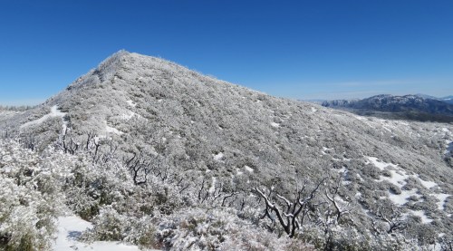
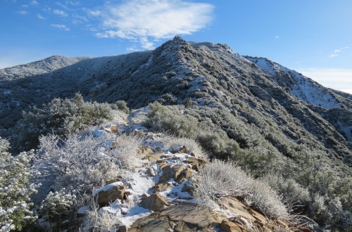
Pines grace the hillside along Tumamait Trail
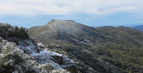
Mount Pinos

Visit almost any of the taller peaks in Santa Barbara and Ventura Counties and to the north or northeast you’ll see Mount Pinos in the distance. Known as Iwihinmu to the Chumash, which translates as place of mystery, the mountain is the tallest in our local area. Part of the Transverse Ranges, it serves as a transition point between the flora and fauna of the Sierra Nevada and our local mountains.

Often covered in snow during the winter, the mountain can make for a great summertime destination when other areas of the backcountry become too hot to enjoy. And because of its distance from urban areas, Mount Pinos is also an excellent place for star gazing.

To get to the trailhead from Santa Barbara, take Highway 101 south to Ventura and merge onto State Route 126, and continue east towards Interstate 5. Turn north onto Interstate 5, and continue to Frazier Mountain Park Road. Follow Frazier Mountain Park Road west to Cuddy Valley Road, which leads to the trailhead. Along the way, the road passes McGill and Mount Pinos Campgrounds, which offer car camping. Cuddy Valley Road ends at the the trailhead, which is near the Chula Vista walk-in campground. The trailhead is about 2.5 hours from Santa Barbara.

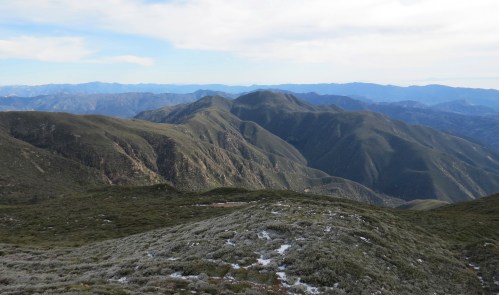
From the trailhead, it’s about three miles roundtrip to the top of Mount Pinos along an unpaved access road. From there, one can extend the hike along the length of Vincent Tumamait Trail, which follows the top of the pine-covered mountains towards Cerro Noroeste. The trail leads through the Chumash Wilderness and offers short side hikes to the top of Sawmill and Grouse Mountains.

About four miles from the trailhead, Tumamait Trail meets North Fork Lockwood Trail. From here, it’s roughly a quarter of a mile down to Sheep Camp, which is worth the side trip. Sheep Camp is the highest camp in Los Padres National Forest and can also be visited as part of a backpacking trip. The full hike along the ridge from the trailhead is about 12 miles roundtrip.

These are just a few of the trails in our area that one can explore during the coming year.

This article originally appeared in Section A of the January 2nd, 2017 edition of Santa Barbara News-Press.

Jeffrey Pines sheep camp north fork lockwood tumamait trail hike backpacking chumash wilderness los padres national forest

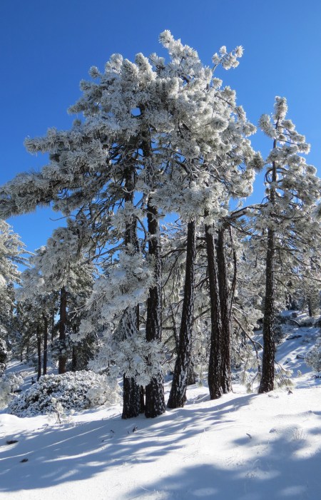
Jeffrey Pines are seen near Sheep Camp

Posted by: James Wapotich | December 28, 2016

Trail Quest: Big Caliente Hot Springs

Sometimes venturing out into nature and immersing in the elements is the easiest way to step out of our everyday lives and see things from a fresh perspective. And sometimes the circumstances of the world around us align just right to give us the opportunity, or at least the excuse we need.

Big Caliente Hot Springs is a popular destination for obvious reasons, there is just something satisfying about soaking in the springs while surrounded by the great outdoors, particularly at night with the stars out above. The springs are reached by a lengthy drive along a bumpy dirt road, which doesn’t seem to deter that many people.

However, when it rains the forest service closes the road at least several days before and after the rain to protect the road and to prevent people from getting stuck back there. When the road is closed the only way in is by foot, mountain bike, or horseback. The shortest route is 18 miles round trip, which significantly reduces the number of visitors.

North Romero Trail Blue Canyon hike backpacking Santa Barbara los padres national forest

Blue Canyon is seen from North Romero Trail

When the rain arrived on a Thursday, I saw my opportunity. I called the forest service the next day and learned the soonest the road would be open was Monday. It was one of the few times I was actually excited that the road was closed.

I was already looking for a place to go backpacking and with winter’s chill settling in and the hectic energy of the holidays in full swing, the hot springs seemed like an ideal destination.

There is no camping allowed at the hot springs, however, just a quarter-mile down the road from the springs is Rock Campground. The site is normally a car-camping destination, but when the road is closed it effectively becomes a trail camp, complete with fire ring and picnic table.

The shortest route to the hot springs on foot is via Blue Canyon. The trailhead is reached from Santa Barbara by taking Gibraltar Road to the top of the Santa Ynez Mountains and turning right onto East Camino Cielo Road. East Camino Cielo continues along the top of the mountains to Romero Saddle, where the paved road ends and unpaved Romero-Camuesa Road begins. A half-mile from Romero Saddle, North Romero Trial crosses the road, which leads down into Blue Canyon. Near the trailhead, the road is just slightly wider to allow for parking.

At the trailhead, I round up my gear, appreciating the clear skies. Not only has the storm closed the road, but it has graciously cleared out of the area.

sierra blanca limestone Blue Canyon Trail hike Santa Ynez River Los Padres National Forest

Outcropping of sierra blanca limestone along Blue Canyon Trail near the Santa Ynez River

From the trailhead, North Romero Trail quickly descends the mile and a half down into Blue Canyon. The trail passes through a mix of toyon, scrub oak, ceanothus, and manzanita; and as it nears the canyon floor, the blue-green outcroppings of serpentine that give the canyon its name come into view.

At the canyon floor the trail meets Blue Canyon Trail. Here, I turn left and continue over to Blue Canyon Camp. The camp is marked with a metal sign nailed to a sycamore tree and above it are the scratch marks from a bear. The camp has a picnic table and fire ring plus three ice can stoves. I make a quick run down to the creek, there are a couple of good size pools filled with fresh rain water, but the creek itself doesn’t appear to be flowing.

Back on the trail, I continue towards Cottam Camp. The trail follows the canyon downstream through a mix of coast live oak, chaparral, and riparian plants. In the creek below I can hear running water.

About a mile and a quarter from Blue Canyon Camp, the trail arrives at a large meadow where Cottam Camp is located. The camp is named for Albert Cottam, who with his brother Russell, built a cabin there in 1915. Both experienced guides and horse packers, they used the site as a pack station when taking guests into the backcountry to hunt and fish.

Agua Caliente Canyon Big Caliente Hot Springs Los Padres National Forest hiking backpacking Santa Barbara Los Padres National Forest

Agua Caliente Canyon

When Albert Cottam was 14, he was invited by the foreman of Pendola Ranch to spend a couple weeks there. The route he took from Montecito, more than a hundred years ago, followed Romero Trail over the mountains and down into Blue Canyon, and then over to the Santa Ynez River and upstream to Pendola Ranch. A route that I was more or less following on my way to the hot springs.

Cottam Camp is at the edge of the meadow under a couple of oaks and a large cottonwood and features a fire ring and picnic table. Currently there is no water at the camp, but usually there is during the spring.

The large meadow is at the juncture of Forbush Canyon and Blue Canyon and it’s here, that Blue Canyon turns north and heads towards the Santa Ynez River. Blue Canyon Trail follows the creek downstream as the canyon widens and then cuts across the broad floodplain of the river.

As the trail leaves Blue Canyon it enters a grove of coast live oak. Hiking through the grove, I’m struck by just how many oaks there are along this stretch of the river. Impressed by the grandeur of the scene, my perspective shifts from being on a backcountry trail to standing amongst oaks that have probably been here for thousands of years, growing undisturbed, generation after generation.

Caught in the timelessness of the moment, the words of T. S. Elliot come to mind, “And the end of all our exploring will be to arrive where we started and know the place for the first time.”

The trail then crosses the Santa Ynez River, which is completely dry, and continues on the other side, passing through more oaks before arriving at a large outcropping of sierra blanca limestone. Here, the trail turns to the left and follows a side channel of the river before climbing away from the river and arriving at Romero-Camuesa Road.

The road makes for easy hiking, passing P-Bar Flat Campground, which has five campsites each with a picnic table and metal fire ring. The camp is currently closed due to hazard trees. The road then passes Middle Santa Ynez Campground which has 11 campsites, each with a picnic table and metal fire ring. There is no one at any of the camps, and the only tracks on the road are from a coyote making its rounds.

At about the 6.5-mile from the trailhead, just past Middle Santa Ynez Campground, Romero-Camuesa Road crosses Agua Caliente Creek and arrives at the intersection with Big Caliente Road. I turn up Big Caliente Road and continue past Pendola Station.

Agua Big Caliente Hot Springs Rock Campground hiking backpacking Santa Barbara backcountry Los Padres National Forest pendola

Creekside pools at Big Caliente Hot Springs

The station was built in 1934. Next to it are the remains of the original Pendola Adobe, which was used by the Pendola family as a headquarters for their cattle ranching operation. The adobe fell into disuse after the construction of Gibraltar Dam, when the family’s grazing lease was discontinued over concerns of cattle contaminating the water downstream.

Continuing up Big Caliente Road, I arrive at Rock Campground in the late afternoon. I set up camp and continue up the road to the hot springs.

The first visitors to the hot springs were the Chumash. However, it was George Owen Knapp who built the first cement pool at the springs. Nearby, he built a cabin, which is no longer standing. Knapp was also instrumental in the construction of East Camino Cielo Road, which provided access to one of his other mountain retreats, now known as Knapp’s Castle.

I continue up the canyon, past the cement pool, to two smaller pools located along the creek. I get in the water at twilight just as the stars are coming out and claim my reward for the long hike.

In the morning, inspired by the frost on the ground and temperatures below 30 degrees, I decide to hike back up to the hot springs for another soak. Feeling the expansiveness of the world around me and the freedom of time in this moment, the need to accomplish things slowly falls away.

On the hike out, I can’t help but notice that my pace is less hurried and the urgency I felt around just about everything is all but forgotten; and even with the long miles, I still feel rejuvenated from just one night in the woods.

This article originally appeared in Section A of the December 26th, 2016 edition of Santa Barbara News-Press.

Posted by: James Wapotich | December 19, 2016

Trail Quest: Montecito’s Olive Mill Grove

Along Olive Mill Road in Montecito is an oak grove rich in local history. The site was once the estate of George Huntington Gould, and one can still find a small stand of olive trees there that may have been part of Montecito’s short-lived olive processing industry.

A short trail leads through the grove and is open to the public. The trail is known as Peter Bakewell Trail, is less than a mile in length, and can be used to make loop hike through the site.

To get to the trailhead from Santa Barbara, take Highway 101 south to the Olive Mill Road exit. Turn left onto Olive Mill Road, and continue north towards the intersection with Hot Springs Road. The trailhead is on the right, just before the intersection and Casa Dorinda retirement community. Parking is found in the pullouts along side the road.

olive mill road trees oak grove Gould Casa Dorinda Peter Bakewell Trail hike Montecito

Olive trees from the Gould estate are seen from Peter Bakewell Trail

At the trailhead is a stone gateway, the original entrance to the Gould estate. From the trailhead, Peter Bakewell Trail follows a somewhat weathered asphalt path, which soon crosses Montecito Creek by way of a bridge. The path is wheelchair accessible.

Just across the bridge the trail branches. The asphalt path continues to the left and improves dramatically in condition. To the right, a footpath continues around the edge of the property. About halfway around the perimeter, the footpath rejoins the asphalt path, which can be used for the return hike.

Continuing along the footpath, the trail leads through a scenic grove of coast live oak. Interspersed amongst the oaks, in the understory, is the occasional chaparral plant. In fact, the distribution of these plants and their location directly under the branches of the oaks suggests that they may have started from seeds dispersed by birds. Amongst the oaks, one can find elderberry, toyon, lemonade berry, and holly-leaf cherry. Some of the birds that can be observed at the site include acorn woodpeckers, northern flickers, scrub jays, morning doves, house finches, and black phoebes.

As the trail reaches the eastern edge of the site it turns north, and continues past a double row of olive trees, which were part of the original Gould estate. Past the olive trees the trail rejoins the asphalt path for the return hike back.

In 1886, George Gould purchased 40-acres of land, including this site, from John P. Neal. He built a modestly-sized house, located near where the olive trees are located. Around his house, he had an expansive lawn and garden, but left the balance of the property in its natural state, which is the oak woodland still seen today.

In 1893, William P. Gould, who may have been a distant cousin of George Gould, purchased land just south of George Gould’s property and built an olive mill, which is what gives Olive Mill Road its name.

Olives were first introduced to California in the 1700s by Franciscan padres through the mission system. The tree does well in our Mediterranean climate and was cultivated for its fruit and oil.

In the 1870s, Ellwood Cooper began a large scale operation of growing and processing olives in Goleta. Inspired by Cooper’s success, William Gould started his own mill in Montecito, but never quite saw the same level of return and, in 1905, closed the mill. The property was later sold and the mill converted into a residence, which at one time was owned by actress and singer Lena Horne.

It’s not clear if the olive trees on George Gould’s estate were for ornamental purposes or agricultural. However, George Gould did own other properties in Montecito where he grew olives that would’ve been processed at the mill south of his home. George Gould passed away in 1926, and the property was sold. Gould also owned property in Cold Spring Canyon; after his passing that land was donated to the city of Santa Barbara by his brother. The undeveloped land is now known as Gould Park.

The property just north of the Gould estate was owned by Isaac Rieman Baxley, who had purchased it from Gould in 1886. Baxley called his estate Everdene. In 1916, Baxley sold the property to William Henry and Anna Dorinda Bliss, who built an 80-room residence on the property to serve as their winter home. The estate gardens were designed by Peter Riedel, who also designed the gardens for the Gould estate, as well as other estates including that of George Owen Knapp.

In 1946, the Bliss estate was sold to by Dr. Homer F. Barnes, who opened Montecito School for Girls. Barnes also purchased the land that was formerly the Gould estate, combining the two pieces of land into a single property. The school closed in 1956, and the property was sold.

In 1971, the land was purchased by Casa Dorinda Associates, which redesigned the school and former Bliss estate into a retirement community. At some point, the buildings from the Gould Estate were removed, but the olive trees and oak grove were left unchanged.

In 1973, Montecito Trails Foundation, working with Casa Dorinda and the county, secured a trail easement through the undeveloped oak grove. The trail was later named Peter Bakewell Trail.

Bakewell was a past president and one of the original founders of Montecito Trails Foundation. He helped secure many of the easements that make up the network of community trails in Montecito and Summerland, maintained by Montecito Trails Foundation.

Founded in 1964 by a group of equestrians and hikers, the local non-profit organization actively works with private property owners and the county to secure and protect easements for public use.

The organization also maintains the front country trails between Gibraltar Road and Franklin Trail, from East Camino Cielo down to the beach. Many of these trails are within in the National Forest or on county-owned land, but receive maintenance from Montecito Trails Foundation.

The work of Montecito Trails Foundation is supported through fundraising and membership donations. Individual membership is $35 and includes a trail map that shows the trails between Gibraltar Road and Franklin Trail. The map is unique in that it shows community trails such as Peter Bakewell Trail that are not shown on other maps. For more information about the organization go to, http://www.montecitotrailsfoundation.info.

Regardless of how far you hike you’ll get to visit some of Montecito’s local history.

This article originally appeared in Section A of the December 19th, 2016 edition of Santa Barbara News-Press.

Posted by: James Wapotich | December 5, 2016

Trail Quest: Adobe Trail

Sometimes a good hike is one that works out well in the end, in spite of whatever challenges might arise. In fact, it’s that same uncertainty combined with being outdoors that can lift a hike from simply getting some exercise to feeling part of something dynamic and ever changing. It also helps to not take weather predictions too literally.

My plan was to hike Adobe Trail, which is about five miles roundtrip. The weather prediction called for rain starting in the morning and continuing through the day. However, recalling that the last time rain was predicted to start in the morning and didn’t actually arrive until the afternoon, I thought I’d take my chances. Rather than stay home, I figured if I got an early start I might be able to make it to the top of the trail before it started raining.

The Adobe Trailhead is located along State Route 166, which is reached from Santa Barbara by taking Highway 101 north to Santa Maria. Continue past Santa Maria to the exit for State Route 166 East, which is the very first exit as Highway 101 crosses the Santa Maria River.

Adobe Trail Los Padres National Forest Condor Trail hiking backpacking

Scenery along Adobe Trail

State Route 166 leads through the foothills of Temettate Ridge before crossing over the Huasna River as it enters Twitchell Reservoir, which is also fed by the Cuyama River.

Gazing out across the reservoir from the road, I can’t help but notice that it’s completely empty, just plants and grazing cattle. No water whatsoever. Twitchell Reservoir actually has more carrying capacity than Lake Cachuma, but is often empty because its primary purpose is to recharge the groundwater basin and provide flood protection for the Santa Maria Valley downstream. The reservoir is not open to the public.

Past the reservoir, State Route 166 essentially follows the Cuyama River upstream towards the trailhead, as well as all the way to the towns of Cuyama and New Cuyama.

As I continue along road, I look for the landmarks that will help me pick out the trailhead, which is easy to miss. Just past Tepusquet Road, on the right, is Pine Canyon Fire Station, on the left. Roughly four miles past the station, on the right, is the Willow Spring trailhead marked with a sign. From here, I know it’s just two more miles to the Adobe trailhead, which is on the left. Parking is found at the trailhead.

At the parking area, I gather up my gear and notice that there is a fair amount of frost on the ground. To the south, I can see grey clouds continuing to build and crowd the sky, but where I am it’s sunny, and to the north there is still plenty of blue sky. Perhaps the storm will skirt past me to the south.

From the trailhead, the trail quickly gets to work climbing away from the Cuyama River, following a series of switchbacks that lead through sparse chaparral composed of mostly coastal sagebrush, purple sage, yucca, and buckwheat. As the trail climbs, it offers views back down towards the river.

After about three-quarters of a mile, the trail branches. The trail to the right continues uphill along the ridge, while the trail to the left leads into a side canyon. The two trails meet up about a mile later.

Having read that there’s a spring in the canyon, I opt to take the trail through the canyon, saving the ridge route for the hike back out. This worked out well given the relative steepness of the ridge route.

As the trail continues, it transitions into chamise and black sage, and then joins the small creek in the canyon. Here, the trail enters a stand of coast live oak and arrives at the spring. Under the oaks is a cattle trough, fed by a pipe, that catches the slow drip from the spring. Nearby is a second, overturned trough.

Past the spring, the trail follows the dry creek up the canyon, which proves to be one of the more scenic parts of the hike.

The trail then climbs out of the canyon, where it meets the ridge trail. From here, it leads uphill through wild grasses and canyon live oak. As I continue along the ridge, the wind starts to pick up. With each passing cloud and alternating clear sky, I find myself questioning and then praising and then questioning my choice to try beat the storm, until the storm arrives.

The rain begins quickly and doesn’t waste any time settling in. I slip on my rain gear and continue uphill, and within a few minutes arrive at what looks like a jeep road. Looking at the map, I realize that I’ve reached the top of Adobe Trail. The rain is cold, but light enough to keep hiking.

I turn right onto Twin Rocks Road, having heard that there’s a cattle pond that one can find, plus an off-trail route that can be used to make a half-mile loop hike back to Adobe Trail.

Twin Rocks Road descends along a ridge between two canyons, passing through more oak savannah. As I continue, I start to see the earthen dam and dry pond through the trees, in the canyon on my right.

Arriving at a fairly large oak tree overlooking the pond, I continue off-trail, descending towards the dam and quickly join a well-established cattle trail that crosses the dam. On the other side, the trail is less distinct; apparently, the cattle are not able to agree on a single route. I opt to follow a trail leading uphill in a straight line from the dam. The trail soon becomes more established and eventually wraps around the hillside, linking back up with Adobe Trail. The intersection is marked with the trunk of a charred oak.

From here, I make the return hike. As I descend back down the ridge, I start to notice a lot more bird activity. It is still raining, but I suspect the rain might be letting up, since the birds always seem to know about these things in advance. And sure enough within 20 minutes the rain stops completely, and for the balance of the hike, it’s just overcast.

With all of its simplicity, Adobe Trail is also part of a larger route called the Condor Trail.

Back in mid-1990s, Alan Coles envisioned a route across the southern Los Padres National Forest that could be through-hiked, similar to the much longer Pacific Crest and Appalachian Trails. The route utilizes existing trails and roads, and as the concept grew and began to take hold, the idea was expanded to create a route that now traverses the entire Los Padres National Forest, connecting both the southern and northern portions of the forest.

Starting in the south at Lake Piru, Condor Trail travels through Sespe Wilderness to State Route 33 in Ventura County. From there, it continues through Santa Barbara County, passing through the Dick Smith and San Rafael Wilderness areas before arriving at State Route 166.

As it approaches State Route 166, Condor Trail follows Willow Spring Trail. From there, it continues along State Route 166 to Adobe Trail and follows it to Twin Rocks Road and continues through the national forest in San Luis Obispo County. The trail then leaves the forest and follows California Coastal Trail up to the northern portion of Los Padres National Forest in Monterey County, where it reenters the forest. The trail ends at Botchers Gap.

Last year, Brittany Nielsen, 30, from San Diego, became the first person to backpack the entire 421-mile route. She started at Lake Piru in May and 37 days later arrived at Botchers Gap. She was supported by “trail angels” who left food and supplies for her at prearranged locations along the route.

Condor Trail was also included in the Central Coast Heritage Protection Act introduced by Representative Lois Capps and Senator Barbara Boxer in 2015. If the act passes, it will add close to a quarter-million acres of new and expanded wilderness areas and designate an additional 159 miles of creeks and rivers as National Wild and Scenic rivers within Los Padres National Forest and Carrizo Plain National Monument, as well as make Condor Trail a National Recreation Trail.

Meanwhile, Adobe Trail still makes for a nice day hike, even with a little rain.

This article originally appeared in Section A of December 5th, 2016 edition of Santa Barbara News-Press.

« Newer Posts - Older Posts »

Categories